webshop.nl
Categorieën
  Sluiten

Meer ITMB
Meer ITMB in Literatuur boeken

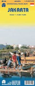
Stadsplattegrond Jakarta en omgeving | ITMB

0
Kaart van het centrum op gedetailleerde schaal en een kaart op de achterzijde van de regio en voorsteden op een schaal van 75.000. Indonesia is emerging quickly as one of the power-houses of Asia. Jakarta is a huge urban area, with a charming city centre. This double-sided map shows Greater Jakarta on one side, with its expressways and inter-urban ...

Webshops met dit product

Webshop
Bezorging
Prijs

Anderen bekeken ook

Stadsplattegrond Jakarta en omgeving | ITMB
Kaart van het centrum op gedetailleerde schaal en een kaart op de achterzijde van de regio en voorsteden op een schaal van 75.000. Indonesia is emerging quickly as one of the power-houses of Asia. Jakarta is a huge urban area, with a charming city centre. This double-sided map shows Greater Jakarta on one side, with its expressways and inter-urban train network and is, in my opinion very useful to business visitors to the city. It includes the airport, the city centre, the enormous soccer stadium (worth a visit), and the roads connecting the different neighbourhoods of this spread-out city. The other side concentrates on the central core of Jakarta, which is where most visitors would spend most time. Road and rail connections are clearly shown, as well as a good range of embassies, museums, hotels, gas stations, religious buildings, hospitals, and touristic attractions. Asian cities tend not to be well-mapped; the last map of the city that I recall was done about ten years ago, so this…
13,95
Stadsplattegrond Manila | ITMB
Goede overzichtelijke stadskaart van Manila en directe omgeving. Manila is the capital of the Philippines and a historic city, as well as a major economic and governmental centre. It is also a very big, sprawling city, like many in Asia, and difficult to map. We have prepared a double-sided map of the city, divided north/south, from Quezon City in the north to the new Alaya shopping centre and the world trading centre in the south. The heart of Manila is the area just north of the Pasig River, with its bustling streets and many shops. The hotel region is south of the river, close to the ocean, and we have done our best to show the hotels well, but there are too many to show all of them. This is an excellent map of a major Asian city; one that has never been mapped to this extent for travel previously. Legend Includes: Roads by classification, domestic airports, public transport lines, ferries, prominent buildings, parks, police stations, hospitals, banks, cinemas, hotels, temples, muse…
13,95
Stadsplattegrond Lima & Central Peru | ITMB
Peru is one of the most popular travel destinations in South America, and everyone going there arrives in Lima, which is a very large and complicated city. In this edition, we have updated all the information for the city, covering the portion between the ocean and the historic centre and southerly to the Miraflores district. Lima is not blessed with a good rapid transit system, but we show the two lines and the busway, embassies, hotels, shopping areas, historic sites etc. the new part of the map is a detailed travel map of the central portion of Peru on the other side. This side would be particularly useful for those visitors planning to travel from Lima to Cuzco, or Pisco, or north to Cajamarca., or even into the upper reaches of the Amazon. It has excellent road information, and hundreds of touristic points of interest are noted on the map. This map is printed double-sided, on paper. Legend Includes: Roads by classification, parks, sanctuaries, native tribes, churches, ruins, sprin…
13,95
Stadsplattegrond Geneve en Zwitserland | ITMB
This map has been a long time in development preparation. The data for a sophisticated country like Switzerland needs delicate handling to do justice to this lovely country. We did not want to do 'just' another road map, similar to those available from a variety of European publishers. Our version shows the physical reality of this mountainous country to good advantage without obscuring the places of interest to visitors. The road/rail infrastructure within the country is well shown with perhaps more villages being included than would normally be the case. The road network in surrounding countries has been simplified to focus attention on Switzerland itself. Touristic points, such as castles, fortresses, ski areas, and museums have been included, but we removed a lot of data, such as gas stations, schools, post offices, most churches and police stations in an effort to avoiding cluttering the map with an over-load of information. The Geneva side of the map goes from the airport in the …
13,95
Stadsplattegrond Las Vegas | ITMB
Stadsplattegrond met register. The "Strip’" not only refers to a burlesque dance but to the pedestrian haven in Las Vegas that entrances and titillates millions of visitors every day. The world’s largest travel destination is Las Vegas, not London or Paris. That’s right, SIN CITY and proud of it, Vegas is one of the modern marvels of total entertainment anywhere in the world – and now ITMB has mapped it as it’s never been seen before. Take the Strip, that stretch of Las Vegas Boulevard from the Mandalay Bay to the venerable Lady Luck, and map it – showing each resort, event centre (oops, center), monorail, and hotel. Add in surrounding attractions and shopping areas, and you have the central portion of this great city covered. The other side goes from the western beltway to Nelles air force base and from the city limits south to McCarron Airport, fully indexed. Printed on plastic paper for durability;
13,95
Stadsplattegrond Streetwise Budapest | Michelin
REVISED 2023Streetwise Budapest Map is a laminated city center map of Budapest, Hungary. The accordion-fold pocket size travel map has an integrated metro map including lines & stations. Coverage includes:Main Budapest Map Front 1: 17,000Main Budapest Map Back 1:11,000Budapest City Center Map 1:11,000Millennium City Center Map 1:17,000Budapest Metro MapDimensions: 4" x 8.5" folded, 8.5" x 27" unfoldedPeople say Budapest is the Paris of Central Europe.   Maybe that statement is true because it combines a combination of western luxuries, architectural beauty, and cosmopolitan European traditions. But this baroque city is still connected to its Eastern European heritage with the steaming baths, incredibly complex language and lusty cuisine. Budapest straddles a curve in the river Danube which bisects two distinct parts.   The east side is known as Pest and the west side is known as Buda, hence Budapest. It's a very logical, well laid out city. Castle Hill is the premier destination for vi…
9,95

Klanten-reviews van Stadsplattegrond Jakarta en omgeving | ITMB

Er zijn nog geen beoordelingen voor dit productBen jij de eerste die een review plaatst?

Meer over Stadsplattegrond Jakarta en omgeving | ITMB

Productomschrijving

Kaart van het centrum op gedetailleerde schaal en een kaart op de achterzijde van de regio en voorsteden op een schaal van 75.000. Indonesia is emerging quickly as one of the power-houses of Asia. Jakarta is a huge urban area, with a charming city centre. This double-sided map shows Greater Jakarta on one side, with its expressways and inter-urban train network and is, in my opinion very useful to business visitors to the city. It includes the airport, the city centre, the enormous soccer stadium (worth a visit), and the roads connecting the different neighbourhoods of this spread-out city. The other side concentrates on the central core of Jakarta, which is where most visitors would spend most time. Road and rail connections are clearly shown, as well as a good range of embassies, museums, hotels, gas stations, religious buildings, hospitals, and touristic attractions. Asian cities tend not to be well-mapped; the last map of the city that I recall was done about ten years ago, so this should fill a gap. Legend Includes: Roads by classification, hotel, monuments, bus terminal and bus routes, museums, shopping centers, tourist information, points of interest and other information

Productspecificaties

Artikelnummer(s)
Brand
ITMB

Verken gerelateerde categorieën

Webshop.nl maakt gebruik van cookies. Ga je verder op onze website, ga dan akkoord met het plaatsen van cookies en de verwerking van deze data door ons en vermelde partners.