webshop.nl
Categorieën
  Sluiten

Meer Borch

Stadsplattegrond Helsinki | Borch

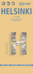
Borch Helsinki is een duidelijke, geplastificeerde plattegrond van het centrum met informatie over openbaar vervoer en bezienswaardigheden. Inclusief straatnamenregister. Our soft-laminated folded map of Helsinki in the 1st edition shows: Helsinki 1:15 000, Helsinki 1:7 500, Greater Helsinki 1:100 000, Public Transport Helsinki, Finland administrat...
10,25

Webshops met dit product

Webshop
Bezorging
Prijs

Anderen bekeken ook

Stadsplattegrond Helsinki | Borch
Borch Helsinki is een duidelijke, geplastificeerde plattegrond van het centrum met informatie over openbaar vervoer en bezienswaardigheden. Inclusief straatnamenregister. Our soft-laminated folded map of Helsinki in the 1st edition shows: Helsinki 1:15 000, Helsinki 1:7 500, Greater Helsinki 1:100 000, Public Transport Helsinki, Finland administrative & time zones, Top 30 Sights. Borch Maps show hotels, museums, monuments, markets, public transport, top sights and points of interest, useful statistics, conversion charts for temperatures, weights and measurements, climate charts showing temperatures, sunshine hours, precipitation and humidity, overview maps, time zones, and much more...   Called "the daughter of the Baltic", Helsinki is located on the tip of a peninsula and on 315 islands. The Helsinki metropolitan area is home to more than a million people. It has close historical connections with Tallinn, Estonia, Stockholm, Sweden and St. Petersburg, Russia. HelsinkI is the capital a…
10,25
Stadsplattegrond Stockholm | Borch
Borch Stockholm is een duidelijke, geplastificeerde plattegrond van het centrum met informatie over openbaar vervoer en bezienswaardigheden. Inclusief straatnamenregister.   Our soft-laminated folded map of Stockholm shows: Stockholm 1:15 000, Gamla Stan 1:7 500, Greater Stockholm 1:100 000, Public Transport Stockholm, Sweden administrative & time zones, Top 30 Sights. Borch Maps show hotels, museums, monuments, markets, public transport, top sights and points of interest, useful statistics, conversion charts for temperatures, weights and measurements, climate charts showing temperatures, sunshine hours, precipitation and humidity, overview maps, time zones, and much more...   Stockholm is Sweden's capital, largest and most populous city, with a population of just under one million in the city and just over two million in its major metropolitan area. Founded around the 13th century, Stockholm was always and remains the cultural, political and economic center of Sweden and is today a ci…
11,50
Stadsplattegrond New York City | Borch
Borch New York City is een duidelijke, geplastificeerde plattegrond van het centrum van New York (Manhattan) en nog een stukje van Brooklyn en Queens met informatie over openbaar vervoer en bezienswaardigheden. Inclusief straatnamenregister.   Our soft-laminated folded map of New York City shows: Central New York City 1:15 000, Flushing Meadows 1:15 000, Five Boroughs 1:100 000, Public Transport New York City, USA administrative & time zones. Borch Maps are easy to fold, durable and water-repellent with a wipeable surface. Borch Maps show hotels, museums, monuments, markets, public transport, top sights and points of interest, useful statistics, conversion charts for temperatures, weights and measurements, climate charts showing temperatures, sunshine hours, precipitation and humidity, overview maps, time zones, and much more...   Nicknamed "The Big Apple", NYC is the most populous city in the United States. Situated in the state of New York, the city has served as the gateway to the U…
10,25
Stadsplattegrond Sydney | Borch
Borch Sydney is een duidelijke, geplastificeerde plattegrond van het centrum met informatie over openbaar vervoer en bezienswaardigheden. Inclusief straatnamenregister. Our soft-laminated folded map of Sydney shows: Inner Sydney 1:15 000, Sydney CBD 1:7 500, Sydney 1:120 000, Sydney & Region 1:450 000, Homebush Bay Olympic Park 1:15 000, Airport Sydney 1:25 000, Public Transport Sydney, Australia administrative & time zones, Top 30 Sights. Borch Maps show hotels, museums, monuments, markets, public transport, top sights and points of interest, useful statistics, conversion charts for temperatures, weights and measurements, climate charts showing temperatures, sunshine hours, precipitation and humidity, overview maps, time zones, and much more...   Sydney, the capital city of the state New South Wales, is Australia's most populous city with an estimated 4.2 million inhabitants in its metropolitan area. Located on the southeastern coast, Sydney is built around Port Jackson, a section of …
10,25
Stadsplattegrond Madrid | Borch
Borch Madrid is een duidelijke, geplastificeerde plattegrond van het centrum met informatie over openbaar vervoer en bezienswaardigheden. Inclusief straatnamenregister.   Our soft-laminated folded map of Madrid shows: Central Madrid 1:10 000, Madrid & Region 1:200 000, Province of Madrid 1:700 000, Toledo 1:9 000, Segovia 1:8 500, Public Transport Madrid, Spain administrative. Borch maps are easy to fold, durable and water-repellent with a wipeable surface. Borch Maps show hotels, museums, monuments, markets, public transport, top sights and points of interest, useful statistics, conversion charts for temperatures, weights and measurements, climate charts showing temperatures, sunshine hours, precipitation and humidity, overview maps, time zones, and much more...   Madrid, located on the Manzanares River, is the capital and largest city of Spain and also its political and geographic center. Local residents are called Madrileños. Not only is Madrid one of the main financial centers of t…
10,25
Stadsplattegrond Chicago | Borch
Borch Chicago is een duidelijke, geplastificeerde plattegrond van het centrum met informatie over openbaar vervoer en bezienswaardigheden. Inclusief straatnamenregister.   Our soft-laminated folded map of Chicago shows: Chicago Downtown 1:8 000, Lincoln Park 1:16 000, Hyde Park 1:20 000, Chicago & Region 1:250 000, O'Hare Airport 1: 22 500, Public Transportation CTA, Top 30 Sights and USA administrative & time zones. Borch Maps are easy to fold, durable and water-repellent with a wipeable surface. Borch Maps show hotels, museums, monuments, markets, public transport, top sights and points of interest, useful statistics, conversion charts for temperatures, weights and measurements, climate charts showing temperatures, sunshine hours, precipitation and humidity, overview maps, time zones, and much more...   Not only famous for Barack Obama and Al Capone, Chicago is also called "America's second city" or the "Windy City". Chicago is the largest city in the state of Illinois, is located on…
10,25
Stadsplattegrond Philadelphia | Borch
Borch Philadelphia is een duidelijke, geplastificeerde plattegrond van het centrum met informatie over openbaar vervoer en bezienswaardigheden. Inclusief straatnamenregister.   Our soft-laminated folded map of Philadelphia shows: Philadelphia Downtown 1:7 000, Philadelphia & Region 1:125 000, University City 1:12 000, Fairmount Park 1:15 000, Public Transport Philadelphia, Top 30 Sights, USA administrative & time zones. Borch Maps are easy to fold, durable and water-repellent with a wipeable surface. Borch Maps show hotels, museums, monuments, markets, public transport, top sights and points of interest, useful statistics, conversion charts for temperatures, weights and measurements, climate charts showing temperatures, sunshine hours, precipitation and humidity, overview maps, time zones, and much more...   Thanks to Benjamin Franklin, one of the founding fathers of the United States, the ideas and actions leading to the American Revolution were formed in Philadelphia and for this rea…
11,50

Klanten-reviews van Stadsplattegrond Helsinki | Borch

Er zijn nog geen beoordelingen voor dit productBen jij de eerste die een review plaatst?

Meer over Stadsplattegrond Helsinki | Borch

Productomschrijving

Borch Helsinki is een duidelijke, geplastificeerde plattegrond van het centrum met informatie over openbaar vervoer en bezienswaardigheden. Inclusief straatnamenregister. Our soft-laminated folded map of Helsinki in the 1st edition shows: Helsinki 1:15 000, Helsinki 1:7 500, Greater Helsinki 1:100 000, Public Transport Helsinki, Finland administrative & time zones, Top 30 Sights. Borch Maps show hotels, museums, monuments, markets, public transport, top sights and points of interest, useful statistics, conversion charts for temperatures, weights and measurements, climate charts showing temperatures, sunshine hours, precipitation and humidity, overview maps, time zones, and much more...   Called "the daughter of the Baltic", Helsinki is located on the tip of a peninsula and on 315 islands. The Helsinki metropolitan area is home to more than a million people. It has close historical connections with Tallinn, Estonia, Stockholm, Sweden and St. Petersburg, Russia. HelsinkI is the capital and largest city of Finland. Helsinki (Helsingfors in Swedish) is the northernmost metropolitan area in the world. Established by King Gustav I of Sweden in 1550, Helsinki consistently ranks very highly in the worlds top ten most livable cities. Due to the mitigating influence of the Baltic Sea and the North Atlantic Current, temperatures in winter are higher than the northern location might suggest, with temperatures in January and February averaging -5 C. Helsinki is also known as a hub of industrial design! In Helsinki slang the city is called Stadi (from the Swedish word stad, meaning "city").This truly fine city must be seen.

Productspecificaties

Artikelnummer(s)
Brand
Borch
Webshop.nl maakt gebruik van cookies. Ga je verder op onze website, ga dan akkoord met het plaatsen van cookies en de verwerking van deze data door ons en vermelde partners.