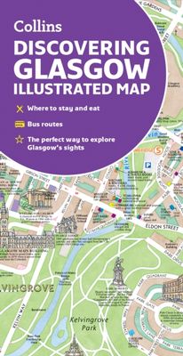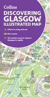
Stadsplattegrond Glasgow Illustrated Map | Collins

0
Explore new places with dependable maps from Collins. As the largest city in Scotland, Glasgow is a vibrant and bustling hub, enjoyed by thousands of visitors each year. This updated map displays delightful water-colour mapping, and includes individual illustrations of all the main sights and landmarks in the city.   Covers the centre of Glasgow f...

Verkopers met dit product

Verkoper
Bezorging
Prijs
DeZwerver.nl logo
DeZwerver.nl
2,95
9,95

Anderen bekeken ook

Stadsplattegrond Glasgow Illustrated Map | Collins
Explore new places with dependable maps from Collins. As the largest city in Scotland, Glasgow is a vibrant and bustling hub, enjoyed by thousands of visitors each year. This updated map displays delightful water-colour mapping, and includes individual illustrations of all the main sights and landmarks in the city.   Covers the centre of Glasgow from the Botanic Gardens in the north and the Riverside Museum to the west to the 12th century Cathedral and the gritty Barras Market to the east. Further mapping stretches southwest to Pollok Park and the newly refurbished Burrell Collection. The map features: Historical and contemporary anecdotesPopular areas at larger scale, hundreds of shops, restaurants, cafes and barsComprehensive travel information and indexShop-by-shop street maps of Buchanan Street and the Merchant CityRailway stations, taxi ranks and car parksBus routes shown for tour companies and airport linksBeautiful illustrations of Glasgow's top sights The perfect companion or …
9,95
Stadsplattegrond Discovering Edinburgh Illustrated Map | Collins
Explore new places with dependable maps from Collins. This brand new edition retains the delightful water-colour mapping, with individual paintings of all the main sights and landmarks.   This brand new edition retains the delightful water-colour mapping, with individual paintings of all the main sights and landmarks.   Popular areas at larger scale, hundreds of shops, restaurants, cafés and bars, comprehensive travel information and index.   This map includes:   • Large-scale plans of the Castle, Royal Mile, Botanic Gardens, Leith and Newington   • Shop-by-shop street maps of Princes Street, George Street, Victoria Street and the Grassmarket   • Railway stations, bus routes, taxi ranks and car parks   • Historical and contemporary anecdotes   • Suggestions for day trips out of the city   • Comprehensive index   Area of coverage:   Covers the centre of Edinburgh from Inverleith Park in the north to The Meadows in the south, and from the Scottish National Gallery of Modern Art in the w…
12,50
Stadsplattegrond Pocket Map Glasgow | Collins
Clear, detailed, full color Collins mapping is presented in a handy format ideal for the pocket or handbag. It is excellent value and covers the most visited area of central Glasgow. It is an essential buy for tourists and residents alike. This map includes: Detailed central area map Around Glasgow map extending to airport, Pollok Park and Strathclyde Park Tourist locations Train and bus stations Listing of major places to visit Detailed street index
7,95
Stadsplattegrond Pocket Map Aberdeen | Collins
Handy little full colour Collins map of Aberdeen with a high level of detail. Clear mapping of the central area extending to the airport and along the coast, with all tourist locations. Map at a scale of 1:10 725 (5.8 inches to 1 mile).   Clear, detailed, full colour Collins mapping is presented in a handy format ideal for the pocket or handbag. It is excellent value and covers the most visited area of central Aberdeen. It is an essential buy for tourists and residents alike.   This map includes: • Detailed central area map • Around Aberdeen map extending to airport and along the coast • Tourist locations • Train and bus stations • Listing of major places to visit, with additional details for Aberdeen Maritime Museum and Duthie Park Winter Gardens • Detailed street index
7,95
Stadsplattegrond Pocket Map Dublin | Collins
Explore new places with handy pocket maps from Collins. Handy little full colour Collins map of central Dublin with a high level of detail. Map at a scale of 1:7,800 (8 inches to 1 mile).   Includes major tourist landmarks. Clear, detailed, full colour Collins mapping is presented in a handy format ideal for the pocket or handbag. It is excellent value and covers the most visited areas of central Dublin.   It is an essential buy for tourists and residents alike. This map includes:* Detailed central area map* Tourist locations* Tram, train, bus stations and ferry information* Listing of major places to visit, with additional details for the main attractions* Detailed street index* Around Dublin area map extending to airport, Dun Laoghaire and Maynooth  
7,95
Stadsplattegrond Pocket Map Edinburgh | Collins
Handy little full colour map of central Edinburgh with a high level of detail. Clear mapping from Leith in the north to The Meadows in the south, and Edinburgh Zoo in the west to Holyrood Park in the east. Map at a scale of 1:11,000 (6 inches to 1 mile).   Clear, detailed, full colour mapping is presented in a handy format ideal for the pocket or handbag. It is excellent value and covers the most visited area of central Edinburgh. It is an essential buy for tourists and residents alike.   This map includes: • Detailed central area map • Around Edinburgh map extending to airport, Pentland Hills and Forth Road Bridge • Tourist locations • Tram, train and bus stations • Listing of major places to visit, with additional details for Edinburgh Castle and Holyroodhouse • Detailed street index
7,95
Stadsplattegrond Plan de ville - Street Map Istanbul | Michelin
NEW. The Michelin Istanbul City Map - part of Michelin's brand-new Laminated City Map series - is ideal for visitors wanting to see the sights and navigate around the city. Points of interest drawn from Michelin Green Guides are described and highlighted on the map for easy sight-seeing. Planned routes and stops can be marked, then wiped off the laminated surface* while the map's accordion-fold pattern allows for a fast look and even faster refold. Rely on Michelin's clear mapping and street index for an enjoyable visit. * Use only dry-erase markers.
12,50
Stadsplattegrond Plan de ville - Street Map Sint Petersburg | Michelin
NEW. The Michelin St. Petersburg City Map - part of Michelin's brand-new Laminated City Map series - is ideal for visitors wanting to see the sights and navigate around the city. Points of interest drawn from Michelin Green Guides are described and highlighted on the map for easy sight-seeing. Planned routes and stops can be marked, then wiped off the laminated surface* while the map's accordion-fold pattern allows for a fast look and even faster refold. Rely on Michelin's clear mapping and street index for an enjoyable visit. * Use only dry-erase markers.
12,50
Stadsplattegrond Plan de ville - Street Map New York | Michelin
NEW. The Michelin New York Map - part of Michelin's brand-new Laminated City Map series - is ideal for visitors wanting to see the sights and navigate around the city. Points of interest drawn from Michelin Green Guides are described and highlighted on the map for easy sight-seeing. Planned routes and stops can be marked, then wiped off the laminated surface* while the map's accordion-fold pattern allows for a fast look and even faster refold. Rely on Michelin's clear mapping and street index for an enjoyable visit. * Use only dry-erase markers.
12,50

Klanten-reviews van Stadsplattegrond Glasgow Illustrated Map | Collins

Er zijn nog geen beoordelingen voor dit productBen jij de eerste die een review plaatst?

Meer over Stadsplattegrond Glasgow Illustrated Map | Collins

Productomschrijving

Explore new places with dependable maps from Collins. As the largest city in Scotland, Glasgow is a vibrant and bustling hub, enjoyed by thousands of visitors each year. This updated map displays delightful water-colour mapping, and includes individual illustrations of all the main sights and landmarks in the city.   Covers the centre of Glasgow from the Botanic Gardens in the north and the Riverside Museum to the west to the 12th century Cathedral and the gritty Barras Market to the east. Further mapping stretches southwest to Pollok Park and the newly refurbished Burrell Collection. The map features: Historical and contemporary anecdotesPopular areas at larger scale, hundreds of shops, restaurants, cafes and barsComprehensive travel information and indexShop-by-shop street maps of Buchanan Street and the Merchant CityRailway stations, taxi ranks and car parksBus routes shown for tour companies and airport linksBeautiful illustrations of Glasgow's top sights The perfect companion or souvenir for visitors to Glasgow.

Productinformatie

    Verken gerelateerde categorieën

    Webshop.nl maakt gebruik van cookies. Ga je verder op onze website, ga dan akkoord met het plaatsen van cookies en de verwerking van deze data door ons en vermelde partners.