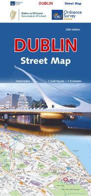
Stadsplattegrond Dublin | Ordnance Survey Ireland

0
A double-sided map of Dublin complete with a separate, full 80 page street index and other useful information....

Verkopers met dit product

Verkoper
Bezorging
Prijs
DeZwerver.nl logo
DeZwerver.nl
2,95
11,95

Anderen bekeken ook

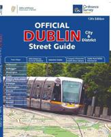
Wegenatlas Dublin official city & district street guide spiral | Ordnance Survey Ireland
Navigate your way around Dublin with confidence with the Official Dublin City & District Street Guide. Find your way around Ireland’s vibrant, historic capital with an enlarged city centre map plus 12 maps of surrounding major towns.   Official Dublin City & District Street Guide features:   - Enlarged city centre map - Maps of Ashbourne, Balbriggan, Blessington, Clane, Delgany/Greystones, Donabate, Dunshaughlin, Kilcock, Lusk, Rush, Rafoath and Skerries - Spiral-bound for ease of laying flat and quick navigation - Schematic maps of all M50 motorway junctions - Up-to-date and indexed information on hospitals, embassies and industrial estates - Garda Road Safety Information - Transport information for bus and rail routes and Dublin Bikes Scheme   Other Ordnance Survey Ireland maps of Dublin include Medieval Dublin, Dublin City Centre Tourist Map and Dublin Commuter Map.
25,95
Stadsplattegrond Dublin | Borch
Borch Dublin is een duidelijke, geplastificeerde plattegrond van het centrum met informatie over openbaar vervoer en bezienswaardigheden. Inclusief straatnamenregister. Our soft-laminated folded map of Dublin shows: Central Dublin 1:12 000, Phoenix Park 1:25 000, Temple Bar & Grafton Street 1:10 000, Dublin & Environs 1:125 000, East Coast 1:700 000, Public Transport Dublin, Ireland administrative & time zones, Top 30 Sights. Borch Maps are easy to fold, durable and water-repellent with a wipeable surface. Borch Maps show hotels, museums, moanuments, markets, public transport, top sights and points of interest, useful statistics, conversion charts for temperatures, weights and measurements, climate charts showing temperatures, sunshine hours, precipitation and humidity, overview maps, time zones, and much more...   The bustling Irish capital has much to offer the visitor, especially with regard to literary history. Once home to Oscar Wilde, James Joyce, W.B. Yeats, G.B. Shaw, Samuel B…
9,95
Stadsplattegrond Pocket Map Dublin | Collins
Explore new places with handy pocket maps from Collins. Handy little full colour Collins map of central Dublin with a high level of detail. Map at a scale of 1:7,800 (8 inches to 1 mile).   Includes major tourist landmarks. Clear, detailed, full colour Collins mapping is presented in a handy format ideal for the pocket or handbag. It is excellent value and covers the most visited areas of central Dublin.   It is an essential buy for tourists and residents alike. This map includes:* Detailed central area map* Tourist locations* Tram, train, bus stations and ferry information* Listing of major places to visit, with additional details for the main attractions* Detailed street index* Around Dublin area map extending to airport, Dun Laoghaire and Maynooth  
7,95
Stadsplattegrond City map Dublin | Lonely Planet
Durable and waterproof, with a handy slipcase and an easy-fold format, Lonely Planet's Dublin City Map is your conveniently sized passport to travelling with ease. With this easy-to-use, full-colour navigation tool in your back pocket, you can truly get to the heart of Dublin, so begin your journey now!         Durable and waterproof   Easy-fold format and convenient size   Handy slipcase   Full colour and easy to use   Extensive street and site index   Images and information about top city attractions   Handy transport maps   Walking tour routes   Practical travel tips and directory   Itinerary suggestions   Covers City Centre, Merrion Square, Temple Bar, Kilmainham, the Liberties, North of the Liffey, Phoenix Park, Docklands   Looking for more extensive coverage? Check out Lonely Planet's Dublin, our most comprehensive guidebook to the city, covering the top sights and most authentic offbeat experiences. Or check out Lonely Planet's Pocket Dublin, a handy-sized guide focused on the …
9,95
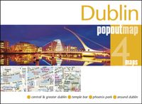
Stadsplattegrond Popout Map Popout Map Dublin | Compass Maps
Handig ( borstzak- ) formaat stadsplattegrond met voldoende detail, zodat je ook de kleinere straatjes erop aantreft. Van veel wereldsteden inmidddels leverbaar en dat is mooi, want juist in dit soort steden wil je je handen liever vrij houden en niet teveel hoeven stoeien met het uitvouwen van een grote plattegrond, en/of teveel als "toerist" opvallen. Door het unieke vouwsysteem blijft alles zeer compact en biedt het kaartje een razendvlugge manier van orientatie. Wel is dit product alleen geschikt voor het ( grote ) centrum van de stad.Verder geven de kaartjes uit deze reeks ook de meeste highlights van de stad aan en ( indien van toepassing ) een overzichtskaartje van de metro. Experience the Irish charm of Dublin with the help of this genuinely pocket-sized, pop-up map. Small in size, yet big on detail, this compact, dependable Dublin city map will ensure you don't miss a thing.* Includes two pop-up maps covering central & greater Dublin * Additional maps covering Temple Bar, Pho…
7,95

Klanten-reviews van Stadsplattegrond Dublin | Ordnance Survey Ireland

Er zijn nog geen beoordelingen voor dit productBen jij de eerste die een review plaatst?

Meer over Stadsplattegrond Dublin | Ordnance Survey Ireland

Productomschrijving

A double-sided map of Dublin complete with a separate, full 80 page street index and other useful information.

Productinformatie

    Verken gerelateerde categorieën

    Webshop.nl maakt gebruik van cookies. Ga je verder op onze website, ga dan akkoord met het plaatsen van cookies en de verwerking van deze data door ons en vermelde partners.