Stadsplattegrond Crumpled City Maps Barcelona | Palomar

0
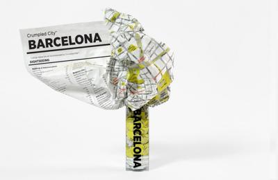
These are pretty much the coolest maps ever, unlike traditional paper maps which can be awkward to deal with, the Barcelona Crumpled City Map can be easily crammed into your pocket, backpack or the carrying pouch provided without having to worry about refolding it along the original creases. Moreover, the map is printed on special technological ma...

Verkopers met dit product

Verkoper
Bezorging
Prijs
DeZwerver.nl logo
DeZwerver.nl
5,95
14,95

Anderen bekeken ook

Nieuw
Stadsplattegrond City map Barcelona | Lonely Planet
De stadsplattegronden van Lonely Planet zijn uitgevoerd op scheur- en watervast papier, zijn lichtgewicht en kennen een handig formaat. Het centrum van de stad is in heldere kleuren in beeld gebracht met straatnamen, bezienswaardigheden en symbolen voor openbaar vervoer. Op de achterzijde staat informatie over de toeristische hoogtepunten en in de meeste gevallen een schematische plattegrond van het openbaar vervoer. Met een register. Durable and waterproof, with a handy slipcase and an easy-fold format, Lonely Planet's Barcelona City Map is your conveniently sized passport to travelling with ease. Get more from your map and your trip with images and information about top city attractions, walking tour routes, transport maps, itinerary suggestions, an extensive street and site index, and practical travel tips and directory. With this easy-to-use, full-colour navigation tool in your back pocket, you can truly get to the heart of Barcelona, so begin your journey now!Durable and waterpr…
9,95
Nieuw
Wegenkaart - landkaart - Stadsplattegrond Barcelona & Catalunya - Catalonië | ITMB
Een degelijke wegenkaart met aanduidingen van o.a. nationale parken, vliegveld, benzinepomp, dirt-roads. Als overzichtskaart goed te gebruiken.   This new edition of Barcelona not only updates an already excellent city map, it relates it to its surrounding hinterland. It is no secret that the area surrounding Barcelona, called Catalunya, has long harboured a strong desire to separate from Spain (the adjacent Basque region has also coveted independence for as long as I can remember). Our regional map extends beyond the strict boundaries of the province/pseudo independent state of Catalunya and is actually a very good map of the east coast of Spain as far south as Valencia, but lets not split hairs. This is an excellent map for anyone visiting the Barcelona area, showing the heart of the city in immaculate detail and providing ample mapping assistance for anyone travelling to nearby urban areas, comprising most of the touristic sights and places of interest.   Legend Includes: Roads by …
13,95
Stadsplattegrond Streetwise Amsterdam | Michelin
Handige stadsplattegrond van Amsterdam in de vorm van een uitklapkaart, die aan twee zijden bedrukt is. Prettig leesbaar, helder kaartbeeld, met een register en een kleine kaart van het openbaar vervoer. Deze kaart is geplastificeerd   REVISED 2023Streetwise Amsterdam Map is a laminated city center map of Amsterdam, Netherlands. The accordion-fold pocket size travel map includes tram lines, metro lines, and water bus. You can find a list of the points of interest, cultural sites, hotels, parks, museum boat stops and tram lines in the index.   Coverage includes:Main Amsterdam Map 1:14,500Central Amsterdam Map 1:9,000Amsterdam Surrounding Area Map 1:80,000Dimensions: 4" x 8.5" folded, 8.5" x 28" unfoldedAmsterdam is one of the most beautiful small scale cities in the world. Before or after a journey through the Netherlands, spend some time here and enjoy the atmosphere of a beautiful European city without the jarring intensity of a larger urban environment. From the winding waterways to…
9,95
Stadsplattegrond Popout Map Barcelona | Compass Maps
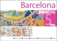
Handig ( borstzak- ) formaat stadsplattegrond met voldoende detail, zodat je ook de kleinere straatjes erop aantreft. Van veel wereldsteden inmidddels leverbaar en dat is mooi, want juist in dit soort steden wil je je handen liever vrij houden en niet teveel hoeven stoeien met het uitvouwen van een grote plattegrond, en/of teveel als "toerist" opvallen. Door het unieke vouwsysteem blijft alles zeer compact en biedt het kaartje een razendvlugge manier van orientatie. Wel is dit product alleen geschikt voor het ( grote ) centrum van de stad.Verder geven de kaartjes uit deze reeks ook de meeste highlights van de stad aan en ( indien van toepassing ) een overzichtskaartje van de metro. Let PopOut Map Barcelona guide you around this wonderful city.   Discover the Catalan delights of Barcelona with the help of this genuinely pocket-sized, pop-up map. Small in size, yet big on detail, this compact, dependable Barcelona city map will ensure you don't miss a thing.   Includes two pop-up m…
7,95
Stadsplattegrond Singapore | Borch
Borch Singapore is een duidelijke, geplastificeerde plattegrond van het centrum met informatie over openbaar vervoer en bezienswaardigheden. Inclusief straatnamenregister. Our soft-laminated folded map of Singapore shows: Singapore City 1:14 000, Singapore 1:120 000, Sentosa Island 1:25 000, Changi Airport 1:4 000 and the Public Transportation SMRT schematic map. Borch Maps are easy to fold, durable and water-repellent with a wipeable surface. Borch Maps show hotels, museums, monuments, markets, public transport, top sights and points of interest, useful statistics, conversion charts for temperatures, weights and measurements, climate charts showing temperatures, sunshine hours, precipitation and sea temperatures, overview maps and much more...   The Republic of Singapore (also known as "Lion City", although history tells us Singapore's founder probably meant "tigers") is a very clean and orderly city-state located on the southern tip of the Malay Peninsula, with Changi airport usuall…
9,95
Nieuw
Stadsplattegrond Barcelona | Borch
Borch Barcelona is een duidelijke, geplastificeerde plattegrond van het centrum met informatie over openbaar vervoer en bezienswaardigheden. Inclusief straatnamenregister.   Our soft-laminated folded map of Barcelona shows: Barcelona Centre 1:11 000, Royal Palace 1: 11 000, Parc Güell 1:11 000, Old Town 1:5 500, Barcelona and Region 1:150 000, Public Transport Barcelona, Top 30 Sights and Spain administrative. Borch maps are easy to fold, durable and water-repellent with a wipeable surface. Borch Maps show hotels, museums, monuments, markets, top sights and points of interest, useful statistics, conversion charts for temperatures, weights and measurements, climate charts showing temperatures, sunshine hours, precipitation and humidity, overview maps, time zones, and much more...   The city of Barcelona is situated on the beautiful Mediterranean coast and is bordered by the Serra de Collserola mountain ridge and the estuaries of the Llobregat and Besòs rivers. The capital city of "Cata…
9,95
Wegenkaart - landkaart 04 Icefields Parkway | Gem Trek Maps
Whether you have a day or a week to spend exploring the sights along the spectacular Icefields Parkway highway, Gem Trek's ICEFIELDS PAKRWAY MAP, a combination map and guide, will help you make the most of your time. Like our much-loved hiking maps, our Icefields Parkway map features detailed cartography and is printed on waterproof and tear-resistant paper.   The Icefields Parkway Map shows all viewpoints, picnic areas, trailheads, campgrounds, hostels, lodges and other services along the Icefields Parkway, while the descriptions in the guide point you to the best of these - the best viewpoints of mountains and lakes, the most interesting points of interest and exhibits, and the best bets for spotting wildlife such as moose, bighorn sheep and mountain goats.   Also included are short descriptions of the ten best walks and day hikes along the Icefields Parkway—from the short stroll to Peyto Lake Viewpoint to the rewarding hike through alpine meadows to Helen Lake.   To make it easier …
13,95
Nieuw
Wegenkaart - landkaart Mexico Central & Mexico City | ITMB
Goede wegenkaart met duidelijk kleurgebruik. Het betreft een deel van Mexico met op de achterkant een stadsplattegrond van het centrale deel van Mexico City. MC is the largest city in the Western Hemisphere, with a population of 28,000,000 (or twice as big as New York City!). It would be impractical to portray the entire urban area on one map and have it make sense, so we show the portion of greatest interest to visitors, from the Chapultepec Zoological Park in the west to the incredibly busy Tapo Bus Terminal in the east, and from the railway station in the north to the southern east-west motorway just south of the main hospital complex. Much of MC’s touristic interest is concentrated in the Zona Rosa, Reforma, and Zocalo segments of the city centre, and these are shown in detail, noting hotels, major restaurants, shopping areas, and points of interest.   The map also includes inset maps of the San Angel area just north of the university, an inset map of the greater Mexico City Feder…
13,95
Nieuw
Wandelkaart 12 Jasper Up-Close | Gem Trek Maps
Water- en scheurvaste wandelkaart van Jasper. Met op de achterzijde een overzicht van de belangrijkste bezienswaardigheden.   Waterproof and tear-resistant hiking and recreation map for the town of Jasper and surrounds in the Canadian Rockies.   Designed for both locals and visitors, Gem Trek’s 1:35,000 Banff Up-Close Map is a detailed relief-shaded topographic map of the Jasper area. On the back of the Jasper Up-Close Map are descriptions of recommended sights, museums and scenic drives to make it easier to plan your day. We’ve also included a hand-picked list of the best six easy walks and day hikes in the area, noting the highlights of each trail, as well as distance, elevation gain and directions to the trailhead. Colour photos and three inset maps, including a town map of Jasper, accompany the descriptions of sights and hikes on the back of the map.   Map specs   Edition: 6th Scale: 1:35,000 Folded size: 4.5 x 9.5 inches Flat size: 18 x 24 inches Paper: Waterproof and tear-resist…
13,95
Nieuw
Wegenkaart - landkaart Tasmanië - Tasmania | Hema Maps
Op deze kaart staat Tasmanië in zijn geheel op 1 deel van de kaart. Goede, overzichtelijke, leesbare kaart van het hele eiland. Nationale Parken zijn er goed op te vinden en de afstanden worden weergegeven. Op de achterkant nog deelkaartjes van enkele steden en NP s. The fourth edition of Hema’s Tasmania State Map features Hema’s distinctive and informative maps fully, all of which have been field checked by Hema’s Map Patrol to ensure the best possible accuracy with the latest mapping data.    A fully indexed state map of Tasmania (TAS) at a scale of 1:500,000. Marked on the mapping are national parks, fuel locations as well as camping and rest areas.    The reverse side consists of:   a summary of the key things to see and do broken up into the North West, Launceston, Tamar and the North a table listing of National Parks and Reserves with key features and facilities (such as Camping and Caravan sites, BBQ, toilets and showers) Visitor centre listing Map of the area around Zeehan…
17,50

Klanten-reviews van Stadsplattegrond Crumpled City Maps Barcelona | Palomar

Er zijn nog geen beoordelingen voor dit productBen jij de eerste die een review plaatst?

Meer over Stadsplattegrond Crumpled City Maps Barcelona | Palomar

Productomschrijving

These are pretty much the coolest maps ever, unlike traditional paper maps which can be awkward to deal with, the Barcelona Crumpled City Map can be easily crammed into your pocket, backpack or the carrying pouch provided without having to worry about refolding it along the original creases. Moreover, the map is printed on special technological material that makes it the lightest and most resistant map on the market, as well as 100% waterproof. The map provides details about a large part of the city, including streets, monuments, museums, art galleries and much more, it also includes a sightseeing index and a list of unique "Soulsights".

Crumple it before use!
  • The map includes all the most important information about Barcelona as well as a list "SoulSights".
  • It just takes 2 seconds to open and close this innovative soft map.
  • Weighing only 20 grams, it is super resistant and 100% waterproof.
  The map uncrumples to around 87 x 58cm.

Verken gerelateerde categorieën

Webshop.nl maakt gebruik van cookies. Ga je verder op onze website, ga dan akkoord met het plaatsen van cookies en de verwerking van deze data door ons en vermelde partners.