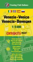
Stadsplattegrond Centrocittà Pocket Venetië | Touring Club Italiano

0
Venice street pocket map with Touring Club Italiano’s excellent, clear cartography; indexed, with a diagram of the vaporetto network, information about main sights, useful addresses, etc. The plan, printed on light, waterproof and tear resistant plastic paper, has clear, elegant cartography. Coverage does not include the area east of the Arsenale ...

Verkopers met dit product

Verkoper
Bezorging
Prijs
DeZwerver.nl logo
DeZwerver.nl
2,95
7,95

Anderen bekeken ook

Wegenkaart - landkaart - Stadsplattegrond Fleximap Dubai | Insight Guides
Geplastificeerde centrumkaart van Dubai, met register. Voor de 'gewone' toerist een handige kaart, geen groot formaat, overzichtelijk met alle belangrijke plaatsen goed weergegeven. Flexi Map Dubai is a laminated, tear-resistant map which includes 3 maps, each accompanied by separate indexes that are categorized for ease of use. The main map depicts Central Dubai at a scale of 1:15 000 and identifies places of interest, public buildings, selected hotels, parks and shopping areas. Both main and minor roads are named, car parks and one-way systems are clearly shown. The Dubai area is shown  at a scale of 1:100 000, Main roads are named, and numbered where applicable, and the Metro system is clearly marked.  An overview map of the United Arab Emirates, at a scale of 1:1 million, shows the road network with intermediate driving distances. Points of interest are shown as well as other features, such as, water springs, coral reefs, shipwrecks and offshore oilfields.   Flexi Map Dubai also g…
9,95
Stadsplattegrond Turin - Turijn | Touring Club Italiano
Goede stadskaart van Turijn met register en openbaar vervoernet. Bezienswaardigheden en hoogtepunten zijn helder zichtbaar. The plan covers Turin with the outer suburbs. Main traffic arteries across the city are highlighted and car parks in the city’s historic centre are marked. The metro line is clearly marked and stations are shown with their names. Churches and other important historic or municipal buildings are prominently coloured and named. For those wanting to venture outside the city centre, coverage includes both Juventus’s Stadio delle Alpi and the Fiat Mirafiori complex.
11,50
Nieuw
Wegenkaart - landkaart - Stadsplattegrond San Diego - California south | ITMB
Wegenkaart en stadsplattegrond in een kaart: aan de ene zijde San Diego stadsplattegrond en op de andere kant een kaart van het zuiden van Californië. San Diego on a clear, well presented street plan from ITMB, with a transit system diagram, a road map of the city and its environs, and a street plan of central Tijuana, plus on the reverse a road map of the US/Mexico border region extending east beyond El Paso and within USA north to Las Vegas.   On one side is an indexed street plan of San Diego, covering the city’s central districts (as indicated in our coverage image), including the downtown area, the Old Town for which an enlargement is provided, Balboa Park, University Heights, the Mission Bay Park with the SeaWorld, and the city’s international airport. The plan clearly shows the MTS and other public transit stations, highlights main traffic arteries and indicates one way streets. Also marked are recommended cycle routes. Streets are annotated with selected block numbers for easi…
13,95
Wegenkaart - landkaart Cordillera Cantabrica - Asturias y provincias limitrofes | Adrados Ediciones
Gedetailleerde wegenkaart an de Cordillera Cantabrica met hoogtelijnen, hoogte verschillen in kleur en schaduw en UTM coördinaten. Met plaatsnamen index! Cordillera Cantabrica on a detailed road map from the Oviedo based Adrados Ediciones, presenting this mountainous region with contours at 100m intervals, altitude coluring, relief shading and UTM coordinates. Since the publishers specialize in detailed hiking maps, including the best coverage of the Picos de Europa, the map includes an exceptionally large number of names of peaks, passes, etc. Symbols highlight best rock and ice climbing areas, huts and refuges, campsites, mountain rescue posts and information centres. Along the coast numerous beaches are named. Road network includes small country roads and tracks. Local railway lines are shown, although not very easy to see on the base map filled with so much information. The map has a 10km UTM grid. Map legend is in Spanish only. On the reverse is a panorama drawing of the area, lo…
14,95
Stadsplattegrond Fleximap Copenhagen - Kopenhagen | Insight Guides
Geplastificeerde kaart van Kopenhagen, met register. Voor de 'gewone' toerist een handige kaart, geen groot formaat, overzichtelijk met alle belangrijke plaatsen goed weergegeven.   Flexi Map Copenhagen is a laminated, tear-resistant map which has 3 maps, each accompanied by its own index.  It includes a list - with descriptions and some photographs - of 23 recommended sights, divided by theme and linked to the mapping by numbered markers. There is also a handy information section with concise details on getting around, tourist offices, money, tipping, opening times, public holidays, telecommunications, emergency telephone numbers and climate.   On the main map, shown at a scale of 1:11,000 (1cm = 0.110km), streets are named and a selection of hotels, public buildings and key sights are prominently marked, pedestrian areas and one-way systems are also shown. The comprehensive index is divided into categories for ease of use. A detailed Metro plan is located on the back cover for eas…
9,95
Nieuw
Stadsplattegrond Manila & Luzon | ITMB
Stadsplan Manila   Manila on a double-sided indexed street plan, with a diagram of the city’s metro network. The plan divides the city north/south, roughly along the upper part of the Pasig River, with a generous overlap between the two sides. Coverage of the northern side extends to Caloocan City - San Francisco del Monte and inland to the Cubao district. The southern side includes the Legaspi Vill and the Ayala Centre area. The plan clearly shows the city’s main traffic arteries, indicating one way streets, car parks and locations of petrol stations. Metro or railway stations and bus terminals are marked and in the port pier numbers are also shown.
14,50
Wegenkaart - landkaart - Stadsplattegrond Fleximap Kuala Lumpur | Insight Guides
Geplastificeerde kaart van Kuala Lumpur, met register. Voor de 'gewone' toerist een handige kaart, geen groot formaat, overzichtelijk met alle belangrijke plaatsen goed weergegeven.   Flexi Map Kuala Lumpur is a laminated, tear-resistant map which has 3 separate maps, each one accompanied by its own index.    It includes a list - with descriptions and some photographs - of 30 recommended sights, divided by theme and linked to the mapping by numbered markers. There is also a handy information section with concise details on getting around, tourist offices, money, tipping, opening times, public holidays, telecommunications, emergency telephone numbers and climate.   On one side is a street plan of the city, shown at a scale of 1:12 500 (1cm = 0.125km), the accompanying index is categorised for ease of use. One way streets, car parks and pedestrian zones are clearly shown and many prominent public buildings, hotels and other places of interest are highlighted and listed in the exten…
9,95
Stadsplattegrond - Wegenkaart - landkaart Fleximap Prague - Praag | Insight Guides
Geplastificeerde kaart van Praag, met register. Voor de 'gewone' toerist een handige kaart, geen groot formaat, overzichtelijk met alle belangrijke plaatsen goed weergegeven.   Flexi Map Prague is a laminated, tear-resistant map which includes 3 maps, each accompanied by separate indexes. The main map depicts Prague at a scale of 1:12 500, the index has been categorized for ease of use. Streets are named along with public buildings and selected hotels.   A Prague Environs map can be found on the reverse and this shows the various routes into the city. A detailed Metro plan is located on the back cover for easy reference.   Also included is a map of western Czech Republic which is depicted at a scale of 1:900 000, in addition to the road and rail networks, this map provides a detailed picture of the topography through the use of relief shading with gradients given for steep ascents.    Flexi Map Prague also gives a list - with descriptions and some photographs - of 21 recommended sig…
9,95
Stadsplattegrond Streetwise Streetwise Manhattan Map | Michelin
Some people think Manhattan and New York City are synonymous, but technically they are not. Manhattan is one of the five boroughs that make up New York City. The others are Brooklyn, The Bronx, Queens, and Staten Island. It's a persnickety detail, but detail is what STREETWISE® is about. For example, the architectural details drawn on the Manhattan New York map are in outline form. A solid drawing would obscure the streets surrounding the location, and therefore hamper the usability of the map. Only in unobstructed locations will you find a solid drawing. You may not notice this or any of the many other details that combine to make a NY city map that has been called the best selling map on earth*.    The STREETWISE® Manhattan Map is detailed from lower tip to upper tip. It is layered with information about sites and mass transit routes. The New York City Subway system is one of the most important and vital rail networks in the world. It is also the fastest and cheapest way to travel n…
9,95

Klanten-reviews van Stadsplattegrond Centrocittà Pocket Venetië | Touring Club Italiano

Er zijn nog geen beoordelingen voor dit productBen jij de eerste die een review plaatst?

Meer over Stadsplattegrond Centrocittà Pocket Venetië | Touring Club Italiano

Productomschrijving

Venice street pocket map with Touring Club Italiano’s excellent, clear cartography; indexed, with a diagram of the vaporetto network, information about main sights, useful addresses, etc. The plan, printed on light, waterproof and tear resistant plastic paper, has clear, elegant cartography. Coverage does not include the area east of the Arsenale (i.e. no Biennale grounds), Giudecca or the islands of the Lagoon beyond the San Michele cemetery. The city’s numerous palaces, churches and other places of interest are clearly named. Vaporetto piers are marked and named, but the lines themselves are shown only on a separate diagram of the whole network accompanied by a list of lines and terminals. Street index is on the reverse includes churches, palaces, canals, museums, etc. The plan is accompanied by a diagram of the vaporetto network, a small map of the city’s environs including Treviso, plus lists of main sights with opening hours, etc., and contact details of other useful institutions. Map legend and all information are in Italian and English.

Webshop.nl maakt gebruik van cookies. Ga je verder op onze website, ga dan akkoord met het plaatsen van cookies en de verwerking van deze data door ons en vermelde partners.