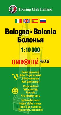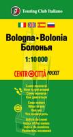
Stadsplattegrond Centrocittà Pocket Bologna | Touring Club Italiano

0
Handige stadsplattegrond van Bologna in klein pocket formaat. Toch staat er nog heel veel op! This city map, with a scale of 1:10.000 includes a detailed road network with information on the characteristics of each road - such as number of lanes, grade of incline, and tolls. Also included is tourist information and useful information on parking, t...

Verkopers met dit product

Verkoper
Bezorging
Prijs
DeZwerver.nl logo
DeZwerver.nl
2,95
7,95

Anderen bekeken ook

Stadsplattegrond Centrocittà Pocket Venetië | Touring Club Italiano
Venice street pocket map with Touring Club Italiano’s excellent, clear cartography; indexed, with a diagram of the vaporetto network, information about main sights, useful addresses, etc. The plan, printed on light, waterproof and tear resistant plastic paper, has clear, elegant cartography. Coverage does not include the area east of the Arsenale (i.e. no Biennale grounds), Giudecca or the islands of the Lagoon beyond the San Michele cemetery. The city’s numerous palaces, churches and other places of interest are clearly named. Vaporetto piers are marked and named, but the lines themselves are shown only on a separate diagram of the whole network accompanied by a list of lines and terminals. Street index is on the reverse includes churches, palaces, canals, museums, etc. The plan is accompanied by a diagram of the vaporetto network, a small map of the city’s environs including Treviso, plus lists of main sights with opening hours, etc., and contact details of other useful institutions…
7,95
Wegenkaart - landkaart 2 Italië Centraal | Touring Club Italiano
Central Italy at 1:400,000 from the Touring Club Italiano, printed on light, waterproof and tear-resistant plastic paper; one of the titles in a series of three touring maps conveniently grouping together several popular holiday areas. The maps very effectively present the country’s topography with attractive altitude colouring, supplemented by names of numerous hill and mountain ranges, valleys, etc, plus spot heights for selected peaks. National parks and scenic routes are highlighted. National parks and scenic routes are highlighted. Grading according to the degree of importance and interest is given not only to towns, villages and historical or architectural sites, but also to holiday resorts and natural curiosities. Symbols highlight churches, monasteries, castles, palaces, ruins and archaeological sites, caves and waterfalls, etc. The maps also provide some information on accommodation, indicating selected isolated hotels, refuges, tourist villages and campsites, Road network st…
13,95
Wegenkaart - landkaart - Stadsplattegrond Montreal & Southern Quebec | ITMB
Stadsplattegrond van Montreal met register. Op de achterzijde een kaart van het zuiden van Quebec. 1:12,500/1:850,000 on waterproof paper. In this third, updated, edition of Canada's third largest city, we have added a user-friendly bonus. As is common now to most of our city maps, we have included a regional map of the hinterland of the urban area, so buyers won't have to purchase a second map to explore the environs of the city being presented. In the case of Montreal, being in a huge geographic country, this means Southern Quebec which, because of its size, dictates a map of more than one to a million scale. In the European context this would be the equivalent of Paris and all of France as a 'regional' map of the surrounds of Paris - but that's France and this is Canada.   Montreal (or Mont Royale in its original) was a village called Hochelaga when the early French explorers arrived in the early 1600s. They established a trading fort and, generally speaking, maintained good relati…
13,95
Stadsplattegrond Streetwise London | Michelin
Handige stadsplattegrond van Londen in de vorm van een uitklapkaart, die aan twee zijden bedrukt is. Prettig leesbaar, helder kaartbeeld, met een register en een kleine kaart van het openbaar vervoer. Deze kaart is geplastificeerd. REVISED 2023Streetwise London Map is a laminated city center map of London, England. The accordion-fold pocket size travel map includes a London Underground map with tube lines & stations. Cover includes:Main London City Map 1:20,000London Underground Map - London Tube MapDimensions: 4" x 8.5" folded, 8.5" x unfoldedLondon is one of the most popular, populated and accessible cites on earth.   People love London. And why not? Londoners are charming and helpful, and their city operates on such a high dosage of civility that it could be considered an art form. London is an urban oasis where you can search out cutting edge design, cuisine, fashion, chic neighborhoods, or traditional culture.   When visiting London, be prepared to walk. Whether its basic window …
9,95
Stadsplattegrond Jakarta en omgeving | ITMB
Kaart van het centrum op gedetailleerde schaal en een kaart op de achterzijde van de regio en voorsteden op een schaal van 75.000. Indonesia is emerging quickly as one of the power-houses of Asia. Jakarta is a huge urban area, with a charming city centre. This double-sided map shows Greater Jakarta on one side, with its expressways and inter-urban train network and is, in my opinion very useful to business visitors to the city. It includes the airport, the city centre, the enormous soccer stadium (worth a visit), and the roads connecting the different neighbourhoods of this spread-out city. The other side concentrates on the central core of Jakarta, which is where most visitors would spend most time. Road and rail connections are clearly shown, as well as a good range of embassies, museums, hotels, gas stations, religious buildings, hospitals, and touristic attractions. Asian cities tend not to be well-mapped; the last map of the city that I recall was done about ten years ago, so thi…
13,95
Stadsplattegrond Centrocittà Pocket Napels | Touring Club Italiano
Napels stadsplattegrond 1:8.000 – Touring Centrocittà Pocket Compact, overzichtelijk en ideaal voor op reis: deze pocketkaart van Napels biedt alles wat je als toerist nodig hebt in één handig formaat. Ontdek de stad te voet, met de metro of met de auto – deze kaart helpt je snel en eenvoudig oriënteren. 🧭 Wat bevat deze kaart? Gedetailleerde plattegrond van het stadscentrum van Napels Het volledige netwerk van openbaar vervoer (metro, bussen enz.) Een straatnamenregister Toeristische informatie in vier talen: Italiaans, Engels, Spaans en Russisch Aanduiding van alle belangrijke bezienswaardigheden en must-sees ✅ Voordelen Handzaam zakformaat (8 × 15 cm gevouwen) – ideaal voor onderweg Wordt geleverd in een stevige PVC-hoes Nuttig voor wie zich verplaatst te voet, met de metro of per auto Duidelijk en overzichtelijk voor een kort verblijf of stedentrip Bevat de essentiële info zonder overbodige details ⚠️ Aandachtspunten Alleen geschikt voor het centru…
7,95
Wegenkaart - landkaart - Stadsplattegrond Washington D.C. & eastern corridor | ITMB
Stadsplattegrond van Washington D.C., 1:12.500, met een overzichtskaart van het gebied van Boston tot aan Washington DC, 1:1.000.000   This is one of the most-visited cities in the USA and one really NEEDS a map to uncover all the statues, memorials, and buildings of interest. Of course, hotels, shopping areas, transportation hubs, parks, etc are also included. With this edition, we also have added a full-sheet map of the Eastern Corridor of the USA to the reverse side of the map. Starting with Boston in the north, through NYC and Philadelphia to Baltimore and on past DC to Richmond and Raleigh, the Eastern Corridor encompasses one-third of the population of the United States and a dozen States. The map shows road and rail connections, with motorways noted in blue and toll roads in green, and includes major historic and touristic sites within the area of coverage.   Legend Includes: Roads by classification, State Boundaries,State Highways, Main Roads, Secondary and other Roads,Hot spr…
13,95
Wegenatlas Local Explorer Street Atlas Cornwall and Plymouth | Philip's Maps
Prachtige wegenatlas van Cornwall  voor fietsers en wandelaars op een super gedetaileerde schaal! Met Lange afstandsfietsroutes en wandelroutes.   Who hasn't explored and enjoyed their surrounding area recently and come to appreciate what is on our respective doorsteps? Philip's have created this new series for walkers, cyclists and local explorers at a scale that provides greener options to uncover all the nature and hidden gems in the local area. The detailed scale allows explorers, walkers and cyclists to avoid main roads and select pathways, bridleways and lanes for optimum enjoyment. Whether it's meandering through the local parks or historic houses, exploring neighbourhood nature spots or the local town, we have the clear mapping and information you need. If you do have to travel to reach areas you'd like to explore, all A and B roads are clearly shown on our Route Planner and we include all the large-scale town and city plans. Exceptional detail allows the user to pinpoint ex…
23,95
Stadsplattegrond Fleximap Copenhagen - Kopenhagen | Insight Guides
Geplastificeerde kaart van Kopenhagen, met register. Voor de 'gewone' toerist een handige kaart, geen groot formaat, overzichtelijk met alle belangrijke plaatsen goed weergegeven.   Flexi Map Copenhagen is a laminated, tear-resistant map which has 3 maps, each accompanied by its own index.  It includes a list - with descriptions and some photographs - of 23 recommended sights, divided by theme and linked to the mapping by numbered markers. There is also a handy information section with concise details on getting around, tourist offices, money, tipping, opening times, public holidays, telecommunications, emergency telephone numbers and climate.   On the main map, shown at a scale of 1:11,000 (1cm = 0.110km), streets are named and a selection of hotels, public buildings and key sights are prominently marked, pedestrian areas and one-way systems are also shown. The comprehensive index is divided into categories for ease of use. A detailed Metro plan is located on the back cover for eas…
9,95
Wegenatlas Local Explorer Street Atlas Somerset | Philip's Maps
Prachtige wegenatlas van Somerset voor fietsers en wandelaars op een super gedetaileerde schaal! Met Lange afstandsfietsroutes en wandelroutes.   Who hasn't explored and enjoyed their surrounding area recently and come to appreciate what is on our respective doorsteps? Philip's have created this new series for walkers, cyclists and local explorers at a scale that provides greener options to uncover all the nature and hidden gems in your local area. The detailed scale allows explorers, walkers and cyclists to avoid main roads and select pathways, bridleways and lanes for optimum enjoyment. Whether it's meandering through the local parks or historic houses, exploring neighbourhood nature spots or the local town, we have the clear mapping and information you need. If you do have to travel to reach areas you'd like to explore, all A and B roads are clearly shown on our Route Planner and we include all the large-scale town and city plans. Exceptional detail allows the user to pinpoint ex…
23,95

Klanten-reviews van Stadsplattegrond Centrocittà Pocket Bologna | Touring Club Italiano

Er zijn nog geen beoordelingen voor dit productBen jij de eerste die een review plaatst?

Meer over Stadsplattegrond Centrocittà Pocket Bologna | Touring Club Italiano

Productomschrijving

Handige stadsplattegrond van Bologna in klein pocket formaat. Toch staat er nog heel veel op!

This city map, with a scale of 1:10.000 includes a detailed road network with information on the characteristics of each road - such as number of lanes, grade of incline, and tolls. Also included is tourist information and useful information on parking, transportation, hospitals, public safety and pedestrian areas.

Verken gerelateerde categorieën

Webshop.nl maakt gebruik van cookies. Ga je verder op onze website, ga dan akkoord met het plaatsen van cookies en de verwerking van deze data door ons en vermelde partners.