webshop.nl
Categorieën
  Sluiten

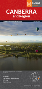
Stadsplattegrond Canberra en omgeving | Hema Maps

Stadsplattegrond van Canberra met een omgevingskaart. Inclusief  register.   A map that has the Canberra suburbs (1:60,000) on one side and the Canberra city, Canberra region (1:850,000) and ACT (1:375,000) maps on the other.    Also included is an information section on Canberra's tourist attractions with necessary tourist attractions attached.   ...
11,50

Webshops met dit product

Webshop
Bezorging
Prijs

Anderen bekeken ook

Wegenkaart - landkaart Gold Coast and region | Hema Maps
Goede, overzichtelijke, leesbare kaart van de hele provincie. Nationale Parken zijn er goed op te vinden en de afstanden worden weergegeven. Op de achterkant nog deelkaartjes van enkele steden en NP s.   Map of Gold Coast: CBD, City, Suburbs & Hinterland This map of the Gold Coast includes detailed mapping of the city (1:15,000) and suburbs (1:50,000), as well as a comprehensive overview of the surrounding Gold Coast Hinterland (1:100,000).   There’s plenty of useful visitor information marked on the mapping for staying in and getting around the Gold Coast, including fully updated roads, facilities and accommodation, as well as 2018 Commonwealth Games venues and temporary Park ‘n’ Ride locations.   Map Features: Perfect for Visitors Surfers Paradise, Coolangatta & Tweed Heads Gold Coast Hinterland Commonwealth Games Venues Commonwealth Games Park n Ride locations Public Transport Route Map 24-hour fuel Accommodation & POI Marked Fully Indexed Suburbs Index Street Index Tourist Attracti…
11,50
Wegenkaart - landkaart Melbourne and Region Map | Hema Maps
Handige kaart van zowel de stad Melbourne als het omliggende gebied. Description Melbourne & Region The Melbourne and Region map features a primary map of Greater Melbourne (1:115,000) that includes highways, major roads and local streets, as well as 24-hour fuel, parks and caravan parks. On the reverse is a Melbourne CBD map with accommodation, shopping and other places of interest pinpointed, along with train and tram network maps and a Melbourne Region map. Key Features Highways, major roads and local streets Points of interest Accommodation Travel Information Parks Caravan Parks 24 Hour Fuel Tram lines Railway stations Suburbs Suburbs Index Shopping centres Theatres/Cinemas Sporting venues Tram and Train network maps The cosmopolitan capital of Victoria, Melbourne is a city of distinct districts: each with its own particular appeal. For a different view of the city head to the observation deck at the Eureka Skydeck for 360° views. A cruise along the Yarra River provides yet another…
11,50
Stadsplattegrond Darwin en omgeving | Hema Maps
Stadsplattegrond van Darwin en de directe omgeving. Inclusief index. Offering maps of the region, suburbs and Darwin’s CBD. Containing the entire city with primary, secondary and tertiary road patterns, city centre distance markers on major roads and postcode and road numbering, these maps are easy and helpful to use, making them appropriate for a wide range of users. Easy to use CBD map Suburban map Regional map Postcodes Points of interest Fully indexed
11,50
Wandelkaart - Topografische kaart 161 OS Explorer Map London South (greenw.m) | Ordnance Survey
Follow the Thames Path through the heart of London’s oldest and most historic areas. Discover Westminster, a square mile densely packed with some of the world’s most famous attractions: Buckingham Palace, Westminster Abbey, Westminster Cathedral and the Palace of Westminster, home to the Houses of Parliament.    Visit the World Heritage Sites of Kew Gardens, Maritime Greenwich including the Royal Observatory and the Palace of Westminster & Abbey complex  Explore the suburbs of Croydon, Esher and Twickenham, home of English rugby and Horace Walpole’s miniature Gothic castle, Strawberry Hill  Walk or cycle the Thames Path National Trail or recreational paths including the London Loop and Vanguard Way  Met zijn 4cm voor 1 km (2 ½ cm voor 1 mijl) schaal, is de OS Explorer kaartenserie de ideale en meest gedetailleerde kaartenreeks voor mensen die graag outdoor-activiteiten zoals fietsen, wandelen, paardrijden, klimmen en watersporten. Deze kaart is nog gedetailleerder dan de 'gewone' La…
19,50
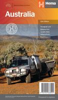
Wegenkaart - landkaart Australia - Australië | Hema Maps
Mooie, grote, duidelijke kaart van Australië met veel informatie. Oa bezinestations (ook in de outback) en een goed overzicht van de doorgaande (grote) wegen waardoor de kaart erg handig is van het plannen van uw route. Ook staan er afstanden op vermeld.   Verder staan er stadkaartjes op van het (centrum) van de belangrijkste Australische steden:   Adelaide, Brisbane, Canberra, Darwin, Hobart, Melbourne, Perth en Sydney   Hema’s iconic large map of Australia is ideal as a trip planning tool and travel companion. Marked on the map are localities, the major road network, distances and major national parks. The map also shows localities, the major road network, distances and major national parks. The visual appeal makes it perfect as a decorative map or an educational tool. On the reverse side is an overview of Australia's iconic touring regions featuring history, geology and landforms, nature, bucket-list attractions and iconic 4WD tracks.   Key Features Hema's iconic map of Austral…
15,95
Stadsplattegrond Bangkok en omgeving | Nelles Verlag
Goede stadskaart van Bangkok en omgeving. Aan beide kanten bedrukt. Met veel toeristische aanduidingen als culturele bezienswaardigheden en aanduidingen van bijvoorbeeld de grotere hotels. Prima leesbare kaart. Bangkok on a double-sided map from Nelles combining an indexed street plan of the city’s central districts at 1:15,000 with a more general plan of the capital with its outer suburbs presented at 1:75,000. Both plans highlight numerous places of interest.   On one side the main, indexed plan covers the city’s inner districts showing public transport routes: metro and skytrain lines with stations, bus routes with line numbers, and express boat service along the river. Public buildings, including selected hotels, are clearly marked and named, and shopping centres or market streets are indicated. The main centre of tourist accommodation, Banglamphoo - Khao San Road area, is also shown in greater detail on a small enlargement.   On the reverse a more general plan at 1:75,000 covers t…
11,95
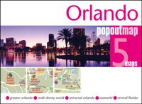
Stadsplattegrond Popout Map Orlando | Compass Maps
Handig ( borstzak- ) formaat stadsplattegrond met voldoende detail, zodat je ook de kleinere straatjes erop aantreft. Van veel wereldsteden inmidddels leverbaar en dat is mooi, want juist in dit soort steden wil je je handen liever vrij houden en niet teveel hoeven stoeien met het uitvouwen van een grote plattegrond, en/of teveel als "toerist" opvallen. Door het unieke vouwsysteem blijft alles zeer compact en biedt het kaartje een razendvlugge manier van orientatie. Wel is dit product alleen geschikt voor het ( grote ) centrum van de stad.Verder geven de kaartjes uit deze reeks ook de meeste highlights van de stad aan en ( indien van toepassing ) een overzichtskaartje van de metro. Explore Florida's playground, Walt Disney World and Orlando, with the help of this genuinely pocket-sized, pop-up, map. Small in size yet big on detail, this compact, dependable, Walt Disney World and Orlando pop-up map will ensure you don't miss a thing. * Includes 2 PopOut maps - a detailed pop-up street …
7,95
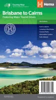
Wegenkaart - landkaart Brisbane to Cairns | Hema Maps
Detailkaart van een deel van Australië. Zeer goed leesbaar, met naast de topografische details veel symbolen waarmee allerhande toeristische zaken worden aangeduid als campsites, nationale parken, attracties, wandelmogelijkheden etc. An easy-to-follow map that shows both the coastal and inland routes from Brisbane to Cairns. Roadside rest areas, intermediate distances, and a quick-find distance chart are also shown. The map shows all the popular tourist destinations along the Queensland coast. Routes between Brisbane with Cairns in a series of touring maps connecting Australia’s main centres of population along some of the most spectacular routes such as the Great Ocean Road or the Savannah Way. The maps highlight 24-hour fuel supplies, roadside rest areas, camping facilities, places of interest, etc., and include distance charts and, in some titles, city maps. Road network indicates unsurfaced roads and tracks. The maps also show railway lines. There is no topographical information be…
13,95
Stadsplattegrond Popout Map Oxford | Compass Maps
Handig ( borstzak- ) formaat stadsplattegrond met voldoende detail, zodat je ook de kleinere straatjes erop aantreft. Van veel wereldsteden inmidddels leverbaar en dat is mooi, want juist in dit soort steden wil je je handen liever vrij houden en niet teveel hoeven stoeien met het uitvouwen van een grote plattegrond, en/of teveel als "toerist" opvallen. Door het unieke vouwsysteem blijft alles zeer compact en biedt het kaartje een razendvlugge manier van orientatie. Wel is dit product alleen geschikt voor het ( grote ) centrum van de stad.Verder geven de kaartjes uit deze reeks ook de meeste highlights van de stad aan en ( indien van toepassing ) een overzichtskaartje van de metro. Experience the elegant university city of Oxford (UK) with the help of this genuinely pocket-sized, pop-up map. Small in size yet big on detail, this compact, dependable, city map of Oxford will ensure you don't miss a thing. * Includes a PopOut map - a detailed street map of the city center * Advice on the …
7,95
Wegenkaart - landkaart Iconic Map Fraser Island - Australië | Hema Maps
Detailkaart van een deel van Australië. Zeer goed leesbaar, met naast de topografische details veel symbolen waarmee allerhande toeristische zaken worden aangeduid als campsites, nationale parken, attracties, wandelmogelijkheden etc. This map is the only complete map of Fraser Island that gives full topographic contours. In addition, all the tracks on the island have been graded accurately and located using Hema's GPS mapping system. The reverse side includes large colour photos, comprehensive text on the history, environment and attractions, and a telephone directory for accommodation, permits, tours and more. Detailed map of the island with contours at 20m intervals plus colouring and graphics to indicate various types of terrain and protected areas, including national and marine parks. Four scenic drives are highlighted and given brief descriptions. The map also shows vehicle entry restrictions, tracks, and footpaths, including the Fraser Island Great Walk. A wide range of symbols h…
15,95

Klanten-reviews van Stadsplattegrond Canberra en omgeving | Hema Maps

Er zijn nog geen beoordelingen voor dit productBen jij de eerste die een review plaatst?

Meer over Stadsplattegrond Canberra en omgeving | Hema Maps

Productomschrijving

Stadsplattegrond van Canberra met een omgevingskaart. Inclusief  register.   A map that has the Canberra suburbs (1:60,000) on one side and the Canberra city, Canberra region (1:850,000) and ACT (1:375,000) maps on the other.    Also included is an information section on Canberra's tourist attractions with necessary tourist attractions attached.   Features of this map include:   Highways,major roads and local streets Points of interest Accommodation Parks Caravan Parks 24Hour Fuel Railway stations Suburbs Suburbs Index Shopping centres Theatres/Cinemas Sporting venues CBD Map ACT Map
Webshop.nl maakt gebruik van cookies. Ga je verder op onze website, ga dan akkoord met het plaatsen van cookies en de verwerking van deze data door ons en vermelde partners.