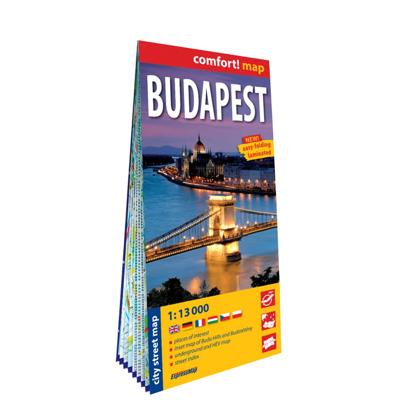
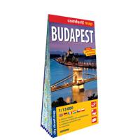
Stadsplattegrond Boedapest | ExpressMap

0

Verkopers met dit product

Verkoper
Bezorging
Prijs
DeZwerver.nl logo
DeZwerver.nl
2,95
12,95

Anderen bekeken ook

Stadsplattegrond Budapest - Boedapest | Michelin
Handige stadsplattegrond van Budapest. Prettig leesbaar, helder kaartbeeld, met een register en een kleine kaart van het openbaar vervoer. Deze kaart is geplastificeerd.  Retrouvez tous les renseignements pratiques pour traverser Budapest à pied, en voiture, à vélo. Le plan MICHELIN Budapest au 1/12 500 est idéal pour parcourir les quartiers de la ville. Pour compléter l information : transports, sens de circulation, parkings et l'index complet de toutes les rues en annexe.
12,95
Stadsplattegrond Budapest - Boedapest | Borch
Borch Budapest is een duidelijke, geplastificeerde plattegrond van het centrum met informatie over openbaar vervoer en bezienswaardigheden. Inclusief straatnamenregister.   Our soft-laminated folded map of Budapest shows: Budapest 1:11 000, Budapest & Region 1:400 000, Margaret Island 1:11 000, Public Transportation Budapest, Top 30 Sights, Hungary administrative and time zones. Borch Maps are easy to fold, durable and water-repellent with a wipeable surface. Borch Maps show hotels, museums, monuments, markets, public transport, top sights and points of interest, useful statistics, conversion charts for temperatures, weights and measurements, climate charts showing temperatures, sunshine hours, precipitation and humidity, overview maps, time zones, and much more...   Budapest is the capital and largest city of Hungary and its commercial, transport and cultural center. Located on the famous Danube river, the Buda half of the city lies on the western bank while Pest is located on the ea…
9,95
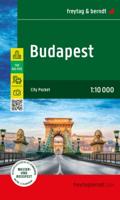
Stadsplattegrond Budapest - Boedapest | Freytag & Berndt
Stadsplattegrond met register. Helder kaartbeeld waarbij de naamgeving goed leesbaar is weergegeven. Met de toeristische bezienswaardigheden in symbolen weergeven: monumenten, musea, stadions e.a. Daarnaast handige zaken als postkantoren, parkeergarages en stations. Veelal ook met een openbaar vervoer of metro kaart als inzet. Explore Budapest with this Freytag & Berndt street map. The best way to plan your trip, prepare your itinerary, and to travel independently in the Hungarian capital.   The map includes an inset of the central area in more detail at 1:5 000 as well as diagram of the whole public transport network.   The legend is in several languages inlcuding English.
13,95
Wegenkaart - landkaart - Stadsplattegrond Hongarije - Boedapest | ITMB
Central Europe emergence from Soviet Russia control has revealed one of the historic gems of Europe. It is difficult to think of Hungary without including Budapest, and the Danube River. This updated edition of Hungary shows the entire country on one side, with Budapest filling the other. This is the perfect map for a trip to the heart of Europe. The map has also been upgraded to plastic paper for durability. With this map, a traveller would not need another map to explore beautiful Hungary   Legend Includes: Road by classification, Major road, Tram, Long distance train, Ferry dock, Church, Post office, Point of interest, Police station, Shopping centre, Pedestrian zone and much more...
13,95
Stadsplattegrond City map Budapest - Boedapest | Lonely Planet
De stadsplattegronden van Lonely Planet zijn uitgevoerd op scheur- en watervast papier, zijn lichtgewicht en kennen een handig formaat. Het centrum van de stad is in heldere kleuren in beeld gebracht met straatnamen, bezienswaardigheden en symbolen voor openbaar vervoer. Op de achterzijde staat informatie over de toeristische hoogtepunten en in de meeste gevallen een schematische plattegrond van het openbaar vervoer. Met een register. Durable and waterproof, with a handy slipcase and an easy-fold format, Lonely Planet Budapest City Map is your conveniently-sized passport to traveling with ease.   Get more from your map and your trip with images and information about top city attractions, walking tour routes, transport maps, itinerary suggestions, extensive street and site index, and practical travel tips and directory. With this easy-to-use, full colour navigation tool in your back pocket, you can truly get to the heart of Budapest, so begin your journey now! Durable and waterproof …
9,95
Stadsplattegrond Popout Map Boedapest Budapest | Compass Maps
Handig ( borstzak- ) formaat stadsplattegrond met voldoende detail, zodat je ook de kleinere straatjes erop aantreft. Van veel wereldsteden inmidddels leverbaar en dat is mooi, want juist in dit soort steden wil je je handen liever vrij houden en niet teveel hoeven stoeien met het uitvouwen van een grote plattegrond, en/of teveel als "toerist" opvallen. Door het unieke vouwsysteem blijft alles zeer compact en biedt het kaartje een razendvlugge manier van orientatie. Wel is dit product alleen geschikt voor het ( grote ) centrum van de stad.Verder geven de kaartjes uit deze reeks ook de meeste highlights van de stad aan en ( indien van toepassing ) een overzichtskaartje van de metro. The ultimate pocket map of Budapest! Explore historic city of Budapest with the help of this genuinely pocket-sized, pop-up map. Small in size yet big on detail, this compact, dependable, city map will ensure you don't miss a thing. * Includes 2 popout maps – a detailed street map of the city centre as well…
7,95
Stadsplattegrond Marseille | ExpressMap
La basilique Notre-Dame-de-la-Garde richement décorée, le port historique et l'abbaye Saint-Victor sont que quelques-unes des nombreuses attractions qu'offre la ville de Marseille. Laminée et facile à plier, la carte de Marseille sera un compagnon indispensable lors d’un voyage dans cette ville magnifique. De plus, elle contient un plan supplémentaire détaillé du centre-ville à l'échelle de 1 : 10 000 (1 cm – 100 m).   Les atouts de la carte :   - riche contenu touristique, par exemple musées, monuments   - réseaux du metro et du tramway   - schéma du métro et des tramways   - plan détaillé du centre-ville   - index des rues.
13,50

Klanten-reviews van Stadsplattegrond Boedapest | ExpressMap

Er zijn nog geen beoordelingen voor dit productBen jij de eerste die een review plaatst?

Meer over Stadsplattegrond Boedapest | ExpressMap

Productinformatie

    Verken gerelateerde categorieën

    Webshop.nl maakt gebruik van cookies. Ga je verder op onze website, ga dan akkoord met het plaatsen van cookies en de verwerking van deze data door ons en vermelde partners.