Stadsplattegrond Berlin - Berlijn | Borch
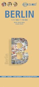
Geplastificeerde stadsplattegrond van Berlijn voor toeristisch gebruik. Met metrokaart en omgevingskaart. Inclusief index. Our soft-laminated folded map of Berlin shows: Berlin 1:18 000, Berlin Mitte 1:11 500, Greater Berlin 1:130 000, Public Transport Berlin, Berlin Wall, Germany administrative and Top 30 sights. Borch Maps are easy to fold, durable and water-repellent with a wipeable surface. Borch Maps show hotels, museums, monuments, markets, public transport, top sights and points of interest, useful statistics, conversion charts for temperatures, weights and measurements, climate charts showing temperatures, sunshine hours, precipitation and humidity, overview maps, time zones, and much more... The second most populous city in the EU, Berlin is influential in European politics, culture and science. Due to its location directly in the center of Europe, Berlin is a major transport hub. Renowned universities, high-profile sports and social events and famous orchestras and museum…
10,25


