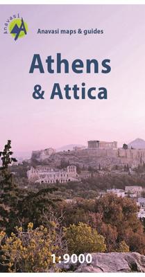
Stadsplattegrond Athene | Anavasi

0
Handzame kleine plattegrond van Athene, op de achterkant een overizcht van de omgeving van de stad en een korte beschrijving van de belangrijkste bezienswaardigheden. Locations of the city’s 102 important archaeological sites, museums, and other important buildings, plus on the reverse a road map of the environs including the port at Piraeus and t...

Verkopers met dit product

Verkoper
Bezorging
Prijs
DeZwerver.nl logo
DeZwerver.nl
2,95
6,95

Anderen bekeken ook

Wegenkaart - landkaart - Stadsplattegrond San Diego - California south | ITMB
Wegenkaart en stadsplattegrond in een kaart: aan de ene zijde San Diego stadsplattegrond en op de andere kant een kaart van het zuiden van Californië. San Diego on a clear, well presented street plan from ITMB, with a transit system diagram, a road map of the city and its environs, and a street plan of central Tijuana, plus on the reverse a road map of the US/Mexico border region extending east beyond El Paso and within USA north to Las Vegas.   On one side is an indexed street plan of San Diego, covering the city’s central districts (as indicated in our coverage image), including the downtown area, the Old Town for which an enlargement is provided, Balboa Park, University Heights, the Mission Bay Park with the SeaWorld, and the city’s international airport. The plan clearly shows the MTS and other public transit stations, highlights main traffic arteries and indicates one way streets. Also marked are recommended cycle routes. Streets are annotated with selected block numbers for easi…
13,95
Nieuw
Stadsplattegrond Bangkok en omgeving | Nelles Verlag
Goede stadskaart van Bangkok en omgeving. Aan beide kanten bedrukt. Met veel toeristische aanduidingen als culturele bezienswaardigheden en aanduidingen van bijvoorbeeld de grotere hotels. Prima leesbare kaart. Bangkok on a double-sided map from Nelles combining an indexed street plan of the city’s central districts at 1:15,000 with a more general plan of the capital with its outer suburbs presented at 1:75,000. Both plans highlight numerous places of interest.   On one side the main, indexed plan covers the city’s inner districts showing public transport routes: metro and skytrain lines with stations, bus routes with line numbers, and express boat service along the river. Public buildings, including selected hotels, are clearly marked and named, and shopping centres or market streets are indicated. The main centre of tourist accommodation, Banglamphoo - Khao San Road area, is also shown in greater detail on a small enlargement.   On the reverse a more general plan at 1:75,000 covers …
11,95
Stadsplattegrond Streetwise Rome | Michelin
Handige stadsplattegrond van Rome in de vorm van een uitklapkaart, die aan twee zijden bedrukt is. Prettig leesbaar, helder kaartbeeld, met een register en een kleine kaart van het openbaar vervoer. Deze kaart is geplastificeerd   REVISED 2023Streetwise Rome Map is a laminated city center map of Rome, Italy. The accordion-fold pocket size travel map has an integrated metro map including subway & railway lines and stations. Coverge includes:Main Rome Map 1:17,000Rome Historic District Map 1:8,700Rome Metro MapDimensions: 4" x 8.5" folded, 8.5" x 32" unfoldedA great map can be the key to discovering all the city has to offer.   Our STREETWISE (R) Rome Map provides a comprehensive and fully detailed map of Rome to aid you in finding your way to all there is to do and see in this great center of history and culture. From Vatican City to the southeast corner of Palatine, the STREETWISE (R) Rome Map covers the entire city in full-color, including graphic representations of the major buildin…
10,50
Nieuw
Wegenkaart - landkaart Taiwan and Taipei | ITMB
Een degelijke kaart met aanduidingen van o.a. nationale parken, vliegveld, benzinepomp, dirt-roads en kleine plattegrond van hoofdstad. Als overzichtskaart goed te gebruiken. Wegenkaart Taiwan en stadsplan Taipei   Combining a map of Taiwan with a street plan of Taipei. The map of the island shows the road and rail networks, indicating local airports and airfields, national parks and scenic areas, places of interest and beaches. The country’s administrative divisions are marked, with names of the provinces and provincial capitals shown in both Roman alphabet and Chinese. All other place names are in Roman alphabet only. Topography is shown by altitude colouring with spot heights. Brief descriptions are provided for main places of interest and a separate inset shows the route of the Taiwan Highspeed Railway.   On the reverse is an street plan of Taipei, highlighting places of interest, railway and metro stations, bus and ferry terminals, selected accommodation, etc. Street and district…
14,50
Nieuw
Stadsplattegrond Caracas | Freytag & Berndt
Stadsplattegrond met register. Helder kaartbeeld waarbij de naamgeving goed leesbaar is weergegeven. Met de toeristische bezienswaardigheden in symbolen weergeven: monumenten, musea, stadions e.a. Daarnaast handige zaken als postkantoren, parkeergarages en stations. Veelal ook met een openbaar vervoer of metro kaart als inzet. Caracas on a large indexed street plan at 1:12,000 from Freytag & Berndt covering the city with its outer districts and showing metro stations, various places of interest and facilities, etc. Coverage extends north to El Avila National Park and south to the La Rinconada race track, Baruta, Canta Rana and Alto Hatillo. West/east the plan extends from Perez Bonalde, Vista Alegre and La Vega districts to beyond the city’s Gen. Francisco de Miranda Airport to Le Marques California Norte, California Sur and Vista Linda districts.
13,95
Stadsplattegrond Manila & Luzon | ITMB
Stadsplan Manila   Manila on a double-sided indexed street plan, with a diagram of the city’s metro network. The plan divides the city north/south, roughly along the upper part of the Pasig River, with a generous overlap between the two sides. Coverage of the northern side extends to Caloocan City - San Francisco del Monte and inland to the Cubao district. The southern side includes the Legaspi Vill and the Ayala Centre area. The plan clearly shows the city’s main traffic arteries, indicating one way streets, car parks and locations of petrol stations. Metro or railway stations and bus terminals are marked and in the port pier numbers are also shown.
14,50
Nieuw
Stadsplattegrond Washington D.C | Freytag & Berndt
Goede stadsplattegrond van Washington D.C. met openbaar vervoer, register. Stadsplattegrond met register. Helder kaartbeeld waarbij de naamgeving goed leesbaar is weergegeven. Met de toeristische bezienswaardigheden in symbolen weergeven: monumenten, musea, stadions e.a. Daarnaast handige zaken als postkantoren, parkeergarages en stations. Veelal ook met een openbaar vervoer of metro kaart als inzet Central Washington DC at 1:12,500 on street plan from Freytag & Berndt clearly showing locations of various government institutions, US and international organizations, numerous foreign embassies, cultural centres, educational establishments and other and places of interest. Metro and railway stations are prominently marked and for drivers access to and from highways is clearly laid out.   Coverage extends north beyond the Howard University Campus to the National Zoological Park; east across the Potomac to Arlington, including the National Cemetery, Fort Myer and the Pentagon; south to the…
13,95
Stadsplattegrond Centrocittà Pocket Venetië | Touring Club Italiano
Venice street pocket map with Touring Club Italiano’s excellent, clear cartography; indexed, with a diagram of the vaporetto network, information about main sights, useful addresses, etc. The plan, printed on light, waterproof and tear resistant plastic paper, has clear, elegant cartography. Coverage does not include the area east of the Arsenale (i.e. no Biennale grounds), Giudecca or the islands of the Lagoon beyond the San Michele cemetery. The city’s numerous palaces, churches and other places of interest are clearly named. Vaporetto piers are marked and named, but the lines themselves are shown only on a separate diagram of the whole network accompanied by a list of lines and terminals. Street index is on the reverse includes churches, palaces, canals, museums, etc. The plan is accompanied by a diagram of the vaporetto network, a small map of the city’s environs including Treviso, plus lists of main sights with opening hours, etc., and contact details of other useful institutions…
7,95
Nieuw
Stadsplattegrond München | Freytag & Berndt
Stadsplattegrond met register. Helder kaartbeeld waarbij de naamgeving goed leesbaar is weergegeven. Met de toeristische bezienswaardigheden in symbolen weergeven: monumenten, musea, stadions e.a. Daarnaast handige zaken als postkantoren, parkeergarages en stations. Veelal ook met een openbaar vervoer of metro kaart als inzet   Large street plan of Munich within its administrative boundaries, with an enlargement of the city centre, a plan of its airport, a diagram of the U and S-Bahn networks and a map of the outer suburbs all conveniently placed in a separate booklet.    The main plan covers Munich at 1:22,500, showing the city’s public transport network: tram and bus routes with stops and line numbers, plus U- and S-Bahn stations. Campsites and youth hostels are marked, as well as the usual range of facilities shown on street plans; public buildings, religious establishments, police, etc.   Map legend which includes English is in a separate booklet attached to the map cover. The boo…
13,95
Nieuw
Stadsplattegrond Dresden | Freytag & Berndt
Stadsplattegrond met register. Helder kaartbeeld waarbij de naamgeving goed leesbaar is weergegeven. Met de toeristische bezienswaardigheden in symbolen weergeven: monumenten, musea, stadions e.a. Daarnaast handige zaken als postkantoren, parkeergarages en stations. Veelal ook met een openbaar vervoer of metro kaart als inzet. Points of interest such as museums of the Dresden State Art Collections, the the Saxon State Opera, theatres and parks are marked, as are local facilities. The enlargement of the Old Town shares the same mapping but with more clarity, and is indexed along with the main map on the reverse. A map of the city’s environs shows the major road network leading into Dresden.
13,95

Klanten-reviews van Stadsplattegrond Athene | Anavasi

Er zijn nog geen beoordelingen voor dit productBen jij de eerste die een review plaatst?

Meer over Stadsplattegrond Athene | Anavasi

Productomschrijving

Handzame kleine plattegrond van Athene, op de achterkant een overizcht van de omgeving van de stad en een korte beschrijving van de belangrijkste bezienswaardigheden.

Locations of the city’s 102 important archaeological sites, museums, and other important buildings, plus on the reverse a road map of the environs including the port at Piraeus and the international airport.   Coverage extends from south of the Acropolis and the Mousson Hill to beyond the central railway station and the National Archaeological Museum, and east well beyond the Lycabettus Hill. 102 locations – archaeological remains, museums, theatres, churches – are highlighted and listed with their addresses and contact details. The plan shows metro stations, and tram routes with line numbers.    On the reverse is a map of the city’s environs showing the road network with the metro and railway lines. Coverage includes the port Piraeus, the city’s international airport and Marathon. English language notes about important places of interest are illustrated with colour photos.

Verken gerelateerde categorieën

Webshop.nl maakt gebruik van cookies. Ga je verder op onze website, ga dan akkoord met het plaatsen van cookies en de verwerking van deze data door ons en vermelde partners.