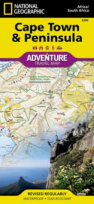
Stadsplattegrond 3200 Adventure Map Cape Town & Peninsula - Kaapstad | National Geographic

0

Verkopers met dit product

Verkoper
Bezorging
Prijs
DeZwerver.nl logo
DeZwerver.nl
2,95
17,95

Anderen bekeken ook

Stadsplattegrond Cape Town - Kaapstad | Borch
Borch Kaapstad is een duidelijke, geplastificeerde plattegrond van het centrum met informatie over openbaar vervoer en bezienswaardigheden. Inclusief straatnamenregister.   Our soft-laminated folded map of Cape Town shows: Cape Town 1:15 000, Cape Peninsula 1:140 000, Cape Town and Region 1:635 000, Garden Route 1:3 000 000, Robben Island 1:40 000, South Africa administrative & time zones, Public Transport Cape Town. Borch Maps are easy to fold, durable and water-repellent with a wipeable surface. Borch Maps show hotels, museums, monuments, markets, public transport, top sights and points of interest, useful statistics, conversion charts for temperatures, weights and measurements, climate charts showing temperatures, sunshine hours, precipitation and humidity, overview maps, time zones, and much more...   Cape Town, the legislative capital and second most populous city of South Africa and the provincial capital of the Western Cape, is also renowned as one of the world's most beautiful…
9,95
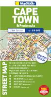
Stadsplattegrond Streetmap Cape Town - Kaapstad | MapStudio
Uitgebreide stadsplattegrond van Kaapstad en directe omgeving.    The Cape Town & Peninsula Street Map is the ideal travel companion to find your way around Cape Town.   Coverage includes:   North : Milnerton West : Hout Bay East : Jakes Gerwel (Vanguard Drive) South : Muizenberg   Great content which includes a detailed map of Cape Town CBD and Waterfront insert map.   The main map is in detailed 1: 25 000 street level scale, which depicts parks and reserves, golf courses, sports fields and stadiums, intersections, route numbers and interchange names. The map also includes places of interest, historical sites and hotels, suburb names and boundaries, schools and sporting venues, industrial areas, wine estates and heritage sites as well as bird sanctuaries and post offices and libaries.  
16,95
Stadsplattegrond Singapore & Malay Peninsula | ITMB
Goede stadsplattegrond van Singapore. Met register en suburban treinsysteem. De echt verre buitenwijken van deze megastad staan er niet op. Aan de achterzijde een overzichtskaart van het vasteland van Maleisië met een schaal van 730.000 Singapore is Asia as it should be: clean, modern, well-governed, efficient, and attractive.  In this edition, which technically should be a first edition due to the transformation of the map into a double-sided one, includes for the first time, our detailed map of the part of Malaysia known as the Malay Peninsula, the ‘mainland’ portion of the country. Singapore and Malaysia are joined together by two motorway crossings and a train operated by Malaysian Railways. Side one of our map concentrates on the urbanized portion of Singapore and its attractions, with a large and detailed inset map of the country of Singapore. Side two covers all of the mainland portion of Malaysia to the Thai border and includes a large inset map of Kuala Lumpur. Motorways are …
13,95
Wegenkaart - landkaart 3105 Adventure Map Northern Yucatan Peninsula - Yucatan schiereiland noord | National Geographic
Wegenkaart van Yucatan schiereiland noord met vermelding van veel bezienswaardigheden, nationale parken en attrakties. Watervast en scheurvast. Juist door deze vermeldingen onderscheidt de kaart zich van andere wegenkaarten. The Northern Yucatan Peninsula and Maya Sites map includes: Detailed city inset maps of Cancún and Mérida with locations of attractions and key infrastructure Maya site locations with detailed Maya site inset maps and information for Chichén Itzá, Ek’ Balam, Tulum, El Rey, Uxmal, Cobá, and San Gervasio Detailed descriptions, photographs, and site maps of important Maya buildings and history Popular Yucatán resort towns Isla Mujeres, Cancun, Playa del Carmen, Akumal, Cozumel, Puerto Aventuras, and Tulum Popular adventure travel recreation points of interest Detailed road network UNESCO World Heritage sites
17,50
Stadsplattegrond - Wegenkaart - landkaart Quebec City & Gaspe Peninsula | ITMB
Een degelijke kaart aan twee kanten bedrukt. Aan de ene zijde een plattegrond van Quebec stad, schaal 1:10.000. En aan de andere zijde een wegenkaart, schaal 1:750.000, van Gaspe schiereiland met aanduidingen van o.a. nationale parken, vliegveld, benzinepomp, dirt-roads. ITMB is pleased to be introducing yet another brand new title to our line. Quebec City is one of the oldest urban areas in North America, having been continuously occupied since 1608 (unfortunately, the first attempt at settlement, in 1606, failed through poor planning, and all the settlers perished). QC is also the only completely walled city in North America and the city streets within the walls have barely changed in 400 years. The city is also linguistically unique in being almost completely French Canadian in language (Montreal is much more Anglophiled). The city was the capital of French Canada until General Wolfe and the British army arrived in 1759. The British were able to climb the cliffs protecting the city…
13,95
Reisgids Pocket Guide Cape Town - Kaapstad | Berlitz
Handige reisgids op zakformaat met korte, bondige en duidelijke informatie over de eilanden en bezienswaardige plekken.  Plan your trip, plan perfect days and discover how to get around - this pocket-sized guide is a convenient, quick-reference companion to discovering what to do and see in Cape Town, from top attractions like Cape Winelands, Castle of Good Hope, Robben Island, Boulders Beach and Table Mountain to hidden gems, including Greenmarket Square, Hermanus and Long Street.   - What to see: comprehensive coverage of the city's attractions, illustrated with striking photography - What to do: how to make the most of your leisure time, from local entertainment to the best activities and shopping - History and culture: giving you a deeper understanding of the city's heritage, people and contemporary life - Practical tips: where to stay, dining out and how to get around: reliable recommendations and expert travel advice - Dictionary: quick-reference bilingual language guide to help…
10,95
Wandelkaart - Topografische kaart 772 Delmarva Peninsula | National Geographic
Prachtige geplastificeerde kaart van het bekende nationaal park. Met alle recreatieve voorzieningen als campsites, maar ook met topografische details en wandelroutes ed. Door uitgekiend kleurgebruik zeer prettig in gebruik. Scheur en watervast! The new Delmarva Trails Illustrated regional topographic recreation map covers all major recreation areas for the Peninsula and Chesapeake Bay region. This beautifully designed map includes all state parks, state wildlife areas, national wildlife areas and key recreation access points. Locations for camping, boating, canoeing/kayaking, hunting, biking/greenways, and fishing are displayed. Highlights include Blackwater and Chincoteague National Wildlife Refuges, Assateague Island National Seashore, Cape Henlopen State Park, and Maryland's Eastern Shore. This map will be an essential trip planning tool, road map, and on-the-ground guide for accessing Delmarva Peninsula's public lands. Includes UTM grids for use with your GPS unit.
17,95
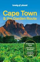
Reisgids Cape Town & Garden Route - Kaapstad | Lonely Planet
De perfecte reisgids voor zowel de georganiseerde als de zelfstandige reiziger. Naast een algemene inleiding van de stad vol met praktische informatie over hoe je er het beste kunt reizen: slapen, eten, vervoer, excursies ... alles kun je er in vinden. Engelstalig. Lonely Planet Lonely Planet's Cape Town and the Garden Route is our most comprehensive guide that extensively covers all the region has to offer, with recommendations for both popular and lesser-known experiences. Climb the impressive Table Mountain, visit historic Robben Island and walk the colourful streets of Bo-Kaap; all with your trusted travel companion.   Inside Lonely Planet's Cape Town and the Garden Route Travel Guide:     Lonely Planet's Top Picks - a visually inspiring collection of the destination's best experiences and where to have them   Itineraries help you build the ultimate trip based on your personal needs and interests Local insights give you a richer, more rewarding travel experience - wheth…
24,95

Klanten-reviews van Stadsplattegrond 3200 Adventure Map Cape Town & Peninsula - Kaapstad | National Geographic

Er zijn nog geen beoordelingen voor dit productBen jij de eerste die een review plaatst?

Meer over Stadsplattegrond 3200 Adventure Map Cape Town & Peninsula - Kaapstad | National Geographic

Productinformatie

    Verken gerelateerde categorieën

    Webshop.nl maakt gebruik van cookies. Ga je verder op onze website, ga dan akkoord met het plaatsen van cookies en de verwerking van deze data door ons en vermelde partners.