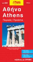
Stadsplattegrond 222 Athene | Orama

0
Gedetailleerd plan inclusief een straatindex en locaties hotels, kerken, scholen, plaatsen en openbare diensten, nuttige telefoonnummers, enz....

Verkopers met dit product

Verkoper
Bezorging
Prijs
DeZwerver.nl logo
DeZwerver.nl
2,95
9,95

Anderen bekeken ook

Stadsplattegrond Athene | Borch
Borch Athene is een duidelijke, geplastificeerde plattegrond van het centrum met informatie over openbaar vervoer en bezienswaardigheden. Inclusief straatnamenregister.   Our soft-laminated folded map of Athens shows: Athens 1: 7500, Athens & Region 1:100 000, Attica 1: 750 000, Acropolis 1:2 400, Epidavros 1:7 000, Mycenae 1:3 500, Public Transport Athens, Greece administrative & time zones, Top 30 Sights. Borch Maps are easy to fold, durable and water-repellent with a wipeable surface. Borch Maps show hotels, museums, monuments, markets, public transport, top sights and points of interest, useful statistics, conversion charts for temperatures, weights and measurements, climate charts showing temperatures, sunshine hours and precipitation, overview maps, time zones, and much more...   Named after the Greek goddess Athena, Athens is so much more than just another interesting European capital. In addition to countless epic landmarks, temples, monuments and gardens, this place also happ…
9,95
Stadsplattegrond Athene | Anavasi
Handzame kleine plattegrond van Athene, op de achterkant een overizcht van de omgeving van de stad en een korte beschrijving van de belangrijkste bezienswaardigheden. Locations of the city’s 102 important archaeological sites, museums, and other important buildings, plus on the reverse a road map of the environs including the port at Piraeus and the international airport.   Coverage extends from south of the Acropolis and the Mousson Hill to beyond the central railway station and the National Archaeological Museum, and east well beyond the Lycabettus Hill. 102 locations – archaeological remains, museums, theatres, churches – are highlighted and listed with their addresses and contact details. The plan shows metro stations, and tram routes with line numbers.    On the reverse is a map of the city’s environs showing the road network with the metro and railway lines. Coverage includes the port Piraeus, the city’s international airport and Marathon. English language notes about important …
6,95

Klanten-reviews van Stadsplattegrond 222 Athene | Orama

Er zijn nog geen beoordelingen voor dit productBen jij de eerste die een review plaatst?

Meer over Stadsplattegrond 222 Athene | Orama

Productomschrijving

Gedetailleerd plan inclusief een straatindex en locaties hotels, kerken, scholen, plaatsen en openbare diensten, nuttige telefoonnummers, enz.

Productinformatie

    Verken gerelateerde categorieën

    Webshop.nl maakt gebruik van cookies. Ga je verder op onze website, ga dan akkoord met het plaatsen van cookies en de verwerking van deze data door ons en vermelde partners.