webshop.nl
Categorieën
  Sluiten

Meer ITMB

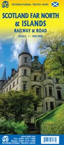
Spoorwegenkaart - Wegenkaart - landkaart Scotland Far North & Islands

0
Great Britain, by its shape, is difficult to map. The population is dense, the road network intense, and the coastline convoluted. A map of the British Isles shows only the major features. Sectional maps of just England, or Just Wales, make little sense, due to the geographic shape of the island kingdom. Scotland also needs more than one map to sho...

Webshops met dit product

Webshop
Bezorging
Prijs

Anderen bekeken ook

Spoorwegenkaart - Wegenkaart - landkaart Scotland Far North & Islands
Great Britain, by its shape, is difficult to map. The population is dense, the road network intense, and the coastline convoluted. A map of the British Isles shows only the major features. Sectional maps of just England, or Just Wales, make little sense, due to the geographic shape of the island kingdom. Scotland also needs more than one map to show its treasures in sufficient detail. ITMB previously issued Scotland Central and South, and now extends its coverage at 1:300,000 to the sparsely-populated highlands and the isolated Western, Orkney, and Shetland island archipelagos that are usually shrunk to insignificance on most maps, as insets. This double-sided map covers the area from Loch Lochy south of Invergarry to John O’Groats in the north, and from the Western islands of Uist and Lewis to the Moray Firth and Craigellachie in the east. The second side has to duplicate part of the first side in order to extend the artwork further eastward to include Aberdeen and northward to includ…
13,95
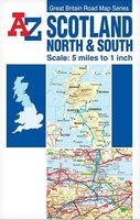
Wegenkaart - landkaart Scotland North & South | A-Z Map Company
The Great Britain Road Map series comprises of five fold-out sheet maps which together cover the whole of Great Britain. Shown at a scale of 5 miles to 1 inch, a continuous grid referencing system permits several or all of the sheets to be mounted together whilst retaining index compatibility.   This A-Z map of Scotland North and South is a full colour, double-sided, fold-out road map.   The Northern Scotland map covers the mainland of northern Scotland from Oban and Perth in the south to Cape Wrath and John o' Groats in the north, including the Isle of Skye, the Inner Hebrides and the Western Isles. The Orkney and Shetland Islands are featured in an inset map at a scale of approximately 12.5 inches to 1 mile. The Southern Scotland map covers the remainder of Scotland southwards and a large section of Northern England to include Berwick-upon-Tweed, Newcastle-upon-Tyne, Middlesbrough, York, Skipton, Fleetwood, Whitehaven and Carlisle. The Isle of Man and part of Northern Ireland are als…
10,95
Wegenkaart - landkaart Guam - West Pacific Cruising | ITMB
Een degelijke kaart met aanduidingen van o.a. nationale parken, vliegveld, benzinepomp, dirt-roads. Als overzichtskaart goed te gebruiken. Certainly, this is the only map of Guam by any major cartographic publishing house. Here are some details: Guam is a north-south island considerably north of New Guinea, and forms part of the American-held group of islands known as the Northern Marianas. Its capital is Hagatna, and the main town is called Tamuning. The island has a well-developed international airport in the middle portion of the island, with a large US military airbase in the northeast corner. The vast majority of the island is touristic, and well worth a visit. The island was "discovered" by Ferdinand Magellan in 1521, and Hagatna is the oldest "European" city in the Pacific, dating from 1686. The town of Inarajan retains a decidedly Spanish appearance to this day. Other attractions include Tumon Beach and its many resorts, the Piti Underwater Observatory, and the famous Cocos Isl…
13,95
Wegenkaart - landkaart Easter Island - Paaseiland en Santiago | ITMB
Easter Island is so isolated that it is not certain whether it is part of Polynesia or an off-shoot of South America. Geologically, it is neither; just a volcanic lump in the vast expanse of the Pacific Ocean. Its original inhabitants probably came from Polynesia; since supplanted by migrants from Chile, which is the political authority governing the island. Regardless, it is an intriguing place, famous for the Maoi - giant heads originally raised to protect family holdings. These huge, mysterious heads rest in various locations on the island and are one of the wonders of the world. This map also includes a detailed map of Santiago de Chile, the capital of Chile, for the simple reason that all flights to Easter Island originate in that city, so everyone going to Easter Island needs a map of Santiago as well. This usage is merely for the convenience of visitors going to Easter Island. ITMB publishes a separate map of Santiago and Central Chile and we intend to continue to do so.   Legen…
13,95
Wegenkaart - landkaart Italy North & Central | ITMB
Italy is a very densely populated country, requiring sectional maps to portray its complex road/rail network in sufficient detail to make sense. This is a brand new title for ITMB, covering the central portion of the peninsula from Naples north to Florence on side one, and includes a large inset map of Sardinia. Side two covers the vast expanse of the north of the country, from the high alpine valleys of D’Aosta and Trentino to the plains of northern Italy and the coastal provinces of the Mediterranean and Adriatic coastlines. The immediate border areas of France and Switzerland are included, but the extensive plate name index covers most of those countries. Motorways (in blue) tend to be toll highways. Multi-lane highways (in magenta) and principal highways (in green) tend to be non-toll. The red lines are ordinary two-lane roadways, and tend to go through villages every kilometer or so and to follow mountainous contours. We spent a week in January, 2020, in the Rome to Naples to Mont…
13,95
Wegenkaart - landkaart Ierland | ITMB
As technology improves, we are able to produce more detailed maps than was previously possible. Such is the case with Ireland, a part of the world consisting of two countries divided by religion and history. Preparing a map of Ireland as a double-sided map means cutting the island into two geographic portions. Side 1 covers the northern half. This includes the portion known as Northern Ireland, or Ulster, and a fair portion of the Republic of Ireland, or Eire; essentially everything north of Dublin and west to Counties Mayo and Galway. Side 2 covers the southern half of the island from just north of Dublin to the outer tips of County Kerry. It also includes a nice inset map of central Dublin. Naturally, all motorways and roads are included, as are touristic attractions, camping/caravan sites, ferry terminals, and Top Attractions. This is a very detailed travel map of the island, printed on waterproof paper for durability. We had great fun driving around Ireland researching this map. It…
14,95

Klanten-reviews van Spoorwegenkaart - Wegenkaart - landkaart Scotland Far North & Islands

Er zijn nog geen beoordelingen voor dit productBen jij de eerste die een review plaatst?

Meer over Spoorwegenkaart - Wegenkaart - landkaart Scotland Far North & Islands

Productomschrijving

Great Britain, by its shape, is difficult to map. The population is dense, the road network intense, and the coastline convoluted. A map of the British Isles shows only the major features. Sectional maps of just England, or Just Wales, make little sense, due to the geographic shape of the island kingdom. Scotland also needs more than one map to show its treasures in sufficient detail. ITMB previously issued Scotland Central and South, and now extends its coverage at 1:300,000 to the sparsely-populated highlands and the isolated Western, Orkney, and Shetland island archipelagos that are usually shrunk to insignificance on most maps, as insets. This double-sided map covers the area from Loch Lochy south of Invergarry to John O’Groats in the north, and from the Western islands of Uist and Lewis to the Moray Firth and Craigellachie in the east. The second side has to duplicate part of the first side in order to extend the artwork further eastward to include Aberdeen and northward to include the wonderful island chains known collectively as the Shetlands and Orkneys. This map instills a sense of history, of adventure, and of being ‘off the beaten path’. It is the Islands and Highlands part of Scotland where Gaelic is still commonly spoken and castles abound, where one can lose oneself traversing single-lane roads across barren moors, or enjoy fishing villages such as Ullapool, or re-visit momentous events in history at Culloden. This is the heart of Scotland.   Legend Includes: Roads by classification, Rivers and Lakes, National Park, Airports, Points of Interests, Mining, Highways, Main Roads, Zoos, Fishing, , and much more...

Productspecificaties

Artikelnummer(s)
Brand
ITMB
Webshop.nl maakt gebruik van cookies. Ga je verder op onze website, ga dan akkoord met het plaatsen van cookies en de verwerking van deze data door ons en vermelde partners.