webshop.nl
Categorieën
  Sluiten

Meer ITMB
Meer ITMB in Literatuur boeken

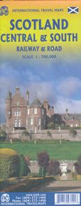
Spoorwegenkaart Schotland - Scotland Central and South Rail and Road |

Een degelijke kaart met aanduidingen van o.a. spoorlijnen, nationale parken, vliegveld, benzinepomp, dirt-roads en kleine plattegrond van hoofdstad. Als overzichtskaart goed te gebruiken. This is another new ITMB title and extends our sectional coverage of the UK northwards from the southernmost border at Gretna Green through the densely-populated ...
13,95

Webshops met dit product

Webshop
Bezorging
Prijs

Anderen bekeken ook

Spoorwegenkaart Schotland - Scotland Central and South Rail and Road |
Een degelijke kaart met aanduidingen van o.a. spoorlijnen, nationale parken, vliegveld, benzinepomp, dirt-roads en kleine plattegrond van hoofdstad. Als overzichtskaart goed te gebruiken. This is another new ITMB title and extends our sectional coverage of the UK northwards from the southernmost border at Gretna Green through the densely-populated Glasgow/Edinburgh/Stirling conurbation to the highlands. The reason for this sectional map is to provide additional space to show 25% more detail than our map of all of Scotland can provide. The north of Scotland is my favourite part of the country, but there isn’t much there except heather and single-lane tracks across treeless moors. The South, like it or not, is where most of Scotland’s four million people live and where most of the castles, palaces, battlefields, parks, and touristic attractions are located. The map also shows the ferry routes to the outer islands of Arran and Mull, and the most poignant battlefield I’ve ever visited, Cul…
13,95
Spoorwegenkaart - Wegenkaart - landkaart Scotland Far North & Islands
Great Britain, by its shape, is difficult to map. The population is dense, the road network intense, and the coastline convoluted. A map of the British Isles shows only the major features. Sectional maps of just England, or Just Wales, make little sense, due to the geographic shape of the island kingdom. Scotland also needs more than one map to show its treasures in sufficient detail. ITMB previously issued Scotland Central and South, and now extends its coverage at 1:300,000 to the sparsely-populated highlands and the isolated Western, Orkney, and Shetland island archipelagos that are usually shrunk to insignificance on most maps, as insets. This double-sided map covers the area from Loch Lochy south of Invergarry to John O’Groats in the north, and from the Western islands of Uist and Lewis to the Moray Firth and Craigellachie in the east. The second side has to duplicate part of the first side in order to extend the artwork further eastward to include Aberdeen and northward to includ…
13,95
Spoorwegenkaart England Southeast & Midlands Rail/Road | ITMB
The shape of the UK makes it difficult to map logically. The term South East, within crowded England, is generally more restrictive than is appropriate for a map. Our definition of SE is from the English Channel north to the northern tip of East Anglia and west to Portsmouth/Reading/Peterborough. This occupies side one of the sheet. Side two consists of that complex portion of England generally called ‘The Midlands’ stretching from Cambridge/Peterborough west to the Welsh border and from Luton/Gloucester north to Manchester/Grimsby. London is, of course, prominent, but only as a main roads map. This is the most recent sectional map of the UK that ITMB has published, and was necessitated by the realization that, to see England properly, one needs a detailed enough map to show rail lines, motorways, A-type highways and B-type secondary roads, but also the tertiary level of road joining villages. The road network of England is incredibly complex and cannot be shown in proper detail withou…
13,95
Wegenkaart - landkaart Castles map of Scotland - Schotland kastelen |
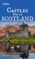
Kaart waarop meer dan 700 kastelen in Schotland staan aangegeven. Discover Scotland's ancient monuments and castles. Explore Scotland’s ancient monuments with this pictorial map featuring over 700 castles and fortified houses. Includes an easy-to-use index listing visitor information and an attractive selection of photographs.   The map includes: • Over 700 castles and fortications • Index comprises map references, the age and type of each castle, public access details, Historic Scotland and National Trust for Scotland ownership, notable grounds and gardens, telephone numbers and websites • Highlights Scotland’s finest castles, castellated mansions and also the best castles for children • Attractive photographs of a selection of castles, together with a brief account of their history • A brief history of Scottish castles and information on architectural types and periods of construction • Internet links and suggested reading for further information   Scotland is a country a…
13,95
Reisgids Scotland - Schotland | Insight Guides
Dé gids als het gaat om achtergrondinformatie en prachtige foto’s. Ideaal om je reis goed te plannen. Door het formaat en gewicht niet zo zeer om mee te nemen in een echte rugzak maar in een Samsonite misstaat deze niet! Uitstekend om thuis voor en na de reis uitgebreid te lezen. Kwalitatief van een hoog niveau! Engels. This Insight Guide is a lavishly illustrated inspirational travel guide to Scotland and a beautiful souvenir of your trip. Perfect for travellers looking for a deeper dive into the destination's history and culture, it's ideal to inspire and help you plan your travels. With its great selection of places to see and colourful magazine-style layout, this Scotland guidebook is just the tool you need to accompany you before or during your trip. Whether it's deciding when to go, choosing what to see or creating a travel plan to cover key places like Glen Coe, Stirling Castle, it will answer all the questions you might have along the way. It will also help guide you when you'…
23,95
Wegenkaart - landkaart Castles map of Scotland - Schotland kastelen |
Kaart waarop meer dan 700 kastelen in Schotland staan aangegeven. Discover Scotland's ancient monuments and castles. Explore Scotland’s ancient monuments with this pictorial map featuring over 700 castles and fortified houses. Includes an easy-to-use index listing visitor information and an attractive selection of photographs.   The map includes: • Over 700 castles and fortications • Index comprises map references, the age and type of each castle, public access details, Historic Scotland and National Trust for Scotland ownership, notable grounds and gardens, telephone numbers and websites • Highlights Scotland’s finest castles, castellated mansions and also the best castles for children • Attractive photographs of a selection of castles, together with a brief account of their history • A brief history of Scottish castles and information on architectural types and periods of construction • Internet links and suggested reading for further information   Scotland is a country a…
13,95
Wandelgids 83 Pathfinder Guides North Coast 500 and Northern Highlands
Enhance your North Coast 500 tour with the only walking guidebook featuring routes based on or accessible from Scotland’s ultimate road trip. Discover Britain’s remotest sandy beaches, Scotland’s most northerly munro, some of the oldest rocks on Earth and more with 28 breathtaking walks accessed from the North Coast 500 as well as 32 unmissable stop-off-and-stroll recommendations.   Featured North Coast 500 and Northern Highlands walks include:   - Circle Loch Coulin where Beinn Eighe and Liathach are reflected in the still waters - Wander the astounding landscape of Knockan Crag, where some of the oldest rocks on Earth can be seen - Climb Ben Hope, Scotland’s most northerly munro, towering above the Flow Country - See the waterfalls and rocks walls of the Big Burn as you ascend Ben Bhraggie for views over the Dornoch Firth - Explore the landscape and history of the Applecross peninsula with sublime views of Raasay - Take a moorland and clifftop route to the vast golden sands of Sandwo…
18,50

Klanten-reviews van Spoorwegenkaart Schotland - Scotland Central and South Rail and Road |

Er zijn nog geen beoordelingen voor dit productBen jij de eerste die een review plaatst?

Meer over Spoorwegenkaart Schotland - Scotland Central and South Rail and Road |

Productomschrijving

Een degelijke kaart met aanduidingen van o.a. spoorlijnen, nationale parken, vliegveld, benzinepomp, dirt-roads en kleine plattegrond van hoofdstad. Als overzichtskaart goed te gebruiken. This is another new ITMB title and extends our sectional coverage of the UK northwards from the southernmost border at Gretna Green through the densely-populated Glasgow/Edinburgh/Stirling conurbation to the highlands. The reason for this sectional map is to provide additional space to show 25% more detail than our map of all of Scotland can provide. The north of Scotland is my favourite part of the country, but there isn’t much there except heather and single-lane tracks across treeless moors. The South, like it or not, is where most of Scotland’s four million people live and where most of the castles, palaces, battlefields, parks, and touristic attractions are located. The map also shows the ferry routes to the outer islands of Arran and Mull, and the most poignant battlefield I’ve ever visited, Culloden, east of Inverness. This was the spot where the clans were slaughtered in 1745, effectively ending the clan system and determining Scotland’s future as a junior partner to England. For history, Scotland is hard to beat, and this map shows the beauty and the majesty of this interesting homeland to excellent advantage. Rail lines have been emphasized.

Productspecificaties

Artikelnummer(s)
Brand
ITMB

Verken gerelateerde categorieën

Webshop.nl maakt gebruik van cookies. Ga je verder op onze website, ga dan akkoord met het plaatsen van cookies en de verwerking van deze data door ons en vermelde partners.