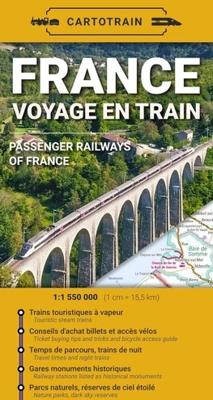
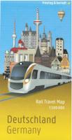
Spoorwegenkaart France Voyage en train | Frankrijk | Cartotrain

0

Verkopers met dit product

Verkoper
Bezorging
Prijs
DeZwerver.nl logo
DeZwerver.nl
2,95
15,95

Anderen bekeken ook

Spoorwegenkaart Frankrijk - France Railway & Road | ITMB
This edition of France continues a developing strain of European country maps for ITMB – placing an emphasis on train travel. Tourism is changing, or rather, is growing exponentially as more and more people from Asia visit France. Most of these visitors, and for that matter, most visitors from North America, prefer to travel around France by using the excellent rail network, rather than by road. Most map publishers have removed rail lines from their maps in order to concentrate on those people travelling by car. Our map shows the road network in good detail, but our difference is that we show the rail network in excellent detail as well. As a country, France is one of the most popular destinations in Europe, and for good reason. Whether one is interested in the chateaux gracing the Loire Valley or the great cathedrals of Chartres or Reims, or the massive defensive fortresses of bygone years, France offers something for everyone. This is a traveller’s map, whether moving around by rail…
13,95
Spoorwegenkaart France North Rail & Bike Travel - Noord Frankrijk | ITMB
The northern half of France is fairly flat, making it an ideal area for biking. However, it is also a rather large area, covering several provinces of France, so we have combined rail access with biking. All the motorways and main highways are also shown, so this map is ideal for someone wanting to drive to, say, Brittany, and bike during their stay in the Breton peninsula. Side 1 covers Normandy, Brittany, the Loire, and the Poitou region west of Paris. Side 2 covers all of northern France from Calais to Strasbourg and south to Lyon. Small adjacent portions of Switzerland and Italy are included. A Top 9 Attractions list is included. France South was published a little while ago, so the entire country is now available in detail. The map is printed on waterproof stone paper for durability. Legend Includes: Roads by classification, Rivers and Lakes, National Park, Airports, Points of Interests, Highways, Main Roads, Zoos, Fishing, and much more...
13,95
Spoorwegenkaart France South Rail and Bike | ITMB
This is a brand new title for ITMB and an attempt to portray a changing travel landscape in a mapping format. Eco-tourism is a rapidly growing activity, with enormous potential. At the same time, governments are seeking to reduce carbon pollution by encouraging train travel, so ITMB is climbing aboard the movement by publishing a map encouraging train travel while still retaining the road network and noting all the long-distance bike routes in southern France by designated number. This is, by its scale, a generalized map of that portion of France south of Poitiers or Lyon to the Mediterranean, so is more of a regional map showing biking opportunities than a detailed trail map. Nevertheless, it is an excellent map on waterproof paper showing cycling routes and tertiary roads that are suitable for recreational exploration. Naturally, motorways and main highways are shown as well.   Legend Includes: Roads by classification, Rivers and Lakes, National Park, Airports, Points of Interests, …
13,95
Fietskaart 767 Vélo en France - Frankrijk | Michelin
Een speciale kaart van Michelin die specifiek gericht is op het fietsen. De kaart geeft route-suggesties verspreid over heel Frankrijk. Op de achterzijde van de kaart worden deze routes meer gedetailleerd weergegeven en kun je ook met een QR-code de GPS tracks downloaden. Je moet de kaart echt zien als een hulpmiddel om mooie fietsplekken en routes te vinden, soms een dagtocht, meestal meerdaags.  l'évasion à la carte! Découvrez au recto de la carte 54 parcours de 22 à 161 km, de 2 à 3 étapes, avec leur niveau de difficulté, pour (re)découvrir la France en solo, en couple ou en famille. Retrouvez au verso le détail de chaque parcours, étape par étape, agrémenté d'idées de visite et d'activités à faire sur les parcours ou à proximité. Sans oublier le tracé GPX de chaque parcours, accessible via un QR code présent sur la carte.
11,95
Spoorwegenkaart The British Isles by Train and Ferry | Cosmographics
Plan your journey and explore the British Isles by train and ferry. This attractive, detailed map shows how the rail network, along with ferries to the more isolated areas, allows you to travel to places right across the British Isles and take in the beautiful scenery. The map clearly shows National Parks, Areas of Outstanding Natural Beauty, forest and woodland areas and the Heritage Coast in England and Wales, much of which is accessible by train and ferry. The rail network includes seasonal and heritage railways. There is also a more detailed map of the London National Park City, the world’s first National Park City. Designed to be fully inclusive and accessible for everyone, including those with colour vision deficiency (CVD).   Map includes:   Passenger rail network with the majority of stations. Seasonal and heritage railways Ferry routes National Parks Areas of Outstanding Natural Beauty Main forest and woodland areas Heritage coast in England and Wales Formaat:  74.5cm …
19,50
Wandelgids - Fotoboek Les plus grands trekkings en France - Frankrijk | Editions Ouest-France
Mooi inspiratieboek over de grote doorgaande GR paden in Frankrijk. Echt een boek om bij weg te dromen, om ideeen op te doen, niet zozeer om het uit te voeren. Une véritable invitation au voyage en neuf itinéraires distincts La baie de Somme et la Côte d’Opale (GR® 120) / La Côte Sauvage de la Manche / Le sentier des douaniers en Bretagne (GR® 34) / Le volcan du Cantal, de puy en puy (GR® 400) / Les Cévennes dans les pas de Stevenson (GR® 70) / Sur le chemin de Compostelle, entre Figeac et Roncevaux (GR® 65) / La traversée des Alpes, du Léman à la Méditerranée (GR® 5) / La traversée des Pyrénées, de l’Atlantique à la Méditerranée (GR® 10) / La traversée de la montagne corse, du nord au sud (GR® 20),  le tout illustré par plus de 150 photographies
23,95
Campergids France Escapades en Camping-Car - Frankrijk | Michelin
De la Bretagne à la Corse, partez à la découverte de  la France avec cette EDITION 2024 du guide Escapades en camping-car France Michelin :   Faites le plein et partez sillonner les routes de France avec cette EDITION 2024 du guide Escapades en camping-car France Michelin :    - 101 circuits touristiques : de 3 à 9 jours avec l'itinéraire jour par jour   - 1 230 adresses : aires de service et de stationnement, campings, restaurants, boutiques, loisirs...   - 127 étapes, visites, randonnées, stations de ski et stations thermales avec leur sélection d'aire de campings   Pensez à utiliser en complément notre Carte Van & Camping-Car France.  
20,95
Reisgids France - Frankrijk | Lonely Planet
De perfecte reisgids voor zowel de georganiseerde als de zelfstandige reiziger. Naast een algemene inleiding van het land / streek vol met praktische informatie over hoe je er het beste kunt reizen: slapen, eten, vervoer, excursies ... alles kun je er in vinden. Engelstalig. Lonely Planet. Lonely Planet's local travel experts reveal all you need to know to plan the trip of a lifetime to France.   Discover popular and off the beaten track experiences from people-watching in one of Bordeaux's atmospheric cafe-filled squares to cycling through one of the world's most famous vineyards in La Voie des Vignes, and paragliding over Lake Annecy.   Build a trip to remember with Lonely Planet's France Travel Guide:   Our classic guidebook format provides you with the most comprehensive level of information for planning multi-week trips Updated with an all new structure and design so you can navigate France and connect experiences together with ease Create your perfect trip with excitin…
25,95

Klanten-reviews van Spoorwegenkaart France Voyage en train | Frankrijk | Cartotrain

Er zijn nog geen beoordelingen voor dit productBen jij de eerste die een review plaatst?

Meer over Spoorwegenkaart France Voyage en train | Frankrijk | Cartotrain

Verken gerelateerde categorieën

Webshop.nl maakt gebruik van cookies. Ga je verder op onze website, ga dan akkoord met het plaatsen van cookies en de verwerking van deze data door ons en vermelde partners.