webshop.nl
Categorieën
  Sluiten

Meer ITMB

Spoorwegenkaart France South Rail and Bike | ITMB

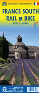
This is a brand new title for ITMB and an attempt to portray a changing travel landscape in a mapping format. Eco-tourism is a rapidly growing activity, with enormous potential. At the same time, governments are seeking to reduce carbon pollution by encouraging train travel, so ITMB is climbing aboard the movement by publishing a map encouraging tr...
13,95

Webshops met dit product

Webshop
Bezorging
Prijs

Anderen bekeken ook

Spoorwegenkaart France South Rail and Bike | ITMB
This is a brand new title for ITMB and an attempt to portray a changing travel landscape in a mapping format. Eco-tourism is a rapidly growing activity, with enormous potential. At the same time, governments are seeking to reduce carbon pollution by encouraging train travel, so ITMB is climbing aboard the movement by publishing a map encouraging train travel while still retaining the road network and noting all the long-distance bike routes in southern France by designated number. This is, by its scale, a generalized map of that portion of France south of Poitiers or Lyon to the Mediterranean, so is more of a regional map showing biking opportunities than a detailed trail map. Nevertheless, it is an excellent map on waterproof paper showing cycling routes and tertiary roads that are suitable for recreational exploration. Naturally, motorways and main highways are shown as well.   Legend Includes: Roads by classification, Rivers and Lakes, National Park, Airports, Points of Interests, M…
13,95
Spoorwegenkaart England Southeast & Midlands Rail/Road | ITMB
The shape of the UK makes it difficult to map logically. The term South East, within crowded England, is generally more restrictive than is appropriate for a map. Our definition of SE is from the English Channel north to the northern tip of East Anglia and west to Portsmouth/Reading/Peterborough. This occupies side one of the sheet. Side two consists of that complex portion of England generally called ‘The Midlands’ stretching from Cambridge/Peterborough west to the Welsh border and from Luton/Gloucester north to Manchester/Grimsby. London is, of course, prominent, but only as a main roads map. This is the most recent sectional map of the UK that ITMB has published, and was necessitated by the realization that, to see England properly, one needs a detailed enough map to show rail lines, motorways, A-type highways and B-type secondary roads, but also the tertiary level of road joining villages. The road network of England is incredibly complex and cannot be shown in proper detail withou…
13,95
Spoorwegenkaart Eastern Europe Railway & Road | ITMB
Spoorwegen kaart van Oost Europa in kleur. Schaal 1:2,600,000. Toont spoorlijnen, snelwegen, secundaire wegen en andere wegen, veerboten en belangrijke scheepvaartdiensten; internationale grenzen, de grenzen van de gebieden met reisbeperkingen; bergen met de hoogte in meters. Met index van plaatsen. Schaal 1:2,600,000. . Gedrukt op twee zijden. ITMB is pleased to announce the release of the final regional map covering Europe at an enhanced scale. Europe may be small in comparison to Canada, but it is densely populated and difficult to map as a continent while providing detail. Eastern Europe used to be defined as everything behind the Iron Curtain during the Cold War, but now it encompasses everything east of Germany and Switzerland, which means that this map covers Italy, Greece and the Balkan countries, the Central European countries of Romania and Hungary and most of Ukraine, Poland and the three Baltic states, and western Russia as far east as Volgograd, as well as much of Turkey. …
13,95
Wegenkaart - landkaart Yellowstone National Park and Wyoming | ITMB
The USA is a vast and wonderful land to explore. ITMB is steadily increasing our coverage of this important travel destination and this month concentrates on the State of Wyoming, with a detailed travel map on one side, including small portions of adjacent states of Utah, Colorado, Nebraska, South Dakota, Montana, and Idaho. The state is lightly populated, with Cheyanne as its capital and main city. Interstates 80 and 90 both traverse the state, with Interstate 25 being the only north-south motorway. Yellowstone National Park occupies the northwest corner of the state and also occupies the second side of the sheet with an extremely detailed map. Yellowstone is the first area in the world to be proclaimed as a national protected area (Banff was second), and Yellowstone remains the paramount preserved wilderness environment in the world. There are several small urban areas within the park for accommodations and servicing, such as West Thumb, Canyon City, and Mammoth Hot Springs. The main…
13,95
Spoorwegenkaart England North and Central Rail and Road | ITMB
This is a new title for ITMB, and continues our expanded coverage of the United Kingdom. Many publishers carry a map of Great Britain (or of the UK), and a few might have one just for England and Wales. We travel extensively through Britain and usually find such maps too generalized for usability. All parts of the UK seem to be blessed with interesting places for a visitor to explore – parish churches, cathedrals, fortresses or castle ruins, market towns, lavish country estates, fabulous gardens, seaside resort towns – the list is endless. The only way to show tertiary-level roads leading to interesting tiny villages with fascinating names, and to portray the wealth of attractions available for the visitor is to divide the UK into logical units, which we did earlier with south East and South West England and now continue to the Scottish border with this map. Coverage is from Birmingham/Peterborough north to York on side one and from Lancaster north to the Scottish border at Berwick-upo…
13,95
Spoorwegenkaart France North Rail & Bike Travel - Noord Frankrijk | IT
The northern half of France is fairly flat, making it an ideal area for biking. However, it is also a rather large area, covering several provinces of France, so we have combined rail access with biking. All the motorways and main highways are also shown, so this map is ideal for someone wanting to drive to, say, Brittany, and bike during their stay in the Breton peninsula. Side 1 covers Normandy, Brittany, the Loire, and the Poitou region west of Paris. Side 2 covers all of northern France from Calais to Strasbourg and south to Lyon. Small adjacent portions of Switzerland and Italy are included. A Top 9 Attractions list is included. France South was published a little while ago, so the entire country is now available in detail. The map is printed on waterproof stone paper for durability. Legend Includes: Roads by classification, Rivers and Lakes, National Park, Airports, Points of Interests, Highways, Main Roads, Zoos, Fishing, and much more...
13,95

Klanten-reviews van Spoorwegenkaart France South Rail and Bike | ITMB

Er zijn nog geen beoordelingen voor dit productBen jij de eerste die een review plaatst?

Meer over Spoorwegenkaart France South Rail and Bike | ITMB

Productomschrijving

This is a brand new title for ITMB and an attempt to portray a changing travel landscape in a mapping format. Eco-tourism is a rapidly growing activity, with enormous potential. At the same time, governments are seeking to reduce carbon pollution by encouraging train travel, so ITMB is climbing aboard the movement by publishing a map encouraging train travel while still retaining the road network and noting all the long-distance bike routes in southern France by designated number. This is, by its scale, a generalized map of that portion of France south of Poitiers or Lyon to the Mediterranean, so is more of a regional map showing biking opportunities than a detailed trail map. Nevertheless, it is an excellent map on waterproof paper showing cycling routes and tertiary roads that are suitable for recreational exploration. Naturally, motorways and main highways are shown as well.   Legend Includes: Roads by classification, Rivers and Lakes, National Park, Airports, Points of Interests, Mining, Highways, Main Roads, Zoos, Fishing, , and much more...

Productspecificaties

Artikelnummer(s)
Brand
ITMB
Webshop.nl maakt gebruik van cookies. Ga je verder op onze website, ga dan akkoord met het plaatsen van cookies en de verwerking van deze data door ons en vermelde partners.