Scratch Map Europa Kraskaart | Maps International

0
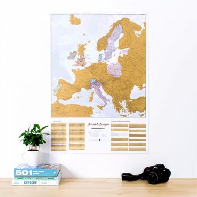
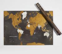
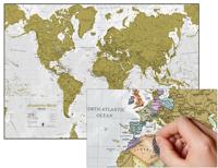
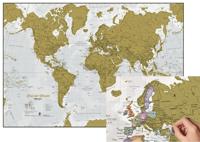
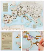
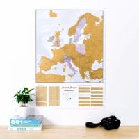
This is a brilliant concept scratch poster of Europe allowing visited destinations to be scratched off revealing the beautifully styled up to date large wall map of Europe underneath. The perfect wall map poster or gift for the travel enthusiast, the scratch off map design allows complete personalization of the European map to display a unique tra...

Verkopers met dit product

Webshop
Bezorging
Prijs
DeZwerver.nl logo
DeZwerver.nl
5,95
24,95

Anderen bekeken ook

Wandkaart Europa - Europe Huge, 170 x 124 cm (5425013063272) | Maps International
Fraaie politieke kaart van het continent, waarbij vooral de politieke aspecten heel duidelijk te lezen zijn. Alle landen hebben verschillende kleuren, steden en belangrijke verbindingen zijn goed te vinden. Geplastificeerde uitvoering met blank houten stokken als een echte schoolkaart.   Maps International’s European political wall map is huge! Our European political wall map is the size of a Smart Car and is the largest single sheet map available to buy.    European Map details: Politically coloured wall map of Europe features countries marked in a different colour, with international boundaries shown. All major towns and cities of Europe are featured within our huge map, and the country's capital cities are clearly marked. The map contains hill and sea shading adding to the vibrant overall effect. The wall map also contains a section showing the different flags of countries in Europe.   Map uses: As with most of our maps, the huge Europe political wall map is available in a variety …
165,-
Prikbord Europa Natuurkundig, 135 x 98 cm | Maps International
Maps International's large physical wall map of Europe is one of the finest money can buy.   European Map details: Our large physical wall map of Europe features the natural terrain of the land, with countries marked and international borders shown. The map's key helps to identify the land elevation and water depth. This large European physical wall map also contains city population detail, national capitals and all the major towns and cities in Europe.   Map uses: As with most of our maps, the large physical wall map of Europe, is available in a range of finishes making it suitable for a variety of locations. Major motorways and transport lines are shown on this European wall map making it an ideal map for planning and logistics   Prikbord Prikbord, geplastificeerd met een glans folie, beschrijfbaar met drooguitwisbare stiten, omkaderd met een stijlvol aluminium designprofiel en afgewerkt met ronde, grijze kunststof hoekstukjes. Een pennengoot en standaard ophangmateriaal worden bijg…
219,95
Wandkaart - Magneetbord Europa - Europe 140 x 100 cm | Maps International
Fraaie politieke kaart van het continent, waarbij vooral de politieke aspecten heel duidelijk te lezen zijn. Alle landen hebben verschillende kleuren, steden en belangrijke verbindingen zijn goed te vinden.    Maps International's large European political wall map is great looking map available to buy.   This politically coloured wall map of Europe features countries marked in a different colour, with international boundaries shown. All major towns and cities are featured within our large map of Europe. Map contains hill and sea shading adding to the vibrant overall effect. The wall map also contains a section showing the different flags of countries in Europe.   Maps International's Europe map is available either plain or laminated. If you are looking to buy a map of Europe, you won't be disappointed with this large stunning wall map.   De kaart wordt in deze versie gelijmd op een plaat, voorzien van een mooie aluminium lijst en een ophangsysteem wordt meegeleverd.
289,-
Wandkaart - Prikbord Europa - Europe 140 x 100 cm | Maps International
Fraaie politieke kaart van het continent, waarbij vooral de politieke aspecten heel duidelijk te lezen zijn. Alle landen hebben verschillende kleuren, steden en belangrijke verbindingen zijn goed te vinden.    De wandkaarten op prikbord worden geleverd met een aluminium lijst en een eenvoudig te monteren ophangsysteem. Zij zijn geschikt voor allerhande markeringsystemen als vlaggetjes en prikkers.   Afwerking Prikbord, geplastificeerd met een glans folie, beschrijfbaar met drooguitwisbare stiften, omkaderd met een stijlvol aluminium designprofiel en afgewerkt met ronde, grijze kunststof hoekstukjes. Een pennengoot en standaard ophangmateriaal worden bijgeleverd.   Maps International's large European political wall map is great looking map available to buy.   This politically coloured wall map of Europe features countries marked in a different colour, with international boundaries shown. All major towns and cities are featured within our large map of Europe. Map contains hill and sea s…
195,-
Wandkaart - Prikbord Europa - Europe HUGE 170 x 124 cm | Maps International
Fraaie politieke kaart van het continent, waarbij vooral de politieke aspecten heel duidelijk te lezen zijn. Alle landen hebben verschillende kleuren, steden en belangrijke verbindingen zijn goed te vinden.    De wandkaarten op prikbord worden geleverd met een aluminium lijst en een eenvoudig te monteren ophangsysteem. Zij zijn geschikt voor allerhande markeringsystemen als vlaggetjes en prikkers.   Maps International's huge European political wall map is great looking map available to buy.   This politically coloured wall map of Europe features countries marked in a different colour, with international boundaries shown. All major towns and cities are featured within our large map of Europe. Map contains hill and sea shading adding to the vibrant overall effect. The wall map also contains a section showing the different flags of countries in Europe.   Maps International's Europe map is available either plain or laminated. If you are looking to buy a map of Europe, you won't be disappo…
375,-
Wandkaart - Magneetbord Europa - Europe, Huge 170 x 124 cm | Maps International
Fraaie politieke kaart van het continent, waarbij vooral de politieke aspecten heel duidelijk te lezen zijn. Alle landen hebben verschillende kleuren, steden en belangrijke verbindingen zijn goed te vinden.    De kaart wordt in deze versie gelijmd op een plaat, voorzien van een mooie aluminium lijst en een ophangsysteem wordt meegeleverd.   Maps International's large European political wall map is great looking map available to buy.   This politically coloured wall map of Europe features countries marked in a different colour, with international boundaries shown. All major towns and cities are featured within our large map of Europe. Map contains hill and sea shading adding to the vibrant overall effect. The wall map also contains a section showing the different flags of countries in Europe.   Maps International's Europe map is available either plain or laminated. If you are looking to buy a map of Europe, you won't be disappointed with this large stunning wall map.
385,-
Scratch Map Bier Brouwerijen Groot-Brittannië Collect & Scratch | Maps International
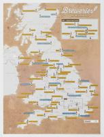
Scratch Off UK Breweries Print is the perfect gift for beer lovers. This is the best way to display your travels to each brewery or if you have sampled the beer. The Scratch Off UK Breweries Print shows our selection of independent beer breweries in England/UK. Each one is located with a beer bottle icon. Scratch off the breweries you have tasted a beer from and see how far you get! Once scratched you can look at the beers you are yet to try and travel the country to find them, or simply see what they have at your local shop. This is our list of 75 independant Beer Breweries that we think should be visited or have their beer tasted, not an official guide.  
16,95
Kinderwereldkaart Scratch the World kids animals, 42 x 60 cm | Maps International
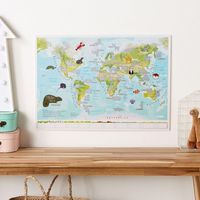
Of het nu een flamingo is in de dierentuin, een neushoorn op safari of een prachtige bij in je achtertuin, wanneer je een dier ziet, neem een muntstukje kras het kraslaagje af de kaart. Maak de kaart van jou door onderaan op de kaart te noteren waar je ze hebt gezien! De Scratch off Kids Animals of the World Print heeft 50 verbluffende illustraties van dieren in de natuur, om te observeren en te krassen.   The Scratch Off Animals of the World Print is a thoughtful, fun and educational map gift for kids that love nature and exploring the world.   Whether it's a flamingo at the zoo, a rhino on safari or a beautiful bee in your back garden, when you spot an animal, grab a coin and scratch it off the map. See how many you can scratch off in a single year, and compare the map with your friends. The Scratch off Kids Animals of the World Print has 50 stunning illustrations of animals in nature, to observe and scratch off your list.
24,95
Stadsplattegrond Streetwise Budapest | Michelin
REVISED 2023Streetwise Budapest Map is a laminated city center map of Budapest, Hungary. The accordion-fold pocket size travel map has an integrated metro map including lines & stations. Coverage includes:Main Budapest Map Front 1: 17,000Main Budapest Map Back 1:11,000Budapest City Center Map 1:11,000Millennium City Center Map 1:17,000Budapest Metro MapDimensions: 4" x 8.5" folded, 8.5" x 27" unfoldedPeople say Budapest is the Paris of Central Europe.   Maybe that statement is true because it combines a combination of western luxuries, architectural beauty, and cosmopolitan European traditions. But this baroque city is still connected to its Eastern European heritage with the steaming baths, incredibly complex language and lusty cuisine. Budapest straddles a curve in the river Danube which bisects two distinct parts.   The east side is known as Pest and the west side is known as Buda, hence Budapest. It's a very logical, well laid out city. Castle Hill is the premier destination for v…
9,95
Reisgids Road Trips Electric Vehicle Road Trips - Europe | Lonely Planet
Hit the road with this ultimate guide to exploring Europe by electric car and discover 60 sublime touring routes with detailed itineraries, maps and charging station locations. Drive into the heights of the Austrian Alps or steer past thundering waterfalls in Iceland using our expert know-how to help you plan your next epic eco-friendly adventure. Cruise the north coast of Crete to find glorious golden beaches and hill-hugged fishing villages or weave your way across Ireland from the heart of Dublin to Galway, sampling the country's finest oysters as you go.   Whether you take your trusty electric vehicle for a spin or you hire a high-end model, this comprehensive guide is packed with irresistible road trips that are suitable for electric vehicles even with a modest range. All of the 60 unforgettable touring routes will guide you to a convenient charging station at the end of each day, allowing you to discover the continent in sustainable style. Inside Electric Vehicle Road Trips - Eu…
34,95

Klanten-reviews van Scratch Map Europa Kraskaart | Maps International

Er zijn nog geen beoordelingen voor dit productBen jij de eerste die een review plaatst?

Meer over Scratch Map Europa Kraskaart | Maps International

Productomschrijving

This is a brilliant concept scratch poster of Europe allowing visited destinations to be scratched off revealing the beautifully styled up to date large wall map of Europe underneath. The perfect wall map poster or gift for the travel enthusiast, the scratch off map design allows complete personalization of the European map to display a unique travel story. Simply grab a coin and scratch off all the countries or cities you have visited, creating your own personalized, continually changing European wall map. The detailed Europe scratch off map features country detail along with capital cities making it the perfect travel map – scratch off your favorite spots!   European Travel Scratch Off Map   The Scratch Off Map Of Europe is printed onto high quality silk art paper with a gloss coating for luxury and the scratch off travel map works exactly like a scratch card - once the gold coating is removed it reveals the mapping underneath. The large wall map measures 23 (h) x 33 (w) inches and will fit a standard A1 sized frame. Frame not supplied.   Your scratch off map of Europe is supplied in secure, protective packaging, rolled in a tube for crease free delivery and immediate display.   Maps International create beautiful and geographically precise maps that inspire and encourage learning about the world that we live in.   We are the definitive online map shop where you can find the finest range of quality wall maps, including our most popular world maps. Our parent company Lovell Johns, has charted a legacy of over 50 years of cartographic excellence, so mapping is at the heart of everything we do.   We deliver across the world, with offices in the US and the UK, where our expert team of cartographers work with passion, on a stunning range of maps for all moods and homes.
Webshop.nl maakt gebruik van cookies. Ga je verder op onze website, ga dan akkoord met het plaatsen van cookies en de verwerking van deze data door ons en vermelde partners.