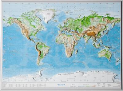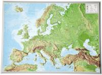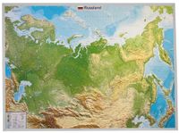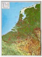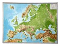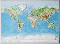
Reliëfkaart Wereld met voelbaar 3D reliëf | A3 | 42 x 30 cm | GeoRelief

0
Prachtige kunststof reliëfkaart met voelbaar reliëf met plaatsnamen, bergnamen en hoogten.   Product: a 3D topographical map with colored graphic relief and hill shading and color feature which are derived from high resolution terrain models. Content: World with detailed landscape relief , hydrographic network, city names, mountain names, mountain...

Verkopers met dit product

Verkoper
Bezorging
Prijs
DeZwerver.nl logo
DeZwerver.nl
5,95
27,95

Anderen bekeken ook

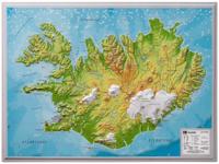
Wandkaart - Reliëfkaart IJsland met voelbaar 3D reliëf 42 x 30 cm | GeoRelief
Prachtig vormgegeven wandkaart van IIsland met reliëf. Uitgevoerd in stevig kunststof is IJsland vanzelfsprekend een land dat zich bij uitstek leent voor een 3D kaart: zo komen de bergmassieven, maar ook de dalen zeer goed tot uiting. De kaart is een mooie herinnering aan een bijzondere trekking of wandeltocht.  Product: a 3D topographical map with colored graphic relief and hill shading and color feature which are derived from high resolution terrain models. Content: Landscape relief, hydrographic network city names, main railway system, motorway network, federal highways, mountain names, elevations, international airports Scale: 1 / 1,4 mio Dikte van de kaart: 14 mm
27,95
Wandelkaart 11 Banff Up-Close | Gem Trek Maps
Waterproof and tear-resistant hiking and recreation map for the town of Banff and surrounds in the Canadian Rockies.   Designed for both locals and visitors, Gem Trek’s 1:35,000 Banff Up-Close Map is a detailed relief-shaded topographic map of the Banff area. All hiking and biking trails are labeled, and distances are marked. Like all Gem Trek maps, the Banff Up-Close Map features detailed cartography and accurate hiking trails with distances, elevation gain, and directions to the trailhead noted. An inset on the back increases coverage of downtown Banff, with museums and all streets marked. Also on the flipside are descriptions of the sights, museums and scenic drives in Banff. We've also included a hand-picked list of the best seven walks and day hikes in the area. The highlights of each trail are noted, as well as distance, elevation gain and directions to the trailhead.   Map specs   Edition: 4th Scale: 1:35,000 Folded size: 4.5 x 9.5 inches Flat size: 18 x 24 inches Paper: Waterp…
13,95
Wandelkaart 15 Canmore Up-Close | Gem Trek Maps
Waterproof and tear-resistant hiking and recreation map for the town of Canmore and surrounds in the Canadian Rockies.   Designed for both locals and visitors, Gem Trek’s 1:35,000 Canmore Up-Close Map is a detailed relief-shaded topographic map of Canmore and the Bow Valley area. This edition has been updated to show all new subdivisions and recent changes to the trail network. On the back of the Canmore Up-Close Map are descriptions of recommended sights and detailed descriptions of the best and most scenic hiking and biking trails, including the highlights of each trail, as well as distance, elevation gain and directions to the trailhead. Also on the back of the map is an inset map of downtown Canmore and colour photos.   Map specs   Edition: 2nd Scale: 1:35,000 Folded size: 4.5 x 9.5 inches Flat size: 18 x 24 inches Paper: Waterproof and tear-resistant   Map coverage   The Canmore Up-Close Map focuses on the town of Canmore in the Canadian Rockies. The map boundary extends along th…
13,95
Wandelkaart 12 Jasper Up-Close | Gem Trek Maps
Water- en scheurvaste wandelkaart van Jasper. Met op de achterzijde een overzicht van de belangrijkste bezienswaardigheden.   Waterproof and tear-resistant hiking and recreation map for the town of Jasper and surrounds in the Canadian Rockies.   Designed for both locals and visitors, Gem Trek’s 1:35,000 Banff Up-Close Map is a detailed relief-shaded topographic map of the Jasper area. On the back of the Jasper Up-Close Map are descriptions of recommended sights, museums and scenic drives to make it easier to plan your day. We’ve also included a hand-picked list of the best six easy walks and day hikes in the area, noting the highlights of each trail, as well as distance, elevation gain and directions to the trailhead. Colour photos and three inset maps, including a town map of Jasper, accompany the descriptions of sights and hikes on the back of the map.   Map specs   Edition: 6th Scale: 1:35,000 Folded size: 4.5 x 9.5 inches Flat size: 18 x 24 inches Paper: Waterproof and tear-resist…
13,95
Wandelkaart 30 Sarganserland - Liechtenstein | Kümmerly & Frey
Zeer duidelijke wandelkaart van een deel van Zwitserland. Deze kaart - gemaakt op scheur en watervast papier - is bedoeld voor de gewone en gemiddelde bergwandelaar. Ook voor huttentochten is deze zeker geschikt. Slechts voor de gevorderde wandelaar die glesjers gaat overschrijden zijn de 25.000 topografische kaarten aan te raden. Op deze 1:60.000 kaarten staan de wandelroutes in 3 soorten weergegeven: Wanderweg, Bergweg en Alpine route. De routes staan goed ingetekend en werken prima naast de vele markingen in het veld. Hoogteverschillen, overnachtingsmogelijkheden, bus routes en gps-informatie ontbreken allemaal niet op deze landkaarten.   The maps have contours at 50m or 25m intervals according to the terrain, enhanced by graphic relief and shading. An overprint distinguishes between sign-posted hiking paths, mountain path where proper walking shoes are necessary, and alpine paths requiring special equipment.   Mountain huts are marked, plus various types of accommodation: campsite…
22,50
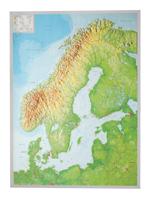
Wandkaart - Reliëfkaart Scandinavië met voelbaar 3D reliëf 77 x 55 x 2 cm | GeoRelief
De uitgever van de kaart is de bekende Duitse uitgever GeoRelief GbR. Deze topografische kaart van Scandinavië heeft een hoge kwaliteit met prachtige kleuren  (engelse versie). De kaart bevat de namen van grote steden, spoorwegen, wegennet, de namen van bergketens en internationale luchthavens. Gemaakt van een hoge kwaliteit kunststof. Extreem duurzaam. Met hoogwaardige licht gestructureerde aluminium lijst van 1,5 cm breed. Our relief map of Scandinavia on a scale of 1:2,900,000 and an elevation of the elevations by a factor of 10, presents this yearning destination for nature lovers, anglers, boaters, and outdoor enthusiasts vividly, in detail and a lovingly designed look.
134,95
Wegenkaart - landkaart Südtirol Alto Adige - Dolomiti - Zuid Tirol - Dolomieten | Tabacco Editrice
Heel duidelijke wegenkaart van Zuid Tirol. De kaart is goed leesbaar met mooie kleurstellin waardoor goed duidelijk wordt hoe en waar de bergbieden en nationale parken liggen.  The South Tyrol region of north-eastern Italy on a durable, waterproof and tear-resistant road map at 1:150,000 from Tabacco with excellent presentation of the topography derived from the publishers’ highly regarded and popular hiking maps, plus on the reverse a panorama drawing of the mountains. Coverage extends from the Austrian border to just past Trento and Feltre, and west/east from Bormio to well east of Belluno.   The map provides a very clear picture of the region’s landscape through graphic relief for its exposed rocky areas, plus relief shading and contours at 100m intervals, and has plenty of names of individual groups, peaks, valleys, etc. Additional colouring indicates woodlands and boundaries of national parks and other protected areas are marked. Minor roads are drawn without generalizing their c…
12,50
Wegenkaart - landkaart Dolomiti - Dolomieten - Lago di Garda - Venezia | Tabacco Editrice
Dolomites – Lake Garda - Venice region of north-eastern Italy on a road map at 1:200,000 from Tabacco with excellent presentation of the topography derived from the publishers’ highly regarded and popular hiking maps, plus on the reverse a panorama drawing of the mountains. Coverage extends from the Austrian border southwards to the A4 motorway including the whole of Lake Garda, Verona, Padua and Venice, plus east to Lienz/Pordenone.   The map provides a very clear picture of the region’s landscape through graphic relief for its exposed rocky areas, plus relief shading and contours at 100m intervals, and has plenty of names of individual groups, peaks, valleys, etc. Additional colouring indicates woodlands and boundaries of national parks and other protected areas are marked. Minor roads are drawn without generalizing their course, showing the twists and turns across the mountainous terrain. Driving distances are marked on main and many connecting routes. Railway lines are shown with …
9,95
Wandelkaart 18 Jungfrau Region - Thuner und Brienzersee | Kümmerly & Frey
Karte für die Regionen Berner Alpen, Berner Oberland Ost, Jungfrau, Eiger, Scheidegg, Grindelwald, Finsteraarhorn, Mürren, Interlaken, Aletschhorn, Kandertal, Kandersteg, Wengen und vieles mehr. Zeer duidelijke wandelkaart van een deel van Zwitserland. Deze kaart - gemaakt op scheur en watervast papier - is bedoeld voor de gewone en gemiddelde bergwandelaar. Ook voor huttentochten is deze zeker geschikt. Slechts voor de gevorderde wandelaar die glesjers gaat overschrijden zijn de 25.000 topografische kaarten aan te raden. Op deze 1:60.000 kaarten staan de wandelroutes in 3 soorten weergegeven: Wanderweg, Bergweg en Alpine route. De routes staan goed ingetekend en werken prima naast de vele markingen in het veld. Hoogteverschillen, overnachtingsmogelijkheden, bus routes en gps-informatie ontbreken allemaal niet op deze landkaarten.   The maps have contours at 50m or 25m intervals according to the terrain, enhanced by graphic relief and shading. An overprint distinguishes between sign-p…
22,50

Klanten-reviews van Reliëfkaart Wereld met voelbaar 3D reliëf | A3 | 42 x 30 cm | GeoRelief

Er zijn nog geen beoordelingen voor dit productBen jij de eerste die een review plaatst?

Meer over Reliëfkaart Wereld met voelbaar 3D reliëf | A3 | 42 x 30 cm | GeoRelief

Productomschrijving

Prachtige kunststof reliëfkaart met voelbaar reliëf met plaatsnamen, bergnamen en hoogten.   Product: a 3D topographical map with colored graphic relief and hill shading and color feature which are derived from high resolution terrain models. Content: World with detailed landscape relief , hydrographic network, city names, mountain names, mountain railways, and elevation. 

Productinformatie

    Verken gerelateerde categorieën

    Webshop.nl maakt gebruik van cookies. Ga je verder op onze website, ga dan akkoord met het plaatsen van cookies en de verwerking van deze data door ons en vermelde partners.