webshop.nl
Categorieën
  Sluiten

Reisinspiratieboek National Geographic Atlas of Wild America | National Geographic

From the deep forests of the Canadian Northwest to the red-rock deserts of the American Southwest, North America offers a myriad of opportunities for hiking, camping, trekking, and simply enjoying the abundance of the natural world. This opulent volume highlights 41 of those wilderness locations. Filled with authoritative maps, data-driven graphic...
78,95

Webshops met dit product

Webshop
Bezorging
Prijs

Anderen bekeken ook

Wandelkaart 901 Banff North National Park | National Geographic
Prachtige geplastificeerde kaart van het bekende nationaal park. Met alle recreatieve voorzieningen als campsites, maar ook met topografische details en wandelroutes ed. Door uitgekiend kleurgebruik zeer prettig in gebruik. Scheur en watervast! The front side of the Banff North map details the south side of the national park, from Siffleur Wilderness Area to the north, to Kootenay National Park to the south. This side also covers survival tips, area trails, entry fees and details both Kootenay and Yoho Nationals Parks. The reverse side of the map details the north side of the park, extending from Siffleur Wilderness area to the south, to White Goat Wilderness to the North. Insets show safe travel in Bear Country, and all the recreation the park has to offer with backpacking, camping, biking, hiking and horseback riding.  National Geographic's Trails Illustrated map of Banff North is a two-sided, waterproof map designed to meet the needs of outdoor enthusiasts with unmatched durability …
17,95
Wegenkaart - landkaart Sierra Nevada | National Geographic
&; Waterproof &; Tear-Resistant &; Travel Map   National Geographic's Sierra Nevada Destination Map strikes the perfect balance between map and guidebook and is an ideal resource for touring the rugged landscape of this culturally and geographically unique region of California and Nevada.   The front side of the print map reveals a detailed map of the region stretching from the Oregon border to California's Eldorado National Forest, bordered by the Sacramento Valley to the west and Nevada's Great Basin to the east. Modoc, Shasta-Trinity, Lassen, Plumas, and Humbolt-Toiyabe National Forests are also included on the map. The map features a comprehensive road network including scenic byways as well as areas of interest such as Indian Reservations, National Parks and Monuments, and Recreation Areas. Trails, historic sites, museums, cultural centers, scenic areas, state parks and other points of interest are also included. In addition, the map features beautiful photographs and informat…
17,50
Wandelkaart - Wegenkaart - landkaart 902 Jasper South National Park | National Geographic
Goede kaart van een deel van Jasper National Park. Geschikt voor overzicht maar ook voor de langere trails: campsites, rivieren, paden, alles kun je er op terug vinden.   National Geographic's Trails Illustrated map of Jasper South is a two-sided, waterproof map designed to meet the needs of outdoor enthusiasts with unmatched durability and detail. This map was created in conjunction with local land management agencies and is loaded with valuable recreation information.   The front side of the Jasper South map details the east side of the national park, from Whitehorse Wildland Provincial Park to the north, to White Goat Wilderness Area to the south. The reverse side of the map details the west side of the park, extending from Cummins Lakes Provincial Park to the south, to Victoria Cross Ranges to the North. Insets show survival tips, safe travel in Bear Country, and all the recreation the park has to offer with backpacking, camping, biking, hiking and horseback riding.   Trails I…
17,50
Wandelkaart - Wegenkaart - landkaart 903 Jasper North National Park | National Geographic
Goede kaart van een deel van Jasper National Park. Geschikt voor overzicht maar ook voor de langere trails: campsites, rivieren, paden, alles kun je er op terug vinden. National Geographic's Trails Illustrated map of Jasper North is a two-sided, waterproof map designed to meet the needs of outdoor enthusiasts with unmatched durability and detail. This map was created in conjunction with local land management agencies and is loaded with valuable recreation information.   The front side of Jasper North map details the east side of the national park, from Rock Lake Solomon Creek Wildland Park to the north, to Whistler's Summit to the south. The reverse side of the map details the west side of the park, extending from Mt. Terry Fox Provincial Park to the south, to Willmore Wilderness Park to the North. Insets show survival tips, safe travel in Bear Country, and what to do while visiting.   Trails Illustrated maps are expertly researched and frequently updated. The maps are printed in the U…
17,50
Fotoboek America the Beautiful | National Geographic
"America the Beautiful' showcases the stunning spaces closest to our nation's heart--from the woods in the Great Appalachian Valley that Davy Crockett once called home to the breathtaking sweep of California's Big Sur coast to the wilds of Alaska. It also celebrates the people who have made this country what it is, featuring a wide range of images including the Arikara Nation in the early 1900s and scientists preparing for travel to Mars on a Hawaiian island. Culled from National Geographic's vaunted photo archives, spanning a period of more than 130 years, this provocative collection depicts the splendor of this great nation as only National Geographic can, with a dramatic combination of modern and historical imagery--from the creation of architectural icons like the Golden Gate Bridge and Lady Liberty to the last of the country's wild places preserved in our national parks. 0With a structure inspired by the original song "America the Beautiful," this book recognizes what makes our na…
47,50
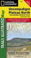
Wandelkaart - Topografische kaart 147 Uncompahgre Plateau North | National Geographic
Prachtige geplastificeerde kaart van het bekende nationaal park. Met alle recreatieve voorzieningen als campsites, maar ook met topografische details en wandelroutes ed. Door uitgekiend kleurgebruik zeer prettig in gebruik. Scheur en watervast! National Geographic's Trails Illustrated map of Uncompahgre Plateau North is a two-sided, waterproof map designed to meet the needs of outdoor enthusiasts with unmatched durability and detail. This map was created in conjunction with local land management agencies and is loaded with valuable recreation information.   The front side of the map details the northeastern section of Uncompahgre National Forest and the Roubideau Area, the eastern portions of Dominguez Escalante National Conservation Area and Dominguez Canyons Wilderness, and the city of Delta. On the reverse side of the map, the northwestern section of Uncompahgre National Forest is featured as well as the Tabeguache Area, Grand Mesa National Forest, and the western portions of Doming…
17,95
Wandelkaart 223 North Cascades National Park | National Geographic
Prachtige geplastificeerde kaart van het bekende nationaal park. Met alle recreatieve voorzieningen als campsites, maar ook met topografische details en wandelroutes ed. Door uitgekiend kleurgebruik zeer prettig in gebruik. Scheur en watervast!   Explore the alpine forests, wild rivers, jagged peaks, and abundant glaciers of North Cascades National Park with National Geographic’s Trails Illustrated map. Expertly researched and created in partnership with local land management agencies, this map features key points of interest including Baker Lake; Rockport State Park; Chelan and Ross Lake National Recreation Areas; Stephen Mather, Mount Baker, and Pasayten Wilderness Areas; Snoqualmie and Okanogan Wenatchee National Forests; and portions of the Sauk, Skagit, and Suiattle rivers.   With miles of clearly marked trails including the popular Pacific Crest and Pacific Northwest trails, this map can guide you off the beaten path and back again. Mileages between intersections are shown and th…
16,95
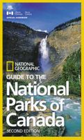
Reisgids National Parks of Canada | National Geographic
Per provincie worden de parken helder beschreven en aangevuld met duidelijke kaarten en prachtige foto's zoals we van National Geographic gewend zijn levert dit een complete gids op. This completely updated guidebook shows you how to make the most out of your visit to Canada's 47 gorgeous national parks, just in time for Canada's 150th birthday--from Cape Breton Highlands to Banff to Pacific Rim National Park Preserve, plus the five newest additions: Naats'ihch'oh National Park Reserve, Mealy Mountains, Rouge Urban, Qausuittuq, and Sable Island National Park Reserve of Canada. Written by national park experts who know the parks inside out, chock-full of handy, practical information, and beautifully illustrated with stunning photography and one-of-a-kind maps prepared by National Geographic cartographers specifically for this book, this edition takes you step-by-step to the must-sees of each park, and lesser known places as well, making sure you don't miss a thing. Detailed guidance hig…
24,95
Wandelkaart - Topografische kaart 747 Green Mountain National Forest North - Moosalamoo NRA - Rutland | National Geographic
Prachtige geplastificeerde kaart van het bekende nationaal park. Met alle recreatieve voorzieningen als campsites, maar ook met topografische details en wandelroutes ed. Door uitgekiend kleurgebruik zeer prettig in gebruik. Scheur en watervast! National Geographic's Green Mountain National Forest North Trails Illustrated topographic map is the most comprehensive available for outdoor enthusiasts of all types. Designed to be easy-to-read, yet highly detailed – this map includes a comprehensive road and trail network distinguishing between major, secondary and 4x4 roads, hiking, horse, biking, multi-use and non-motorized winter trails. All forest roads are labeled with their official road number and trails are clearly identified with their given name. Land management boundaries are color-coded showing National Forest, Ranger District, Wilderness Areas, Conservation Areas and more, plus the locations of private land within the Green Mountain National Forest. The renowned Appalachian Trail…
17,95
Wandelkaart - Topografische kaart 748 Green Mountain National Forest South - Robert T. Stafford White Rocks NRA - Manchester | National Geographic
Prachtige geplastificeerde kaart van het bekende nationaal park. Met alle recreatieve voorzieningen als campsites, maar ook met topografische details en wandelroutes ed. Door uitgekiend kleurgebruik zeer prettig in gebruik. Scheur en watervast! National Geographic's Green Mountain National Forest South Trails Illustrated topographic map is the most comprehensive available for outdoor enthusiasts of all types. Designed to be easy-to-read, yet highly detailed – this map includes a comprehensive road and trail network distinguishing between major, secondary and 4x4 roads, hiking, horse, biking, multi-use and non-motorized winter trails. All forest roads are labeled with their official road number and trails are clearly identified with their given name. Land management boundaries are color-coded showing National Forest, Ranger District, Wilderness Areas, Conservation Areas and more, plus the locations of private land within the Green Mountain National Forest. The renowned Appalachian Trail…
17,95

Klanten-reviews van Reisinspiratieboek National Geographic Atlas of Wild America | National Geographic

Er zijn nog geen beoordelingen voor dit productBen jij de eerste die een review plaatst?

Meer over Reisinspiratieboek National Geographic Atlas of Wild America | National Geographic

Productomschrijving

From the deep forests of the Canadian Northwest to the red-rock deserts of the American Southwest, North America offers a myriad of opportunities for hiking, camping, trekking, and simply enjoying the abundance of the natural world. This opulent volume highlights 41 of those wilderness locations. Filled with authoritative maps, data-driven graphics, awe-inspiring photographs, and thoughtful essays, this vivid book will feed the soul of everyone who loves wild places. Six lush chapters take readers from the eastern woodlands to the central plains, from the northern wilderness to southwestern desert lands--including key wilderness areas in Canada and Mexico. You'll discover the fascinating history of the High Peaks of the Adirondacks, learn about fossil remains on the Upper Missouri River, gaze through the rainforest canopy of Alaska's Tongass National Forest, and experience Grand Canyon Parashat's Dark Sky Park. A special section rich in maps and graphics highlights 13 thematic topics, such as the National Scenic Trail System and the human impact on wilderness areas. This beautiful book, bursting with information and lyricism, will inspire all who have journeyed into the wild--and intrigue many who still hope to do so.
Webshop.nl maakt gebruik van cookies. Ga je verder op onze website, ga dan akkoord met het plaatsen van cookies en de verwerking van deze data door ons en vermelde partners.