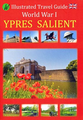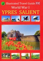
Reisgids Ypres Salient - Ieper en omgeving | War travel

0
Een zeer uitgebreide, royaal van foto's voorziene reisgids langs de 'bezienswaardigheden' van de 1e Wereldoorlog. Goede beschrijvingen en uitstekende kaarten waarmee je deze plekken kunt terugvinden in het veld.    World War 1, also known as the Great War or ‘The War to End All Wars’, lasted from July 28, 1914 to November 11, 1918. The world was c...

Verkopers met dit product

Webshop
Bezorging
Prijs
DeZwerver.nl logo
DeZwerver.nl
niet bekend
17,50

Anderen bekeken ook

Reisgids World War 1 north east - Eerste Wereldoorlog | War travel
Marne - Argonne - Maas - Verdun - Les Eparges - Saint Mihiel - Vogezen   Een zeer uitgebreide, royaal van foto's voorziene reisgids langs de 'bezienswaardigheden' van de 1e Wereldoorlog. Goede beschrijvingen en uitstekende kaarten waarmee je deze plekken kunt terugvinden in het veld.    World War 1, also known as the Great War or ‘The War to End All Wars’, lasted from July 28, 1914 to November 11, 1918. The world was caught up in a global conflict and Europe endured four years of horrific fighting. The landscape is still marked with mine and artillery craters, trenches, cemeteries and forts still mark the landscape. Numerous memorials honor the dead and museums exhibit vestiges of a time that should never be forgotten. This illustrated travel guide describes these sites, which are located in the northeast of France between Reims and the Swiss border, an area which saw some of the bloodiest battles of the war. Meer informatie   With the use of detailed maps, GPS coordinates and address…
21,50
Historische Kaart Verdun - Eerste Wereldoorlog | War travel
Themakaart over de geschiedenis van de Eerste Wereldoorlog in en rond Verdun. Met gedetailleerde inzetten van Verdun, Argonne en Saint-Michel. Aandacht voor monumenten, musea, vestingen, loopgraven en kerkhoven.  Mooi kleurgebruik, veel detail en heel gedetailleerd. Gedrukt op stone-paper, dat gaat echt veel langer mee.   Van de uitgever Discover Verdun and its surroundings. This double-sided printed map shows the locations of cemeteries, monuments, forts, trenches and museums in and around Verdun. The map is printed on Stone Paper, 100% water-repellent, very durable in use and paper-free. Folded size 12.5 * 25 cm, unfolded 70 * 100 cm.   Discover 10 destroyed villages, 66 World War I cemeteries (37 French, 28 German and 1 American), 30 fortresses, 40 monuments, 16 trenches and 10 World War I museums using this highly detailed map.   The map is divided into 4 sections:   The city of Verdun. Visit the underground Citadelle, the beautiful Victory Monument, the old town in Vauban style a…
15,-
Reisgids 1e Wereldoorlog - World War I Battlefields | Bradt Travel Guides
Thoroughly updated for this new 3rd edition, Bradt's World War I Battlefields remains the only compact practical travel guide to cover both French and Belgian battlefield sites involved in one of the deadliest conflicts in human history, which changed the face of foreign policy and European geography forever. The 2014-18 centenary of the First World War was a huge catalyst for battlefield tourism, leading to a proliferation of innovative new museums, memorials, commemorative trails, statues and more - which are comprehensively covered in this update. Co-authored by two award-winning travel writers, this lightweight and pocket-friendly guidebook is perfect for visitors. It covers all the main sites, memorials and museums of the entire Western Front alongside practical information such as travelling there and getting around, and how to book the best guided tours.   In the Belgian section of the book, chapters cover Ypres and the Ypres Salient; Poperinge and Heuvelland; Diksmuide, Veurne…
13,95
Reisgids Friuli Venezia Giulia | Bradt Travel Guides
Voor vele landen net zo goed, zo niet beter dan de Planet. Beduidend soberder uitgevoerd, maar ook met veel informatie voor zelfstandige reizigers of backpackers en met veel kaartmateriaal. Een aanrader!   This new title continues Bradt's coverage of lesser-known but increasingly popular Italian regions and is the only guide available to Friuli Venezia Giulia, a region that forms the major part of the hinterland of Venice (but does not - despite the name - include Venice itself), and which is a convenient and fascinating place to spend time on the beach, in the Alps or relaxing in the country. It is notable also for its wines and distinctive cuisine, which, with touches of neighbouring Austria and Slovenia stirred in, are starting to attract attention around the world.   Written by long-time travel authors and Italy specialists Dana Facaros and Michael Pauls, background and practical information are complemented by ten easy-to-follow chapters, covering Trieste, its coast and the Carso…
22,50
Reisgids D-Day Landings - Normandie | Bradt Travel Guides
Published to commemorate the 80th anniversary of the military mission that changed World War II, D-Day Landings: a Travel Guide to Normandy's Beaches and Battlegrounds is Bradt's new guidebook to visiting beaches, memorials, museums, battlefields and other sites associated with D-Day and the Battle of Normandy (Operation Overlord). A simple-to-follow, portable guide for independent travellers, it includes maps and driving instructions to help visitors go back in time to explore World War II history. Written by two experienced travel writers who, between them, are experts in France and military history, D-Day Landings is designed for visitors who want to see all or part of Normandy. Covering the ground from the D-Day landing beaches (Sword, Juno, Gold, Omaha and Utah) up to the Falaise Gap and Cherbourg, it encompasses both every major site and a host of smaller, less well-known locations - venturing well beyond the coast to include sites associated with the capture of Cherbourg (D+20)…
14,95
Reisgids Slow Travel Cambridgeshire and the Fens | Bradt Travel Guides
Een bijzondere serie van Bradt guides, waarin een gedeelte van Engeland uitgebreid beschreven wordt. Met veel aandacht voor kleine details die je niet al gauw elders zult vinden. Naast de beschrijvende informatie vind je ook een schat aan praktische informatie als accommodatie-adressen of leuke pubs. Een aanrader! This new book adds Cambridgeshire and the Fens to Bradt's award-winning Slow Travel series - the biggest series of UK regional travel guides, now over 20 titles strong. No other title offers the range and depth of information on this varied, beautiful and surprisingly undiscovered region. Cambridge itself attracts visitors, students, professionals and academics from around the world, but beyond the University City lie towns and villages, wide open spaces, gentle waterways and wonderful cycling and walking country that comparatively few take time to discover. Engaging and unexpected, this is an informative guide that captures both the stand-out highlights and lesser-known att…
22,50
Reisgids Travel guides Okinawa & Japan's Southern Islands | Bradt Travel Guides
There’s a whole world in Japan’s Southwest Islands. This brand new guidebook is the first to include all the practical information that visitors to the islands will need. It covers the best of the archipelago’s sites, activities, history, culture and language, as well as providing important practical information for visitors to this rewarding but remote area of Japan. The archipelago’s 1100km stretch, from the southern tip of mainland Japan to Taiwan, makes it geographically and biologically diverse. The landscape includes award-winning beaches, coral reefs, tropical jungles and ancient forests – this guide shows the best way of experiencing them all. Maps of dive sites, snorkel spots, hiking trails and cycle routes are included, as well as local tour operators that can take you there. The islands are also home to many animals including the world’s largest moth, indigenous wild cats, hammerhead sharks, whales and manta rays.   The Southwest Islands are culturally diverse too. Once the…
27,50
Reisgids Sri Lanka | Bradt Travel Guides
Voor vele landen net zo goed, zo niet beter dan de Planet. Beduidend soberder uitgevoerd, maar ook met veel informatie voor backpackers en met veel kaartmateriaal. Een aanrader! The new seventh edition of Bradt's Sri Lanka remains the most detailed and comprehensive guidebook to this alluring island nation. Written by Philip Briggs, one of the world's most experienced and highly regarded guidebook writers, this thoroughly updated guide provides detailed coverage of every aspect of this diverse and compact country, from idyllic tropical coastlines to mist-shrouded tea plantations and time-warped colonial homesteads. Alongside in-depth sections on all major beach resorts, archaeological sites, historic towns and national parks, it introduces adventurous travellers to intriguing lesser-known sites and emergent destinations inaccessible for decades prior to 2009, when the civil war ended.Beach holidays are a year-round attraction, while fantastic Buddhist-affiliated UNESCO World Heritage …
24,95
Historische Kaart 14 - 18 Map of Verdun (Battlefield map) | Eerste Wereld Oorlog | Pen and Sword publications
Comprehensive mapping for the Battle of Verdun 1916 and a sizable part of the early days of the Meuse-Argonne Offensive 1918. Clearly produced in full color, with different types of feature in different colors, all supported by two comprehensive keys. For many years the Holts have provided tourers to the battlefields with excellent mapping for the Ypres Salient and the Somme. This map of the Verdun/Meuse area fills one of the many gaps in the coverage of the Western Front. This map of the Verdun battlefield is in the same style, using a color coded system to distinguish the different types of features. It includes some 300 locations of memorials, cemeteries, significant remnants of the battle terrain, remaining fortifications, trenches, the destroyed villages and other vestiges of the war. On the reverse there is a cut out and enlarged section of the Verdun battlefield in particular - the most visited part of the area, which provides greater detail. This section includes the Ossuary…
9,95
Reisgids Somaliland | Bradt Travel Guides
Voor vele landen net zo goed, zo niet beter dan de Planet. Beduidend soberder uitgevoerd, maar ook met veel informatie voor backpackers en met veel kaartmateriaal. Een aanrader!   There is a reason no other publisher produces a guide to Somaliland: it is not an easy book to produce. The research is extremely challenging, the production is expensive and, because Somaliland is such a niche travel destination, the sales potential is very limited. Unfortunately, the first edition of this book did not recoup its costs. We were left with a difficult decision: increase the retail price to make a second edition possible or admit defeat and allow the guide to go out of print. We don’t like to admit defeat.   This second edition is significantly more expensive than the first edition, but we sincerely hope you’ll understand why that is the case, and feel that the revised price still represents excellent value for such vital and unique information. We are committed to providing high quality tr…
34,95

Klanten-reviews van Reisgids Ypres Salient - Ieper en omgeving | War travel

Er zijn nog geen beoordelingen voor dit productBen jij de eerste die een review plaatst?

Meer over Reisgids Ypres Salient - Ieper en omgeving | War travel

Productomschrijving

Een zeer uitgebreide, royaal van foto's voorziene reisgids langs de 'bezienswaardigheden' van de 1e Wereldoorlog. Goede beschrijvingen en uitstekende kaarten waarmee je deze plekken kunt terugvinden in het veld.    World War 1, also known as the Great War or ‘The War to End All Wars’, lasted from July 28, 1914 to November 11, 1918. The world was caught up in a global conflict and Europe endured four years of horrific fighting. The landscape is still marked with mine and artillery craters, trenches, cemeteries and forts still mark the landscape. Numerous memorials honor the dead and museums exhibit vestiges of a time that should never be forgotten. This illustrated travel guide describes these sites, which are located in and around Ypres - Ieper, which is known as Ypres Salient. Many battles were fought in this region.    Detailed map GPS coordinates addresses

Verken gerelateerde categorieën

Webshop.nl maakt gebruik van cookies. Ga je verder op onze website, ga dan akkoord met het plaatsen van cookies en de verwerking van deze data door ons en vermelde partners.