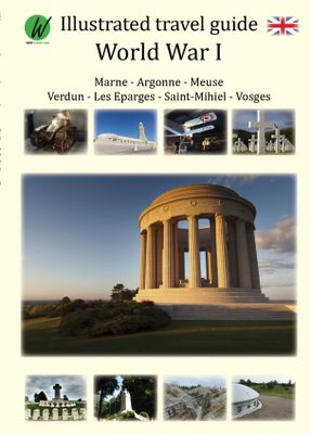
Reisgids World War 1 north east - Eerste Wereldoorlog | War travel

0
Marne - Argonne - Maas - Verdun - Les Eparges - Saint Mihiel - Vogezen   Een zeer uitgebreide, royaal van foto's voorziene reisgids langs de 'bezienswaardigheden' van de 1e Wereldoorlog. Goede beschrijvingen en uitstekende kaarten waarmee je deze plekken kunt terugvinden in het veld.    World War 1, also known as the Great War or ‘The War to End A...

Verkopers met dit product

Verkoper
Bezorging
Prijs
DeZwerver.nl logo
DeZwerver.nl
niet bekend
2,95
21,50

Anderen bekeken ook

Reisgids World War 1 north east - Eerste Wereldoorlog | War travel
Marne - Argonne - Maas - Verdun - Les Eparges - Saint Mihiel - Vogezen   Een zeer uitgebreide, royaal van foto's voorziene reisgids langs de 'bezienswaardigheden' van de 1e Wereldoorlog. Goede beschrijvingen en uitstekende kaarten waarmee je deze plekken kunt terugvinden in het veld.    World War 1, also known as the Great War or ‘The War to End All Wars’, lasted from July 28, 1914 to November 11, 1918. The world was caught up in a global conflict and Europe endured four years of horrific fighting. The landscape is still marked with mine and artillery craters, trenches, cemeteries and forts still mark the landscape. Numerous memorials honor the dead and museums exhibit vestiges of a time that should never be forgotten. This illustrated travel guide describes these sites, which are located in the northeast of France between Reims and the Swiss border, an area which saw some of the bloodiest battles of the war. Meer informatie   With the use of detailed maps, GPS coordinates and address…
21,50
Historische Kaart Verdun - Eerste Wereldoorlog | War travel
Themakaart over de geschiedenis van de Eerste Wereldoorlog in en rond Verdun. Met gedetailleerde inzetten van Verdun, Argonne en Saint-Michel. Aandacht voor monumenten, musea, vestingen, loopgraven en kerkhoven.  Mooi kleurgebruik, veel detail en heel gedetailleerd. Gedrukt op stone-paper, dat gaat echt veel langer mee.   Van de uitgever Discover Verdun and its surroundings. This double-sided printed map shows the locations of cemeteries, monuments, forts, trenches and museums in and around Verdun. The map is printed on Stone Paper, 100% water-repellent, very durable in use and paper-free. Folded size 12.5 * 25 cm, unfolded 70 * 100 cm.   Discover 10 destroyed villages, 66 World War I cemeteries (37 French, 28 German and 1 American), 30 fortresses, 40 monuments, 16 trenches and 10 World War I museums using this highly detailed map.   The map is divided into 4 sections:   The city of Verdun. Visit the underground Citadelle, the beautiful Victory Monument, the old town in Vauban style a…
15,-
Reisgids 1e Wereldoorlog - World War I Battlefields | Bradt Travel Guides
Thoroughly updated for this new 3rd edition, Bradt's World War I Battlefields remains the only compact practical travel guide to cover both French and Belgian battlefield sites involved in one of the deadliest conflicts in human history, which changed the face of foreign policy and European geography forever. The 2014-18 centenary of the First World War was a huge catalyst for battlefield tourism, leading to a proliferation of innovative new museums, memorials, commemorative trails, statues and more - which are comprehensively covered in this update. Co-authored by two award-winning travel writers, this lightweight and pocket-friendly guidebook is perfect for visitors. It covers all the main sites, memorials and museums of the entire Western Front alongside practical information such as travelling there and getting around, and how to book the best guided tours.   In the Belgian section of the book, chapters cover Ypres and the Ypres Salient; Poperinge and Heuvelland; Diksmuide, Veurne…
13,95
Reisgids Verdun en omgeving - eerste wereldoorlog | War travel
Verdun, een prachtige oude stad, gelegen aan de Maas en gebouwd rond de oude Citadel was tijdens de Eerste Wereldoorlog het toneel van een grote veldslag.   Van 21 februari 1916 tot 20 december 1916 woedde hier een van de bloedigste veldslagen uit de Eerste Wereldoorlog. Het Duitse leger lanceerde er een groot offensief genaamd ‘Gericht’. Het doel was het Franse leger ‘leeg te bloeden’ en hiermee te vernietigen.   Dit resulteerde in tot dusver ongekend geweld welke het landschap heeft gevormd en waarvan de sporen tot op vandaag duidelijk aanwezig zijn.   Bezoek de verwoeste dorpen, loopgraven, monumenten, forten en begraafplaatsen welke  bewaard zijn gebleven. Deze reisgids heeft al deze bezienswaardigheden duidelijk in kaart  gebracht, van de bunker van Kolonel Driant tot de Voie Sacrée, van de grootste Amerikaanse begraafplaats in Europa tot het indrukwekkende Ossuaire Douaumont.    Naast de zeer gedetailleerde kaarten zijn ook GPS coördinaten en adressen opgenomen. De Google Maps e…
14,95
Fotoboek World War II Battlefields - 2e Wereldoorlog | Amber Books
Featuring battlefield sites divided by wartime theater, World War II Battlefields allows the reader to explore well-known battle locations today and compare them to images captured during the height of the conflict. Examine the huge concrete bunker at Fort Eben Emael, Belgium, captured by German glider troops in May 1940 and still intact today. See the beaches at Tarawa atoll, a scene of fierce fighting between the US Marines and the Japanese defenders in 1943, or the streets of the Ukrainian city of Kharkiv, the center of a bloody battle between the II SS Panzer Korps and the Red Army. Explore the Norman village of Villers-Bocage, where a few German Tiger tanks halted the advance of the British 7th Armoured Division a week after the D-Day landings. Visit the twin medieval towers of the bridge at Remagen on the Rhine river, made famous in photos and movies, or the dozens of Japanese ships sunk in Truk Lagoon following comprehensive American air attacks, and today a popular dive site.…
27,95
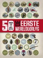
De Eerste Wereldoorlog
50 dingen die je moet weten over De Eerste Wereldoorlog! In 1914 brak een oorlog uit die uitgroeide tot een wereldwijd conflict. Lees hoe de gebeurtenissen zich ontwikkelden, ontmoet de belangrijkste personen in het conflict en ontdek de langdurige impact van de Eerste Wereldoorlog. Vol met weetjes, landkaarten en foto's biedt dit full-color boek alle informatie over een tragische periode in de wereldgeschiedenis. In deze serie verschenen eerder 50 dingen over 'Extreem weer', 'De Tweede Wereldoorlog', 'Uitvindingen', 'Het heelal' en 'Het menselijk lichaam'.
16,99
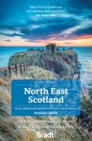
Reisgids Slow Travel North East Scotland | Bradt Travel Guides
Smitten by Scotland since childhood, travel writer Rebecca Gibson moved to Moray and started exploring her new home region on foot to produce this new title in Bradt's award-winning series of Slow travel guides to UK regions. Walkers, cyclists, wildlife lovers, families, history and folklore enthusiasts, and foodies are all catered for, with coverage of a wide range of attractions. As the only comprehensive guidebook to North East Scotland in print, it also contains all the practical information you could need to plan and enjoy time in this thrillingly diverse yet largely under-explored part of Britain.   This region of mountains and coasts, ancient Caledonian pine forests and salmon-rich rivers harbours much to enthral and surprise. Long famous among hillwalkers, mountaineers and nature lovers, the Cairngorms is the UK's largest National Park and holds five of its six tallest summits - but also abounds in fairy folklore. Balmoral Estate has been a royal residence since Queen Victoria…
22,50
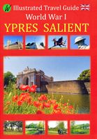
Reisgids Ypres Salient - Ieper en omgeving | War travel
Een zeer uitgebreide, royaal van foto's voorziene reisgids langs de 'bezienswaardigheden' van de 1e Wereldoorlog. Goede beschrijvingen en uitstekende kaarten waarmee je deze plekken kunt terugvinden in het veld.    World War 1, also known as the Great War or ‘The War to End All Wars’, lasted from July 28, 1914 to November 11, 1918. The world was caught up in a global conflict and Europe endured four years of horrific fighting. The landscape is still marked with mine and artillery craters, trenches, cemeteries and forts still mark the landscape. Numerous memorials honor the dead and museums exhibit vestiges of a time that should never be forgotten. This illustrated travel guide describes these sites, which are located in and around Ypres - Ieper, which is known as Ypres Salient. Many battles were fought in this region.    Detailed map GPS coordinates addresses
17,50
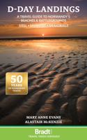
Reisgids D-Day Landings - Normandie | Bradt Travel Guides
Published to commemorate the 80th anniversary of the military mission that changed World War II, D-Day Landings: a Travel Guide to Normandy's Beaches and Battlegrounds is Bradt's new guidebook to visiting beaches, memorials, museums, battlefields and other sites associated with D-Day and the Battle of Normandy (Operation Overlord). A simple-to-follow, portable guide for independent travellers, it includes maps and driving instructions to help visitors go back in time to explore World War II history. Written by two experienced travel writers who, between them, are experts in France and military history, D-Day Landings is designed for visitors who want to see all or part of Normandy. Covering the ground from the D-Day landing beaches (Sword, Juno, Gold, Omaha and Utah) up to the Falaise Gap and Cherbourg, it encompasses both every major site and a host of smaller, less well-known locations - venturing well beyond the coast to include sites associated with the capture of Cherbourg (D+20)…
14,95

Klanten-reviews van Reisgids World War 1 north east - Eerste Wereldoorlog | War travel

Er zijn nog geen beoordelingen voor dit productBen jij de eerste die een review plaatst?

Meer over Reisgids World War 1 north east - Eerste Wereldoorlog | War travel

Productomschrijving

Marne - Argonne - Maas - Verdun - Les Eparges - Saint Mihiel - Vogezen   Een zeer uitgebreide, royaal van foto's voorziene reisgids langs de 'bezienswaardigheden' van de 1e Wereldoorlog. Goede beschrijvingen en uitstekende kaarten waarmee je deze plekken kunt terugvinden in het veld.    World War 1, also known as the Great War or ‘The War to End All Wars’, lasted from July 28, 1914 to November 11, 1918. The world was caught up in a global conflict and Europe endured four years of horrific fighting. The landscape is still marked with mine and artillery craters, trenches, cemeteries and forts still mark the landscape. Numerous memorials honor the dead and museums exhibit vestiges of a time that should never be forgotten. This illustrated travel guide describes these sites, which are located in the northeast of France between Reims and the Swiss border, an area which saw some of the bloodiest battles of the war. Meer informatie   With the use of detailed maps, GPS coordinates and addresses, this guide shows you exactly where to find these remarkable places. Each subject comes with a brief historical description and photos, providing you with important insights on what to expect when you plan your visit. Additionally, each subject comes with its own web page, which provides the sites’ actual opening times, a zoomable google maps map which can be used to navigate and links to the sites’ official web page for additional information.   This guide provides you the ideal tool to plan your visit to the World War I battlefields in France

Productinformatie

    Verken gerelateerde categorieën

    Webshop.nl maakt gebruik van cookies. Ga je verder op onze website, ga dan akkoord met het plaatsen van cookies en de verwerking van deze data door ons en vermelde partners.