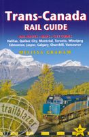
Reisgids Trans-Canada Rail Guide | Trailblazer Guides

0
De perfecte reisgids om met de trein Canada te bereizen. Tips voor de mooiste routes, de beste uitstapjes en goede adressen voor eten, slapen en vervoer. Engels. Fully revised 6th edition of this established guide to the world's most scenic rail ride A journey on Canada's transcontinental railroad ranks as one of the greatest rail experiences in t...

Verkopers met dit product

Verkoper
Bezorging
Prijs
DeZwerver.nl logo
DeZwerver.nl
2,95
23,50

Anderen bekeken ook

Reisgids Trans-Canada Rail Guide | Trailblazer Guides
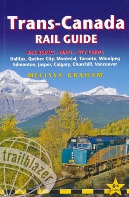
De perfecte reisgids om met de trein Canada te bereizen. Tips voor de mooiste routes, de beste uitstapjes en goede adressen voor eten, slapen en vervoer. Engels. Fully revised 6th edition of this established guide to the world's most scenic rail ride A journey on Canada's transcontinental railroad ranks as one of the greatest rail experiences in the world. Stretching from the Atlantic to the Pacific, the lines span 6358km (3974 miles), taking in not only several of North America's finest cities but also some of the most dramatic scenery on earth, including the spectacular Rocky Mountains.   Rail travel for all budgets Where to get the best deals whether you are looking for the cheapest rail tickets with shoestring accommodation along the way or the most luxurious guided tours City guides and maps   All the city guides have been thoroughly updated and include the latest developments in 10 major stops along the lines: Halifax, Québec City, Montréal, Toronto, Winnipeg, Edmonton, Church…
23,50
Treinreisgids Japan by Rail | Trailblazer Guides
Treinreishandboek van Japan, met beschrijvingen en praktische informatie over alle belangrijke spoorwegen en de steden onderweg, dwars door Japan (treinreizen) Japan is steeped in legend and myth, perhaps the greatest of which is the popular misconception that the country is simply too expensive to visit. The truth is that flights to Japan are cheaper than they've ever been, accommodation can be great value, while the warm hospitality which awaits every visitor costs nothing at all. The real secret to travelling around the country on a budget, however, is the Japan Rail Pass.   Use this comprehensive guide in conjunction with a rail pass to get the most out of a trip to Japan. * Practical information - planning your trip; when to go; suggested itineraries; what to take; festivals and events. * City guides and maps - where to stay, where to eat, what to see in 30 towns and cities; historical and cultural background.   * Kilometre-by-kilometre route guides - covering train journey…
28,50
Treinreisgids Trans-Siberian Handbook - Trans Siberië | Trailblazer Guides
De meest uitgebreide en beste reisgids van de Trans - Siberische spoorlijn door rusland, China en Mongolië. Zeer complete gids vol met informatie en plattegronden en kaarten. Het maakt het leven in en rondom de trein heel eenvoudig en zeer interessant. Zo ongeveer voor elke plek waar je kunt stoppen vind je informatie. Een echte aanrader!   A trip across Siberia on the longest continuous railway track in the world is undoubtedly the journey of a lifetime. It’s also a convenient way to reach China, Mongolia or Japan. Tickets are not expensive or difficult to arrange.   Russia is changing fast and it’s now no more difficult to arrange a ticket for the journey of a lifetime on the Trans-Siberian Railway than it is to book an Easyjet flight online, as the new edition of this acclaimed guide shows. The Trans-Siberian Handbook includes everything from how to arrange the trip, where to go and what to see along the way.   Kilometre-by-kilometre route guides covering the entire routes of the T…
24,50
Wandelgids Thames Path | Trailblazer Guides
This book follows the Thames Path National Trail from the river's source in Gloucestershire to the Thames Barrier in London. Officially 184 miles (294km) in length (although the actual distance you walk will depend on a number of decisions you make en route), the path meanders, accompanied by its watery muse, through pristine and tranquil countryside, past historic sites and buildings, via pub, lock, weir, and the occasional scattering of waterfowl, to a city, once the fulcrum of an empire, and now the heart of modern day England. The river, responsible for the metropolis' very being, tells tales, inspires artists, accommodates swans, geese, and water voles, reflects the silhouettes of red kites and kingfishers, provides employment, entices adventure, and allows time for carefree pilgrims to procrastinate and think. Following its banks is a grand way to go for a ramble. The path begins, as the river does, in a meadow in the Cotswolds; its upper reaches lonely and wild, the meadows and…
19,95
Wandelgids South Downs Way | Trailblazer Guides
The South Downs Way is a 100-mile footpath which follows the line of chalk hills stretching from Winchester to Eastbourne. Walking the length of the Downs is the best way to experience this beautiful landscape with its mixture of rolling hills, steep hanging woodland and windswept fields. You'll also pass through picture-postcard villages with welcoming pubs, thatched cottages and country gardens. 1. Unique mapping features - In many walking guides the reader has to read a route description then try to relate it to the map. Our guides are easier to use because walking directions, tricky junctions, places to stay and eat, points of interest and walking times are all written onto the maps themselves in the places to which they apply. With their uncluttered clarity, these are not general-purpose maps but fully-edited maps drawn by walkers for walkers. Downloadable GPS waypoints also included. 2. The largest scale walking maps available - At just under 1:20,000 (8cm or 31/8 inches to 1 mi…
20,95
Wandelgids Cleveland Way | Trailblazer Guides
All the information you need to enjoy your hiking adventure along the Cleveland Way in this fully revised and updated 2nd edition. In the beautiful, wild countryside of the North York Moors National Park in northern England lies this fabulous trail, the Cleveland Way. The 110-mile route runs from Helmsley near Thirsk around the western edge of the park to reach the coast at Saltburn-by-the-Sea.   It then continues along the eastern edge of the park south down the coast through Whitby, Robin Hood's Bay and Scarborough to finish in Filey. Combining moorland and coast there's wonderful scenic variety to this walk, with crumbling castles and idyllic fishing villages to explore. The guide includes:48 large-scale walking maps - at just under 1:20,000 - showing route times, places to stay, places to eat, points of interest, and 8 town plans10 colour stage maps to help plan your walk, including hills and descents, and two colour overview mapsPlaces to stay with reviews - campsites, bunkhouses…
21,95
Wandelgids Kilimanjaro - A Trekking Guide to Africa's Highest Mountain | Trailblazer Guides
Dat dit boek je met de planning helpt is geen loze kreet. Werkelijk alle facetten van de berg en zijn omgeving komen aan bod. De auteur geeft informatie over hoe je een reis naar de Kili kunt boeken, hoe je er komt, wat je er kunt verwachten en hoe je vervolgens de top kunt bereiken. Maar hij is ook erg duidelijk voor wat betreft het bereiken van die top: doe dat alleen onder begeleiding van een erkende gids en doe het op je gemak. Kilimanjaro is immers niet voor niets de hoogste berg van Afrika en daarmee één van de beruchte 'seven summits'. Practical, best-selling guide to climbing Mount Kilimanjaro, Africa's highest mountain and most popular trek.   Fully updated 6th edition with amendments in 2024.   At 5895m (19,341ft) Kilimanjaro is Africa's highest mountain. Yet with no mountaineering skills necessary to reach the summit, even non-climbers can experience the thrill of climbing one of the world's greatest peaks. Taking you from the dusty plains of East Africa through jungle…
25,95
Wandelgids Dales Way | Trailblazer Guides
The popular Dales Way long-distance footpath begins in Ilkley, West Yorkshire and runs for 84 miles (135km) to end in the Lake District, in Bowness-on-Windermere. It follows riverside paths along the River Wharf towards Ribblehead and the watershed of northern England, then meanders along the river valleys of Dentdale, the River Mint and the River Kent dropping down into the Lake District to end beside Lake Windermere. It's a relatively easy walk that takes about a week. Includes 40 large-scale maps (3 1/8 inches to 1 mile); 9 town plans and 8 overview maps. Full details of all accommodations and campsites, restaurants and pubs; plus full public transport information. Plus day-walks. - 40 large-scale walking maps - at just under 1:20,000 - showing route times, places to stay, points of interest and much more - 9 town plans - 8 area maps and trail profiles - Itineraries for all walkers - whether walking the route in its entirety over a week or sampling the highlights on day walks and s…
19,95
Wandelgids Pennine Way | Trailblazer Guides
Trailblazer British Walking Guide to the Pennine Way, Britain's best-known National Trail that winds for 256 miles through three National Parks - the Peak District, Yorkshire Dales and Northumberland. This superb footpath showcases Britain's finest upland scenery, while touching the literary landscape of the Bronte family and Roman history along Hadrian's Wall. 138 large-scale walking maps - at just under 1:20,000 - showing route times, gradients, where to stay, interesting features.   Guides to 57 towns and villages - along the way. Itineraries for all walkers - whether walking the route in its entirety or sampling the highlights on day walks and short breaks. Practical information for all budgets - Edale to Kirk Yetholm.   Where to stay with reviews - B&Bs, hostels, campsites, pubs and hotels. Where to eat with reviews. What to see, plus detailed town plans.   Public transport information - for all access points on the path. GPS waypoints - also downloadable from the Trailblazer web…
23,50
Wandelgids Pembrokeshire Coast Path | Trailblazer Guides
Pembrokeshire Coast Path – Wandelgids van Trailblazer (Engelstalig) Volg een van de mooiste kustpaden van Groot-Brittannië met deze uitgebreide Trailblazer-gids voor het Pembrokeshire Coast Path. Deze National Trail van 299 km (186 mijl) voert je langs de ruige kustlijn van het Pembrokeshire Coast National Park in Zuidwest-Wales – bekend om zijn zandstranden, vissersdorpen, vogelrijke kliffen en verborgen baaien. Wat biedt deze gids? 236 pagina’s boordevol informatie 96 trailkaarten en 15 stadsplattegronden – met routeaanwijzingen direct op de kaart 60 kleurenfoto’s en een kleurrijke 4 pagina’s tellende bloemenherkenningsgids 14 etappekaarten en 2 overzichtskaarten Volledige informatie over accommodaties, eetgelegenheden en openbaar vervoer langs het pad GPS-waypoints te downloaden voor digitale navigatie De unieke cartografie van Trailblazer maakt het verschil: de kaarten bevatten niet alleen het pad, maar ook wandelinstructies, bezienswaardigheden, horeca en wandel…
21,95

Klanten-reviews van Reisgids Trans-Canada Rail Guide | Trailblazer Guides

Er zijn nog geen beoordelingen voor dit productBen jij de eerste die een review plaatst?

Meer over Reisgids Trans-Canada Rail Guide | Trailblazer Guides

Productomschrijving

De perfecte reisgids om met de trein Canada te bereizen. Tips voor de mooiste routes, de beste uitstapjes en goede adressen voor eten, slapen en vervoer. Engels.

Fully revised 6th edition of this established guide to the world's most scenic rail ride A journey on Canada's transcontinental railroad ranks as one of the greatest rail experiences in the world. Stretching from the Atlantic to the Pacific, the lines span 6358km (3974 miles), taking in not only several of North America's finest cities but also some of the most dramatic scenery on earth, including the spectacular Rocky Mountains.  
  • Rail travel for all budgets Where to get the best deals whether you are looking for the cheapest rail tickets with shoestring accommodation along the way or the most luxurious guided tours
  • City guides and maps   All the city guides have been thoroughly updated and include the latest developments in 10 major stops along the lines: Halifax, Québec City, Montréal, Toronto, Winnipeg, Edmonton, Churchill, Calgary, Jasper and Vancouver. 
  • Mile-by-mile route guide What to see along the route; with 27 maps, and now adapted to match VIA's and The Rocky Mountaineer's new scheduling/timetables for what to see out of the window as you travel.
  • Facts about the Country

Productinformatie

    Verken gerelateerde categorieën

    Webshop.nl maakt gebruik van cookies. Ga je verder op onze website, ga dan akkoord met het plaatsen van cookies en de verwerking van deze data door ons en vermelde partners.