Reisgids The England Coast Path | gritstone Publishing

0
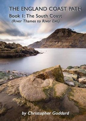
The England Coast Path is a new long distance path around the whole coast of England. At 2,88 miles, it is the longest coastal path in the world and provides an important opportunity for exploring the peripheral landscape of this maritime country.   This is the first in a series of four guidebooks, providing the most thorough information for walki...

Verkopers met dit product

Verkoper
Bezorging
Prijs
DeZwerver.nl logo
DeZwerver.nl
2,95
22,50

Anderen bekeken ook

Wandelgids - Reisgids The England Coast Path | Bloomsbury
The definitive guidebook to the entire 3,000-mile length of the new England Coast Path. For anyone planning a trip to the coast or a UK summer holiday, the new England Coast Path national trail is a hugely exciting prospect, and this guidebook shows you how to make the most of every single glorious mile. Environmentalists, volunteers, campaigners, land owners and politicians all came together to create this 'ninth wonder of the world', and from the opening of the path in 2020 onwards, anyone has been able to walk and wild camp along the entire 3,000-mile length of the English coast.   It's a fantastic opportunity for all walkers, campers, fans of the coast and the outdoors. Stephen Neale has spent many happy months walking, camping and surveying the path, and from that experience has written a fantastically detailed and rich guidebook covering the route itself, along with everything from the best places to swim, hunt for fossils and eat seafood to hidden away beaches and canoeing spot…
26,50
Wandelgids The South West Coast Path | Cicerone
Goede wandelgids van het langste gemarkeerde wandelpad van Groot Brittanië; 1015 km! Uit de bekende Cicerone serie, dus met mooie foto's en duidelijke routebeschrijvingen en kaartjes. The South West Coast Path is Britain's longest way-marked trail, measuring a staggering 1015km (630 miles). Written by the well-known outdoor writer, Paddy Dillon, the guide provides a wealth of detailed knowledge to help tackle this immense route with confidence. It describes the way-marked trail from Minehead to Poole along the north Devon, Cornish and south Devon coastline to finish at Poole Harbour. A full introduction provides the route's historical background, advice on accommodation along the route and details on travelling to and around the South West.There is detailed information on how to use this guide to make the most of your walk, whether you choose to walk the whole route in one go or decide to achieve sections at intervals.Day-by-day route summaries accompany the 45-day stages and the fina…
24,95
Wandelatlas Adventure Atlas Minehead to Brean Down - England Coast Path | A-Z Map Company
Gedetailleerde wandelkaart van een gedeelte van het England Coast Path.   The A-Z Adventure Series of maps combines the best of OS and A-Z, creating the perfect companion for walkers, off-road cyclists, horse riders and anyone wishing to explore the great outdoors.   This official* Minehead to Brean Down Adventure Map covers a 58 mile (93km) section of the England Coast Path, a new National Trail around England's coast. More than just a path, it represents a new right of way that gives everyone the legal right to explore the coast for the very first time. Opening in sections, the England Coast Path is scheduled to complete in 2020.   The path along the Somerset coastline has marvellous seaward and inland views with access to sandy beaches and shores rich with geology. Salt marshes, sand dunes and mudflats provide a vital habitat for wildlife, especially birds. A number of seaside towns along the way provide the opportunity for refreshment.   This self-covered sheet map is double sided…
7,95
Wandelgids Wales Coast Path: Snowdonia and Ceredigion | Northern Eye Books
Official Guide: Wales Coast Path: Snowdonia & Ceredigion Coast One of seven Official Guides to the Wales Coast Path This Official Guide to the Snowdonia & Ceredigion Coast section of the Wales Coast Path contains everything local and long-distance walkers need to enjoy the path.   Cardigan Bay probably offers a more diverse walking experience than any other section of the Wales Coast Path. The stretch covered in this book – from Porthmadog in the north to Cardigan in the south – largely covers two contrasting Welsh counties.   The first 97 kilometres pass through Gwynedd, along the western edge of the Snowdonia National Park. Here, just before the rivers that rise in the highest of the Welsh mountains reach the sea, they fan out to form broad estuaries that provide rich pickings for waders and other birdlife. The estuaries of the Dwyryd, the Mawddach and the Dyfi are the largest of these. Between them are some very large dune systems, including Morfa Harlech and Morfa Dyffryn – home t…
23,95
Reisgids The South West Coast Path | Bloomsbury
Often featuring in lists of the world's best walks, the South West Coast Path is 630 miles long, and passes through two World Heritage Sites. This guide to the path is a modern take on the traditional (turn right at the stile, and follow the footpath to the bridge) guidebook: instead of telling readers where to go step by step, Stephen gives fantastic ideas for what to do as they travel along the path. There are so many amazing adventures and places to visit (some 'secret' and some well known) and this guide highlights 1,000 of them, all situated along the route.   After an Introduction giving a history of the path and the stories of the people who made it (Why is this path the most popular National Trail? Why is it so closely associated with tales of King Arthur? When is the best time to visit?) the bulk of the book focuses on all the amazing things you can do along the path itself. It is divided into regions, with over 70 adventures/highlights per region: West Somerset, North Devon,…
27,95
Wandelgids Trekking the Coast to Coast Path | Knife Edge Outdoor
The definitive two-way guide to the Coast to Coast Path: both eastbound and westbound routes are described in full. Real Maps: Full Ordnance Survey mapping inside (1:25,000). All accommodation is numbered and marked on the maps. 19 different itineraries: schedules of 11, 12, 13, 14, 15, 16, 17, 18 and 19 days for hikers and runners. Includes both eastbound and westbound itineraries. Difficult calculations of time, distance and altitude gain/loss are done for you. Also includes: - Detailed information on equipment and traveling light - Full accommodation listings: the best pubs, B&B's and hotels - Detailed section on camping, including wild camping - Everything the trekker needs to know: route, costs, difficulty, weather, travel, and more - Essential info for both self-guided and guided trekkers - Information on plants and wildlife - Numbered way points linking the Real Maps to our clear descriptions The Coast to Coast Path is the most popular and aspirational long-distance walking …
21,95
Wandelgids Wales Coast Path: Pembrokeshire | Northern Eye Books
Official Guide: Wales Coast Path: Pembrokeshire   One of seven Official Guides to the Wales Coast Path   The 186 mile/300km long Pembrokeshire section of the Wales Coast Path runs through some of Wales’ most varied and dramatic coastal scenery — high, rugged cliffs and long sandy bays, Pembroke Castle, St David’s cathedral and St Govan’s remote cliff-wrapped chapel, with several large offshore islands. Pembrokeshire is also Britain’s only coastal National Park.   This Official Guide splits the route into 14 convenient day sections, each of about 10-17 miles / 16-27 kilometres. It contains everything local and long-distance walkers need to enjoy the path and includes:   An overview of Pembrokeshire with dedicated history and wildlife sections Fourteen day-walk sections with detailed route descriptions and full, enhanced Ordnance Survey mapping Distance charts, section overviews, background information and interpretation of places of interest Stunning professional photographs throughout…
22,50
Wandelgids Great Walks on the England Coast Path | Cicerone
Guidebook to 30 routes celebrating the best day and weekend walks on the England Coast Path, a new National Trail. Includes a varied selection of walks along the country's diverse shoreline, on cliff paths, estuaries, beaches and saltmarsh. Routes from 9 to 45km to suit all ages and abilities, many of which can be enjoyed all year round. At around 4500km (2800 miles), the England Coast Path is the longest coastal trail in the world. This inspirational large-format guide presents a handpicked selection of 30 highlight sections, offering a taste of England's stunning and diverse shoreline. Routes range from 9 to 45km, spanning between 3 hours and 2 days, offering options to suit all abilities. They can be accessed by public transport and are walkable year round (weather permitting!). Route descriptions are accompanied by 1:50,000 OS map extracts. Included in each walk are comprehensive listings of public transport, toilets and places to eat and drink, which highlight the excellent walki…
27,95
Fietskaart Cycling guides Dartmoor - South Devon | Goldeneye
Dartmoor. One of England’s greater National Parks; the Forest of Dartmoor covers 365 square miles and contains the highest ground in England south of the Peak District. On its desolate moorland tracks the wanderer can believe they are further from a public road than anywhere in the country, but on the fringes lush valleys lead down on every side to thick woodland, green vegetation and picturesque villages. Dartmoor is well known for its wildlife - attractive herds of ponies, seemingly wild but in fact individually owned, foxes, badgers and otters - also the occasional adder. Fallow, roe and Sitka deer can often be seen, but the red deer of Exmoor have never penetrated the area. Buzzards, kestrels and various Birds of Prey are frequently seen, as well as the wheatear, while crows, ravens and the skylark are fairly commonplace. The Moor abounds in prehistoric remains. There are also many deserted medieval villages with remains of the traditional ‘longhouse’ buildings. For centuries tin …
12,95
Wandelgids Wales Coast Path Carmarthen Bay & Gower | Northern Eye Books
Official Guide: Wales Coast Path: Carmarthen Bay & Gower   One of seven Official Guides to the Wales Coast Path   The Carmarthen Bay and Gower section of the Wales Coast Path runs for 120 miles/193 kilometres between the popular seaside town of Tenby, via Amroth on the eastern edge of the Pembrokeshire Coast National Park, to Swansea, on the landward side of the Gower Peninsula.   This Official Guide splits the route into 12 convenient day sections, each of about 10-17 miles / 16-27 kilometres. It contains everything local and long-distance walkers need to enjoy the path and includes:   An overview of Carmarthen Bay and Gower with dedicated history and wildlife sections Twelve day-walk sections with detailed route descriptions and full, enhanced Ordnance Survey mapping Distance charts, section overviews, background information and interpretation of places of interest Stunning professional photographs throughout Information on accommodation, public transport, local information, weather…
22,50

Klanten-reviews van Reisgids The England Coast Path | gritstone Publishing

Er zijn nog geen beoordelingen voor dit productBen jij de eerste die een review plaatst?

Meer over Reisgids The England Coast Path | gritstone Publishing

Productomschrijving

The England Coast Path is a new long distance path around the whole coast of England. At 2,88 miles, it is the longest coastal path in the world and provides an important opportunity for exploring the peripheral landscape of this maritime country.   This is the first in a series of four guidebooks, providing the most thorough information for walking the entire route. It covers over 700 miules along the south coast of England from the River Thames in London to the River Exe at Exmouth. Tracing the coastlines of Kent, Sussex, Hampshire, Dorset and the Isle of Wight, this varied route takes in dizzying chalk cliffs, estuarine marshes, long beachfront promenades, densely wooded undercliffs and many more rewarding landscapes.    While the whole route has yet to be fully opened, the south coast section is almost entirely accessible and this book provides alternatives to those few streches that are not. There is information on public transport, parking, accommodation, campsites, refreshments, and local history, as well as a song for each section of the route. Whether you´re walking the route in small sections or all in one go, this is the perfect companion to the England Coast Path.

Verken gerelateerde categorieën

Webshop.nl maakt gebruik van cookies. Ga je verder op onze website, ga dan akkoord met het plaatsen van cookies en de verwerking van deze data door ons en vermelde partners.