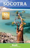
Reisgids Socotra | Bradt Travel Guides

0
Bradt slaagt er weer in om een unieke reisgids uit tegeven; Socotra, een voor velen totaal onbekend eiland  voor de kust van Somalie, Yemen en Oman. Uniek in veel opzichten en vrijwel onbereikbaar. Maar tegelijk een droom voor veel reizigers! The new, thoroughly updated second edition of Bradt’s Socotra remains the first and only guide available t...

Verkopers met dit product

Verkoper
Bezorging
Prijs
DeZwerver.nl logo
DeZwerver.nl
2,95
27,95

Anderen bekeken ook

Nieuw
Reisgids Central America on a Budget - Midden-Amerika | Rough Guides
Zeer goede reisgids voor zowel de georganiseerde maar vooral voor de zelfstandige reiziger. Boordevol informatie over reizen, slapen, eten, maar ook musea en cultuur. Voor veel landen meestal completer en beter dan de Lonely Planet ! Met Belize, Guatemala, San Salvador, Honduras, Nicaragua, Costa Rica & Panama. Ideal for independent travellers, this guidebook to the Central America on a Budget, written by destination experts, combines must-see sights with hidden gems and offers essential tips for both planning and on-the-ground adventures. It's sustainably printed to ensure environmental responsibility. Inside this Central America on a Budget travel book, you'll find: Regional deep dive – coverage of key regions, offering a rich selection of places and experiences, and honest reviews of each one Itinerary samples – designed for various durations and interests Practical information – tips on how to get there and get around, use public transport, beat the crowds, save time and mo…
27,95
Nieuw
Reisgids Hawai'i the Big Island | Lonely Planet
De perfecte reisgids voor zowel de georganiseerde als de zelfstandige reiziger. Naast een algemene inleiding van het land / streek vol met praktische informatie over hoe je er het beste kunt reizen: slapen, eten, vervoer, excursies ... alles kun je er in vinden. Engelstalig. Lonely Planet. Indulge your spirit of adventure on the biggest Hawaiian island. It’s still a vast frontier, full of unexpected wonders. Lonely Planet will get you to the heart of Hawai‘i, the Big Island, with amazing travel experiences and the best planning advice.   Lonely Planet's local travel experts reveal all you need to know to plan the trip of a lifetime to Hawai'i the Big Island. Discover popular and off the beaten track experiences from visiting the 44ft 'Akaka Falls surrounded by lush rainforests to snorkelling at Kealakekua Bay State Historical Park, and dining with the locals at the lively Kamuela Farmers Market. Build a trip to remember with Lonely Planet's Hawai'i the Big Island travel guide: Ou…
24,95
Nieuw
Reisgids Mini Rough Guide Dublin | Rough Guides
Een kleinere versie in zakformaat van de grotere versies van de Rough Guides. Als altijd weer vol met goede informatie over cultuur en praktische zaken. Achterin kleine plattegronden. This mini pocket Dublin travel guidebook is perfect for travellers looking for essential information about Dublin. It provides details on key places and main attractions, along with a selection of itineraries, recommendations for restaurants and top tips on how to make the most of your trip. It's sustainably printed to ensure environmental responsibility. In this Dublin guidebook, you will find: Curated recommendations of places – expert picks of main attractions, child-friendly activities and relaxing spots, plus where to take the best photos What's new, when to go and sustainable travel – all-new features direct you to what you need to know Things not to miss in Dublin – O'Connell Street, Kilmainham Gaol, The Guinness Storehouse Tour, Custom House, Trinity College, Phoneix Park, National Gallery, Te…
12,50
Nieuw
Wandelgids GR 11 Spaanse Pyreneeen - Through the Spanish Pyrenees | Cicerone
Uitstekende wandelgids van dit geweldige gebied. goed beschreven met veel praktische informatie om de route te kunnen lopen, inclusief redelijke kaarten. Beschrijving van de GR 11, het lange afstandswandelpad aan de Spaanse kant van de Pyreneeën. Aanbevolen wandelkaarten Schaal 1:50.000 Wandelkaart Senda Pirenaica GR11 | Editorial Alpina - Set van 21 kaarten Of Wandelkaarten van Rando Pyreneeën - 10 losse kaarten This comprehensive guidebook to the magnificent GR11 trail, which runs 820km from the Atlantic to the Mediterranean, provides everything trekkers will need to take up the challenge - detailed route description, excellent photographs, lots of background information and unique, custom-produced maps. This glorious traverse of the Pyrenees, on the Spanish side, is a serious challenge - passing over a succession of high alpine passes where boulderfields, scree slopes and occasional snowfields may need to be crossed. It is presented in 47 stages of 8-31km.    It is well waymarked a…
23,95
Wandelkaart A15 Sarrabus da Costa Rei a Porto Corallo | Abies
Sarrabus is a territory that is not known by everybody yet. Here lies its charm and this has made possible to keep this environmental area out of big building speculations and also out of history. In fact it preserves little traces of the past, and paradoxically the remains from the prehistoric age are more meaningful than those back to more recent times. We can find traces from the most remote past not far from the State Road SS125, that from Muravera goes to Costa Rei, by visiting the nuraghe Murtas, the nuraghe S’Aqua Secis and the megalithic complexes of Scalas and Cuili Piras. They are about ten menhirs, almost fully intact, arranged in groups and fixed in the ground in the original orthostatic position. They have been put in relation with the position of the sun and the moon, at dawn and at sunset. In fact they were used as a very precise astronomic calendar but also for religious purposes since they represented both the masculine divinity and the fertility according to the wors…
12,95
Nieuw
Wandelgids GR 70: The Robert Louis Stevenson Trail van Le Puy tot St-Jean du Gard | Cicerone
Uitstekende wandelgids van een gerenommeerde Engelse uitgever. De tochten zijn met zorg beschreven en voorzien van allerhande nuttige informatie. Met beperkt kaartmateriaal. Aanbevolen wandelkaarten bij deze gids 1:100.000 Wandelkaart GR 70 The Stevenson Trail | IGN - Institut Géographique National Als overzichtskaart Of Wegenkaart 156 Le Puy en Velay - Privas - Mende | IGN - Institut Géographique National Wegenkaart 163 Avignon - Nimes | IGN - Institut Géographique National  of 1:25.000 1. Wandelkaart - Topografische kaart 2835OT Le Puy-en-Velay | IGN - Institut Géographique National 2. Wandelkaart - Topografische kaart 2836OT Gerbier de Jonc | IGN - Institut Géographique National 3. Wandelkaart - Topografische kaart 2736SB Monistrol d'Allier, Solignac-sur-Loire, Cayres | IGN - Institut Géographique National 4. Wandelkaart - Topografische kaart 2737SB Langogne - Grandrieu | IGN - Institut Géographique National 5. Wandelkaart - Topografische kaart 2738SB Le Bleymard | IGN - Institut G…
23,95
Wandkaart Zuid Amerika, politiek, 91 x 117 cm | National Geographic
Staatkundige  kaart van Zuid-Amerika (in kleur). De kaart wordt verzonden in een koker.  This classic map of South America shows political boundaries, place names, airports, major roads and highways, and other geographic features for the entire continent. 36 x 46 inches (approx). Scale size: 1:7,105,000. Founded in 1915 as the Cartographic Group, the first division of the National Geographic Society, National Geographic Maps has been responsible for illustrating the world around us through the art and science of mapmaking. Today, National Geographic Maps continues this mission by creating the world s best wall maps, recreation maps, atlases, and globes which inspire people to care about and explore their world. All proceeds from the sale of National Geographic maps go to support the Society s non-profit mission to increase global understanding and promote conservation of our planet through exploration, research, and education.
49,95
Nieuw
Wandkaart 22074 Frankrijk, België en Nederland, 60 x 77 cm | National Geographic
>Our classic wall map of France, Belgium, and the Netherlands shows political boundaries, major highways and roads, cities and towns, and a wealth of other incredibly accurate geographic detail.    France the map shows the division of the country into regions, with a list of their names and regional capitals (curiously, Corsica is not included on the map – what would Napoleon think of that?). The map also provides plenty of names of both geographical features (Pyrenees, Cevennes, etc) and the country’s traditional historical regions (Gascony, Maine, Bourbonais, etc). National parks are highlighted. Within Belgium the map indicates the division into Flanders, Wallonia and the Brussels Region and in the Netherlands boundaries of the country’s administrative provinces are marked. Topography is shown by relief shading and within the Netherlands the areas below the sea level are also indicated. The map shows the network of main road and rail connections, local airports, as well as ferry …
25,95
Nieuw
Wandelgids Backpacker's Britain | Cicerone
Guidebook includes 25 2 or 3-day walks taking walkers into the most scenic and wild parts of Wales, from Snowdon, the Glyderau and Carneddau in the north, down to the Black Mountains, Brecon Beacons and Fforest Fawr ranges in the south, including the ridges of the Arans, Arenigs, Berwyns and Cadair Idris, the Cwmdeuddwr hills and Plynlimon.   The mountains of Wales are a great place to get away from it all for a few days, and this book describes the very best backpacking routes throughout the principality. A total of 25 two- or three-day walks take you into the most scenic, beautiful and wild parts of Wales, each one with a night or more out among the mountains at wild camp sites, bothies or hostels. The routes cover all the main mountain ranges, from Snowdon, the Glyderau and Carneddau in the north, down to the Black Mountains, Brecon Beacons and Fforest Fawr ranges in the south. Everything in between is included too, such as the superb ridges of the Arans, Arenigs, Berwyns and Cadai…
18,95

Klanten-reviews van Reisgids Socotra | Bradt Travel Guides

Er zijn nog geen beoordelingen voor dit productBen jij de eerste die een review plaatst?

Meer over Reisgids Socotra | Bradt Travel Guides

Productomschrijving

Bradt slaagt er weer in om een unieke reisgids uit tegeven; Socotra, een voor velen totaal onbekend eiland  voor de kust van Somalie, Yemen en Oman. Uniek in veel opzichten en vrijwel onbereikbaar. Maar tegelijk een droom voor veel reizigers!

The new, thoroughly updated second edition of Bradt’s Socotra remains the first and only guide available to the largest of the four islands that make up the Socotra Archipelago in the Arabian Sea, 390 km offshore from their mother land, Yemen.

A UNESCO World Natural Heritage Site packed with dramatically varied and essentially undisturbed landscapes (mountains, forest, ravines, sand-dunes, beaches, caves…), Socotra is unique. Sometimes known as ‘The Galapagos of the Indian Ocean’, the archipelago has an exceptionally large number of species found nowhere else in the world (‘endemic’) in an area barely the size of Wiltshire. Accordingly, wildlife-watchers love Socotra: of 220 bird species recorded, 11 are endemic, while more than 300 plant species are endemic, as are all the land snails, 90% of reptiles and about 60% of spiders.

Socotra offers much to fascinate the adventurous traveller. Visitors may snorkel from boats or pristine beaches; camel-trek into mountains formed by volcanic activity; gawp at bizarre plants – dragon blood trees that resemble huge, fuzzy-topped umbrellas and giant desert roses; engage with Socotra's rich history, which stretches back to the Stone Age and includes ancient cave art; and lunch at delightful fishing villages.

Bradt’s full-colour guide covers everything needed for a successful visit, including pre-departure planning, getting there, tour operators, where to stay and what to see. Background information on history, people, language and culture is followed by an easy-to-follow geographical breakdown covering all parts of the island, from the capital Hadiboh to Ayhaft Canyon National Park, Qaria lagoon, Rosh Marine Nature Sanctuary, Homhil Nature Sanctuary, Terbak village, Hoq Cave, Qalansiyah, Diksam plateau and Firmihin Forest.

To preserve its fragile environments, the recent growth in tourism – enabled by recent improvements in transport links and resulting in expansion of tourist infrastructure – is being handled with extreme care. Strict regulations are in force to preserve the island's natural heritage and nearly three-quarters has protected status. This pristine and relatively unknown little island, so full of natural treasures, may be on the brink of a very different future. Responsible tourism is paramount, so let Bradt’s Socotra be your guide to this captivating island.

Verken gerelateerde categorieën

Webshop.nl maakt gebruik van cookies. Ga je verder op onze website, ga dan akkoord met het plaatsen van cookies en de verwerking van deze data door ons en vermelde partners.