webshop.nl
Categorieën
  Sluiten

Meer Bradt Travel Guides

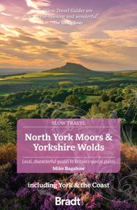
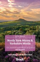
Reisgids Slow Travel North York Moors - Yorkshire Wolds | Bradt Travel

0
Een bijzondere serie van Bradt guides, waarin een gedeelte van Engeland of Schotland uitgebreid beschreven wordt. Met veel aandacht voor kleine details die je niet al gauw elders zult vinden. Naast de beschrijvende informatie vind je ook een schat aan praktische informatie als accommodatie-adressen of leuke pubs. Een aanrader! Yorkshire resident, ...

Webshops met dit product

Webshop
Bezorging
Prijs

Anderen bekeken ook

Reisgids Slow Travel North York Moors - Yorkshire Wolds | Bradt Travel
Een bijzondere serie van Bradt guides, waarin een gedeelte van Engeland of Schotland uitgebreid beschreven wordt. Met veel aandacht voor kleine details die je niet al gauw elders zult vinden. Naast de beschrijvende informatie vind je ook een schat aan praktische informatie als accommodatie-adressen of leuke pubs. Een aanrader! Yorkshire resident, outdoors enthusiast and travel writer Mike Bagshaw has thoroughly updated this new third edition of Bradt’s North York Moors & Yorkshire Wolds, part of Bradt’s award-winning series of Slow travel series of guides to UK regions. It remains the only standalone guide to this region of contrasts. Walkers, cyclists, wildlife-lovers, families, foodies and culture vultures will find everything they need to plan and enjoy time here.   From magnificent cliffs and beaches along Yorkshire’s Heritage Coast and rolling hills in the North York Moors (one of the original nine National Parks of England and Wales) to the Wolds’ tranquil chalk grasslands, th…
22,50
Fietskaart 10 Cycling guides North York Moors | Goldeneye
Scheur- en watervast foetskaart van de North York Moors  met ingetekende fietsroutes.   Our maps are double-sided, printed on an A2 sheet with a concertina fold. This allows for easy folding and folding, and an ease of access to the mapping. The material is rain and tear-resistant. Our early maps were designed at the scale of 2 miles to 1 inch/1:126,720. The later designs along with digitalisation are 1: 100,000. We were encouraged by the Cycle Touring Club to convert our cartography toward the cycle market (to replace the out-of-print Bartholomew series). As time and the series progressed we have added more data: The National Cycle Network routes, Regional Routes, and Traffic-Free Family Routes, as and when they are developed. These routes are in addition to the Circular Routes Goldeneye Commissioned at the outset of our publishing schedule. We are also adding to new editions; bike shops, cycle hire, and tea rooms, along with the tourist attractions already featured. Our plan is to ma…
14,95
Reisgids Slow Travel Yorkshire Dales | Bradt Travel Guides
Een bijzondere serie van Bradt guides, waarin een gedeelte van Engeland of Schotland uitgebreid beschreven wordt. Met veel aandacht voor kleine details die je niet al gauw elders zult vinden. Naast de beschrijvende informatie vind je ook een schat aan praktische informatie als accommodatie-adressen of leuke pubs. Een aanrader! This new, thoroughly updated third edition of Yorkshire Dales (Slow Travel), part of Bradt’s series of distinctive ‘Slow’ travel guides to local UK regions, remains the most comprehensive guide to the area and covers the whole of the Yorkshire Dales National Park and Nidderdale Area of Outstanding Natural Beauty plus nearby ‘slow’ and historic towns and villages. The Yorkshire Dales could have been invented for modern travel. The region’s cinematic caves, valleys, waterfalls and limestone geology are famous round the world. Within a short walk are filmset-perfect traditional pubs and cafes where you are as likely to chat to shepherds as celebrities.   The Dales h…
23,50
Fietskaart 10 Cycling guides North York Moors | Goldeneye
Scheur- en watervast foetskaart van de North York Moors  met ingetekende fietsroutes.   Our maps are double-sided, printed on an A2 sheet with a concertina fold. This allows for easy folding and folding, and an ease of access to the mapping. The material is rain and tear-resistant. Our early maps were designed at the scale of 2 miles to 1 inch/1:126,720. The later designs along with digitalisation are 1: 100,000. We were encouraged by the Cycle Touring Club to convert our cartography toward the cycle market (to replace the out-of-print Bartholomew series). As time and the series progressed we have added more data: The National Cycle Network routes, Regional Routes, and Traffic-Free Family Routes, as and when they are developed. These routes are in addition to the Circular Routes Goldeneye Commissioned at the outset of our publishing schedule. We are also adding to new editions; bike shops, cycle hire, and tea rooms, along with the tourist attractions already featured. Our plan is to ma…
14,95
Reisgids Slow Travel Dumfries and Galloway | Bradt Travel Guides
Reisgids over een specifiek deel van Schotland met veel cultuur en geschiedenis, maar zeker ook praktische tips zoals je van uitgever Bradt mag verwachten.  Written by resident experts, this new, thoroughly updated second edition of Bradt’s Dumfries and Galloway remains the only full-blown guide to this increasingly popular southwest corner of Scotland. The region is covered in depth, from Eskdale in the east to Scotland’s southern tip at the Mull of Galloway, via Annandale, Nithsdale, Dumfries, The Stewartry, The Machars and Moors, and the Rhins. Lively descriptions, historical anecdotes and enthusiastic writing combine with hand-picked accommodation recommendations to reveal one of Scotland’s best kept secrets.   New attractions and features covered in this edition include Kirkcudbright Galleries, an increased focus on wildlife and birdwatching, and a round-up of the many distilleries and breweries in the region. There are also specialist contributions covering everything from smokin…
20,95
Wandelgids Yorkshire Wolds Way | Aurum Press
Een mooie wandelgids met een goede beschrijving en hele duidelijke kaarten met ingetekende route.   The Yorkshire Wolds were brought to international attention in 2012 by David Hockney’s magnificent Royal Academy exhibition of paintings of the region. Now, Tony Gowers’ completely updated, expanded and re-designed National Trail Guide offers the essential companion to the forgotten but fascinating landscape through which this Trail runs.   The Trail runs from Hessle in the south, by the Humber Bridge, to Filey on the North Yorkshire coast, through the Wolds' secluded and special 'dry valleys', a succession of tranquil villages, and past cel;ebrated locations like Thixendale woods now immortalised in Hockney's vast and dazzling paintings.   As well as comprehensive route descriptions accompanied by OS 1:25,000 maps, the book features a Philip Larkin Trail around Hull, digressions to the handsome town of Beverley with its beautiful Minster, the Holderness region made famous by Winfred Hol…
20,95
Reisgids Slow Travel Norfolk | Bradt Travel Guides
Een bijzondere serie van Bradt guides, waarin een gedeelte van Engeland of Schotland uitgebreid beschreven wordt. Met veel aandacht voor kleine details die je niet al gauw elders zult vinden. Naast de beschrijvende informatie vind je ook een schat aan praktische informatie als accommodatie-adressen of leuke pubs. Een aanrader! This new, thoroughly updated, third edition of Bradt’s Norfolk, part of Bradt’s award-winning ‘Slow travel’ series of guides to UK regions, turns the spotlight on this county of contrasts, from the fine city of Norwich to the watery wilderness of the Broads and the sweeping beaches of the superlative north coast. As well as featuring all the main sights, experienced travel writer and local resident Laurence Mitchell ensures that Bradt’s Norfolk covers places and aspects not detailed by other guidebooks and offers a special emphasis on car-free travel, walking (including along several long-distance footpaths), accommodation, local food and pubs. Written in an ent…
22,50
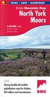
Wandelkaart North York Moors | Harvey Maps
"I’ve enjoyed and endured tough and challenging walks throughout the North York Moors, and this tough, durable, detailed map is the ideal companion and guide." Paddy Dillon, outdoor writer.   Detailed map of the North York Moors on one sheet at 1:40,000 scale.   Includes the popular North Yorkshire Moors Railway and the Lyke Wake Walk.     North York Moors on one sheet: This map covers around 560 square miles of country - the only detailed map to cover this whole area on one sheet. It also includes the popular North Yorkshire Moors Railway and the Lyke Wake Walk. There are also map extensions to Guisborough and east towards Scarborough. Being part of the British Mountain Map series this map is printed on polyethylene - light, durable, tearproof and 100% waterproof. Colour shading is used for easy identification of hills and valleys.
29,95

Klanten-reviews van Reisgids Slow Travel North York Moors - Yorkshire Wolds | Bradt Travel

Er zijn nog geen beoordelingen voor dit productBen jij de eerste die een review plaatst?

Meer over Reisgids Slow Travel North York Moors - Yorkshire Wolds | Bradt Travel

Productomschrijving

Een bijzondere serie van Bradt guides, waarin een gedeelte van Engeland of Schotland uitgebreid beschreven wordt. Met veel aandacht voor kleine details die je niet al gauw elders zult vinden. Naast de beschrijvende informatie vind je ook een schat aan praktische informatie als accommodatie-adressen of leuke pubs. Een aanrader! Yorkshire resident, outdoors enthusiast and travel writer Mike Bagshaw has thoroughly updated this new third edition of Bradt’s North York Moors & Yorkshire Wolds, part of Bradt’s award-winning series of Slow travel series of guides to UK regions. It remains the only standalone guide to this region of contrasts. Walkers, cyclists, wildlife-lovers, families, foodies and culture vultures will find everything they need to plan and enjoy time here.   From magnificent cliffs and beaches along Yorkshire’s Heritage Coast and rolling hills in the North York Moors (one of the original nine National Parks of England and Wales) to the Wolds’ tranquil chalk grasslands, this region offers remarkable variety. Nestled at its heart is York, probably Britain’s best-preserved medieval city, with its stunning Minster, northern Europe’s largest Gothic cathedral.   The region is increasingly popular for outdoors pursuits, which feature strongly in this guide. The Tour de Yorkshire cycle race has helped establish the region as a cycling Mecca. Walkers can explore along ten long-distance footpaths. Sandy beaches, rocky coves, stunning woodlands and heather-clad moors make the destination ideal for families keen to immerse children in nature. Whitby has become a nationally acclaimed centre for whale- and dolphin-watching tours, while wildlife-lovers can also delight in otters and adders, or gawp at ‘seabird skyscrapers’ at Bempton Cliffs, including England’s only breeding colony of gannets, Europe’s largest seabird).   This culturally resonant region harbours treats as diverse as steam train journeys across remote moorland (as featured in the Harry Potter and Mission Impossible films), local food and drink (from seafood, meats and cheeses to independent breweries and gastropubs), the Georgian opulence of Castle Howard (of Brideshead Revisited fame), the Goth Weekend festival at Whitby (where Count Dracula made landfall in Bram Stoker’s novel), Britain’s oldest seaside resort (Scarborough), the country’s tallest standing stone (Rudston) and even the purported burial site of Beowulf (Boulby Cliffs).   With coverage of places not featured in other guidebooks and extensive practical detail conveyed in an informative yet laidback style, plus an emphasis on car-free travel, Bradt’s North York Moors & Yorkshire Wolds is the optimal guide to this fascinating region.
Productspecificaties

Artikelnummer(s)
Brand
Bradt Travel Guides
Webshop.nl maakt gebruik van cookies. Ga je verder op onze website, ga dan akkoord met het plaatsen van cookies en de verwerking van deze data door ons en vermelde partners.