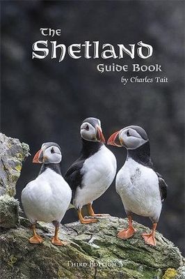
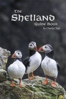
Reisgids Shetland Guide Book | Charles Tait

0
The Shetland Guide Book offers unrivalled detail on the more than 100 islands that make up the Shetland Isles. The islands have a wealth of archaeological history, from viking farms to bronze age burial mounds, but the natural wonders are just as impressive and this guide will tell you where you can catch a glimpse of everything from puffins to po...

Verkopers met dit product

Verkoper
Bezorging
Prijs
DeZwerver.nl logo
DeZwerver.nl
2,95
24,95

Anderen bekeken ook

Reisgids Shetland Guide Book | Charles Tait
The Shetland Guide Book offers unrivalled detail on the more than 100 islands that make up the Shetland Isles. The islands have a wealth of archaeological history, from viking farms to bronze age burial mounds, but the natural wonders are just as impressive and this guide will tell you where you can catch a glimpse of everything from puffins to ponies.   Charles Tait Guidebooks   Charles Tait Guidebooks are photographed, researched, designed and written by the author. Being an Orcadian photographer and travel writer, Charles Tait has been publishing guidebooks based on the natural and cultural history of the Highlands and Islands since 1991. The aim is to create authoritative, readable, informative, easily assimilated handbooks to each area. Each book is extensively illustrated with photographs by Charles Tait, as well as Ordnance Survey maps, old photographs and prints. The guides include introductions covering natural history, archaeology, history and the economy. The Gazetteer cove…
24,95
Reisgids Isle of Skye Guide Book | Charles Tait
The Isle of Skye is one of the most popular visitor destinations in Scotland and it was voted the fourth best island in the world by National Geographic. Being a relitavely small island, this guidebook has everything you'll need to experience the wonders of Skye. It covers all the main sites of interest, monuments, details of all of the best places to visit, walks and visitor attractions. It also includes a selection of 11 suggested day itineraries.   Charles does an excellent job at leaving nothing untouched when delving into the beauty that Skye has to offer. Some of the different sections covered range from Nature and Enviroment, Birds, Flora, Fauna, History, Archaeology and Culture. All sections are supported with Charles' own photography, with nearly 800 mostly new and unpublished photographs.   Charles Tait guide books   The Charles Tait guides for Scotland are chock full of information, which will both inspire you before your trip and enhance your experience whilst you're there…
24,95
Reisgids Outer Hebrides Guide Book | Charles Tait
The Outer Hebrides Guide Book provides a thoroughly informative insight into unique life on the Scottish islands. Learn in fine photographic and written detail about the active traditional crafts, ancient archeology, geology and undisturbed nature and wildlife across these stunning islets.   This wonderfully written guide by experienced travel writer and photographer Charles Tait takes you around the main magical islands of the Outer Hebrides off the west coast of Scotland. Take a step back in time and explore the rich cultural, historical and natural delights of Lewis, Harris, The Uists, and Barra.   All the information provided in this guide is complimented by 12 hand-picked itineraries across the main islands of the Outer Hebrides. Each itinerary lists recommended sites, monuments and activities across a designated region or theme and are all accompanyed with Ordnance Survey maps for clarity.   How this guide is laid out   The Charles Tait guides for Scotland are brimming with info…
24,95
Reisgids Schotland - North coast 500 guide book | Charles Tait
Zeer gedegen reisgids over een uniek gebied van Scholtand, het noorden met Inverness als centraal punt. Zeer compleet met veel informatie, goede kaarten en mooie foto;s. Echt een aanrader als je naar het betreffende gebied gaat! The NC500 guide has 256 pages. It is a handy pocket size (140x220mm) and covers all the main sites of interest, monuments, visitor attractions and islands in Caithness, Sutherland and Ross & Cromarty as well as suggested itineraries, placesof interest, walks and boat trips, information on transport and services. It is profusely illustrated withover 700 of Charles Tait's images, mostly new and unpublished as well as maps and old photos.  
24,95
Reisgids British Breaks Shetland | Rough Guides
Discover Shetland guidebook, written by Rough Guides experts, perfect for holidaying in the UK, packed with full-colour photography and sight descriptions suited to different travellers' needs. It's sustainably printed to support environmental responsibility. Inside this Shetland travel book, you will find: Must-see recommendations - expertly chosen main attractions, hidden gems, family-friendly spots and relaxing retreats in tourist hotspots Top picks in Shetland - essential experiences including Shetland Museum, Eshaness, Hermaness National Nature Reserve, St Ninian's Isle, Mousa Broch, Jarlshof, Sumbrugh Head, Scalloway, Isle of Noss, Fair Isle, Unst selected to enrich your journey Best itineraries - diverse trip plans, suiting various durations and interests, and including recommendations for where to eat and drink along the way Shetland overview - a visual at-a-glance map spotlights key areas, with brief highlights Inspiration for day trips - suggestions for extending yo…
14,95
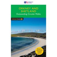
Wandelgids 082 Pathfinder Guides Orkney and Shetland | Ordnance Survey
Wandelgids van een deel van Engeland. Deze gids bevat 28 dagwandelingen, variërend van korte tochten tot pittige dagtochten. De bijbehorende kaarten zijn uitstekend: men heeft de topografische kaarten van Ordnance Survey gebruikt waarop de route is ingetekend. Daarnaast praktische informatie over de wandeling en wat beschrijvingen van het gebied. 28 outstanding walks – 23 circular and five there-and-back routes visiting eleven islands across both archipelagos. The size and nature of the islands lend themselves best to short and half-day walks where unhurried and free-range walking is encouraged and the endless distractions of scenery, seabirds, wildflowers and sea watching are best appreciated and enjoyed at a relaxed pace.   In Orkney, the first walk is a short stroll around Hoxa Head with its extensive views across Scapa Flow and subsequent routes go on to explore more widely over Mainland Orkney and take in the islands of Hoy, Rousay and South Ronaldsay, concluding with a ramble al…
18,50
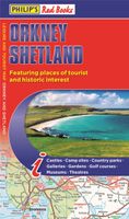
Wegenkaart - landkaart Orkney Shetland | Philip's Maps
Whether it's the outstanding natural beauty, ancient sites or an activity-packed break calling you, the Philip's leisure and tourist map of Orkney and Shetland is all you need. Places of interest are clearly marked on the easy-to-read mapping - ideal for planning that all-important route.   This double-sided Philip's leisure and tourist map of Orkney and Shetland gives detailed coverage of the islands' road networks at an easy-to-read scale of approximately 2.5 miles to 1 inch. The Orkney Islands are featured on side one of the map, with the Shetland Islands shown on the reverse.   The maps show places of tourist and historic interest, including beaches, castles, camping sites, distilleries, galleries, gardens, golf courses, museums, nature trails, historic sites, sports and entertainment venues. From the ancient settlement of Orkney's Skara Brae and Scapa Flow to the Shetland Museum and Bobby's Bus Shelter, all the top places of interest are featured on each side of the map for Orkne…
11,50
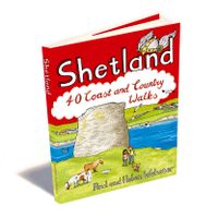
Wandelgids Shetland | Pocket Mountains
Handige compacte wandelgids met 40 dagwandelingen. Deze gids bevat kleine kaartjes en leuke uitgebreide informatie over wat er langs de route te zien is. Goede wandelkaarten zijn echter we noodzakelijk voor deze tochten: de Ordnance Survey explorer maps of Landanger maps zijn zeer geschikt. The most northerly of Britain's island groups, Shetland is so far removed from the rest of the UK that it usually appears as an inset on maps. Although relatively little known to those from outside the islands, Shetland is a magnificent terrain for walkers, especially those who love to really explore and get away from the beaten track. The coastal walking here includes some of the finest in the country, with superb cliffs, towering sea stacks, caves and natural arches seemingly around every corner. Added to this is Shetland's better known claim to fame for its spectacular seabird colonies, huge gannetries, moorland packed with arctic and great skuas, arctic terns in the more sheltered spots, and ev…
10,95

Klanten-reviews van Reisgids Shetland Guide Book | Charles Tait

Er zijn nog geen beoordelingen voor dit productBen jij de eerste die een review plaatst?

Meer over Reisgids Shetland Guide Book | Charles Tait

Productomschrijving

The Shetland Guide Book offers unrivalled detail on the more than 100 islands that make up the Shetland Isles. The islands have a wealth of archaeological history, from viking farms to bronze age burial mounds, but the natural wonders are just as impressive and this guide will tell you where you can catch a glimpse of everything from puffins to ponies.   Charles Tait Guidebooks   Charles Tait Guidebooks are photographed, researched, designed and written by the author. Being an Orcadian photographer and travel writer, Charles Tait has been publishing guidebooks based on the natural and cultural history of the Highlands and Islands since 1991. The aim is to create authoritative, readable, informative, easily assimilated handbooks to each area. Each book is extensively illustrated with photographs by Charles Tait, as well as Ordnance Survey maps, old photographs and prints. The guides include introductions covering natural history, archaeology, history and the economy. The Gazetteer covers each parish and island in depth and is followed by information on transport, local services, a bibliography and a detailed index.   Guidebooks for Scotland in the Charles Tait series also include publications on the North Highlands, the Isle of Skye and the Outer Hebrides.   How this guide to Shetland is laid out   The first 120 pages are used to give an overview of the natural environment of the Shetland Isles as well as the archaelogy, history and culture.   The following Gazetteer sections discuss the Shetland mainland, which is divided up into south, west, central and northeast, Whalsay, Lerwick, Bressay, Noss, Yell, Fetlar, Unst, Foula, Papa Stour, Skerries and Fair Isle. Text and photographs build a picture of the area, with historical photos thrown in for comparison. Although not exactly itineraries, as no driving directions, distances or times are provided, sections of mapping are given to help with navigation and the sights are listed in geographical order. So with the aid of an additional map or atlas, you could easily plan a driving route visiting the sights that interest you most.   At the back of the book is information on how to get to Shetland by plane, public transport, car or motorhome. There is also some information on inter-island ferries and contact information and websites for several of the attractions discussed in the guide.    Finally, there is an index to help you navigate the guide. On the inside back cover is an overview map of the Shetland Islands.
Productinformatie

    Verken gerelateerde categorieën

    Webshop.nl maakt gebruik van cookies. Ga je verder op onze website, ga dan akkoord met het plaatsen van cookies en de verwerking van deze data door ons en vermelde partners.