webshop.nl

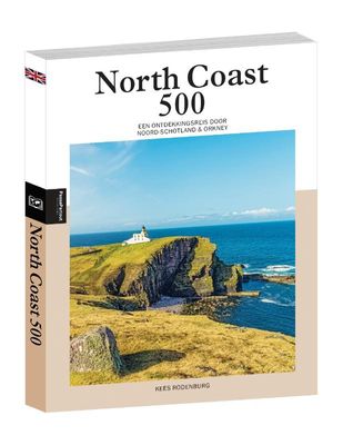
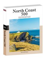
Reisgids PassePartout North Coast 500 | Edicola

0
Met het lanceren van de North Coast 500 in 2015 werd in één keer Noord-Schotland op de kaart gezet. De ruim 800 km lange route, die start en eindigt in Inverness en grotendeels loopt langs de noord-schotse kusten, omlijst een enorm uitgestrekt gebied waarin talloze uitersten zich aan de mobiele reiziger opdringen: van kleine pittoreske dorpjes tot...

Webshops met dit product

Webshop
Bezorging
Prijs
DeZwerver.nl logo
DeZwerver.nl
niet bekend
24,50

Anderen bekeken ook

Reisgids The North Coast 500 | Rough Guides
This practical travel guide to the North Coast 500 features detailed factual travel tips and points-of-interest structured lists of all iconic must-see sights as well as some off-the-beaten-track treasures. Our itinerary suggestions and expert author picks of things to see and do will make it a perfect companion both, ahead of your trip and on the ground. This North Coast 500 guide book is packed full of details on how to get there and around, pre-departure information and top time-saving tips, including a visual list of things not to miss.   Our colour-coded maps make the North Coast 500 easier to navigate while you're there. This guide book to the North Coast 500 has been fully updated post-COVID-19 and it comes with a free eBook. The Rough Guide to the North Coast 500 covers: Inverness to the Black Isle and beyond, the road to John O'Groats, along the North Coast, exploring the Northwest and Wester Ross to Inverness.   Inside this North Coast 500 travel guide you'll find: RECOMMEND…
13,95
Reisgids PassePartout Schotse Hooglanden | Edicola
Schotland. Land van clans, kastelen, meren, eilanden en bergen. De Schotse Hooglanden en de Westkust vormen binnen dit Schotland een klasse apart. Heuvels en bergen voor zover het oog reikt, afgewisseld met valleien, lochs en hier en daar een bos. Je vindt er de hoogste toppen van Groot-Brittannië maar ook levendige stadjes en verstilde dorpen langs de kust. Dit enorm uitgestrekte gebied is bovendien dunbevolkt en leeg. Erg leeg. Niet voor niets wordt er wel gesproken over een van de laatste wildernissen van West-Europa. De Schotse Hooglanden zijn daarom populair bij wandelaars en klimmers, en het unieke licht oefent grote aantrekkingskracht uit op fotografen. En automobilisten en motorrijders die van een fijn stukje sturen houden, weten bovendien de smalle en kronkelige te waarderen. Michiel Mulder was acht jaar lang actief bij een uitgeverij van fotobladen voordat hij in 2008 de stap maakte naar freelance redacteur en fotograaf. Naast schrijven en fotograferen organiseert hij ook re…
24,50
Reisgids PassePartout Isle of Skye | Edicola
Veel mensen associëren de Hebriden met witte stranden en een azuurblauwe zee. Toch hebben de Hebriden nog veel meer te bieden dan dat: een fascinerende geschiedenis, traditionele cultuur, een eigen identiteit en een enorme diversiteit in natuurschoon en wildlife. In Isle of Skye en de noordelijke eilanden van de Hebriden wordt u meegenomen op een reis die al deze facetten probeert te laten zien in woord en beeld; van het imponerende landschap van het eiland Skye en het grote belang van traditionele landbouw voor de natuur op de Uists tot de merktekens van een oude beschaving op Lewis & Harris en de grandeur van de St. Kilda archipel. Kees Rodenburg verhuisde in 2008 met zijn vrouw Anita naar Schotland. Na enige jaren in Fort William gewoond te hebben, kwamen zij in 2013 op het eiland Skye terecht. Werkend als informatiemedewerker bij Visit Scotland en later als buschauffeur en toergids op Skye, heeft hij niet alleen de bijzondere plekjes op de eilanden leren kennen, maar ook kennis ge…
24,50
Reisgids North Coast 500 NC500 | Collins
Highly illustrated, full colour book showcasing what is unique about the North Coast 500. Striking images and descriptive text of the best places to visit are shown along with a simple route map showing locations. 100 of the best places to stop on route including; * Beaches and bays; Sandwood Bay to Red Point Beach * Engineering and architecture; Caledonian Canal to Noss Head Lighthouse * Historic sites; Culloden battlefield to Dunrobin Castle * Off the beaten track; Cape Wrath to Traligill Caves * Urban areas: Ullapool to John o' Groats * Wildlife and nature: Dunnet Head to Suilven A book to help plan your trip around the dramatic North Scotland. An indication of how long to spend at each place is given along with full description and photograph.
34,95
Reisgids - Accommodatiegids North Coast 500 | Collins
A guide to the best places to enjoy the local Scottish cuisine and where to rest for the night along the famous North Coast 500. Elemental, enchanting and inspiring, the NC500 is Scotland's most popular touring route, a stunning 500 mile loop around Northern Scotland. This unique guide makes sure that at every stage and stop of the way, you will find the most creative chefs, the best hotels, the cosiest pubs, the best local foods and the most acclaimed destinations. Researched and written by travel bloggers, Campbell Kerr and Gemma Spence. Photographs taken on route to show the exactly what you will see and experience along the way. The ultimate guide to where to eat and stay along Scotland's ultimate touring route. LET OP: De locaties van bezienswaardigheden in deze gids staan aangeduid met /// met drie woorden. Deze woorden kunt u invullen op de website https://what3words.com/ om de locatie te vinden!
20,95
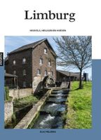
Reisgids PassePartout Limburg | Edicola
Van de heuvels bij Mook tot de heuvels van Vaals vinden asperge-eters, vlaailiefhebbers, wijndrinkers en andere bourgondische levensgenieters elkaar. Je kunt er op zoek naar heiligen, kapelletjes, carréhoeven, holle wegen, orchideeën, veenpaden, mergelgroeven en nog veel meer. Tussen de zandgrond van Noord-Limburg en de löss en mergel in Zuid-Limburg vind je enorm veel variatie, van kastelen tot kruisbeelden, van rivierduinen tot de hoogste berg van ons land. En de Maas verbindt dit alles van zuid naar noord, gevoed door beken die al kronkelend fraaie en natuurrijke beekdalen creëerden. Neem eens een kijkje bij Nederlands enige grindrivier, een open mergelgroeve of in een tot streekculinair centrum omgebouwde watertoren. Fietsend, wandelend, kuierend, speurend, zittend, liggend, sportend: Limburg blijft betoveren.00Elio Pelzers is een ervaren reisjournalist, die zich zowel dichtbij huis als in verafgelegen streken thuis voelt. Geboren en getogen in Zuid-Limburg, waar hij graag dwaalt …
24,50
Wandelkaart Northumberland Coast Path and Berwickshire Coastal Path | Harvey Maps
Mooie, duidelijke kaart van de Northumberland Coast Path en het vervolg daarop de Berwickshire Coastal Path in Noord-Engeland en Schotland. Geplastificeerd met veel extra informatie en uitsnedes van de route.    The Northumberland Coast Path stretches for 103km (64m) from Cresswell in the south to Berwick-upon-Tweed in the north. The Berwickshire Coastal Path stretches for 48km (28m) and continues this route from Berwick-upon-Tweed to Cockburnspath. These routes are part of the North Sea Trail and offer some of the finest coastal walking in the country with rugged coastline, stunning cliff scenery and panoramic views.   XT40 - These maps are a leap forward in technical excellence. They are tough, durable, light and 100% waterproof - virtually indestructible in normal use.   They are light to carry, and compact - not the great bulky package you get with a laminated map.   The map is detailed, with the routes clearly marked. It also contains general information, useful telephone numbers…
25,95
Wegenatlas Adventure Atlas North Coast 500 | A-Z Map Company
The A-Z Adventure Series of maps is the perfect companion for walkers, off-road cyclists, and anyone wishing to explore the great outdoors.   The scenic North Coast 500 is one of the most popular routes in Scotland and journeying along it makes for an incredible adventure. The 516 mile (830 km) route passes through picturesque landscapes and abundant wildlife, linking a wide range of tourist destinations in the Highlands.   This A-Z North Coast 500 Adventure Atlas features more than 90 pages of continuous 1:50 000 mapping, providing detailed coverage of the entire route. A route planner showing distances between places and the amenities available is also included, along with the locations of:   Campsites (seasonal opening) Information Centres Hotels/B&Bs Youth Hostels Pubs, Restaurants and Cafes Shops Petrol Stations Now with NEW electric charge point data from Zapmap! Other walks available in the A-Z Adventure series include: Cotswold Way, Peddars Way and Norfolk Coast Path, Coast to…
13,95
Reisgids Slow Travel North York Moors - Yorkshire Wolds | Bradt Travel Guides
Een bijzondere serie van Bradt guides, waarin een gedeelte van Engeland of Schotland uitgebreid beschreven wordt. Met veel aandacht voor kleine details die je niet al gauw elders zult vinden. Naast de beschrijvende informatie vind je ook een schat aan praktische informatie als accommodatie-adressen of leuke pubs. Een aanrader! Yorkshire resident, outdoors enthusiast and travel writer Mike Bagshaw has thoroughly updated this new third edition of Bradt’s North York Moors & Yorkshire Wolds, part of Bradt’s award-winning series of Slow travel series of guides to UK regions. It remains the only standalone guide to this region of contrasts. Walkers, cyclists, wildlife-lovers, families, foodies and culture vultures will find everything they need to plan and enjoy time here.   From magnificent cliffs and beaches along Yorkshire’s Heritage Coast and rolling hills in the North York Moors (one of the original nine National Parks of England and Wales) to the Wolds’ tranquil chalk grasslands, t…
22,50
Wandelkaart North Wales Coast Path Map | Northern Eye Books
Enhanced, large scale (1: 25,000) Ordnance Survey mapping in a handy atlas format with all the mapping you need to walk a complete North Wales Coast section of the Wales Coast Path.   Continuous OS mapping covering the complete route from Chester to Bangor, on the Menai Strait. Contains generous coastal extracts from large-scale OS Explorer maps 266, 265, 264 and OL17.   The North Wales Coast Ordnance Survey mapping book is part of a series of map atlases covering the whole of the 870-mile long Wales Coast Path. The enhanced OS 1:25,000 maps are accurate, up-to-date and reliable. Additional map symbols show tea shops, cafes, extra parking, and public toilets.   A brief introduction to the North Wales Coast includes a fascinating photo mosaic highlighting notable views, places of interest and wildlife you’ll meet along the way. There is also a section of detailed Useful Information at the back of the atlas.   Laminated flapped covers showing Wales Coast Path signs and waymarkers, route…
16,50

Klanten-reviews van Reisgids PassePartout North Coast 500 | Edicola

Er zijn nog geen beoordelingen voor dit productBen jij de eerste die een review plaatst?

Meer over Reisgids PassePartout North Coast 500 | Edicola

Productomschrijving

Met het lanceren van de North Coast 500 in 2015 werd in één keer Noord-Schotland op de kaart gezet. De ruim 800 km lange route, die start en eindigt in Inverness en grotendeels loopt langs de noord-schotse kusten, omlijst een enorm uitgestrekt gebied waarin talloze uitersten zich aan de mobiele reiziger opdringen: van kleine pittoreske dorpjes tot verrassend grote steden; van liefelijke valleien tot nauwe kloven; van prachtige zandstranden tot steil uit zee oprijzende klippen en van zacht glooiende heuvels tot ruige bergen.    In North Coast 500, een ontdekkingsreis door Noord–Schotland worden al deze verschillende gebieden (inclusief de Orkneys) in beeld gebracht, waarbij niet alleen de belangrijkste bezienswaardigheden worden belicht maar ook minder bekende plekjes vermeld worden. Hoewel de nadruk ligt op dat wisselende natuurschoon, wordt ook aandacht geschonken aan de eveneens diverse cultuur en historie van deze gebieden.    Kees Rodenburg en zijn vrouw Anita zijn al sinds 1996 vaste bezoekers van Schotland. Hun passie voor dit prachtige land leidde ertoe dat zij in 2008 naar Schotland emigreerden. Na een aantal jaar in Fort William gewoond te hebben, verhuisden zij in 2008 naar het eiland Skye. Hiervandaan maken zij nog steeds allerlei trips naar al die spectaculaire gebieden waar de Schotse Hooglanden zo rijk aan is. 

Verken gerelateerde categorieën

Webshop.nl maakt gebruik van cookies. Ga je verder op onze website, ga dan akkoord met het plaatsen van cookies en de verwerking van deze data door ons en vermelde partners.