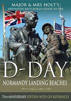
Reisgids Major & Mrs Holt's Definitive Battlefield Guide to the D-Day Normandy Landing Beaches | Pen and Sword publications

0
Already the best-selling English-language guide to the area, universally known as THE BIBLE, this is the 75th anniversary, completely revised, up-to-date, much expanded edition of the DEFINITIVE GUIDE TO THE D-DAY NORMANDY LANDING BEACHES. The third in the Holts' important series of Battlefield Guides (following the Somme and the Ypres Salient) i...

Verkopers met dit product

Verkoper
Bezorging
Prijs
DeZwerver.nl logo
DeZwerver.nl
2,95
23,95

Anderen bekeken ook

Historische Kaart Major & Mrs Holt's Battle Map of The Normandy D-Day Landing Beaches | Pen and Sword publications
This is the only detailed battle map of the D-Day Beaches area that shows the locations of 400 memorials   The map is double sided showing the US beaches on one side and the British and Canadian on the other   It is in full colour with detailed thematic and alphabetical indexes making it easy to find what you are looking for.   Landing force details and battle lines are overlaid onto a grid of modern roads.   Size - The map measures 19.5 inches (49cm) by 28 inches (71cm).  It is printed in four colours and is on firm glossy paper.   On one side at a scale of 1:116,000 are shown The British Landing Beaches from Bayeux in the west to Ouistreham (covering GOLD,JUNO and SWORD) plus the 6th BR AB DZs from Pegasus Bridge to Dives.   On the other side at a scale of 1:116,000 are shown the US AE DZs around Ste Mere Eglise and Ste Marie du Mont and the US Landing Beaches, UTAH and OMAHA.   The Falaise Gap   There is also a small boxed section showing the area of Falaise and the locati…
9,95
Reisgids D-Day Landings - Normandie | Bradt Travel Guides
Published to commemorate the 80th anniversary of the military mission that changed World War II, D-Day Landings: a Travel Guide to Normandy's Beaches and Battlegrounds is Bradt's new guidebook to visiting beaches, memorials, museums, battlefields and other sites associated with D-Day and the Battle of Normandy (Operation Overlord). A simple-to-follow, portable guide for independent travellers, it includes maps and driving instructions to help visitors go back in time to explore World War II history. Written by two experienced travel writers who, between them, are experts in France and military history, D-Day Landings is designed for visitors who want to see all or part of Normandy. Covering the ground from the D-Day landing beaches (Sword, Juno, Gold, Omaha and Utah) up to the Falaise Gap and Cherbourg, it encompasses both every major site and a host of smaller, less well-known locations - venturing well beyond the coast to include sites associated with the capture of Cherbourg (D+20)…
14,95
Reisgids Visiting the Normandy Invasion Beaches and Battlefields | Pen and Sword publications
This splendid and timely book will be invaluable to those visiting the battlefields, sites, museums, memorials and cemeteries of the D-Day Normandy landings. It is intended for those planning and leading school groups and similar parties but is also ideal for individual/family visitors. Rather than list every site, it provides realistic itineraries to the best places in the Normandy area. Even these are flexible to allow party leaders suitable discretion. The author provides helpful information for each site such as its context in the War, visitor orientation, the 'spiel' (the essential facts to engage, inform and entertain), suggested activity and relevant photos and maps. This combines to make every visit of maximum benefit and interest and yet reduce the workload of the party leaders. There are also valuable tips for lunch breaks, free time ideas and other helpful pointers.   WW2,  Tweede wereldoorlog, 2e wereldoorlog  
18,50
Historische Kaart Major & Mrs Holt's Battle Map of Market Garden | Pen and Sword publications
This is the only map of its kind devised and created by Major and Mrs Holt and is used by many guides   It shows the locations of 300 memorials and war cemeteries over THE WHOLE OPERATION MARKET-GARDEN AREA   It shows the progress of the battle from Leopoldsburg to  Eindhoven, Nijmegen, Arnhem and Oosterbeek overlaid on modern roads   In four colours, double sided and with 10 inset maps it shows all drop and landing zones   Suitable for navigation by car, bicycle or foot   Size - The map measures 19.5 inches (49cm) by 28 inches (71cm). It is printed in four colours and is on firm glossy paper.   On one side at a scale of 1:180,000 is shown the whole of the Market Garden corridor of operations from Arnhem in the north to Leopoldsburg in the south and from Vught in the west to Overloon in the east. See below for details of the other side.   What is Marked on the Map   This map is quite unique and no other exists that shows the Market Garden Corridor in such detail. Over 230 memor…
9,95
Historische Kaart Major & Mrs Holt's Battle Map of The Somme | Pen and Sword publications
This is the only map available that shows the exact locations of 300 memorials and places of interest on the battlefields of the Somme   This Sixth Edition also covers the American and Canadian areas between Amiens and Montdidier.    It is double sided in four colours with an overall view on one side and a detailed view on the other, both showing battle lines and ORBAT information   There are detailed alphabetical and thematic indexes to all 300 points.   Size - The map measures 19.5 inches (49cm) by 28 inches (71cm). It is printed in four colours and is double sided on firm glossy paper.   On one side at a scale of 1:70,000 is shown the whole of the Somme battle area from Bullecourt in the north to Amiens in the south and from Doullens in the west to Pyronne in the east. Also on this side are the colour coded indexes and the map of the 1918 sector from Villers Bretonneux to Cantigny.   On the other side at a scale of 1:40,000 the battle area mostly, but not exclusively, associat…
9,95
Reisgids Eyewitness Top 10 Normandy | Dorling Kindersley
Make the most of your trip to Normandy with DK Eyewitness Top 10. Planning is a breeze with our simple lists of ten, covering the best Normandy offers and ensuring you get everything.   The pocket-friendly format is light and easily portable, the perfect companion while out and about.   Inside, you'll find:   Top 10 lists of Normandy's must-sees, including Mont-St-Michel, the Bayeux Tapestry, Deauville and La Côte Fleurie, Étretat and the D-Day Beaches Normandy's most interesting areas, with the best places for sightseeing, food and drink, and shopping Themed lists, including the best outdoor activities, forests, villages, local dishes and much more Easy-to-follow itineraries, perfect for a day trip, a weekend, or a week A laminated pull-out map of New England, plus six full-colour area maps   DK Eyewitness's Top 10s have been helping travellers make the most of their breaks since 2002.   DK is the world's leading illustrated reference publisher, producing beautifully designed books f…
12,50
Reisgids Family Guide France | Dorling Kindersley
Perfect for planning and enjoying a stress-free family holiday, this easy-to-use guide book is packed with insider tips and information on the best family-friendly activities and attractions.   Admire the views from the Eiffel Tower, build sandcastles on the beaches of the French Riviera or marvel at the majesty of Versailles. From recommendations of child-friendly restaurants to suggestions for rainy-day activities, this guide book takes the work out of planning a family trip to France. Inside Family Guide France: - Each major listing includes details of the closest toilets, the nearest places to grab a snack or meal, what do if it rains, and where kids can play and let off steam - Contains cartoons, quizzes and games to keep young travellers happy all day long - Detailed coloured maps of all the major attractions and areas help you navigate with ease - Colour-coded area guides make it easy to find information - At-a-glance pages highlight all the best sights and activities in each a…
21,50
Wandelgids Walking Waterloo: A Guide | Pen and Sword publications
Wandelgids over de Slag bij Waterloo   Charles Esdaile’s new guide to the Battle of Waterloo presents the experience of the soldiers who took part in the battle in the most graphic and direct way possible – through their own words. In a series of walks he describes in vivid detail what happened in each location on 18 June 1815 and he quotes at length from eyewitness accounts of the men who were there.   Each phase of the action during that momentous day is covered, from the initial French attacks and the intense fighting at Hougoumont and La Haye Sainte to the charges of the French cavalry against the British squares and the final, doomed attack of Napoleon’s Imperial Guard.   This innovative guide to this historic site is fully illustrated with a selection of archive images from the War Heritage Institute in Brussels, modern colour photographs of the battlefield as it appears today and specially commissioned maps which allow the visitor to follow the course of the battle on the groun…
24,95
Reisgids Thailand's Islands and Beaches | Lonely Planet
De perfecte reisgids voor zowel de georganiseerde als de zelfstandige reiziger. Naast een algemene inleiding van het land / streek vol met praktische informatie over hoe je er het beste kunt reizen: slapen, eten, vervoer, excursies ... alles kun je er in vinden. Lonely Planet's local travel experts reveal all you need to know to plan the trip of a lifetime to Thailand's Islands and Beaches.   Discover popular and off the beaten track experiences from visiting Phuket Elephant Sanctuary to feed the rescued elephants, to dining with locals at the vibrant Surat Thani Night Market, and freediving off the north coast of Ko Pha-Ngan.   Build a trip to remember with Lonely Planet's Thailand's Islands & Beaches travel guide:   Our classic guidebook format provides you with the most comprehensive level of information for planning multi-week trips Updated with an all new structure and design so you can navigate Thailand's Islands & Beaches and connect experiences together with ease Cre…
24,95
Historische Kaart 14 - 18 Map of Verdun (Battlefield map) | Eerste Wereld Oorlog | Pen and Sword publications
Comprehensive mapping for the Battle of Verdun 1916 and a sizable part of the early days of the Meuse-Argonne Offensive 1918. Clearly produced in full color, with different types of feature in different colors, all supported by two comprehensive keys. For many years the Holts have provided tourers to the battlefields with excellent mapping for the Ypres Salient and the Somme. This map of the Verdun/Meuse area fills one of the many gaps in the coverage of the Western Front. This map of the Verdun battlefield is in the same style, using a color coded system to distinguish the different types of features. It includes some 300 locations of memorials, cemeteries, significant remnants of the battle terrain, remaining fortifications, trenches, the destroyed villages and other vestiges of the war. On the reverse there is a cut out and enlarged section of the Verdun battlefield in particular - the most visited part of the area, which provides greater detail. This section includes the Ossuary…
9,95

Klanten-reviews van Reisgids Major & Mrs Holt's Definitive Battlefield Guide to the D-Day Normandy Landing Beaches | Pen and Sword publications

Er zijn nog geen beoordelingen voor dit productBen jij de eerste die een review plaatst?

Meer over Reisgids Major & Mrs Holt's Definitive Battlefield Guide to the D-Day Normandy Landing Beaches | Pen and Sword publications

Productomschrijving

Already the best-selling English-language guide to the area, universally known as THE BIBLE, this is the 75th anniversary, completely revised, up-to-date, much expanded edition of the DEFINITIVE GUIDE TO THE D-DAY NORMANDY LANDING BEACHES.

The third in the Holts' important series of Battlefield Guides (following the Somme and the Ypres Salient) it employs the same, highly acclaimed formula. Once again the cold facts are interlaced with anecdotes of bravery, humour, sadness and humanity.

This new edition now contains:

All the landing Beaches: JUNO, SWORD, GOLD, OMAHA, UTAH All the Airborne Operations: British and American Two Approach Routes; Six timed and measured Itineraries 21 in-text Itinerary maps, Battle maps & Diagrams Approx 400 recommended sites within the D-Day planned area of advance, all with photos, each with Latitude & Longitude references (New for this Edition) Over 400 coloured pictures, 352 pages Memorials / Museums / Batteries / Bunkers / Landing fields Allied and German War Cemeteries Historical background to the landings The Plans and what actually happened Information about Allied and German War Graves Associations Veterans and other commemorative associations Normandy tourist information: Where to stay / where to eat Cameos about personalities - VCs / MOHs / Poets / Photographers etc

Packaged with the Battle Map of the Normandy Landing Beaches showing the sea Assault formations for UTAH, OMAHA, GOLD, JUNO and SWORD Beaches and the air Assault Formations round Ste M Eglise and Pegasus Bridge; the D-Day Objectives and the Ground Gained on D-Day.

Productinformatie

    Verken gerelateerde categorieën

    Webshop.nl maakt gebruik van cookies. Ga je verder op onze website, ga dan akkoord met het plaatsen van cookies en de verwerking van deze data door ons en vermelde partners.