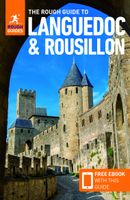
Reisgids Languedoc and Roussillon | Rough Guides

0
Zeer goede reisgids voor zowel de georganiseerde maar vooral voor de zelfstandige reiziger. Boordevol informatie over reizen, slapen, eten, maar ook musea en cultuur. Voor Europese landen meestal completer en beter dan de Lonely Planet ! This in-depth coverage of Languedoc and Roussillon's local attractions, sights, and restaurants takes you to th...

Verkopers met dit product

Verkoper
Bezorging
Prijs
DeZwerver.nl logo
DeZwerver.nl
niet bekend
22,50

Anderen bekeken ook

Wandelkaart A15 Sarrabus da Costa Rei a Porto Corallo | Abies
Sarrabus is a territory that is not known by everybody yet. Here lies its charm and this has made possible to keep this environmental area out of big building speculations and also out of history. In fact it preserves little traces of the past, and paradoxically the remains from the prehistoric age are more meaningful than those back to more recent times. We can find traces from the most remote past not far from the State Road SS125, that from Muravera goes to Costa Rei, by visiting the nuraghe Murtas, the nuraghe S’Aqua Secis and the megalithic complexes of Scalas and Cuili Piras. They are about ten menhirs, almost fully intact, arranged in groups and fixed in the ground in the original orthostatic position. They have been put in relation with the position of the sun and the moon, at dawn and at sunset. In fact they were used as a very precise astronomic calendar but also for religious purposes since they represented both the masculine divinity and the fertility according to the wors…
12,95
Wandelkaart A06 Siniscola | Abies
Siniscola area at 1:25,000 in a series of contoured maps from Ed. Abies. Overprint highlights campsites and agriturismo accommodation, climbing sites, wild sheep and bird watching sites and archaeological remains. This title has no UTM grid. Main series at 1:60,000 (Nos. 1 to 12) The maps have contours at 100m intervals and colouring for woodlands and maquis shrubland. Local trails are highlighted, with additional overprint for selected hiking, mountain bike and kayaking routes listed on the reverse of the maps with brief notes and grading for the degree of difficulty. All the maps have a UTM grid for GPS users. Very extensive range of symbols highlight numerous places of interest and tourist facilities, including campsites and caravan parks, beaches, sport and recreational sites, archaeological remains and nuraghi, etc. The maps also indicate places where typical local products can be purchased. On the reverse each title has descriptions of its main places of interest, beaches, etc…
12,95
Woordenboek Phrasebook & Dictionary Russian - Russisch | Lonely Planet
Handige taalgids Engels - Russisch en omgekeerd. Veel thematische hoofdstukken met zinnen, het cyrillische alphabet natuurlijk en basis woordenschat. In binnenzakformaat! Admirers of Russian literature claim that the 'Slavic soul' of writers such as Chekhov or Tolstoy can't be fully appreciated in translation. For the less ambitious, the language will bring you closer to deciphering the 'riddle wrapped in a mystery inside an enigma' that is Russia. Get More From Your Trip with Easy-to-Find Phrases for Every Travel Situation! Lonely Planet Phrasebooks have been connecting travellers and locals for over a quarter of a century - our phrasebooks and mobile apps cover more than any other publisher! Order the right meal with our menu decoder Never get stuck for words with our 3500-word two-way dictionary We make language easy with shortcuts, key phrases & common Q&As Feel at ease, with essential tips on culture & manners Coverage includes: Basics, Practical, Social, Safe Travel, Food!
9,50
Wandelkaart - Topografische kaart 147 OS Explorer Map Sevenoaks and Tonbridge | Ordnance Survey
Met zijn 4cm voor 1 km (2 ½ cm voor 1 mijl) schaal, is de OS Explorer kaartenserie de ideale en meest gedetailleerde kaartenreeks voor mensen die graag outdoor-activiteiten zoals fietsen, wandelen, paardrijden, klimmen en watersporten. Deze kaart is nog gedetailleerder dan de 'gewone' Landranger maps. Voor- en achterzijde bedrukt! Zeker op de moors en andere natuurgebieden van onschatbare waarden met echt alle aspecten van het landschap op de kaart ingetekend. Zeer goede detailkaart met topografische ondergrond. Hierop zijn toeristische symbolen van bezienswaardigheden ingetekend, daarnaast staan bijvoorbeeld campings en jeugdherbergen vermeld en - voor wandelaars het belangrijkst - alle right of way paden en Lange afstands Wandelpaden zijn er op te vinden. De ideale kaart voor het wandelen in Engeland, Wales of Schotland.   These highly detailed maps show all the administrative boundaries, settlements as small as isolated farms, the road network down to unfenced roads and country tra…
19,50
Reisgids Western USA - West USA | Lonely Planet
De perfecte reisgids voor zowel de georganiseerde als de zelfstandige reiziger. Naast een algemene inleiding van het land / streek vol met praktische informatie over hoe je er het beste kunt reizen: slapen, eten, vervoer, excursies ... alles kun je er in vinden. Engelstalig. Lonely Planet   Lonely Planet’s Western USA is your passport to the most relevant, up-to-date advice on what to see and skip, and what hidden discoveries await you. Cruise down coastal highways, soak up Seattle’s culture, or be awestruck by the Grand Canyon; all with your trusted travel companion. Get to the heart of Western USA and begin your journey now!   Inside Lonely Planet’s Western USA Travel Guide:   Up-to-date information - all businesses were rechecked before publication to ensure they are still open after   2020’s COVID-19 outbreak NEW top experiences feature - a visually inspiring collection of [destination’s] best experiences and where to have them Improved planning tools for family traveler…
22,50
-20%
Gatzaag 46mm 60mm diep Mandrex SuperXcut TCT zonder Adapter
Gatzaag 46mm 60mm diep Mandrex SuperXcut TCT zonder AdapterSpecificaties gatenzaag 46mm 60mm diepType zaag GatenzaagQuick adapter NeeCentreerboor NeeGatzaaghouder NeeHout JaMDF JaPlastic PVC JaAcryl Jazachte steen/stucwerk JaStaal / ijzer NeeRVS NeeMetselwerk/baksteen  JaKoffer Nee MULTI-PURPOSE SuperXcutKENMERKEN- 5x sneller en 10x de levensduur in vergelijking met een Bi-metaal gatzaag- Zaagdiepte 60mm (2-3/8”) om diepere gaten in 1 keer te boren- Uitstekende afvoer van spanen dankzij de speciale ontworpen brede sleuven- Schone gaten met een minimale warmteontwikkeling- Geschikt voor gebruik met elektrische- en accuboormachinesDe allersnelste gatzaag met unieke zetting van de hardmetalen tanden voor schonegaten en hoge snijprestaties. Gaat gemakkelijk 10x langer mee in vergelijkingmet Bi-metaal zagen. De hardmetalen tanden zijn van een speciaal ontwikkeldesamenstelling, wat resulteert in waanzinnige prestaties en duurzaamheid.

12,97

10,38
Wandelkaart - Topografische kaart OL62 OS Explorer Map Coreen Hills & Glenlivet | Ordnance Survey
Met zijn 4cm voor 1 km (2 ½ cm voor 1 mijl) schaal, is de OS Explorer kaartenserie de ideale en meest gedetailleerde kaartenreeks voor mensen die graag outdoor-activiteiten zoals fietsen, wandelen, paardrijden, klimmen en watersporten. Deze kaart is nog gedetailleerder dan de 'gewone' Landranger maps. Voor- en achterzijde bedrukt! Zeker op de moors en andere natuurgebieden van onschatbare waarden met echt alle aspecten van het landschap op de kaart ingetekend. Zeer goede detailkaart met topografische ondergrond. Hierop zijn toeristische symbolen van bezienswaardigheden ingetekend, daarnaast staan bijvoorbeeld campings en jeugdherbergen vermeld en - voor wandelaars het belangrijkst - alle right of way paden en Lange afstands Wandelpaden zijn er op te vinden. De ideale kaart voor het wandelen in Engeland, Wales of Schotland. Map sheet OL 62 covers Correen Hills and Glenlivet. Highlights include Cairngorms National Park, Gordon Way and Badingair Hill. Also includes Water of Bogie, Rhynie…
19,50
Fietskaart 11 De Sterkste van de Regio Groene Hart | Buijten & Schipperheijn
De actueelste Nederlandkaart met fietsknooppunten! Een vrijwel onverwoestbare kaart bovendien, met handige informatie over campings, veerdiensten etc. Regio Groene Hart. Duidelijk kaartbeeld met royale letter Compleet netwerk van fietspaden en kleine wegen Alle bewegwijzerde fietsknoppunten Landelijke wandelroutes en streekwandelingen Webadressen van alle bed-and-breakfastlocaties en veerdiensten Precieze locaties van monumenten Groot formaat Groot schaal Compact gevouwen Zeer klein opgevouwen formaat van water- en scheurvast papier. Handig voor op de racefiets! An up-to-date cycle map, with wayfinding points clearly marked. This map is virtually indestructible, waterproof and tear-proof. Complete with useful information about camp sites, ferry locations, and long-distance bike routes, this map is a must-have for long and short distance cycling. Its handy pocket size means that it  can fold easily into a handlebar bag. A complete network of bicycle paths and small roads …
12,90
Fietskaart 09 De Sterkste van de Regio Utrecht | Buijten & Schipperheijn
De actueelste Nederlandkaart met fietsknooppunten! Een vrijwel onverwoestbare kaart bovendien, met handige informatie over campings, veerdiensten etc. Regio Utrecht. Duidelijk kaartbeeld met royale letter Compleet netwerk van fietspaden en kleine wegen Alle bewegwijzerde fietsknoppunten Landelijke wandelroutes en streekwandelingen Webadressen van alle bed-and-breakfastlocaties en veerdiensten Precieze locaties van monumenten Groot formaat Groot schaal Compact gevouwen Zeer klein opgevouwen formaat van water- en scheurvast papier. Handig voor op de racefiets! An up-to-date cycle map, with wayfinding points clearly marked. This map is virtually indestructible, waterproof and tear-proof. Complete with useful information about camp sites, ferry locations, and long-distance bike routes, this map is a must-have for long and short distance cycling. Its handy pocket size means that it  can fold easily into a handlebar bag. A complete network of bicycle paths and small roads Bicy…
12,90
Fietskaart 14 De Sterkste van de Regio Midden Brabant | Buijten & Schipperheijn
De actueelste Nederlandkaart met fietsknooppunten! Een vrijwel onverwoestbare kaart bovendien, met handige informatie over campings, veerdiensten etc. Regio Midden Brabant . Duidelijk kaartbeeld met royale letter Compleet netwerk van fietspaden en kleine wegen Alle bewegwijzerde fietsknoppunten Landelijke wandelroutes en streekwandelingen Webadressen van alle bed-and-breakfastlocaties en veerdiensten Precieze locaties van monumenten Groot formaat Groot schaal Compact gevouwen Zeer klein opgevouwen formaat van water- en scheurvast papier. Handig voor op de racefiets! An up-to-date cycle map, with wayfinding points clearly marked. This map is virtually indestructible, waterproof and tear-proof. Complete with useful information about camp sites, ferry locations, and long-distance bike routes, this map is a must-have for long and short distance cycling. Its handy pocket size means that it  can fold easily into a handlebar bag. A complete network of bicycle paths and small roa…
12,90

Klanten-reviews van Reisgids Languedoc and Roussillon | Rough Guides

Er zijn nog geen beoordelingen voor dit productBen jij de eerste die een review plaatst?

Meer over Reisgids Languedoc and Roussillon | Rough Guides

Productomschrijving

Zeer goede reisgids voor zowel de georganiseerde maar vooral voor de zelfstandige reiziger. Boordevol informatie over reizen, slapen, eten, maar ook musea en cultuur. Voor Europese landen meestal completer en beter dan de Lonely Planet !

This in-depth coverage of Languedoc and Roussillon's local attractions, sights, and restaurants takes you to the most rewarding spots—from the Arena of Nîmes to castle ruins to museums—and stunning color photography brings the land to life on the pages. With a beautiful new cover, amazing tips and information, and key facts, The Rough Guide to Languedoc & Roussillon is the perfect travel companion.

Discover Languedoc and Roussillon's highlights, with expert advice on exploring the best sites, participating in festivals, and exploring local landmarks through extensive coverage of this fascinating location.

Easy-to-use maps; reliable advice on how to get around; and insider reviews of the best hotels, restaurants, bars, clubs, and shops for all budgets ensure that you won't miss a thing.

Verken gerelateerde categorieën

Webshop.nl maakt gebruik van cookies. Ga je verder op onze website, ga dan akkoord met het plaatsen van cookies en de verwerking van deze data door ons en vermelde partners.