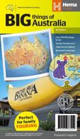
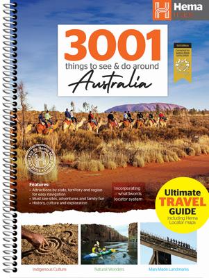
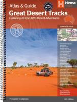
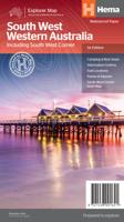
NieuwWegenkaart - landkaart Australia - Australië | Hema Maps Mooie, grote, duidelijke kaart van Australië met veel informatie. Oa bezinestations (ook in de outback) en een goed overzicht van de doorgaande (grote) wegen waardoor de kaart erg handig is van het plannen van uw route. Ook staan er afstanden op vermeld. Verder staan er stadkaartjes op van het (centrum) van de belangrijkste Australische steden: Adelaide, Brisbane, Canberra, Darwin, Hobart, Melbourne, Perth en Sydney Hema’s iconic large map of Australia is ideal as a trip planning tool and travel companion. Marked on the map are localities, the major road network, distances and major national parks. The map also shows localities, the major road network, distances and major national parks. The visual appeal makes it perfect as a decorative map or an educational tool. On the reverse side is an overview of Australia's iconic touring regions featuring history, geology and landforms, nature, bucket-list attractions and iconic 4WD tracks. Key Features Hema's iconic map of Austra…17,50
NieuwWegenkaart - landkaart Australia - Australië | Hema Maps Een handzame kaart van Australië met op de achterkant een aantal stadsplattegrondjes. A country map of Australia that includes city maps on the reverse for compact travel use. Ideal reference map and trip planning tool City maps National parks Distance grid Road distances14,50
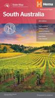
NieuwWegenkaart - landkaart South Australia state handy map | Hema Maps Duidelijke, handzame kaart van South Australia. Great for using in the car, Hema's South Australia Handy Map clearly shows highways, minor and secondary roads, national and state routes and fully-indexed cities, towns and localities. Detailed road distances are also shown. The map splits the state in two, with half on one side of the map and half on the other. This results in a much smaller piece of paper which is far easier to manage in your car. The map features: Camping Areas Rest Areas 24 Hour Fuel Outback Fuel Caravan Parks National Parks Fully Indexed Points of Interest Distance Grid14,50
NieuwWegenkaart - landkaart Australië - natuurkundig -Australia Road & Terrain | Hema Maps Landkaart van heel Australië met nadruk op de natuurkundige aspecten, toch zijn ook de wegen goed zichtbaar. Hema’s iconic large map of Australia is coloured to reflect the country's climate zones. Marked on the map are localities, the major road network, distances and major national parks. The visual appeal makes it perfect as a decorative map or an educational tool. On the reverse side is an overview of Australia's iconic touring regions featuring history, geology and landforms, nature, bucket-list attractions and iconic 4WD tracks. Key Features Full road and terrain hillshade map Major road networks & distances Overview of Australia's iconic touring regions Climate zones National parks Aboriginal Land Distance grid Locality Index17,50
Reisgids Islandeering: Adventures Around Britain's Hidden Islands | Wild Things Publishing Walk, scramble, cycle, wade or even swim around the outer edge of our wildest islands. Islandeering provides all the information you need to circumnavigate 50 amazing hidden islands off the shores of England, Scotland & Wales. From Essex, Somerset and Cornwall to Pembrokeshire, Northumberland and the Hebrides; follow wild foreshores and remote coast paths. Complete each journey to discover a magical archipelago world. 50 islands to bag, with routes from easy to difficult and detailed directions with GPX downloads. Beautiful photography and maps. Hidden islands for the best wildlife, local food, swimming, wild camping, secret beaches, coasteering, legends and foraging. Engaging writing charting historical, geographical and wildlife highlights. Tips for coasteering, scrambling, camping, wild swimming and kayaking.23,95
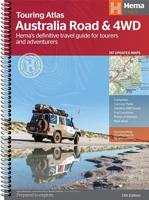
NieuwWegenatlas Australia Road & 4WD Easy Read Atlas | A3 | Ringband | Hema Maps Deze gloednieuwe editie van Hema's best verkopende wegenatlas van Australië telt nu 188 pagina's en is opgemaakt met een prachtige cartografie in een nieuwe stijl. Elke atlas in de reeks bevat nu ook kaarten voor 4WD en touring bestemmingen zoals Cape York, Fraser Island, Top End, Kimberley, Pilbara, Central Australia, High Country Victoria en de Flinders Ranges. Extra kaarten geven de drukke kuststroken in meer detail weer. De atlas is nog steeds de ultieme bron van informatie om Australië te verkennen, met de omvangrijke kartering van Hema en veel relevante tourinformatie. Op de kaarten worden campings, overnachtingsplaatsen, stopplaatsen, benzinestations, erkende informatiediensten en interessante bezienswaardigheden weergegeven met icoontjes. Een handig raster om afstanden af te lezen, een gids van de nationale parken, een lijst van de erkende informatiediensten en een volledig plaatsnamenregister zijn inbegrepen en helpen bij de planning en tijdens de reis. Featuring trusted He…48,95