Reisboek Northern Highlands | Luath Press

0
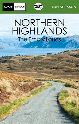
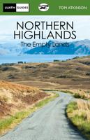
The Empty Lands are that great area of northern Scotland between Ullapool and Cape Wrath, and between Bonar Bridge and John o' Groats. It is truly the Land of the Mountain and the Flood, where land and sea mingle in unsurpassed glory. From the pier-head at Ullapool to the Smoo caves at Durness, and from the Dornoch Cathedral to Dounreay Nuclear Es...

Verkopers met dit product

Verkoper
Bezorging
Prijs
DeZwerver.nl logo
DeZwerver.nl
2,95
12,50

Anderen bekeken ook

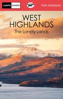
Reisboek The West Highlands | Luath Press
Inveraray, Oban, Kintyre, Glencoe, Loch Awe, Loch Lomond, Appin, Islay - all the glories of Argyll are described in this book. From Dumbarton to Campletown and north to Loch Etive there is a great wealth of beauty unmatched in Scotland. It is a quiet and lonely land, a land still unspoiled, a land of history and legend, a land of unsurpassed glory. Tom Atkinson describes it all, writing with deep insight into the land he loves. There could be no better guide to its beauties and history. Once Atkinson has taken you there, these lands can never feel lonely.  
12,50
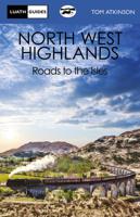
Reisboek The North West Highlands | Luath Press
This book deals with the vast and lovely area lying to the north and west of Fort William, and going up through the Highlands as far as Ullapool. It is a land of still unspoiled loveliness, of mountain, lock and silver sand. It is a vast, quiet land of peace and grandeur. Atkinson will take you along General Wade's military roads, incorporating the splendour of Eilean Donan Castle, Ardnamurchan Point and the delightful fishing port of Mallaig. Legend, history and vivid description are combined to make this book essential to all who visit this Highland Wonderland.  
12,50
Fietskaart Reivers Cycle Routes | Northern Heritage Services
The long-distance Reivers Cycle Routes are two intertwining signed / waymarked bi-directional ‘coast to coast’ cycle routes between the North Sea and the Irish Sea.   The original Reivers Cycle Route was created in 1998 eventually becoming NCN Route 10 with interlinking on-road and off-road sections but this soon morphed into a one-size-fits-all route which never worked well. The regenerated re-launched Reivers Cycle Routes are two intertwining route options – one which is as much off-road as possible suitable for gravel and cross bikes, hybrids and mountain bikes and a version designed for capable road cyclists 100% on tarmac.   The routes are bi-directional and continuously reward the rider with beautiful views of the constantly changing terrain, provide many places of interest to pass by or call in and many lovely villages and quiet hamlets to cycle through or stay the night. Most importantly, there is a supply of excellent on route or close-to-route refreshments stops.   The off-r…
16,50
Wandelkaart - Topografische kaart 150 OS Explorer Map | Active Canterbury / Isle of Thanet | Ordnance Survey
Discover Canterbury, city of saints and kings, ancient heartland of England at the foot of the Kent Downs and the head of the River Stour Valley with its vineyards. Follow the river to the coast to discover unspoiled Deal, artistic Margate and picturesque Whitstable.  Starting in Canterbury, take the Stour Valley Walk to Sandwich and the long sweeping sand and shingle beach of Sandwich Bay  Walk the Long Rock from Whitstable to Herne Bay before taking the Thanet Coastal Path around the Isle of Thanet and its three famous Georgian and Victorian resorts of Margate, Ramsgate and Broadstairs   Take the National Trails of the England Coast Path and North Downs Way or choose from a lattice of other popular recreational paths  Met zijn 4cm voor 1 km (2 ½ cm voor 1 mijl) schaal, is de OS Explorer kaartenserie de ideale en meest gedetailleerde kaartenreeks voor mensen die graag outdoor-activiteiten zoals fietsen, wandelen, paardrijden, klimmen en watersporten.   Deze kaart is nog gedetailleerd…
25,95
Wandelkaart - Topografische kaart 150 OS Explorer Map Canterbury, Isle of Thanet | Ordnance Survey
Discover Canterbury, city of saints and kings, ancient heartland of England at the foot of the Kent Downs and the head of the River Stour Valley with its vineyards. Follow the river to the coast to discover unspoiled Deal, artistic Margate and picturesque Whitstable.  Starting in Canterbury, take the Stour Valley Walk to Sandwich and the long sweeping sand and shingle beach of Sandwich Bay  Walk the Long Rock from Whitstable to Herne Bay before taking the Thanet Coastal Path around the Isle of Thanet and its three famous Georgian and Victorian resorts of Margate, Ramsgate and Broadstairs   Take the National Trails of the England Coast Path and North Downs Way or choose from a lattice of other popular recreational paths  Met zijn 4cm voor 1 km (2 ½ cm voor 1 mijl) schaal, is de OS Explorer kaartenserie de ideale en meest gedetailleerde kaartenreeks voor mensen die graag outdoor-activiteiten zoals fietsen, wandelen, paardrijden, klimmen en watersporten. Deze kaart is nog gedetailleer…
19,50
Fietskaart Cycling guides Exmoor - North Devon | Goldeneye
Scheur- en watervast foetskaart van Exmoor en Noord Devon met ingetekende fietsroutes.   Our maps are double-sided, printed on an A2 sheet with a concertina fold. This allows for easy folding and folding, and an ease of access to the mapping. The material is rain and tear-resistant. Our early maps were designed at the scale of 2 miles to 1 inch/1:126,720. The later designs along with digitalisation are 1: 100,000. We were encouraged by the Cycle Touring Club to convert our cartography toward the cycle market (to replace the out-of-print Bartholomew series). As time and the series progressed we have added more data: The National Cycle Network routes, Regional Routes, and Traffic-Free Family Routes, as and when they are developed. These routes are in addition to the Circular Routes Goldeneye Commissioned at the outset of our publishing schedule. We are also adding to new editions; bike shops, cycle hire, and tea rooms, along with the tourist attractions already featured. Our plan is to …
12,95
Reisgids Slow Travel Scotland's North Highlands | Bradt Travel Guides
Scotland's North Highlands (Slow Travel) is the latest title in Bradt's series of distinctive, widely acclaimed 'Slow' travel guides to local UK regions. Written by a northern Scotland specialist who edits the award-winning JRNY Travel Magazine, this guidebook provides greater detail than any other to the whole of northern Scotland - roaming far beyond the increasingly popular 516-mile North Coast 500 (NC500) driving route. Coupling a wide, personal selection of places to explore with focused advice on travel practicalities, Scotland's North Highlands (Slow Travel) encourages visitors to adopt a leisurely approach designed to tease out the region's special qualities - and contribute positively to local communities. In the far northern reaches of Scotland, Sutherland, Caithness and Ross-shire are regions that, by their nature, demand to be taken slowly. Single-track roads dominate, skirting lochs and winding up and over moorland and mountains carpeted with blanket bog, settlements are …
24,95
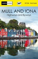
Reisboek Mull and Iona | Luath Press
The fairest of the inner Hebridean islands and Scotland's great centre of celtic Christianity.   Both Mull and Iona are now easily accessible even for day visitors from the mainland, and no parts of Scotland will give more joy to the traveller. Iona, made famous by Columba, founder of Celtic Christianity, represents a spiritual experience rare enough in the world today. The colourful front of Tobermory will welcome you to Mull, an island with fascinating geology to discover amongst the beautiful surroundings of Ben More and nearby Fingal's cave.
12,50
Wandelkaart - Topografische kaart 8 OS Explorer Map | Active Chichester South Harting area | Ordnance Survey
Explore the South Downs National Park, follow the South Downs Way up to the picturesque village of South Harting sheltered beneath Harting Down. Discover Chichester Harbour with its delightful fishing villages or range further afield to Selsey at the tip of the Manhood Peninsula.    Seek unspoiled coastlines and countryside on Hayling Island, where windsurfing was invented  Marvel at Chichester’s intact Roman walls and cathedral tower now home to a family of peregrine falcons  Walk or cycle the South Downs Way through gorgeous countryside past South Harting, or explore Chichester Harbour on the Sussex Border Path and Shipwrights Way    Met zijn 4cm voor 1 km (2 ½ cm voor 1 mijl) schaal, is de OS Explorer kaartenserie de ideale en meest gedetailleerde kaartenreeks voor mensen die graag outdoor-activiteiten zoals fietsen, wandelen, paardrijden, klimmen en watersporten.   Deze kaart is nog gedetailleerder dan de 'gewone' Landranger maps. Voor- en achterzijde bedrukt! Zeker op de moors en…
25,95
Reisgids The Beaches of Scotland | Vertebrate Publishing
Scotland is renowned for its dramatic, fierce landscapes, but many people don't realise that some of the country's most exhilarating scenery rests on its coastline. The Beaches of Scotland by Stacey McGowan Holloway is a guide to over 150 hand-picked beaches around Scotland's coast, stretching from the mainland to the Outer Hebrides before sweeping north to Orkney and Shetland. These beaches offer something for everyone, from gentle sands which feel almost tropical to rugged coves which can only be accessed by kayak.   The selected beaches have not been chosen for purely aesthetic reasons: these locations offer some amazing opportunities for adventure. From surfing to snorkelling, kayaking, camping and cold-water swimming, this book travels from Kilmory Beach, with its views over the Paps of Jura, along single-track roads to Singing Sands on the Ardnamurchan peninsula. It takes you from Portabello on the edge of Edinburgh's bustling streets to Kervaig Beach in the far north-west, wher…
27,95

Klanten-reviews van Reisboek Northern Highlands | Luath Press

Er zijn nog geen beoordelingen voor dit productBen jij de eerste die een review plaatst?

Meer over Reisboek Northern Highlands | Luath Press

Productomschrijving

The Empty Lands are that great area of northern Scotland between Ullapool and Cape Wrath, and between Bonar Bridge and John o' Groats. It is truly the Land of the Mountain and the Flood, where land and sea mingle in unsurpassed glory. From the pier-head at Ullapool to the Smoo caves at Durness, and from the Dornoch Cathedral to Dounreay Nuclear Establishment, Tom Atkinson describes it all, with his usual deep love for the land and its people. Myths and legends, history, poetry, and a keen eye for the landscape and all its creatures make this book an essential companion for all who travel to that magnificent part of Scotland.  

Verken gerelateerde categorieën

Webshop.nl maakt gebruik van cookies. Ga je verder op onze website, ga dan akkoord met het plaatsen van cookies en de verwerking van deze data door ons en vermelde partners.