RAINCOAT BALL

0
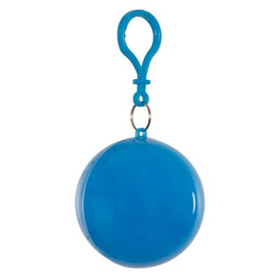
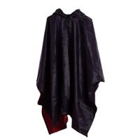
This raincoat comes in a spherical case with a carabiner clip, an original and convenient way to attach it to your rucksack, bag or belt and protect yourself from the rain at any time.The ball has an approximate diameter of 6.5 cm.Colours vary according to availability....

Verkopers met dit product

Verkoper
Bezorging
Prijs
echtveelvoorweinig.nl logo
echtveelvoorweinig.nl
2-3 werkdagen
6,99
0,74

Anderen bekeken ook

Qubic System - QS-210-PL 3-DOF 4 Axis Motion system
QUBIC SYSTEM - QS-210-PL 3-DOF 4-Axis Motion SystemUnlock a New Level of Sim Racing Realism and PerformanceContact our customer service for availability and personalized quotes.The Qubic System QS-210 3-DOF Motion System is a refined, compact version of the renowned QS-220 industrial linear actuators, designed to enhance your sim racing experience. The QS-210 combines linear efficiency, simple installation, and maintenance-free operation, providing powerful motion feedback, making it the ideal solution for dedicated sim racers. With the same advanced features as the actuators used in Qubic System's advanced motion cockpits - such as low latency and real-time vibrations - the QS-210 offers an unparalleled driving experience.The system is specially designed for compatibility with the most popular aluminum-profile cockpits worldwide and comes with additional brackets for easy installation, making it the perfect choice for sim racing enthusiasts looking for precision and immersion.Automoti…
6.999,-
Pro Click Wireless Gaming Mouse
With so much of your day spent working with a mouse, why compromise on its quality? Teaming up with Humanscale, weve combined expertise to design an office mouse with improved ergonomic comfort and pro-grade precisionfor high-performance productivity that redefines the way you work. Ergonomic form factor for all-day comfort at work Engineered by top ergonomics scientists and designers, its added palm support prevents your wrist from anchoring onto work surfaces, alleviating strain and promoting better arm posture. Razer 5G Advanced Optical Sensor for cutting-edge precision Its 16,000 DPI ensures even the finest movement of your mouse is tracked, giving you an acute level of precision that maximizes your productivity and efficiency at work. Multi-Host Connectivity For Up To 4 Devices for convenient multi-tasking Pair up to 4 devices and conveniently switch between your desktop, laptop, Android tablet or TV screen with just one click, without the constant need to pair and unpair. 8 progr…
98,95
iRing® Link Dock Set - Car Phone Holder - Removable for wireless charging - 360-degree rotation - 180-degree tilt function
Discover the iRing® Link, a convenient detachable version of the trusted iRing® Original. Unlike the fixed attachment of the iRing® Original, the iRing Link uses a simple click/slide mechanism. This allows you to easily remove it, for example, for wireless charging. With the ability to rotate 360 degrees and tilt 180 degrees, you can effortlessly position your phone horizontally to, for instance, watch videos or make use of the stand-by mode of Apple. Combine this with the included iRing® Dock. Many choose to use the iRing Dock in the car, ideal for navigating, for example. You easily attach the Dock and slide your phone with the iRing. This keeps your phone securely in place, and you can effortlessly rotate it 360 degrees to find the perfect viewing angle. Features: Detachable function (convenient for wireless charging) 360-degree rotation and 180-degree tilt function Adjustable viewing angle Versatile use Detachable Function You can easily attach the iRing® Link in just two steps. Fi…
23,95
Nieuw
iRing® Link Dock Set - Car Phone Holder - Removable for wireless charging - 360-degree rotation - 180-degree tilt function
Discover the iRing® Link, a convenient detachable version of the trusted iRing® Original. Unlike the fixed attachment of the iRing® Original, the iRing Link uses a simple click/slide mechanism. This allows you to easily remove it, for example, for wireless charging. With the ability to rotate 360 degrees and tilt 180 degrees, you can effortlessly position your phone horizontally to, for instance, watch videos or make use of the stand-by mode of Apple. Combine this with the included iRing® Dock. Many choose to use the iRing Dock in the car, ideal for navigating, for example. You easily attach the Dock and slide your phone with the iRing. This keeps your phone securely in place, and you can effortlessly rotate it 360 degrees to find the perfect viewing angle. Features: Detachable function (convenient for wireless charging) 360-degree rotation and 180-degree tilt function Adjustable viewing angle Versatile use Detachable Function You can easily attach the iRing® Link in just two steps. Fi…
23,95
Wegenkaart - landkaart - Fietskaart Clare (Ierland) | Xploreit Maps
Mooie geplastificeerde en scheurvaste kaart van de County Clare met index. This Xploreit map is an essential companion for your next trip to County Clare. Whatever your location in the county, a quick scan of the map will reveal all the local attractions including the best drives, cycle routes and walks in the area.  It is fully revised and now includes the Clare section of the long-distance Euro Velo Atlantic Cycle Route. From Loop Head, with its famous lighthouse, you can follow West Clare’s wild and rugged coast as it rises to the spectacular Cliffs of Moher and meets The Burren, the unique limestone pavement of the northern uplands. East Clare has numerous walking and sightseeing opportunities also, with Lough Derg and Slieve Bernagh as highlights. Convenient and informative, this touring map will help you discover ancient megalithic tombs, imposing castles, sparkling lakes, golden beaches and the many charming towns and villages dotted around ‘The Banner County’. Topography is sh…
23,50
Wandelgids Trekking in Austria's Hohe Tauern. | Cicerone
Trekking-gids voor de Hohe Tauern in de Oostenrijkse oostelijke Alpen. Een vijftal tochten worden beschreven, vier tochten door de Glockner-, Venediger- en Reichengroepen. Eén tocht het het gehele Nationalpark Hohe Tauern. Although less well know than some other Alpine regions, Austria's Hohe Tauern National Park boasts spectacular mountain scenery, snow-clad peaks and a splendid network of attractive and welcoming mountain huts. It is also home to Austria's highest peak, the 3798m Gross Glockner.   This guide presents four short hut-to-hut treks in the Hohe Tauern region in the heart of the Austrian Tirol: the 7-day Reichen Group Rucksack Route, the 7-day Venediger Group Rucksack Route, the 8-day Venediger Glacier Tour and the 9-day Glockner Rucksack Route. Two other routes, linking stages of the main treks to complete a traverse of the Hohe Tauern National Park and an ascent of the Gross Glockner, are summarised in brief. Also included are multiple excursions to climb neighbouring p…
26,50
Wandelkaart Walking the Cotswold Way | Cicerone
Handzaam gidsje met alleen de topografische routekaarten van 1:25000. De uitgebreide wandelgids (inclusief dit gidsje) is hier te bestellen. All the mapping you need to complete the Cotswold Way National Trail between Chipping Campden and Bath, across the Cotswolds AONB.   An accompanying Cicerone guidebook - The Cotswold Way - describes the full route in both directions with lots of other practical and historical information. NOTE: The accompanying guidebook includes a copy of this map booklet.   Following the Cotswold escarpment, the Cotswold Way provides dramatic and far-reaching views across the Severn Vale towards the Welsh hills, plunging down to visit honey-coloured villages, old market towns and the elegant and historic city of Bath. The longest of the 13 stages is 10 miles, the shortest 6 miles: these are dictated by the existence of overnight accommodation.   This booklet of Ordnance Survey 1:25,000 Explorer maps has been designed for convenient use on the trail. It shows th…
13,95
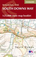
Wandelkaart - Kaart The South Downs Way Map Booklet | Cicerone
All the mapping you need to complete the 100 mile (160km) South Downs Way National Trail, between Eastbourne and Winchester. With easy walking on ancient trackways, the route features wooded areas, river valleys and attractive villages and is rich in natural, geological and historical interest. This booklet of Ordnance Survey 1:25,000 Explorer maps has been designed for convenient use on the trail.   It shows the full and up-to-date line of the route along with the relevant extract from the OS Explorer map legend, and can be used when walking the trail in either direction. Conveniently sized for slipping into a jacket pocket or the top of a rucksack, it comes in a clear PVC sleeve. An accompanying Cicerone guidebook - The South Downs Way - describes the full route in both directions and includes lots of other practical and historical information, for those who prefer a written guide.   The guidebook INCLUDES a copy of this map booklet.
18,50
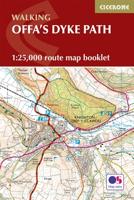
Wandelkaart Offa's Dyke Path - Wales | Cicerone
Handzaam gidsje met alleen de topografische routekaarten van 1:25000. De uitgebreide wandelgids (inclusief dit gidsje) is hier te bestellen. All the mapping you need to complete the Offa's Dyke Path National Trail, the longest linear earthwork in Britain, running 177 miles along the English–Welsh border between Sedbury (near Chepstow) and Prestatyn on the north Wales Coast   NOTE: An accompanying Cicerone guidebook - Offa's Dyke Path - describes the full route with lots of other practical and historical information. The accompanying guidebook includes a copy of this map booklet.   This booklet of Ordnance Survey 1:25,000 Explorer maps has been designed for convenient use on the trail. It shows the full and up-to-date line of the Offa's Dyke Path, along with the relevant extract from the OS Explorer map legend. It is conveniently sized for slipping into a jacket pocket or top of a rucksack and comes in a clear PVC sleeve.   The walk is astonishingly varied, taking in the lower Wye gorg…
14,95

Klanten-reviews van RAINCOAT BALL

Er zijn nog geen beoordelingen voor dit productBen jij de eerste die een review plaatst?

Meer over RAINCOAT BALL

Productomschrijving

This raincoat comes in a spherical case with a carabiner clip, an original and convenient way to attach it to your rucksack, bag or belt and protect yourself from the rain at any time.The ball has an approximate diameter of 6.5 cm.Colours vary according to availability.

Productinformatie

    Productspecificaties

    Artikelnummer(s)
    EAN
    8445090153625

    Verken gerelateerde categorieën

    Webshop.nl maakt gebruik van cookies. Ga je verder op onze website, ga dan akkoord met het plaatsen van cookies en de verwerking van deze data door ons en vermelde partners.