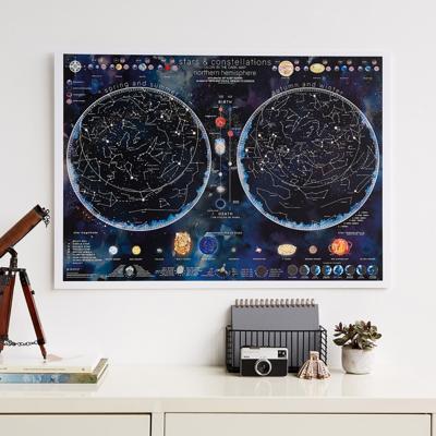
Poster - Wandkaart Stars & constellations glow in the dark 84.1 x 59.4 cm | Maps International

0
Prachtige glow-in-the-dark wandkaart van het heelal. CONSTELLATIONS MAP POSTER: Glow in the dark poster is packed with illustrated information that includes the planets in our solar system, satellites, lunar positions, eclipses, meteors and comets. STAR STRUCK: Engage in the excitement of Northern Hemisphere stars and constellations with this u...

Verkopers met dit product

Verkoper
Bezorging
Prijs
DeZwerver.nl logo
DeZwerver.nl
2,95
31,95

Anderen bekeken ook

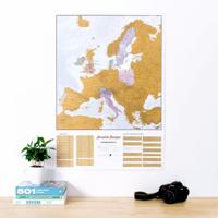
Scratch Map Europa Kraskaart | Maps International
This is a brilliant concept scratch poster of Europe allowing visited destinations to be scratched off revealing the beautifully styled up to date large wall map of Europe underneath. The perfect wall map poster or gift for the travel enthusiast, the scratch off map design allows complete personalization of the European map to display a unique travel story. Simply grab a coin and scratch off all the countries or cities you have visited, creating your own personalized, continually changing European wall map. The detailed Europe scratch off map features country detail along with capital cities making it the perfect travel map – scratch off your favorite spots!   European Travel Scratch Off Map   The Scratch Off Map Of Europe is printed onto high quality silk art paper with a gloss coating for luxury and the scratch off travel map works exactly like a scratch card - once the gold coating is removed it reveals the mapping underneath. The large wall map measures 23 (h) x 33 (w) inches and …
24,95
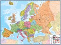
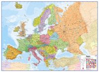
Wandkaart Europa - Europe Huge, 170 x 124 cm | Maps International
Fraaie politieke kaart van Europa, waarbij vooral de politieke aspecten heel duidelijk te lezen zijn. Alle landen hebben verschillende kleuren, steden en belangrijke verbindingen zijn goed te vinden. Papieren uitvoering. Let op: deze heeft geen versie in metalen strips, de kaart is simpelweg te groot daarvoor. Wel is er nog een optie met houten stokken  Maps International’s European political wall map is huge! Our European political wall map is the size of a Smart Car and is the largest single sheet map available to buy.  European Map details: Politically coloured wall map of Europe features countries marked in a different colour, with international boundaries shown. All major towns and cities of Europe are featured within our huge map, and the country's capital cities are clearly marked. The map contains hill and sea shading adding to the vibrant overall effect. The wall map also contains a section showing the different flags of countries in Europe. Map uses: As with most of our ma…
47,95
Wandkaart Europa - Europe Huge, 170 x 124 cm | Maps International
Fraaie politieke kaart van het continent, waarbij vooral de politieke aspecten heel duidelijk te lezen zijn. Alle landen hebben verschillende kleuren, steden en belangrijke verbindingen zijn goed te vinden. Geplastificeerde uitvoering. Let op: deze heeft geen metalen strips, de kaart is simpelweg te groot daarvoor. Wel is er nog een optie met houten stokken    Maps International’s European political wall map is huge! Our European political wall map is the size of a Smart Car and is the largest single sheet map available to buy.    European Map details: Politically coloured wall map of Europe features countries marked in a different colour, with international boundaries shown. All major towns and cities of Europe are featured within our huge map, and the country's capital cities are clearly marked. The map contains hill and sea shading adding to the vibrant overall effect. The wall map also contains a section showing the different flags of countries in Europe.   Map uses: As with most …
64,95
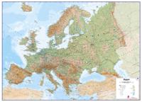
Wandkaart Europa Natuurkundig, 135 x 98 cm | Maps International
Maps International's large physical wall map of Europe is one of the finest money can buy.   European Map details: Our large physical wall map of Europe features the natural terrain of the land, with countries marked and international borders shown. The map's key helps to identify the land elevation and water depth. This large European physical wall map also contains city population detail, national capitals and all the major towns and cities in Europe.   Map uses: As with most of our maps, the large physical wall map of Europe, is available in a range of finishes making it suitable for a variety of locations. Major motorways and transport lines are shown on this European wall map making it an ideal map for planning and logistics
24,95
Wandkaart Europa Natuurkundig, 135 x 98 cm | Maps International
Maps International's large physical wall map of Europe is one of the finest money can buy.   European Map details: Our large physical wall map of Europe features the natural terrain of the land, with countries marked and international borders shown. The map's key helps to identify the land elevation and water depth. This large European physical wall map also contains city population detail, national capitals and all the major towns and cities in Europe.   Map uses: As with most of our maps, the large physical wall map of Europe, is available in a range of finishes making it suitable for a variety of locations. Major motorways and transport lines are shown on this European wall map making it an ideal map for planning and logistics
37,95
Wandkaart Europa - Europe Huge, 170 x 124 cm (5425013063272) | Maps International
Fraaie politieke kaart van het continent, waarbij vooral de politieke aspecten heel duidelijk te lezen zijn. Alle landen hebben verschillende kleuren, steden en belangrijke verbindingen zijn goed te vinden. Geplastificeerde uitvoering met blank houten stokken als een echte schoolkaart.   Maps International’s European political wall map is huge! Our European political wall map is the size of a Smart Car and is the largest single sheet map available to buy.    European Map details: Politically coloured wall map of Europe features countries marked in a different colour, with international boundaries shown. All major towns and cities of Europe are featured within our huge map, and the country's capital cities are clearly marked. The map contains hill and sea shading adding to the vibrant overall effect. The wall map also contains a section showing the different flags of countries in Europe.   Map uses: As with most of our maps, the huge Europe political wall map is available in a variety …
165,-
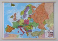
Wandkaart 56ML Europa, 140 x 100 cm | Maps International
Fraaie politieke kaart van het continent, waarbij vooral de politieke aspecten heel duidelijk te lezen zijn. Alle landen hebben verschillende kleuren, steden en belangrijke verbindingen zijn goed te vinden. Geplastificeerde uitvoering met blauw metalen strips boven en onder de kaart waardoor deze eenvoudig is op te hangen. Maps International's large European political wall map is great looking map available to buy. This politically coloured wall map of Europe features countries marked in a different colour, with international boundaries shown. All major towns and cities are featured within our large map of Europe. Map contains hill and sea shading adding to the vibrant overall effect. The wall map also contains a section showing the different flags of countries in Europe.   Maps International's Europe map is available either plain or laminated. If you are looking to buy a map of Europe, you won't be disappointed with this large stunning wall map.
49,95
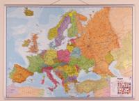
Wandkaart 56P Europa, 139 x 100 cm | Maps International
Fraaie politieke kaart van het continent, waarbij vooral de politieke aspecten heel duidelijk te lezen zijn. Alle landen hebben verschillende kleuren, steden en belangrijke verbindingen zijn goed te vinden. geplastificeerde versie. Maps International's large European political wall map is great looking map available to buy. This politically coloured wall map of Europe features countries marked in a different colour, with international boundaries shown. All major towns and cities are featured within our large map of Europe. Map contains hill and sea shading adding to the vibrant overall effect. The wall map also contains a section showing the different flags of countries in Europe.   Maps International's Europe map is available either plain or laminated. If you are looking to buy a map of Europe, you won't be disappointed with this large stunning wall map.
38,95
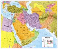
Wandkaart Middle East - Midden Oosten, 120 x 100 cm | Maps International
Maps International's Middle East wall map shows the whole of the Middle East area.    Middle East Map Details: This political wall map of the Middle East features countries marked in different colours, with international borders clearly shown. The map's key shows a panel of flags from each of the countries displayed in this Middle East map. This political wall map of Africa also contains population detail, capital cities and all the major towns and cities in this continent.    Middle East Map uses: As with most of our maps, the Middle East political wall map, is available in a range of finishes from paper and laminated finishes to wooden style frames. Ideal size for an office or classroom. 
37,95
Wandkaart - Magneetbord Europa - Europe 140 x 100 cm | Maps International
Fraaie politieke kaart van het continent, waarbij vooral de politieke aspecten heel duidelijk te lezen zijn. Alle landen hebben verschillende kleuren, steden en belangrijke verbindingen zijn goed te vinden.    Maps International's large European political wall map is great looking map available to buy.   This politically coloured wall map of Europe features countries marked in a different colour, with international boundaries shown. All major towns and cities are featured within our large map of Europe. Map contains hill and sea shading adding to the vibrant overall effect. The wall map also contains a section showing the different flags of countries in Europe.   Maps International's Europe map is available either plain or laminated. If you are looking to buy a map of Europe, you won't be disappointed with this large stunning wall map.   De kaart wordt in deze versie gelijmd op een plaat, voorzien van een mooie aluminium lijst en een ophangsysteem wordt meegeleverd.
289,-

Klanten-reviews van Poster - Wandkaart Stars & constellations glow in the dark 84.1 x 59.4 cm | Maps International

Er zijn nog geen beoordelingen voor dit productBen jij de eerste die een review plaatst?

Meer over Poster - Wandkaart Stars & constellations glow in the dark 84.1 x 59.4 cm | Maps International

Productomschrijving

Prachtige glow-in-the-dark wandkaart van het heelal.
  • CONSTELLATIONS MAP POSTER: Glow in the dark poster is packed with illustrated information that includes the planets in our solar system, satellites, lunar positions, eclipses, meteors and comets.
  • STAR STRUCK: Engage in the excitement of Northern Hemisphere stars and constellations with this unique poster that's great for day and night.
  • FOCAL POINT: Measuring at 59 (h) x 84 (w) centimeters, this large poster is easily seen and will add excitement and fun in any bedroom.
  • CREASE-FREE DELIVERY: Constellation map poster is made of silk art paper and is rolled in a tube for delivery, so it arrives ready to display.
  • MAPS INTERNATIONAL: Our philosophy of 'cartographic excellence' combines detail, design and high quality finishes in a range of stunning wall maps.


Productinformatie

    Verken gerelateerde categorieën

    Webshop.nl maakt gebruik van cookies. Ga je verder op onze website, ga dan akkoord met het plaatsen van cookies en de verwerking van deze data door ons en vermelde partners.