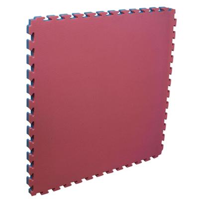
PIECE TATAMI SOFTEE 2.0

0
Indicated for teaching and sports activities where a space with conditioned floor is required for schools, training. Part for recreational use. Available in two thicknesses: 2cm and 4cm. Mesures: 100x100cm....

Verkopers met dit product

Verkoper
Bezorging
Prijs
echtveelvoorweinig.nl logo
echtveelvoorweinig.nl
2-3 werkdagen
6,99
29,84

Anderen bekeken ook

Next Level Racing FLIGHT SIMULATOR
Next Level Racing® Flight Simulator Cockpit Key Features: Dedicated cockpit for maximum simulation immersion: Designed for the ultimate flight simulation experience, from combat flights to space exploration. Suitable for a variety of applications: Ideal for users in combat, general aviation, commercial aviation and space exploration. Compatibility with all major brands: Supports flight electronics such as yokes, joysticks, rudders and throttles from Thrustmaster®, Logitech®, Saitek®, Honeycomb, Virtual Fly, Crosswind and other brands. Wide range of customization options: Customize your flight experience with extensive setting options for ergonomics and configuration. Keyboard and Mouse Support: Includes specially designed Next Level Racing® keyboard and mouse pads for easy navigation and control. Buttkicker® adapter and Next Level Racing® four-point harness: For extra realism and comfort during your flight. Motion compatibility: Suitable for use with Next Level Racing® Motion Plus pla…
819,-
Wandelkaart - Topografische kaart 170 OS Explorer Map | Active Abingdon / Wantage / Vale | Ordnance Survey
Discover the Vale of White Horse, rolling hills dominated by the extraordinary, eponymous White Horse, an enigmatic Bronze Age chalk carving which can be seen for miles leaping across the hillside. Explore the historic market towns of Abingdon-on-Thames, dating back to Saxon times; Wantage, birthplace of King Alfred the Great; Wallingford and Faringdon, known for its 100-foot high folly tower.     Visit the iconic White Horse and the ancient landscape that surrounds it, including Uffington Castle and Dragon Hill, where St George slew the dragon  Follow streams flowing through the chalk uplands and discover unique locations like the Manger and its Giant Steps, remnants of the Ice Age  Walk, hike or cycle along the ancient Ridgeway through the wold or a number of other popular recreational paths including sections of the Thames Path, Lambourn Valley Way and Chiltern Way    Met zijn 4cm voor 1 km (2 ½ cm voor 1 mijl) schaal, is de OS Explorer kaartenserie de ideale en meest gedetailleerd…
25,95
Wandelkaart - Topografische kaart 170 OS Explorer Map Abingdon, Wantage & Vale of White Horse | Ordnance Survey
Discover the Vale of White Horse, rolling hills dominated by the extraordinary, eponymous White Horse, an enigmatic Bronze Age chalk carving which can be seen for miles leaping across the hillside. Explore the historic market towns of Abingdon-on-Thames, dating back to Saxon times; Wantage, birthplace of King Alfred the Great; Wallingford and Faringdon, known for its 100-foot high folly tower.     Visit the iconic White Horse and the ancient landscape that surrounds it, including Uffington Castle and Dragon Hill, where St George slew the dragon  Follow streams flowing through the chalk uplands and discover unique locations like the Manger and its Giant Steps, remnants of the Ice Age  Walk, hike or cycle along the ancient Ridgeway through the wold or a number of other popular recreational paths including sections of the Thames Path, Lambourn Valley Way and Chiltern Way    Met zijn 4cm voor 1 km (2 ½ cm voor 1 mijl) schaal, is de OS Explorer kaartenserie de ideale en meest gedetaille…
19,50
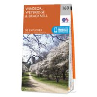
Wandelkaart - Topografische kaart 160 OS Explorer Map | Active Windsor / Weybridge / Bracknell | Ordnance Survey
Follow the Thames Path through Windsor, home to the world’s largest and oldest inhabited castle, to Egham, Staines and Weybridge with its motoring and aviation museums. Walk in the footsteps of King John as you take the Three Castles Path from Windsor Castle southwest past Bracknell and Wokingham.     Enjoy a royal encounter at Windsor Castle, home to British kings and queens for over 1,000 years and Her Majesty the Queen’s favourite residence  Discover the pretty villages of Chertsey and Chobham, Ascot Racecourse and the London Bus Museum in Weybridge  Walk, ramble or cycle along the Thames Path and recreational paths including the Blackwater Valley Path, Colne Valley Way and Three Castles Path Met zijn 4cm voor 1 km (2 ½ cm voor 1 mijl) schaal, is de OS Explorer kaartenserie de ideale en meest gedetailleerde kaartenreeks voor mensen die graag outdoor-activiteiten zoals fietsen, wandelen, paardrijden, klimmen en watersporten.   Deze kaart is nog gedetailleerder dan de 'gewone' Landra…
25,95
Wandelkaart - Topografische kaart 160 OS Explorer Map Windsor, Weybridge, Bracknell | Thames Path | Ordnance Survey
Follow the Thames Path through Windsor, home to the world’s largest and oldest inhabited castle, to Egham, Staines and Weybridge with its motoring and aviation museums. Walk in the footsteps of King John as you take the Three Castles Path from Windsor Castle southwest past Bracknell and Wokingham.     Enjoy a royal encounter at Windsor Castle, home to British kings and queens for over 1,000 years and Her Majesty the Queen’s favourite residence  Discover the pretty villages of Chertsey and Chobham, Ascot Racecourse and the London Bus Museum in Weybridge  Walk, ramble or cycle along the Thames Path and recreational paths including the Blackwater Valley Path, Colne Valley Way and Three Castles Path Met zijn 4cm voor 1 km (2 ½ cm voor 1 mijl) schaal, is de OS Explorer kaartenserie de ideale en meest gedetailleerde kaartenreeks voor mensen die graag outdoor-activiteiten zoals fietsen, wandelen, paardrijden, klimmen en watersporten. Deze kaart is nog gedetailleerder dan de 'gewone' Landr…
19,50
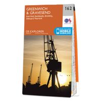
Wandelkaart - Topografische kaart 162 OS Explorer Map | Active Greenwich and Gravesend | Ordnance Survey
Consider yourself at home as you explore London's East End, a byword for cheeky Cockneys, gruesome murders and political activism. See the Thames in a new light in Greenwich, where you can stand on the Meridian Line at the Royal Observatory and climb aboard the Cutty Sark.    Explore the maritime town of Gravesend, visit a Cold War bunker  Uncover London's history as an Imperial trading hub at West India Docks, built in 1802  Walk and cycle along the London Loop through West Thurrock and Sidcup, and other recreational paths including the Thames Path National Trail through the heart of London Met zijn 4cm voor 1 km (2 ½ cm voor 1 mijl) schaal, is de OS Explorer kaartenserie de ideale en meest gedetailleerde kaartenreeks voor mensen die graag outdoor-activiteiten zoals fietsen, wandelen, paardrijden, klimmen en watersporten. Deze kaart is nog gedetailleerder dan de 'gewone' Landranger maps. Voor- en achterzijde bedrukt! Zeker op de moors en andere natuurgebieden van onschatbare waarden …
25,95
Wandelkaart - Topografische kaart 162 OS Explorer Map Greenwich, Gravesend | Ordnance Survey
Consider yourself at home as you explore London's East End, a byword for cheeky Cockneys, gruesome murders and political activism. See the Thames in a new light in Greenwich, where you can stand on the Meridian Line at the Royal Observatory and climb aboard the Cutty Sark.    Explore the maritime town of Gravesend, visit a Cold War bunker  Uncover London's history as an Imperial trading hub at West India Docks, built in 1802  Walk and cycle along the London Loop through West Thurrock and Sidcup, and other recreational paths including the Thames Path National Trail through the heart of London Met zijn 4cm voor 1 km (2 ½ cm voor 1 mijl) schaal, is de OS Explorer kaartenserie de ideale en meest gedetailleerde kaartenreeks voor mensen die graag outdoor-activiteiten zoals fietsen, wandelen, paardrijden, klimmen en watersporten. Deze kaart is nog gedetailleerder dan de 'gewone' Landranger maps. Voor- en achterzijde bedrukt! Zeker op de moors en andere natuurgebieden van onschatbare waard…
19,50
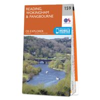
Wandelkaart - Topografische kaart 159 OS Explorer Map | Active Reading / Wokingham / Pangbourne | Ordnance Survey
Experience everything Reading has to offer and discover the charms of Wokingham and of Pangbourne, an idyllic waterside town on the River Thames among the gorgeous North Wessex Downs. Follow the Thames Path through Pangbourne and Reading where it skirts the evocative, 900-year-old ruins of Reading Abbey.     Visit Basildon Park, immortalised in Pride & Prejudice, and neighbouring Beale Wildlife Park for a wilder experience  Swim in the Thames Lido or visit the award-winning, much-loved Museum of English Rural Life (MERL)  Walk, hike or cycle along this peaceful stretch of the Thames Path or other recreational paths including the Blackwater Valley Path Met zijn 4cm voor 1 km (2 ½ cm voor 1 mijl) schaal, is de OS Explorer kaartenserie de ideale en meest gedetailleerde kaartenreeks voor mensen die graag outdoor-activiteiten zoals fietsen, wandelen, paardrijden, klimmen en watersporten.   Deze kaart is nog gedetailleerder dan de 'gewone' Landranger maps. Voor- en achterzijde bedrukt! Zeke…
25,95
Wandelkaart - Topografische kaart 159 OS Explorer Map Reading, Wokingham & Pangbourne Map | Thames Path | Ordnance Survey
Experience everything Reading has to offer and discover the charms of Wokingham and of Pangbourne, an idyllic waterside town on the River Thames among the gorgeous North Wessex Downs. Follow the Thames Path through Pangbourne and Reading where it skirts the evocative, 900-year-old ruins of Reading Abbey.     Visit Basildon Park, immortalised in Pride & Prejudice, and neighbouring Beale Wildlife Park for a wilder experience  Swim in the Thames Lido or visit the award-winning, much-loved Museum of English Rural Life (MERL)  Walk, hike or cycle along this peaceful stretch of the Thames Path or other recreational paths including the Blackwater Valley Path Met zijn 4cm voor 1 km (2 ½ cm voor 1 mijl) schaal, is de OS Explorer kaartenserie de ideale en meest gedetailleerde kaartenreeks voor mensen die graag outdoor-activiteiten zoals fietsen, wandelen, paardrijden, klimmen en watersporten. Deze kaart is nog gedetailleerder dan de 'gewone' Landranger maps. Voor- en achterzijde bedrukt! Zek…
19,50
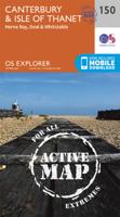
Wandelkaart - Topografische kaart 150 OS Explorer Map | Active Canterbury / Isle of Thanet | Ordnance Survey
Discover Canterbury, city of saints and kings, ancient heartland of England at the foot of the Kent Downs and the head of the River Stour Valley with its vineyards. Follow the river to the coast to discover unspoiled Deal, artistic Margate and picturesque Whitstable.  Starting in Canterbury, take the Stour Valley Walk to Sandwich and the long sweeping sand and shingle beach of Sandwich Bay  Walk the Long Rock from Whitstable to Herne Bay before taking the Thanet Coastal Path around the Isle of Thanet and its three famous Georgian and Victorian resorts of Margate, Ramsgate and Broadstairs   Take the National Trails of the England Coast Path and North Downs Way or choose from a lattice of other popular recreational paths  Met zijn 4cm voor 1 km (2 ½ cm voor 1 mijl) schaal, is de OS Explorer kaartenserie de ideale en meest gedetailleerde kaartenreeks voor mensen die graag outdoor-activiteiten zoals fietsen, wandelen, paardrijden, klimmen en watersporten.   Deze kaart is nog gedetailleerd…
25,95

Klanten-reviews van PIECE TATAMI SOFTEE 2.0

Er zijn nog geen beoordelingen voor dit productBen jij de eerste die een review plaatst?

Meer over PIECE TATAMI SOFTEE 2.0

Productomschrijving

Indicated for teaching and sports activities where a space with conditioned floor is required for schools, training. Part for recreational use. Available in two thicknesses: 2cm and 4cm. Mesures: 100x100cm.

Productinformatie

    Verken gerelateerde categorieën

    Webshop.nl maakt gebruik van cookies. Ga je verder op onze website, ga dan akkoord met het plaatsen van cookies en de verwerking van deze data door ons en vermelde partners.