Meer Pelckmans

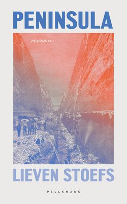
Peninsula - Lieven Stoefs - ebook

0

Verkopers met dit product

Verkoper
Bezorging
Prijs
eBook.nl logo
eBook.nl
0
gratis
9,99

Anderen bekeken ook

Stadsplattegrond Singapore & Malay Peninsula | ITMB
Goede stadsplattegrond van Singapore. Met register en suburban treinsysteem. De echt verre buitenwijken van deze megastad staan er niet op. Aan de achterzijde een overzichtskaart van het vasteland van Maleisië met een schaal van 730.000 Singapore is Asia as it should be: clean, modern, well-governed, efficient, and attractive.  In this edition, which technically should be a first edition due to the transformation of the map into a double-sided one, includes for the first time, our detailed map of the part of Malaysia known as the Malay Peninsula, the ‘mainland’ portion of the country. Singapore and Malaysia are joined together by two motorway crossings and a train operated by Malaysian Railways. Side one of our map concentrates on the urbanized portion of Singapore and its attractions, with a large and detailed inset map of the country of Singapore. Side two covers all of the mainland portion of Malaysia to the Thai border and includes a large inset map of Kuala Lumpur. Motorways are …
13,95
Llyn Peninsula | Northern Eye Books
This handy little guide book gives you the ten very best short circular walks along the Lln peninsula section of the Wales Coast Path   The Lln pushes 30 miles into the Irish Sea, tipped by the holy isle of Bardsey, or Ynys Enlli — ‘the island of 20,000 saints’. This remote and unspoilt landscape is characterised by traditional farms and compact villages, punctuated by volcanic hills. Its relative isolation has made it a haven for the Welsh language and culture.   Sea cliffs, offshore rocks and intimate coves dominate the northern coast, while the gentler southern coast promises sandy beaches and holiday towns like Abersoch and Pwllheli. But for sheer beauty, tranquillity and wildlife, the Lln is hard to beat.
10,95
Wandelkaart Dingle Peninsula | Harvey Maps
The whole of the Dingle Peninsula on one lightweight, waterproof map at the popular 1:30,000 scale.   Includes Mount Brandon and the entire Brandon Group of mountains in the west of the Peninsula.   To the east, the Slieve Mish mountains are also shown.   The map also shows the Dingle Way - a 179km long distance walking route around the edge of the Peninsula that starts and finishes in Tralee. The route is highlighted in red.   The Blasket Islands are also shown at 1:50,000 scale. Popular for day trips, these uninhabited islands are the most westerly point of Europe.   Placenames in English and Gaeilge / Gaelic.   Archaeological sites and walls and fences in farmland are clearly marked.
25,50
Reisgids Antarctic Peninsula | British Antarctic Survey
Fully revised with a new chapter on climate change and updated and expanded maps. Focusing on the geography and physical phenomena of this remote region, this book contains all the information visitors will need during their trip. It describes and explains the geographical setting, climate and weather, geology, glaciology, and much more, and includes the location of research stations and historic sites. Drawing on the world-class scientific and cartographic expertise of BAS, the guide is perfect for adventure tourists and visiting scientists alike.
24,95
Wegenkaart - landkaart Mexico Yucatan Peninsula | ITMB
Een degelijke kaart met aanduidingen van o.a. nationale parken, vliegveld, benzinepomp, dirt-roads en kleine plattegrond van hoofdstad. Als overzichtskaart goed te gebruiken.   This is a modest upgrading, with little change over the previous edition; same cover, same ISBN, same price. We ran out of copies faster than expected and found few changes necessary to make to the artwork. Yucatan is one of those parts of Mexico seemingly unaffected by the Drug Wars, which appear to be tapering off in any case, and is as popular as ever.   Legend Includes: Roads by classification, International Airports, Domestic Airports, Lighthouses, Points of Interest, Archaeological Sites, Beaches, Caves, Gas Stations, Reefs, National Parks, Swamps, Mangroves, Temples, Camp Ground, Museums, Forts, Shipwrecks, Sinkholes, Border Crossings, Harbours, Churches, Monasteries, Mines, Other Archaeological Remains, Trailer Parks, Airstrip, Viewpoints, Cultural World Heritage, Fishing, Paragliding, Diving, Sailing, …
13,95
Wegenkaart - landkaart Kuala Lumpur & Malay Peninsula | ITMB
Goede stadsplattegrond van Kuala Lumpur. Met register en suburban treinsysteem. De echt verre buitenwijken van deze megastad staan er niet op. Aan de achterzijde een overzichtskaart van het vasteland van Maleisië met een schaal van 730.000 Street map of Kuala Lumpur at 1:10,000 covering the city from the Sentul Terminal and the Setapak Park in the north to the Chinese Cemetery in the south, and from the Parliament House (Bangunan Paliament) in the west to the Royal Selangor Golf Club in the east. TDetail includes markets, notable and public buildings, shopping malls, various religious buidings, accommodation, museums, theatres and cinemas, points of interest, post offices and police stations, bus terminals. Various railway systems and pedestrian roads are also indicated alongside land use, e.g. parks, markets, industrial areas, attractions, etc. Includes an extensive index of place names.  
13,95
Wegenkaart - landkaart Antarctic Peninsula - Antarctica | Zagier & Urruty
Kaart van het Antarctisch Schiereiland met tekeningen van de voorkomende Fauna. Dit is het stuk van Antarctica waar vrijwel alle toeristen rondvaren op de cruiseschepen of zeilboten. The North of the Peninsula is the most visited part of Antarctica every summer. Glaciers, inlets and sailing ports, scientific stations, etc. On the back side large maps of the main visited islands and ports. Artistic drawings of birds and mammals.
17,95

Klanten-reviews van Peninsula - Lieven Stoefs - ebook

Er zijn nog geen beoordelingen voor dit productBen jij de eerste die een review plaatst?

Meer over Peninsula - Lieven Stoefs - ebook

Productinformatie

    Productspecificaties

    Artikelnummer(s)
    EAN
    9789464019841
    Brand
    Pelckmans
    Webshop.nl maakt gebruik van cookies. Ga je verder op onze website, ga dan akkoord met het plaatsen van cookies en de verwerking van deze data door ons en vermelde partners.