webshop.nl

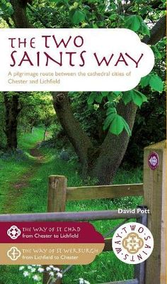
Pelgrimsroute - Wandelgids The Two Saints Way | Northern Eye Books

0
An impressive guide book that coincides with the growing interest in pilgrimage as an aspect of ‘wellness’ tourism that benefits body, mind and spirit.   The guide is packed with information both practical and historical. It is an attractive publication with OS map extracts and numerous high quality colour photos.   The Two Saints Way has a symmet...

Webshops met dit product

Webshop
Bezorging
Prijs
DeZwerver.nl logo
DeZwerver.nl
niet bekend
18,95

Anderen bekeken ook

Wandelgids Wales Coast Path: Snowdonia and Ceredigion | Northern Eye Books
Official Guide: Wales Coast Path: Snowdonia & Ceredigion Coast One of seven Official Guides to the Wales Coast Path This Official Guide to the Snowdonia & Ceredigion Coast section of the Wales Coast Path contains everything local and long-distance walkers need to enjoy the path.   Cardigan Bay probably offers a more diverse walking experience than any other section of the Wales Coast Path. The stretch covered in this book – from Porthmadog in the north to Cardigan in the south – largely covers two contrasting Welsh counties.   The first 97 kilometres pass through Gwynedd, along the western edge of the Snowdonia National Park. Here, just before the rivers that rise in the highest of the Welsh mountains reach the sea, they fan out to form broad estuaries that provide rich pickings for waders and other birdlife. The estuaries of the Dwyryd, the Mawddach and the Dyfi are the largest of these. Between them are some very large dune systems, including Morfa Harlech and Morfa Dyffryn – home t…
23,95
Campergids All the Aires France South | Vicarious Books
Due to the increased number of Aires entries, All the Aires France is now divided into two volumes: North and South. You are currently looking at the South guide which lists the Aires in southern France only. These books can be purchased individually or as a double deal together.   As the name suggests, All the Aires France South maps and details 1801 dedicated motorhome stopovers in France. It is the only complete French Aires de services guide book available in English. The guidebook enables you to make an informed choice about where to stop and where to stay overnight on your travels in your motorhome or campervan throughout southern France.   All the Aires France South has been revised and updated into its most user-friendly format. All the nearby Aires fall on the same page. This makes it easier to cross reference and select an Aire within an area. Closed Aires are now marked with an X on the maps and are found in a list at the rear of the book. Motorway Aires are marked with a l…
20,95
Opruiming - Wandelgids South Wales Coast | Northern Eye Books
OUDE DRUK The 115 mile/185km long South Wales Coast section of the Wales Coast Path runs through unexpectedly varied and dramatic coastal scenery. Highlights of the route include the historic coastal cities of Swansea and Cardiff, vast sand dune systems at Merthyr Mawr and Kenfig Burrows, the stunning limestone scenery and fossil-rich cliffs of the 14-mile long Glamorgan Heritage Coast, the Newport Wetlands RSPB reserve, the open Wentlooge Levels, and of course pretty Chepstow itself. This Official Guide splits the route into nine achievable day sections, each of about 10-17 miles / 16-27 kilometres, starting and ending at accessible towns and villages that offer places to stay, eat and drink. This guide contains everything local and long-distance walkers need to enjoy the path and includes: An overview of the South Wales Coast with dedicated history and wildlife sections Nine day-walk sections with detailed route descriptions and full, enhanced Ordnance Survey mapping Distance cha…
7,95
Wandelgids Mysterious Walks in the Peak District | Northern Eye Books
Even the Peak District’s name conceals a mystery. Forget the obvious: a visitor expecting towering peaks will be disappointed, as the name comes from the Pecsaetan tribe who once lived here. But there’s a twist: the Anglo-Saxon means “settlers of the Pec”…and that word pec has the same root as our peak, the dialect pike and the Pyrenean pic. So, ultimately, the Peak District is named after its peaks, after all.   The Peak District is broadly defined by the conurbations at its corners: Manchester, Sheffield, Derby and Stoke. Within this rectangle, the National Park forms a rough oval of around 550 square miles.   The area is traditionally divided into the Dark Peak – peat moorland edged by gritstone, with rugged villages in the valleys — and the softer White Peak – upland pastures defined by drystone walls, divided by gorges and limestone villages. The eastern and western moors are similar to the Dark Peak, but have their own subtly distinctive characters.   The Peak District was occup…
10,95
Wandelgids West Highland Way | Aurum Press
Gedegen routegids van het beroemdste pad van Schotland. Uitstekende kaarten, goede achtergronden, helaas wat beperkte praktische informatie. Engels. The 93-mile West Highland Way is indisputably Britain's most spectacular long-distance path. The first section, following the eastern shore of Loch Lomond, offers an idyllic waterside walk, with the full grandeur of the Highlands gradually revealing itself. Then, after crossing the barren wilderness of the Rannoch Moor, the walker climbs the Devil's Staircase above Glencoe and traverses classic Highland landscapes to reach Fort William and, if he or she wishes, a grand finale at the peak of Britain's highest mountain, Ben Nevis. This comprehensive, easy-to-use guide is an authoritative companion, packed with indispensable information. The West Highland Way recreational Path Guide by Anthony Burton is the definitive guide to Britain’s most spectacular long distance walk. This comprehensive, easy-to-use guide contains the entire route split…
20,95
Wandelgids Cleveland Way | Trailblazer Guides
All the information you need to enjoy your hiking adventure along the Cleveland Way in this fully revised and updated 2nd edition. In the beautiful, wild countryside of the North York Moors National Park in northern England lies this fabulous trail, the Cleveland Way. The 110-mile route runs from Helmsley near Thirsk around the western edge of the park to reach the coast at Saltburn-by-the-Sea.   It then continues along the eastern edge of the park south down the coast through Whitby, Robin Hood's Bay and Scarborough to finish in Filey. Combining moorland and coast there's wonderful scenic variety to this walk, with crumbling castles and idyllic fishing villages to explore. The guide includes:48 large-scale walking maps - at just under 1:20,000 - showing route times, places to stay, places to eat, points of interest, and 8 town plans10 colour stage maps to help plan your walk, including hills and descents, and two colour overview mapsPlaces to stay with reviews - campsites, bunkhouses…
21,95
Wandelgids Wales Coast Path: Pembrokeshire | Northern Eye Books
Official Guide: Wales Coast Path: Pembrokeshire   One of seven Official Guides to the Wales Coast Path   The 186 mile/300km long Pembrokeshire section of the Wales Coast Path runs through some of Wales’ most varied and dramatic coastal scenery — high, rugged cliffs and long sandy bays, Pembroke Castle, St David’s cathedral and St Govan’s remote cliff-wrapped chapel, with several large offshore islands. Pembrokeshire is also Britain’s only coastal National Park.   This Official Guide splits the route into 14 convenient day sections, each of about 10-17 miles / 16-27 kilometres. It contains everything local and long-distance walkers need to enjoy the path and includes:   An overview of Pembrokeshire with dedicated history and wildlife sections Fourteen day-walk sections with detailed route descriptions and full, enhanced Ordnance Survey mapping Distance charts, section overviews, background information and interpretation of places of interest Stunning professional photographs throughout…
22,50
Wandelgids Wales Coast Path Carmarthen Bay & Gower | Northern Eye Books
Official Guide: Wales Coast Path: Carmarthen Bay & Gower   One of seven Official Guides to the Wales Coast Path   The Carmarthen Bay and Gower section of the Wales Coast Path runs for 120 miles/193 kilometres between the popular seaside town of Tenby, via Amroth on the eastern edge of the Pembrokeshire Coast National Park, to Swansea, on the landward side of the Gower Peninsula.   This Official Guide splits the route into 12 convenient day sections, each of about 10-17 miles / 16-27 kilometres. It contains everything local and long-distance walkers need to enjoy the path and includes:   An overview of Carmarthen Bay and Gower with dedicated history and wildlife sections Twelve day-walk sections with detailed route descriptions and full, enhanced Ordnance Survey mapping Distance charts, section overviews, background information and interpretation of places of interest Stunning professional photographs throughout Information on accommodation, public transport, local information, weather…
22,50
Wandelgids Pembrokeshire | Northern Eye Books
OS Map Books: Wales Coast Path: Pembrokeshire Coast Path Map Atlas | Ordnance Survey ‘Explorer’ Large-scale 1:25,000 maps for the Pembrokeshire Coast in compact book format | Pocket Atlas | Walking Wales | UK Long-Distance Trails | Hiking | Adventure   One of seven handy Ordnance Survey Map Books covering the entire 870 mile/1400 kilometre-long, world-class Wales Coast Path — from Chester in the north to Chepstow in the south.   Enjoy enhanced, large scale (1:25,000) Ordnance Survey Explorer mapping in compact atlas format with all the detailed mapping you need to walk the Pembrokeshire Coast section of the Wales Coast Path.   Continuous, full colour OS mapping covering the Wales Coast Path between Cardigan and Amroth. Contains extracts from large scale Explorer maps OL 35 and OL 36. The enhanced OS 1:25,000 maps are accurate, up-to-date and reliable. Additional map symbols show tea shops, cafes, extra parking, and public toilets.   A brief introduction to Pembrokeshire Coast includes…
17,50
Fietskaart Reivers Cycle Routes | Northern Heritage Services
The long-distance Reivers Cycle Routes are two intertwining signed / waymarked bi-directional ‘coast to coast’ cycle routes between the North Sea and the Irish Sea.   The original Reivers Cycle Route was created in 1998 eventually becoming NCN Route 10 with interlinking on-road and off-road sections but this soon morphed into a one-size-fits-all route which never worked well. The regenerated re-launched Reivers Cycle Routes are two intertwining route options – one which is as much off-road as possible suitable for gravel and cross bikes, hybrids and mountain bikes and a version designed for capable road cyclists 100% on tarmac.   The routes are bi-directional and continuously reward the rider with beautiful views of the constantly changing terrain, provide many places of interest to pass by or call in and many lovely villages and quiet hamlets to cycle through or stay the night. Most importantly, there is a supply of excellent on route or close-to-route refreshments stops.   The off-r…
16,50

Klanten-reviews van Pelgrimsroute - Wandelgids The Two Saints Way | Northern Eye Books

Er zijn nog geen beoordelingen voor dit productBen jij de eerste die een review plaatst?

Meer over Pelgrimsroute - Wandelgids The Two Saints Way | Northern Eye Books

Productomschrijving

An impressive guide book that coincides with the growing interest in pilgrimage as an aspect of ‘wellness’ tourism that benefits body, mind and spirit.   The guide is packed with information both practical and historical. It is an attractive publication with OS map extracts and numerous high quality colour photos.   The Two Saints Way has a symmetrical structure with the two cathedrals at either end, Stoke Minster in the middle and two churches dedicated to St Mary at the quarter points. With this in mind, the 92 mile route is divided into four colour coded sections – 1: Chester to Nantwich, 2: Nantwich to Stoke, 3: Stoke to Stafford and 4: Stafford to Lichfield. Each section is further divided into four stages of between 3.5 and 8.5 miles in length. The route is described in both directions.   Highlights on this varied route include Beeston Castle, Englelsea Brook Chapel and Museum, the Staffordshire Hoard at the Potteries Museum, Trentham Gardens and Cannock Chase Area of outstanding Natural Beauty. The guide contains a wealth of fascinating information on many features of interest.

Verken gerelateerde categorieën

Webshop.nl maakt gebruik van cookies. Ga je verder op onze website, ga dan akkoord met het plaatsen van cookies en de verwerking van deze data door ons en vermelde partners.