Pelgrimsroute (kaart) - Wandelkaart Caminos de Santiago en España y Portugal | CNIG - Instituto Geográfico Nacional

0
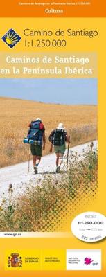
Een duidelijke overzichtskaart van Spanje en Portugal waarop alle pelgrimsroutes naar Santiago de Compostela - de Camino"s - staan ingetekend. Ideaal voor het uitkiezen en plannen van een langere wandelroute. Het is door de schaal niet een kaart die te gebruiken is als wandelkaart.   CAMINOS DE SANTIAGO   Camino Francés   ES01 Camino Francés   Cam...

Verkopers met dit product

Verkoper
Bezorging
Prijs
DeZwerver.nl logo
DeZwerver.nl
2,95
8,95

Anderen bekeken ook

Pelgrimsroute (kaart) - Wandelkaart Caminos de Santiago en España y Portugal | CNIG - Instituto Geográfico Nacional
Een duidelijke overzichtskaart van Spanje en Portugal waarop alle pelgrimsroutes naar Santiago de Compostela - de Camino"s - staan ingetekend. Ideaal voor het uitkiezen en plannen van een langere wandelroute. Het is door de schaal niet een kaart die te gebruiken is als wandelkaart.   CAMINOS DE SANTIAGO   Camino Francés   ES01 Camino Francés   Caminos del Este    ES08 Camino de Levante   ES23 Camino de Santiago de Castellón-Bajo Aragon   ES25 Camino de Sagunto       Caminos del Norte   ES03 Camino del Norte    ES05 Camino Primitivo    ES37 Camino de la Lana Valencia-Requena   ES11 Camino Olvidado Caminos del Sureste    ES20 Camino Vasco del Interior   ES33 Camino de Baztán   ES45 Camino Lebaniego       60S Caminos del Sureste    ES28 Camino de El Salvador   ES13 Camino de la Lana    ES29 Ruta Vadiniense   ES15 Ruta del Argar    ES30 Camino Calzada de los Blendios   ES38 Camino del Alba    ES31 Camino del Valle de Mena Bilbao-Balmaseda-Burgos   ES32 Camino Vía de Bayona   ES39 Camino d…
8,95
Pelgrimsroute (kaart) - Wandelkaart Camino Frances, wandelen naar Santiago de Compostela | CNIG - Instituto Geográfico Nacional
Kaarten voor de Camino Frances: Set van 10 topografische kaarten en een overzichtskaart om te wandelen door Noord Spanje naar Santiago de Compostella, op de kaarten  toeristische informatie (zoals overnachten, restaurants, bussen, winkels, etc) met symbolen aangegeven. De kaarten zijn met UTM grid en geschikt voor gebruik met GPS. Op de kaarten zijn ook hoogteprofielen te vinden. De pelgrimsroute is in 38 etappes en loopt vanaf de grens, Pyreneeen naar Santiago.   The whole of Way of St James to Santiago de Compostela in a set of 11 maps: 10 double-sided topographic maps at 1:50,000 plus an overview map of northern Spain, published by the Spanish civilian survey organization. Descriptions in 6 languages; English, French, Spanish, German, Italian & Portuguese   Each 1:50,000 map is double-sided and has four 57 x 35cm panels with full topographic mapping of the area through which the route passes. Contours are at 50m intervals, with additional shading and colouring/graphics to show s…
18,95
Wandelgids - Pelgrimsroute Camino de Santiago - Camino Frances | Cicerone
Voor diegenen die de klassieke Camino Frances gaan lopen (als één van de vele wegen dienaar Santiago de Compostela leiden) is dit één van de beste wandelgidsen die er zijn. Zowel de beschrijvingen van de routes en etappes, de kaarten in een losse set en de hoeveelheid praktische informatie is bijzonder goed te noemen.  This two-volume set of guidebook and map book makes an indispensable companion to planning and walking the 784km Camino Frances pilgrim route from St-Jean-Pied-de-Port across northern Spain to Santiago de Compostela. Divided into 6 sections, the guidebook includes an additional section from Santiago de Compostela to Finisterre and Muxia on the Galician coast. Each section is broken down into detailed stages with easily customisable start and finish points due to the amount of accommodation available en route. Over 500 of these pilgrim lodgings are listed within this guidebook, including all public and private albergues, with contact details and a description of faciliti…
24,95
Wandelatlas - Pelgrimsroute (kaart) 160 Camino de Santiago | Michelin
Camino de Santiago - St Jean Pied de Port, Santiago de Compstela - 1 : 150.000 - Michelin kaartboekje. Heel handzaam boekje met de kaarten voor de route van St. Jean Pied de Port, Santiago de Compstela met praktische informatie zoals overnachtingsplekken inclusief contactgegevens, stadsplattegronden, grafieken van landschap, km-traject per pagina met de ingetekende route. De legenda is in 6 verschillende talen, waaronder het Nederlands. Ook ontbreekt een stempel-deel niet!  Voor het Franse deel kunt u Michelin kaartgids 161 gebruiken.  
9,95
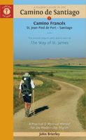
Wandelgids - Pelgrimsroute Camino de Santiago - Camino Francés | Camino Guides Brierley
Engelstalige wandelgids over het Spaanse traject, de El Camino Francés, van de pelgrimstocht naar Santiago de Compostella. In het gids wordt de wandelroute beschreven vanaf de Pyreneeen, Frankrijk Saint-Jean-Pied-de-Port, via Roncesvalles naar Santiago. Het wandelboek geeft duidelijke beschrijvingen van de dagetappes met routekaartjes, overnachtingsadressen in pelgrims hostels en andere accommodatie en verdere praktische informatie  2024 editionNow updated to include newer maps and photos, this comprehensive guidebook to the Camino de Santiago and its offshoots contains all the information needed by modern-day pilgrims wishing to walk the sacred Way of St. James. Overview route planners plus daily stage maps and detailed town plans help sojourners with all the advance preparation they need.   The maps feature contour guides to help distinguish the terrain that will be crossed each day, while full information on all pilgrim hostels, as well as details for alternative accommodation,…
27,95
Wandelgids - Pelgrimsroute The Camino del Norte and Camino Primitivo | Cicerone
This guidebook describes the Camino del Norte and Camino Primitivo pilgrim routes to Santiago do Compostela in northwest Spain. The 820km Camino del Norte follows the coast from Irún, on the French border, and takes about 5 weeks to complete. The 355km Camino Primitivo splits off from the Camino del Norte near Villaviciosa and passes through Oviedo and Lugo en route to Compostela. It takes roughly 2 weeks to walk. This book also includes an overview of a continuation route from Santiago to Finisterre. Physically demanding, but not difficult, the caminos are best walked from in late spring to autumn.   The guidebook is broken into stages of between 15 and 35km, most of which end in a town or village with a pilgrim albergue. There is indispensable information on facilities, food and lodging, 1:1000 scale maps of the route and town maps for key locations. With notes on preparation and planning, travel and equipment, a list of useful sources of information, and a glossary, the book provid…
23,95
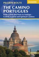
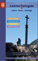
Wandelgids - Pelgrimsroute The Camino Portugués | Cicerone
A guidebook to walking the Camino Portugués (Portuguese Way), 620km from Lisbon in Portugal to Santiago in Spain. The book gives stage-by-stage directions for the Central Camino, starting from Lisbon, Porto or Tui, the Coastal Camino between Porto or Vigo, and the Spiritual Variant route from Pontevedra to Redondela. It also describes link routes that can be used to swap from one route to another. Detailed route guidance and maps are accompanied by fascinating information about historic and religious sites passed along the way. It is packed with essential information for pilgrims, with advice on getting there, when to go, where to stay and equipment. An indispensable facilities table showing the availability of accommodation, refreshments, supermarkets, ATMs and pharmacies along the route, and a handy glossary, make this the complete guide to the Camino. Since 1211 Santiago de Compostela has been a place of holy pilgrimage and the Camino Portugues is the second most travelled pilgri…
26,50
Wandelgids - Pelgrimsroute Camino de Santiago kaartenatlas | Camino Guides Brierley
Gids met kaartmateriaal voor de Jakobsweg van St. Jean Pied de Port, Roncesvalles naar Santiago de Compostela. De wandelkaarten ca. schaal 1:100.000 met begeleidende tekst in Engels, Spaans, Frans, Duits, Portugees, Italiaans, Nederlands en Pools en hoogteprofielen A complete set of maps and town plans in English, Spanish, French, German, Portuguese, Italian, Dutch and Polish make up this indispensable guidebook for spiritual seekers and travellers wishing to walk the way of Saint James. Covering the sacred route from St. Jean Pied de Port to Santiago, this portable book of maps makes the perfect companion for adventurers attempting to heed the spiritual calling.   Revised and updated to offer the most recent information, this exploration is light enough to carry while walking long distances each day. The maps show the location of all pilgrim hostels en route, the distances between villages, and points of interest, as well as counter guides, alternative routes, and accommodations.
21,95
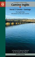
Pelgrimsroute - Wandelgids Camino Inglés | Camino Guides Brierley
Camino Inglés: This ancient route was popular with pilgrims arriving by sea from England, Ireland and Northern Europe in the medieval period. It all but faded from memory but is quietly coming back to life and now ready to welcome pilgrims seeking a more solitary way along the rugged rías of Northern Galicia. It was previously combined with the route to Finisterre which was described as the road less travelled but that acclaim has now passed to the English way (or Celtic way) that starts in Ferrol or A Coruña and now fully merits its own edition. Few pilgrims walking the Camino Inglés commence in A Coruña which, at less than 100 km, does not entitle the pilgrim to a compostela unless they have walked an extra 25 km in their own country or combine it with the route from Ferrol. This provides an opportunity to visit the only site in Galicia directly linked with the life of Jesus - his first miracle in Cana of Galilee. By combining two distinct starting points we also come to understand …
21,95
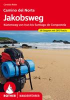
Wandelgids - Pelgrimsroute 279 Jakobsweg Camino del Norte | Rother Bergverlag
Uitstekende wandelgids van de Camino del Norte. Alle 34 etappen worden apart beschreven, de beschrijvingen zijn bijzonder goed, maar - als altijd - zijn de kaartjes wat beperkt.    Unter den vielen Jakobswegen, die durch Spanien nach Santiago de Compostela führen, ist der Camino del Norte entlang der nordspanischen Küste einer der ruhigsten und am wenigsten überlaufenen. Genau darin liegt der Reiz des Küstenweges: Hier finden die Jakobswegwanderer noch die Balance zwischen Ruhe und Gelassenheit abseits des Massenbetriebes. Der Rother Wanderführer »Camino del Norte« stellt diesen Weg mit allen Varianten und wichtigen Infos für Pilger vor.   Doch nicht nur aufgrund seiner Stille, auch landschaftlich und kulturell ist der Camino del Norte ein herrliches Ziel. Die spanische Atlantikküste gibt sich mal grün und lieblich, dann wieder wild und schroff. Städte wie das mondäne Seebad San Sebastián, das von der Industrie- zur Kulturstadt gewandelte Bilbao mit dem Guggenheim-Museum, die einzigar…
18,50

Klanten-reviews van Pelgrimsroute (kaart) - Wandelkaart Caminos de Santiago en España y Portugal | CNIG - Instituto Geográfico Nacional

Er zijn nog geen beoordelingen voor dit productBen jij de eerste die een review plaatst?

Meer over Pelgrimsroute (kaart) - Wandelkaart Caminos de Santiago en España y Portugal | CNIG - Instituto Geográfico Nacional

Productomschrijving

Een duidelijke overzichtskaart van Spanje en Portugal waarop alle pelgrimsroutes naar Santiago de Compostela - de Camino"s - staan ingetekend. Ideaal voor het uitkiezen en plannen van een langere wandelroute. Het is door de schaal niet een kaart die te gebruiken is als wandelkaart.   CAMINOS DE SANTIAGO   Camino Francés   ES01 Camino Francés   Caminos del Este    ES08 Camino de Levante   ES23 Camino de Santiago de Castellón-Bajo Aragon   ES25 Camino de Sagunto       Caminos del Norte   ES03 Camino del Norte    ES05 Camino Primitivo    ES37 Camino de la Lana Valencia-Requena   ES11 Camino Olvidado Caminos del Sureste    ES20 Camino Vasco del Interior   ES33 Camino de Baztán   ES45 Camino Lebaniego       60S Caminos del Sureste    ES28 Camino de El Salvador   ES13 Camino de la Lana    ES29 Ruta Vadiniense   ES15 Ruta del Argar    ES30 Camino Calzada de los Blendios   ES38 Camino del Alba    ES31 Camino del Valle de Mena Bilbao-Balmaseda-Burgos   ES32 Camino Vía de Bayona   ES39 Camino del Sureste Benidorm    ES42 Camino del Sureste Ramal Sur    ES44 Camino del Sureste Cartagena-Murcia    ES48 Camino de las Asturias       Caminos Insulares   ES46 Ruta Jacobea Tunular Insular-Gáldar       Caminos de Galicia   ES02 Camino Portugués desde Tui    ES06 Camino Inglés    ES07 Camino de Fisterra y Muxía   ES17 Camino de Invierno   ES18 Camino Portugués de la Costa A Guarda-Baiona-Redondela   ES40 Ruta del Mar y Variante Espiritual       Caminos Franceses   FRO1 Via Turonensis-París   FRO2 Via Lemovicensis-Vezelay   FRO3 Via Podiensis-Le-Puy-en-Velay    FRO4 Via Tolosana-Arles    FRO5 Voie des Piemonts   FR12 Chemin Voie Littorale-Royan  -Irun   FR13 Le Chemin Côtie-Lesseron-Bayonne    FR22 Chemin Firmi-Toulouse    FR26 Voie de Garonne Toulouse-St.Gaudens   FR27  Chemin Maubourguet-Lourdes   FR44 Voie Col d'Ourdiss-  Lortet-Port-d'Ourdiss   FR45 Voie Arudy-Sainte-Colome-Somport   FR46 Chemin de Fontcaude St-Gervais-sur-M       Caminos Andaluces   ES04 Via de la Plata-Camino Mozárabe a Santiago   ES10 Camino Mozárabe    ES35 Camino Sur de Huelva   ES36 Vía Augusta de Cádiz       Caminos catalanes    ES14  Camino Jacobeo del Ebro    ES22 Camino de Santiago de Montserrat  a San Juan de la Peña    ES24 Camí Catalá de Sant Jaume       Caminos Portugueses   PT01 Caminho Central Lisboa-Tui   PT02 Caminho Português Interior a Santiago    PT03 Caminho Português por la Costa   PT04 Caminho Senda da Orla Litoral Porto-Caminha   PT05 Caminho Português Porto-Braga-Ponte de Lima   PT06 Camin o Torres    PT07 Caminho Português de la Vía de la Plata   PT08 Caminho Central Faro-Golega   PT09 Caminho Nascente-Tavira-Trancoso     Caminos del Centro   ES04 Vía de la Plata de Zamora a Astorga   ES12 Camino de Madrid    ES16 Camino Mozárabe Sanabrés   ES21 Camino Castellano Aragonés y Soria    ES34 Camino Manchego de Ciudad Real  a Toledo   ES43  Camino de la Santa Cruz    ES47 Ramal Oeste de la Vía de la Plata    ES49 Camino Mendocino a Santiago        Santiago de Compostela O Inicio o fin del camino Localidad de la que pasa el Camino de Santiago Se  han cartografiado solo los Caminos de Santiago recuperados por iniciativa de las asociaciones jacobeas Este conjunto caminero cuenta con señalización específica, descripción de itinerarios e infraestructura de acogida.       

Productinformatie

    Verken gerelateerde categorieën

    Webshop.nl maakt gebruik van cookies. Ga je verder op onze website, ga dan akkoord met het plaatsen van cookies en de verwerking van deze data door ons en vermelde partners.