Pelgrimsroute (kaart) - Wandelkaart Camino Frances, wandelen naar Santiago de Compostela | CNIG - Instituto Geográfico Nacional

0
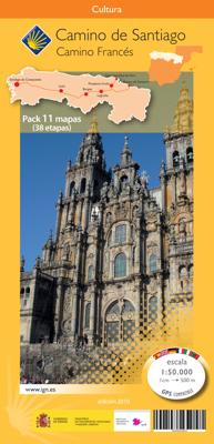
Kaarten voor de Camino Frances: Set van 10 topografische kaarten en een overzichtskaart om te wandelen door Noord Spanje naar Santiago de Compostella, op de kaarten  toeristische informatie (zoals overnachten, restaurants, bussen, winkels, etc) met symbolen aangegeven. De kaarten zijn met UTM grid en geschikt voor gebruik met GPS. Op de kaarten zi...

Verkopers met dit product

Verkoper
Bezorging
Prijs
DeZwerver.nl logo
DeZwerver.nl
5,95
18,95

Anderen bekeken ook

Wandelgids - Pelgrimsroute Camino de Santiago - Camino Frances | Cicerone
Voor diegenen die de klassieke Camino Frances gaan lopen (als één van de vele wegen dienaar Santiago de Compostela leiden) is dit één van de beste wandelgidsen die er zijn. Zowel de beschrijvingen van de routes en etappes, de kaarten in een losse set en de hoeveelheid praktische informatie is bijzonder goed te noemen.  This two-volume set of guidebook and map book makes an indispensable companion to planning and walking the 784km Camino Frances pilgrim route from St-Jean-Pied-de-Port across northern Spain to Santiago de Compostela. Divided into 6 sections, the guidebook includes an additional section from Santiago de Compostela to Finisterre and Muxia on the Galician coast. Each section is broken down into detailed stages with easily customisable start and finish points due to the amount of accommodation available en route. Over 500 of these pilgrim lodgings are listed within this guidebook, including all public and private albergues, with contact details and a description of faciliti…
24,95
Wandelgids - Pelgrimsroute Camino de Santiago - Camino Francés | Camino Guides Brierley
Engelstalige wandelgids over het Spaanse traject, de El Camino Francés, van de pelgrimstocht naar Santiago de Compostella. In het gids wordt de wandelroute beschreven vanaf de Pyreneeen, Frankrijk Saint-Jean-Pied-de-Port, via Roncesvalles naar Santiago. Het wandelboek geeft duidelijke beschrijvingen van de dagetappes met routekaartjes, overnachtingsadressen in pelgrims hostels en andere accommodatie en verdere praktische informatie  2024 editionNow updated to include newer maps and photos, this comprehensive guidebook to the Camino de Santiago and its offshoots contains all the information needed by modern-day pilgrims wishing to walk the sacred Way of St. James. Overview route planners plus daily stage maps and detailed town plans help sojourners with all the advance preparation they need.   The maps feature contour guides to help distinguish the terrain that will be crossed each day, while full information on all pilgrim hostels, as well as details for alternative accommodation,…
27,95
Nieuw
Wandelgids - Pelgrimsroute The Camino Portugués | Cicerone
A guidebook to walking the Camino Portugués (Portuguese Way), 620km from Lisbon in Portugal to Santiago in Spain. The book gives stage-by-stage directions for the Central Camino, starting from Lisbon, Porto or Tui, the Coastal Camino between Porto or Vigo, and the Spiritual Variant route from Pontevedra to Redondela. It also describes link routes that can be used to swap from one route to another. Detailed route guidance and maps are accompanied by fascinating information about historic and religious sites passed along the way. It is packed with essential information for pilgrims, with advice on getting there, when to go, where to stay and equipment. An indispensable facilities table showing the availability of accommodation, refreshments, supermarkets, ATMs and pharmacies along the route, and a handy glossary, make this the complete guide to the Camino. Since 1211 Santiago de Compostela has been a place of holy pilgrimage and the Camino Portugues is the second most travelled pilgri…
26,50
Nieuw
Wandelgids Camino de Santiago - Via Podiensis GR65 | Cicerone
Handzaam boekje met de routebeschrijving inclusief een heleboel praktische informatie. Uitstekende beschrijving en redelijke kaarten.   This guidebook describes in full the 735km Via Podiensis (GR65), a historic pilgrimage route through southern France from Le Puy-en-Velay to Saint-Jean-Pied-de-Port, where the trail meets the famous Camino Francés to Santiago de Compostela (Spain). Also detailed are 2 major variants: the Célé Valley (GR651) and Rocamadour (GR6 and GR46). Split into 28 stages, the full route takes 4 to 6 weeks to complete but can be divided into shorter sections - Figeac and Condom are well positioned to break the walk into three 2-week chunks. It can be adapted to suit all abilities, with regularly spaced accommodation and baggage transport available, and is best walked in spring and autumn, with May and September the most popular months. Abundant accommodation options offer a warm welcome to walkers and pilgrims and a chance to enjoy delicious home-cooked meals made…
26,95
Wandelatlas - Pelgrimsroute Camino Portugués | Village to Village Press
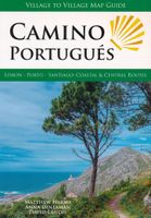
Prettig lichtgewicht gidsje met alle kaarten van de route op gedetailleerd nivo en de basisinformatie voor de route. Voor de wandelaar een goed alternatief voor de wat zwaardere meer uitgebreide gidsen. Fully updated for 2025! This Village to Village Map Guide to the Camino Portugués is a lightweight minimalist guidebook to walking the Way of Saint James from Lisbon and Porto to Santiago de Compostela on the Camino Portugués. The Camino Portugués traverses Portugal with options to remain inland on the traditional Central Route or explore the coast on the newer Coastal route, including the Variante Espiritual! Let op: de Fatima route is dus alleen digitaal beschikbaar bij de uitgever, dit staat niet in de gids. New for 2025 - information on the Fátima route including free GPS tracks for download. This map guide to the Camino Portugués provides walking information for over 1100km of the Camino Portugués on the Coastal, Central, Senda Litoral, Variante Espiritual and Fátima routes: - Ful…
25,50
Nieuw
Wandelgids Camino de Santiago - Jakobsweg - Sint Jacobs route | Rother Bergverlag
With over 1000 years of history, the Way of St. James is one of the classic long distance walks. This historical route along almost 1000 kilometres from the Pyrenees to Santiago de Compostela offers unique cultural, scenic and nature experiences. Since the Holy Year of 2010 the Way of St. James has gained even more in popularity and attracts more and more people from very different backgrounds, faiths and generations. It does not matter what the reason might be for setting out on the path to Santiago de Compostela - in the end you are confident that you have had a quite special experience. The Rother walking guide describes in a total of 42 stages the whole of the Camino francés from Saint-Jean-Pied-de-Port via Roncesvalles, as well as the Aragon route from the Somport pass via Jaca to Santiago de Compostela, including possible secondary routes and the extension to Finisterre or Muxía. Thus the Way of St. James leads through a wealth of diverse landscapes, continuously interrupted by …
17,50
Wandelgids Walk! La Gomera | Discovery Walking Guides
La Gomera is the ultimate get-away-from-it-all island: easy-going, unspoilt, friendly, isolated from the hustle and bustle of modern living, and so laid back it’s virtually supine - even the volcanoes have been dormant for millions of years. The walks, however, are a bit more energetic. For the new 4th edition of Walk! La Gomera Charles Davis has teamed up with Jan Kostura. Jan brings his wide experience and passion for the Canaries, checking, re-walking and revising existing routes, and adding a couple of his own adventures, including a new Top Three Gomeran walk. Two routes have been dropped as having become too dangerous, but the good news is that many of the more harum-scarum walks have been improved through path clearing and the addition of railings to the vertiginous stretches. Other good news is that the devastating forest fires of 2012 have proved not nearly as damaging as we feared, leaving most of our itineraries unscathed. In short, there is every reason to take off and ex…
17,50
Pelgrimsroute - Wandelgids London to Walsingham Camino | Trailblazer Guides
Full colour, larger format Inspirational guide describing the 13 stages of the pilgrimage route from London to the shrines at Walsingham in Norfolk. The book follows a resurrected route which has now been given official recognition by the Confraternity of St James, better known for their organisation of the famous Camino de Santiago in Spain. That means any pilgrim who walks at least 25km of it, and gathers pilgrim stamps along the way, will be able to use that 25km towards the total of 100km that must be walked in order to get the official Passport/Credencial when they arrive at Santiago. In his foreword to this new guide, the Archbishop of York writes: "I have walked to Walsingham twice ... [and] ... I walked the Camino del Norte to Santiago. I am therefore delighted that the route from London to Walsingham is now better established and therefore more available for other pilgrims and also drawn into the network of pilgrimages under the umbrella of the Confraternity of Saint James. W…
24,95
Nieuw
Wandelgids - Pelgrimsroute The Camino del Norte and Camino Primitivo | Cicerone
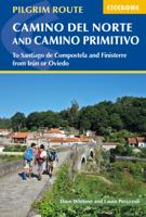
This guidebook describes the Camino del Norte and Camino Primitivo pilgrim routes to Santiago do Compostela in northwest Spain. The 820km Camino del Norte follows the coast from Irún, on the French border, and takes about 5 weeks to complete. The 355km Camino Primitivo splits off from the Camino del Norte near Villaviciosa and passes through Oviedo and Lugo en route to Compostela. It takes roughly 2 weeks to walk. This book also includes an overview of a continuation route from Santiago to Finisterre. Physically demanding, but not difficult, the caminos are best walked from in late spring to autumn.   The guidebook is broken into stages of between 15 and 35km, most of which end in a town or village with a pilgrim albergue. There is indispensable information on facilities, food and lodging, 1:1000 scale maps of the route and town maps for key locations. With notes on preparation and planning, travel and equipment, a list of useful sources of information, and a glossary, the book provid…
23,95
Wandelgids - Pelgrimsroute Camino de Santiago kaartenatlas | Camino Guides Brierley
Gids met kaartmateriaal voor de Jakobsweg van St. Jean Pied de Port, Roncesvalles naar Santiago de Compostela. De wandelkaarten ca. schaal 1:100.000 met begeleidende tekst in Engels, Spaans, Frans, Duits, Portugees, Italiaans, Nederlands en Pools en hoogteprofielen A complete set of maps and town plans in English, Spanish, French, German, Portuguese, Italian, Dutch and Polish make up this indispensable guidebook for spiritual seekers and travellers wishing to walk the way of Saint James. Covering the sacred route from St. Jean Pied de Port to Santiago, this portable book of maps makes the perfect companion for adventurers attempting to heed the spiritual calling.   Revised and updated to offer the most recent information, this exploration is light enough to carry while walking long distances each day. The maps show the location of all pilgrim hostels en route, the distances between villages, and points of interest, as well as counter guides, alternative routes, and accommodations.
21,95

Klanten-reviews van Pelgrimsroute (kaart) - Wandelkaart Camino Frances, wandelen naar Santiago de Compostela | CNIG - Instituto Geográfico Nacional

Er zijn nog geen beoordelingen voor dit productBen jij de eerste die een review plaatst?

Meer over Pelgrimsroute (kaart) - Wandelkaart Camino Frances, wandelen naar Santiago de Compostela | CNIG - Instituto Geográfico Nacional

Productomschrijving

Kaarten voor de Camino Frances: Set van 10 topografische kaarten en een overzichtskaart om te wandelen door Noord Spanje naar Santiago de Compostella, op de kaarten  toeristische informatie (zoals overnachten, restaurants, bussen, winkels, etc) met symbolen aangegeven. De kaarten zijn met UTM grid en geschikt voor gebruik met GPS. Op de kaarten zijn ook hoogteprofielen te vinden. De pelgrimsroute is in 38 etappes en loopt vanaf de grens, Pyreneeen naar Santiago.   The whole of Way of St James to Santiago de Compostela in a set of 11 maps: 10 double-sided topographic maps at 1:50,000 plus an overview map of northern Spain, published by the Spanish civilian survey organization. Descriptions in 6 languages; English, French, Spanish, German, Italian & Portuguese   Each 1:50,000 map is double-sided and has four 57 x 35cm panels with full topographic mapping of the area through which the route passes. Contours are at 50m intervals, with additional shading and colouring/graphics to show several different types of land cover (forests, meadows, olive groves, vineyards, etc.) An overprint highlights the route and its variants. Although the maps, given their scale, are primarily designed for walkers, where appropriate alternatives for cyclists are also marked. Icons indicate various related historical monuments. The maps have a 1km UTM grid, plus margin ticks for latitude and longitude.   Each title also has route profiles for the sections covered by it, plus panels presenting the route annotated with various facilities available in local towns and villages: accommodation, restaurants, food shops, access to trains or busses, bicycle repair shops, etc. The last map has just two panels with 1:50,000 maps but provides on the reverse an aerial view of Santiago de Compostela showing the route from the city's outskirts to the centre, plus a detailed street plan of the centre at 1:3,500 approx. highlighting its famous buildings and recommending four sightseeing routes.   Completing the set is a double-sided, somewhat basic map of northern Spain at 1:500,000 showing the network of main roads plus railways. The overprint highlights only the main route, as presented on the 1:50,000 maps - the coastal variant is not covered. Topography is indicated by relief shading with names of main mountain ranges.


Productinformatie

    Verken gerelateerde categorieën

    Webshop.nl maakt gebruik van cookies. Ga je verder op onze website, ga dan akkoord met het plaatsen van cookies en de verwerking van deze data door ons en vermelde partners.