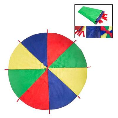
PARACHUTE 2M

0
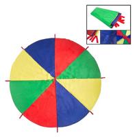
Essential element in the school framework and in leisure activities. It allows you to enjoy recreational activities with guaranteed success at any age, in different games, collaboration and opposition.Parachute 2m: 8 grip handles and no inner hole. Presentation in individual bag...

Verkopers met dit product

Verkoper
Bezorging
Prijs
echtveelvoorweinig.nl logo
echtveelvoorweinig.nl
2-3 werkdagen
6,99
15,72

Anderen bekeken ook

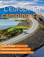
Campergids Europe en camping-car | Michelin
The Camping Car Europe will help you find all the best spots for your camping car holiday in 25 European countries. Camping Car Europe is your perfect travel companion to explore Europe in a Camper and includes 75 suggested itineraries and is packed with practical information on where to stay, what to do as well as information on road regulations in each countries. Camping Car Europe features for each itinerary a presentation of the the country, tourist and leisure activities as well as practical mapping and addresses with service areas, camping and leisure facilities. Camping Car Europe features For each itinerary, you will find - A presentation of each country, climate and cultural heritage - A presentation of suggested itineraries, tourist & leisure activities - A map for your itinerary and the different stops - Practical addresses with service areas, camping, leisure facilities, etc. - Advices from the Michelin Man for an easy drive around Europe The guide is mainly in French, but…
18,50
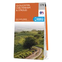
Wandelkaart - Topografische kaart 179 OS Explorer Map Gloucester, Cheltenham, Stroud | Ordnance Survey
The essential map for outdoor activities in Gloucester, Cheltenham and Stroud. The OS Explorer Map is the Ordnance Survey's most detailed folding map and is recommended for anyone enjoying outdoor activities including walking, horse riding and off-road cycling. This map now comes with a digital version which you can download to your smartphone or tablet.Providing complete GB coverage, the OS Explorer map series details information essential in the great outdoors, including youth hostels, pubs and visitor information. Rights of way, fences, permissive paths and bridleways are clearly shown, ensuring you have the best information to get the most out of your time in the countryside. FeaturesCotswold Way Severn Way Gloucestershire Way Macmillan Way Wysis WayCotswold Way (National Trail) GloucesterCheltenhamGloucester Stroud1:25 000 scale (4 cm to 1 km - 2.5 inches to 1 mile) Met zijn 4cm voor 1 km (2 ½ cm voor 1 mijl) schaal, is de OS Explorer kaartenserie de ideale en meest gedetailleerd…
19,50
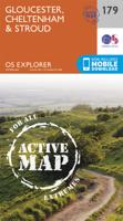
Wandelkaart - Topografische kaart 179 OS Explorer Map | Active Gloucester / Cheltenham / Stroud | Ordnance Survey
The essential map for outdoor activities in Gloucester, Cheltenham and Stroud. The OS Explorer Map is the Ordnance Survey's most detailed folding map and is recommended for anyone enjoying outdoor activities including walking, horse riding and off-road cycling. This map now comes with a digital version which you can download to your smartphone or tablet.Providing complete GB coverage, the OS Explorer map series details information essential in the great outdoors, including youth hostels, pubs and visitor information. Rights of way, fences, permissive paths and bridleways are clearly shown, ensuring you have the best information to get the most out of your time in the countryside. FeaturesCotswold Way Severn Way Gloucestershire Way Macmillan Way Wysis WayCotswold Way (National Trail) GloucesterCheltenhamGloucester Stroud1:25 000 scale (4 cm to 1 km - 2.5 inches to 1 mile)   Met zijn 4cm voor 1 km (2 ½ cm voor 1 mijl) schaal, is de OS Explorer kaartenserie de ideale en meest gedetaillee…
25,95
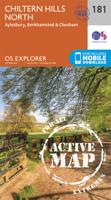
Wandelkaart - Topografische kaart 181 OS Explorer Map | Active Chiltern Hills North | Ordnance Survey
The essential map for outdoor activities in Chiltern Hills North. The OS Explorer Map is the Ordnance Survey's most detailed folding map and is recommended for anyone enjoying outdoor activities including walking, horse riding and off-road cycling. This map now comes with a digital version which you can download to your smartphone or tablet.Providing complete GB coverage, the OS Explorer map series details information essential in the great outdoors, including youth hostels, pubs and visitor information. Rights of way, fences, permissive paths and bridleways are clearly shown, ensuring you have the best information to get the most out of your time in the countryside. FeaturesIcknield Way RidgewayNorth Buckinghamshire Way Icknield Way PathSwan's Way Two Ridges Link Aylesbury RingSouth Bucks Way Chess Valley Walk Chiltern Link Thame Valley WalkGrand Union Canal Walk Midshires Way Bledlow Circular Ride Hertfordshire Way Chiltern WayRidgeway (National Trail) Bedfordshire Buckinghamshire H…
25,95
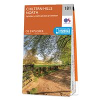
Wandelkaart - Topografische kaart 181 OS Explorer Map Chiltern Hills North | Ordnance Survey
The essential map for outdoor activities in Chiltern Hills North. The OS Explorer Map is the Ordnance Survey's most detailed folding map and is recommended for anyone enjoying outdoor activities including walking, horse riding and off-road cycling. This map now comes with a digital version which you can download to your smartphone or tablet.Providing complete GB coverage, the OS Explorer map series details information essential in the great outdoors, including youth hostels, pubs and visitor information. Rights of way, fences, permissive paths and bridleways are clearly shown, ensuring you have the best information to get the most out of your time in the countryside. FeaturesIcknield Way RidgewayNorth Buckinghamshire Way Icknield Way PathSwan's Way Two Ridges Link Aylesbury RingSouth Bucks Way Chess Valley Walk Chiltern Link Thame Valley WalkGrand Union Canal Walk Midshires Way Bledlow Circular Ride Hertfordshire Way Chiltern WayRidgeway (National Trail) Bedfordshire Buckinghamshire H…
19,50
Asetek SimSports - Forte Formula Button Box (Black, Aluminum)
Asetek SimSports - Forte Formula Button Box (Black, Aluminum)Forte Formula Button BoxFor sim racers who demand peak performance, customization, and control, the Forte Formula Button Box delivers an unparalleled racing experience. Designed with best-in-class ergonomics, this high-performance interface ensures seamless access to every button, switch, and encoder, enabling quick, intuitive adjustments without breaking focus on the track.Precision Engineering for Maximum ControlWith 144 programmable inputs, the Forte Formula Button Box offers limitless customization through RaceHub, allowing you to tailor every function to your driving style. From DRS activation to brake bias adjustments, every input is designed to give you a competitive edge.The durable metal spider chassis reinforces the button box's structure, eliminating flex and ensuring a rigid, long-lasting racing interface. The interchangeable handle system lets you switch grips over time without compromising strength or durability…
549,-
Reisgids - Natuurgids Hidden Beaches | Wild Things Publishing
Wild Swimming British Coast is een gids met beschrijvingen en foto's van de mooiste plekken om te zwemmen in de vrije natuur langs de kust van Engeland, Schotland en Wales (Groot-Brittannie). IThe fully revisied second edition of Wild Swimming Coast now includes even more for walkers, swimmers and explorers: Full national coverage of Britain's most beautiful beaches Lagoons, sea caves and amazing places to snorkel New 1:25,000 Ordnance Survey mapping Best beach cafes, local food, pubs and campsites Where to sea kayak, coasteer and swim with dolphins   Best activities with children and families This revised and expanded edition of the best-selling coastal classic features the same winning formula of stunning photography, engaging travel writing and practical guidance. It is set to continue as the definitive guide to Britain's secret beaches and hidden coastline.   Imagine a summer of swimming and exploring by the sea - finding secret steps down to white sand coves or smugglers' tunnels…
25,95

Klanten-reviews van PARACHUTE 2M

Er zijn nog geen beoordelingen voor dit productBen jij de eerste die een review plaatst?

Meer over PARACHUTE 2M

Productomschrijving

Essential element in the school framework and in leisure activities. It allows you to enjoy recreational activities with guaranteed success at any age, in different games, collaboration and opposition.Parachute 2m: 8 grip handles and no inner hole. Presentation in individual bag

Productinformatie

    Verken gerelateerde categorieën

    Webshop.nl maakt gebruik van cookies. Ga je verder op onze website, ga dan akkoord met het plaatsen van cookies en de verwerking van deze data door ons en vermelde partners.