

Meer PassePartout reizen
Meer PassePartout reizen in Schoolboeken & studieboeken

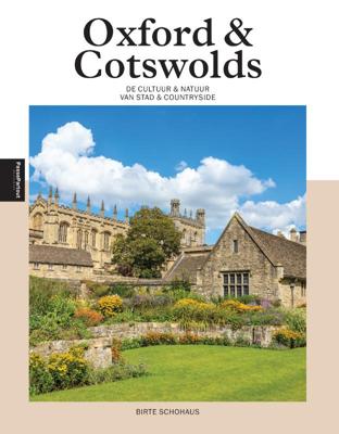
Oxford & Cotswolds (Paperback)

0
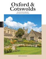
Wie Oxford zegt, heeft het vaak over de beroemde universiteit. En terecht, de stad en de onderwijsinstelling zijn al eeuwen nauw met elkaar verbonden. Sterker nog, de universiteit bepaalt grote delen van het stadsbeeld. Overal stuit je op Harry Potter-achtige bibliotheken en zalen, indrukwekkende collegegebouwen en zie je studenten en docenten in v...

Alle aanbiedingen van dit product

Verkoper
Bezorging
Prijs
Boekenwereld.com logo
Boekenwereld.com
Binnen één werkdag in huis
gratis
24,50

Anderen bekeken ook

Wegenkaart - landkaart Planning Map Oxford & the Cotswolds | Lonely Planet
Durable and waterproof, with a handy slipcase and an easy-fold format, Lonely Planet's Oxford & the Cotswolds Planning Maphelps you get around with ease.   Get more from your map and your trip with images and information about top attractions, itinerary suggestions, a transport guide, planning information, themed lists and practical travel tips.   Durable and waterproof Easy-fold format and convenient size Handy slipcase Full colour and easy to use Before-you-go info Beautiful imagery Tailored itineraries Can't-miss regional highlights Detailed town index Transport planner Themed lists Covers Oxford, the Cotswolds and more   Looking for more coverage? Check out Lonely Planet's Pocket Oxford & the Cotswolds, our small, handy-sized guide featuring the best sights and experiences for a short trip or weekend visit.   About Lonely Planet: Lonely Planet is a leading travel media company and the world's number one travel guidebook brand, providing both inspiring and trustworthy i…
10,95
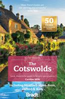
Reisgids Slow Travel Cotswolds | Bradt Travel Guides
Reisgids over een specifiek deel van Engeland met veel cultuur en geschiedenis, maar zeker ook praktische tips zoals je van uitgever Bradt mag verwachten.  In this new, thoroughly updated third edition of Bradt’s The Cotswolds, part of Bradt’s distinctive ‘Slow travel’ series of guides to UK regions, local resident and experienced travel writer Caroline Mills shares her favourite places in a region that remains as popular as ever. Drawing on more than 50 years’ living in the Cotswolds, and combining engaging first-person narrative with authoritative advice, Mills slows readers down and helps them delve deeply into a range of regions: the Cotswolds National Landscape Area of Outstanding Natural Beauty (AONB); the Cotswold escarpment, hills and valleys; the Wiltshire Cotswolds and the area known as the Four Shires; three Cotswold ‘gateways’ (Stratford-upon-Avon, Bath and Oxford); the lesser-known ‘hidden’ fringes of the Cotswolds; and – new for this edition – the Oxfordshire Cotswolds, …
23,95
Fietskaart 02 Cycling guides Cotswolds cycling | Goldeneye
Fietskaart van Cotswold met ondermeer 28 ingetekende rondritten en veel toeristische informatie. Explore the Cotswolds by bike with this laminated, waterproof Cotswolds map. With 28 circular, clearly-marked routes this easy-to-use map will help you discover the best of the Cotswolds along the quietest country lanes. The Cotswolds are ideal for the touring cyclist and day-tripper.   They represent England at her very best. Long, winding lanes connect beautiful villages with excellent pubs and friendly tearooms. The landscape you cycle through is rich in imagery; rolling hills, dry-stone walls, lazy trickling trout streams and quaint, undisturbed hamlets.   Our Cotswold Cycling Country Lanes map includes:* Traffic-free family cycling trails - including the Stroud Valley Cycle Trail, The Oxford Waterway and the Forest of Dean Family Trail with recommendations on where to park. * National Cycle Network routes - the linked series of traffic-free paths and traffic-calmed roads being de…
15,95
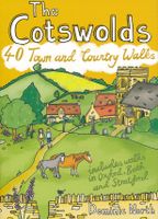
Wandelgids The Cotswolds | Pocket Mountains
Handige compacte wandelgids met 40 dagwandelingen. Deze gids bevat kleine kaartjes en leuke uitgebreide informatie over wat er langs de route te zien is. Goede wandelkaarten zijn echter we noodzakelijk voor deze tochten: de Ordnance Survey explorer maps of Landanger maps zijn zeer geschikt.   From upland outlooks and secret valleys to rolling pastures and honey stone villages, nature and history weave together in the Cotswolds to create a landscape that is the epitome of rural England. In these 40 walks Dominic North unlocks the secrets of the Cotswolds, from the hills and lanes in the north to the languid riverbanks and ancient woods of the south. Along the way discover sleepy villages, grand country houses and architectural curiosities, and then reach out to explore three of England's most celebrated cities, Bath, Oxford and Stratford-upon-Avon. Plaatsen in het boekje Bath, Bathampton, Batsford, Belas Knap, Bibury, Blenheim Park, Blockley, Bourton-on-the-Hill, Bourton-on-the-Water, …
10,95
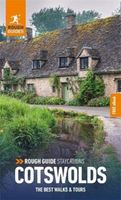
Reisgids Cotswolds | Rough Guides
Handige pocketgids met enkele auto- en wandelroutes.   Inspirational and informative new pocket guide, with free eBook, making the most of holidaying at home in the UK through clearly laid-out walks and tours.   Explore the best of the Cotswolds with this unique travel guide, packed full of insider information and stunning images. From making sure you don't miss out on must-see, top attractions like Stratford-upon-Avon, Cheltenham and Gloucester to discovering cultural gems including the stunning National Arboretum in Westonbirt, a picturesque hike along the Cotswold Way, and a typical Cotswold-stone manor house at Snowshill Manor, the easy-to-follow, ready-made walking and driving routes will save you time, and help you plan and enhance your staycation in the Cotswolds.   Features of this travel guide to the Cotswolds: - Eight walks and tours: detailed itineraries feature all the best places to visit, including where to eat along the way - Local highlights: discover the area's…
12,95
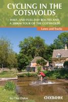
Fietsgids Cycling in the Cotswolds | Cicerone
Guidebook of 21 half and full-day day cycle routes, and one four-day 200km tour of the Cotswolds. All the routes described are suitable for hybrid or mountain bikes, and most routes have an on-road alternative. The Cotswolds boasts cycle-friendly lanes, rolling countryside, canal paths and bridleways perfect for exploration by bike The Cotswolds is home to pretty honey-hued stone villages set in a landscape of rolling countryside. The dramatic 100-mile limestone escarpment offers breathtaking views, while the network of quiet lanes, cycle-friendly canal paths, tracks and bridleways is perfect for exploration on a bicycle.   All the routes described here are suitable for hybrid or mountain bikes and graded from easy through to challenging, with information on surface, distance and ascent as well as those all-important en route cafés and pubs. Where the main cycle route described goes off-road, and on-road alternative is described for almost every ride. Some exciting off-road sections a…
18,95
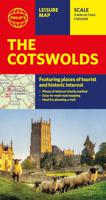
Wegenkaart - landkaart The Cotswolds | Philip's Maps
A new edition of this double-sided map of the Cotswolds clearly featuring places of tourist and historic interest in an easy-to-read style of mapping, alongside six handy town centre plans. This leisure and tourist map of the Cotswolds gives detailed coverage of the area's road network at a scale of approximately 2 miles to 1 inch (1:125,000). The coverage stretches from Abingdon in the east to Gloucester in the west, and from Swindon in the south to Great Malvern in the north. The map shows places of tourist and historic interest, including castles, camping and caravanning sites, country parks, galleries, gardens, golf courses, museums, nature trails, historic sites, sports venues, theatres and wildlife parks. An index to principal places of interest is also featured. With some of the most enchanting towns and cities in England in the area - all with extraordinary history and notable natural beauty - use the Philip's Leisure Map to explore and delight in the Cotswold magic. Includ…
11,50
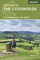
Wandelgids Walking in the Cotswolds | England | Cicerone
A guidebook to 30 circular walks in the Cotswolds, the largest Area of Outstanding Natural Beauty in England. Ranging from 4 to 12 miles in length, the routes are graded from easy to strenuous, offering something for every walker. Fourteen of the routes described include sections of the Cotswold Way National Trail, a 102-mile walk that winds its way from Chipping Campden to Bath.   Step-by-step route descriptions are accompanied by 1:50,000 mapping. There is plenty of information on the many points of interest passed en route, including Roman ruins, ancient stone circles, Neolithic long barrows and historic villages. Also included is a useful route table summary, information on accommodation, and details on the region’s geology, landscape, plants and wildlife.   Covering 790 square miles, the Cotswolds is home to lush green hills, picturesque valleys and beautiful beech woodlands. The impressive Edge – a remarkable limestone escarpment – offers ethereal views across the Vales of the S…
23,95
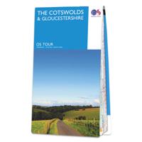
Fietskaart 8 Tour Map The Cotswolds & Gloucestershire | Ordnance Survey
De Ordnance Survey Tour Maps met schaal 1:100.000 zijn uitstekend geschikt om zelf je fietsvakantie te plannen in Engeland. Ze laten alle alle grote en kleinere wegen zien. Bovendien staan de Routes van National Cycle Network ingetekend. Ook erg handig zijn de vermeldingen van campings, jeugdherbergen en andere accommodaties! Kortom de perfecte fietskaart! De kaarten laten alle grote en kleine wegen zien, wel zijn er ter vereenvoudiging andere - met name topografische details - weggelaten. Het is dus kiezen voor een groter gebied (deze kaarten) of een beduidend kleiner gebied met topografische kenmerken zonder ingetekende fietsroutes. (de Landranger 1:50.000 serie). Daarnaast worden op de Tour Maps-serie de Langs Afstands Wandelroutes, Kust Wandel Routes en de National Trails aangegeven. Handig voor het overzicht voor het plannen van een meerdaagse wandelroute.  
11,95

Klanten-reviews van Oxford & Cotswolds (Paperback)

Er zijn nog geen beoordelingen voor dit productBen jij de eerste die een review plaatst?

Meer over Oxford & Cotswolds (Paperback)

Productomschrijving

Wie Oxford zegt, heeft het vaak over de beroemde universiteit. En terecht, de stad en de onderwijsinstelling zijn al eeuwen nauw met elkaar verbonden. Sterker nog, de universiteit bepaalt grote delen van het stadsbeeld. Overal stuit je op Harry Potter-achtige bibliotheken en zalen, indrukwekkende collegegebouwen en zie je studenten en docenten in vol ornaat over straat lopen. Maar Oxford is meer dan haar universiteit. De stad heeft een rijke geschiedenis en verschillende levendige wijken. Het is juist het samenspel tussen town and gown, de stad en de universiteit dus, dat Oxford gemaakt heeft tot wat het is: Een levendige stad die uitnodigt om al haar facetten te ontdekken. Direct om de hoek van Oxford beginnen de Cotswolds, een landelijk gebied met kleine, schattige dorpjes, uitgestrekte velden en beroemde herenhuizen en paleizen. Uitgeroepen tot een 'Area of Outstanding Natural Beauty' is het beschermde gebied ook onder Britten een gewilde vakantiebestemming. Een fantastische

Productinformatie

    Productspecificaties

    Artikelnummer(s)
    EAN
    9789493432468
    Brand
    PassePartout reizen

    Verken gerelateerde categorieën

    Webshop.nl maakt gebruik van cookies. Ga je verder op onze website, ga dan akkoord met het plaatsen van cookies en de verwerking van deze data door ons en vermelde partners.