Opruiming - Fietskaart The Sperrins Region | Sustrans

0
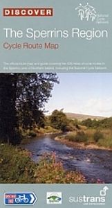
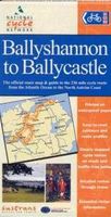
De officiële fietskaart van Sustrans in het natuurgebied De Sperrins. Duidelijk aangegeven fietsroutes op autovrije paden en rustige landschapswegen. Makkelijk leesbaar, gedetailleerde stadsplattegronden, extra achtergrondinformatie en waterbestendig hoesje. The Official Sustrans route map and guide covering the 428 miles of cycle routes in the Sp...

Verkopers met dit product

Webshop
Bezorging
Prijs
DeZwerver.nl logo
DeZwerver.nl
niet bekend
11,75

Anderen bekeken ook

Fietskaart Cycle Map The Bay Cycle Way | Sustrans
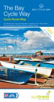
Het is niet een heel overzichtelijke kaart, het zijn juist blokken van een deel van de route waarop deze staat ingetekend. Daarin juist wel heel goed met handige stedenkaarten en route profielen. Eigenlijk voor de route als zodanig onmisbaar, je mist alleen het overzicht een beetje.   This is the official map for the Bay Cycle Way route, an 81 mile (130km) coastal cycle route around Morecambe Bay in the north west of England, and winner of the Visitor Experience Award - Lancashire Tourism Awards 2015. This relatively flat route hugs the spectacular coastline of Morecambe Bay along quiet roads, greenways, canal towpaths and promenades, offering breath taking scenery from Walney Island near Barrow right round to Glasson Dock south of Lancaster. The route looks out over the Irish Sea and is ideal for spotting terns, curlew, knot, oystercatcher and even grey seals.   This full colour map based on Ordnance Survey data shows clearly mapped cycle routes on traffic-free paths, quiet lanes …
14,95
Fietskaart Cycle Map Pennine Cycleway South | Sustrans
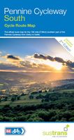
The official route map for the 136-mile (219km) southern part of the Pennine Cycleway on National Cycle Network Route 68 from Derby to Settle.   This linear map shows the route and immediate surrounding area over a series of separate map panels. The full colour map based on Ordnance Survey data shows clearly mapped cycle routes on traffic-free paths, quiet lanes and roads, with easy to read contours, route profiles and mile markers. Also features detailed inset maps for the major towns and cities, tourist info and cycle shop and hire information, and other local routes.   The southern half of the Pennine Cycleway is a beautiful, yet challenging ride which takes you through the dramatic scenery of the Peak District and the South Pennines. The route takes you from the bustling railway city of Derby to the historic town of Settle, taking in the famous spa town of Buxton and the lovely Yorkshire town of Holmfirth, renowned location of the TV classic “Last of the Summer Wine”.   This secti…
13,50
Fietskaart Cycle Route Map Lôn Las Cymru North | Sustrans
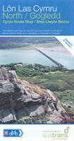
Het is niet een heel overzichtelijke kaart, het zijn juist blokken van een deel van de route waarop deze staat ingetekend. Daarin juist wel heel goed met handige stedenkaarten en route profielen. Eigenlijk voor de route als zodanig onmisbaar, je mist alleen het overzicht een beetje. This linear map shows the northern section of the Lon Las Cymru route and surrounding area over a series of separate map panels.   The route connects Holyhead and Anglesey to Llanidloes in the Wye Valley, the heart of Wales, using minor roads, railway paths, forestry tracks and ancient coach roads. There are some tough challenges as the route crosses the Snowdonia National Park and the range of the Cambrian Mountains.    This full colour map based on Ordnance Survey data shows clearly mapped cycle routes on traffic-free paths, quiet lanes and roads, with easy to read contours and route profiles. Also features detailed inset maps for the major towns and cities and tourist information.   National Cycle Netwo…
16,95
Fietskaart ADFC Regionalkarte Ostwestfalen | BVA BikeMedia
Gedetailleerde fietskaart van populaire regio's in Duitsland: Ostwestfalen Von Minden bis Paderborn, vom Osnabrücker Land bis zur Weser Für Sportliche: Teutoburger Wald, Wiehengebirge, Weserbergland, Eggegebirge Für Genussradler: die Münsterländer Bucht und der Weserradweg   - Ideaal voor dagtochten en weekendtrips - Met suggesties voor dagtochten - Weerbestendig en scheurvast papier  - Zeer gedetailleerde kaart met vermelding van verkeersdrukte, het type wegdek, hoogtelijnen en de hellingen dmv 1 of 2 pijlen - GPX tracks voor thematische routes, fietsroutes en tour suggesties online te downloaden   Official card of the ADFC General German Bicycle Club e.V. The ideal map for planning and carrying out day and weekend bike tours. On a large area of up to 70 x 100 kilometres you will find everything cyclists need. Routes, day tour suggestions, attractions, leisure information and much more. Optimal orientation * clearly designed * easy to handle * all signposted bike paths as well as …
12,95
Reisgids Green Britain & Northern Ireland | Rough Guides
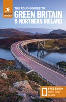
Een kleinere versie van de grotere versies van de Rough Guides. Als altijd weer vol met goede informatie over cultuur en praktische zaken. Achterin kleine plattegronden.   Practical travel guide to Green Britain & Northern Ireland with a free eBook featuring points-of-interest structured lists of all sights and off-the-beaten-track treasures, with detailed colour-coded maps, practical details about what to see and to do in Green Britain & Northern Ireland. The Rough Guide to Green Britain & Northern Ireland also includes details on how to get there and around, pre-departure information, as well as top time-saving tips, like a visual list of things not to miss in Green Britain & Northern Ireland, expert author picks and itineraries to help you plan your trip. This guide book has been fully updated post-COVID-19.     The Rough Guide to Green Britain & Northern Ireland covers: London & the Southeast, the Southwest, Central England, Northern England, Wales, Scotland and Northern Irela…
13,95
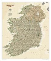
Wandkaart Ierland, antiek, 76 x 92 cm | National Geographic
National Geographic Maps' new Ireland wall map is one of the most authoritative maps yet published of the Emerald Isle. Of the nearly 1,000 place-names shown on this map, all within the Republic of Ireland adhere to that nation's constitution—that the Irish and English language share official status. Thus, Gaelic (Irish) place-names, along with their English variants in parentheses, are shown within Irish-speaking regions while English place-names, along with their Gaelic variants, are shown outside these areas.   Ireland Classic is ideal for those researching their Irish ancestry, a perfect tool for business reference, and a beautiful addition to any décor. It’s one of the largest and most detailed wall maps specifically for Ireland available today. Shown on the map are over 1,000 named places including primary and secondary towns, counties, political boundaries, infrastructure, and selected historical sites for both Ireland and Northern Ireland.   Place-name Details: Per the Republi…
31,95
Fietskaart Reivers Cycle Routes | Northern Heritage Services
The long-distance Reivers Cycle Routes are two intertwining signed / waymarked bi-directional ‘coast to coast’ cycle routes between the North Sea and the Irish Sea.   The original Reivers Cycle Route was created in 1998 eventually becoming NCN Route 10 with interlinking on-road and off-road sections but this soon morphed into a one-size-fits-all route which never worked well. The regenerated re-launched Reivers Cycle Routes are two intertwining route options – one which is as much off-road as possible suitable for gravel and cross bikes, hybrids and mountain bikes and a version designed for capable road cyclists 100% on tarmac.   The routes are bi-directional and continuously reward the rider with beautiful views of the constantly changing terrain, provide many places of interest to pass by or call in and many lovely villages and quiet hamlets to cycle through or stay the night. Most importantly, there is a supply of excellent on route or close-to-route refreshments stops.   The off-r…
16,50
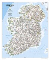
Wandkaart Ireland - Ierland, 76 x 91 cm | National Geographic
National Geographic Maps' new Ireland wall map is one of the most authoritative maps yet published of the Emerald Isle. Of the nearly 1,000 place-names shown on this map, all within the Republic of Ireland adhere to that nation's constitution—that the Irish and English language share official status. Thus, Gaelic (Irish) place-names, along with their English variants in parentheses, are shown within Irish-speaking regions while English place-names, along with their Gaelic variants, are shown outside these areas.   Ireland Classic is ideal for those researching their Irish ancestry, a perfect tool for business reference, and a beautiful addition to any décor. It’s one of the largest and most detailed wall maps specifically for Ireland available today. Shown on the map are over 1,000 named places including primary and secondary towns, counties, political boundaries, infrastructure, and selected historical sites for both Ireland and Northern Ireland.   Place-name Details: Per the Republi…
31,95
Fietskaart The Ultimate UK Cycle Route Planner | Excellent Books
Fully updated and revised 4th edition for 2022 with an increased sheet size. One of the best selling UK cycle publications giving an overview of all the main signed UK cycle routes - the only publication that has all these together on one single map. New clearer map design for 2022 including canal towpaths plus new section on bikepacking and long-distance off-road trails such as the Great North Way and King Alfred's Way.   Author Richard Peace has written and photographed more than 30 cycling titles as well as being a contributor to numerous cycling magazines and websites including Cycle (the official Cycle UK magazine), Road.cc, ebiketips and Freewheeling France websites.  
16,95

Klanten-reviews van Opruiming - Fietskaart The Sperrins Region | Sustrans

Er zijn nog geen beoordelingen voor dit productBen jij de eerste die een review plaatst?

Meer over Opruiming - Fietskaart The Sperrins Region | Sustrans

Productomschrijving

De officiële fietskaart van Sustrans in het natuurgebied De Sperrins.

Duidelijk aangegeven fietsroutes op autovrije paden en rustige landschapswegen. Makkelijk leesbaar, gedetailleerde stadsplattegronden, extra achtergrondinformatie en waterbestendig hoesje.

The Official Sustrans route map and guide covering the 428 miles of cycle routes in the Sperrins area of Northern Ireland, including the National Cycle Network. CTB812

Verken gerelateerde categorieën

Webshop.nl maakt gebruik van cookies. Ga je verder op onze website, ga dan akkoord met het plaatsen van cookies en de verwerking van deze data door ons en vermelde partners.