Opblaasbare wereldbol - globe natuurkundig | ITMB

0
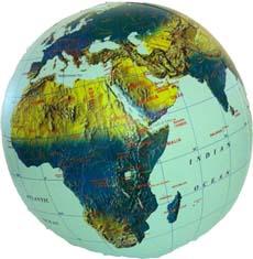
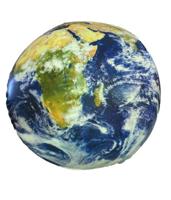
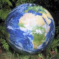
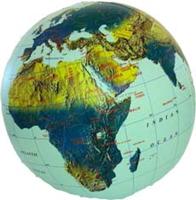
Natuurkundige globe met een diameter van 40 cm. Met een lichtblauwe oceaan, namen van landen en een overzicht van de landgrenzen. Physical Relief 12” Globe Ball with light blue ocean, countries named and borders shown  The inflatables are stored in individual plastic bags with an identifying header stapling it closed. Each label notes the ball is ...

Verkopers met dit product

Verkoper
Bezorging
Prijs
DeZwerver.nl logo
DeZwerver.nl
2,95
12,95

Anderen bekeken ook

Nieuw
Opblaasbare wereldbol - globe World Political | ITMB
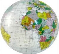
Een staatkundige opblaasglobe, dus elk land heeft zijn eigen kleur. De opblaasglobe heeft een diameter van 40 centimeter. De oceaan is lichtblauw. De wereldsteden staan erop. De globe is vervaardig van sterk plastic. Daardoor is de globe uitermate geschikt voor educatieve doeleinden. Political 16” Globe Ball with light blue ocean, countries shown in differing colours, urban place names  The inflatables are stored in individual plastic bags with an identifying header stapling it closed. Each label notes the ball is phthalate free and safe for children.  
12,95
Wereldbol - Globe Duo XL | Ø 40 Cm | met verlichting | Columbus Verlag
Na 28 drukgangen krijgt het kaartbeeld DUO zijn uiteindelijke vorm en ontstaat de Koning onder de globes. In onverlichte toestand zijn de verschillende landen zichtbaar en is het beeld staatkundig. Met het licht aan toont de globe zijn natuurkundige gezicht waarbij het reliëf op werkelijk schitterende wijze naar voren komt. Bol is van acrylglas en heeft een diameter van 40 cm. Voet en meridiaan zijn van edelstaal. Elektradraad extern. Van de uitgever Desktop globe made of acrylic glass Ø 40 cm, handcrafted, stainless steel mounting.   Since its introduction over 70 years ago, the DUO symbolizes the two-in-one principle: Non-illuminated, the map shows different countries, illuminated, the complex print additionally reveals the physical image - with detailed topography and seemingly three-dimensional elevations.   A complex 120 halftone printing process ensures that even the smallest writings are crystal clear and sharply depicted, down to details like railway and shipping routes and ev…
497,-
Nieuw
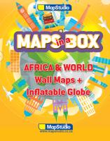
Opblaasbare wereldbol - globe Maps in a Box - Africa & World | MapStudio
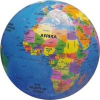
Een leuke set van 2 wandkaarten, de wereld en Afrika, en een opblaasbare globe. Daar de heldere kleuren zijn de landen goed te onderscheiden. Van elk land is ook de hoofdstad weergegeven. De kaarten en globe zijn engelstalig Formaat: - Wandkaart wereld 69 x 100 cm - Wandkaart Afrika 100 x 69 cm - Opblaasbare globe 30 cm World Map updated maps from our reliable map database clear easy-to-read mapping on a large format sheet bright colours with clear legible text all countries of the world & their capitals listed disputed international boundaries bright colours highlighting each country• map legend, north point & scale bar     Africa Map New updated maps from our reliable map database clear easy-to-read mapping on a large format sheet all countries of africa and their capitals bright colours highlighting each country clear legible text locator map showing position of african continent flags of all african countries shown map legend, north point & scale bar major connectin…
24,95
Wereldkaart 22010 natuurkundig, oceaanbodem, 116 x 77 cm | National Geographic
Bijzonder fraaie natuurkundige kaart van National Geographic waarbij het accent ligt op de fysische aspecten van de aarde met veel details van de oceanen. Een schoonheid aan de muur!   Our World Physical - Ocean Floor map highlights the Earth's land and undersea forms with exquisite hand-painted relief. Drawn in the Winkel Tripel projection to minimize distortion of the landforms. Two corner inset maps show the Earth's crust and world climatic zones   .Superb representation of the ocean floor makes this physical map of the world one of the most interesting titles in the National Geographic Society’s long list of wall maps. Drawn with great skill to achieve a 3-D effect, ocean floor plains, basins, continental shelves, trenches, ridges and fractures are shown with their names, indicating in many places their depth in metres.   On land masses relief shading shows the mountain chains, whilst the colouring indicates different types of terrain: arid regions, vegetation, tundra, etc. The ma…
24,95
Barglobe Artemide classic - trolley barglobe | Zoffoli
- Binnenin is plaats voor maximaal 12 glazen en 4 tot 5 flessen - 16e-eeuwse kaart - Draait volledig rond zijn meridiaan, zowel wanneer deze open als gesloten is   De barglobes worden verzonden in een zeer stevige doos en stootvrij verpakt. Wel moet u zelf nog enkele handelingen verrichten: op een simpele manier moeten de delen nog in elkaar worden gezet, maar dat is slechts een kwestie van wat schroeven en bouten volgens de handleiding plaatsen.   Artemide is a chestnut-stained wooden Bar Cabinet. It is perfect to greet your guests with a twist of elegance. A fifty-centimetre-width spherical drinks cabinet with bottle case and glassware storage make the central part of this trolley bar globe. The upper tray offers an excellent surface to store your bar accessories, jugs, glasses and your special wine and liquor bottles. A useful bottom wooden shelf painted with water-based colours is also part of this beautiful Trolley Bar Globe. The globe sphere, whose map is a faithful reproductio…
829,95
Wereldkaart 22090 Natuurkundig - the world physical, 178 x 122 cm | National Geographic
Bijzonder fraaie natuurkundige kaart van National Geographic waarbij het accent ligt op de fysische aspecten van de aarde met veel details van de oceanen. Een schoonheid aan de muur! Our World Physical - Ocean Floor map highlights the Earth's land and undersea forms with exquisite hand-painted relief. Drawn in the Winkel Tripel projection to minimize distortion of the landforms. Two corner inset maps show the Earth's crust and world climatic zones. Scale: 1:24,031,000. Superb representation of the ocean floor makes this 175.5 x 121.5cm (5ft 9” x 4ft approx.) physical map of the world one of the most interesting titles in the National Geographic Society’s long list of wall maps. Drawn with great skill to achieve a 3-D effect, ocean floor plains, basins, continental shelves, trenches, ridges and fractures are shown with their names, indicating in many places their depth in metres. On land masses relief shading shows the mountain chains, whilst the colouring indicates different types of …
52,95
Prikbord Europa Natuurkundig, 135 x 98 cm | Maps International
Maps International's large physical wall map of Europe is one of the finest money can buy.   European Map details: Our large physical wall map of Europe features the natural terrain of the land, with countries marked and international borders shown. The map's key helps to identify the land elevation and water depth. This large European physical wall map also contains city population detail, national capitals and all the major towns and cities in Europe.   Map uses: As with most of our maps, the large physical wall map of Europe, is available in a range of finishes making it suitable for a variety of locations. Major motorways and transport lines are shown on this European wall map making it an ideal map for planning and logistics   Prikbord Prikbord, geplastificeerd met een glans folie, beschrijfbaar met drooguitwisbare stiten, omkaderd met een stijlvol aluminium designprofiel en afgewerkt met ronde, grijze kunststof hoekstukjes. Een pennengoot en standaard ophangmateriaal worden bijg…
219,95

Klanten-reviews van Opblaasbare wereldbol - globe natuurkundig | ITMB

Er zijn nog geen beoordelingen voor dit productBen jij de eerste die een review plaatst?

Meer over Opblaasbare wereldbol - globe natuurkundig | ITMB

Productomschrijving

Natuurkundige globe met een diameter van 40 cm. Met een lichtblauwe oceaan, namen van landen en een overzicht van de landgrenzen.

Physical Relief 12” Globe Ball with light blue ocean, countries named and borders shown  The inflatables are stored in individual plastic bags with an identifying header stapling it closed. Each label notes the ball is phthalate free and safe for children

Verken gerelateerde categorieën

Webshop.nl maakt gebruik van cookies. Ga je verder op onze website, ga dan akkoord met het plaatsen van cookies en de verwerking van deze data door ons en vermelde partners.