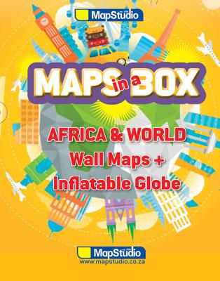
Opblaasbare wereldbol - globe Maps in a Box - Africa & World | MapStudio

0
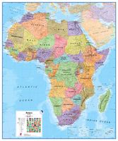
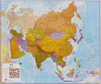
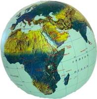
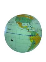
Een leuke set van 2 wandkaarten, de wereld en Afrika, en een opblaasbare globe. Daar de heldere kleuren zijn de landen goed te onderscheiden. Van elk land is ook de hoofdstad weergegeven. De kaarten en globe zijn engelstalig Formaat: - Wandkaart wereld 69 x 100 cm - Wandkaart Afrika 100 x 69 cm - Opblaasbare globe 30 cm World Map updated maps fro...

Verkopers met dit product

Verkoper
Bezorging
Prijs
DeZwerver.nl logo
DeZwerver.nl
5,95
24,95

Anderen bekeken ook

Nieuw
Opblaasbare wereldbol - globe World Political | ITMB
Een staatkundige opblaasglobe, dus elk land heeft zijn eigen kleur. De opblaasglobe heeft een diameter van 40 centimeter. De oceaan is lichtblauw. De wereldsteden staan erop. De globe is vervaardig van sterk plastic. Daardoor is de globe uitermate geschikt voor educatieve doeleinden. Political 16” Globe Ball with light blue ocean, countries shown in differing colours, urban place names  The inflatables are stored in individual plastic bags with an identifying header stapling it closed. Each label notes the ball is phthalate free and safe for children.  
12,95
Nieuw
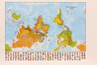
Wereldkaart 71 Wereld upside down, 136 x 100 cm | Maps International
Een totaal andere kijk op de wereld: hang het eens ondersteboven! De mooie heldere kaart van Maps International nu in een upside-down uitvoering. Engelstalig, geplastificeerd, met vlaggen Afwerking: geplastificeerd De wandkaart wordt afgewerkt met een inkapselingsproces. Inkapseling betekent dat de kaarten met warmte worden geperst tussen twee vellen film van industriële kwaliteit. Houd er rekening mee dat de randen van deze kaart niet zijn geplastificeerd.   Inkapseling geeft de kaart een schrijf- / veegafwerking, wat betekent dat met een droog afveegbare marker elk schrift op de kaart kan worden weggeveegd.   View the world from a different direction with Maps International's large political upside down world wall map.  Map details: This is an upside down world wall map with everything reversed! The south is at the top of the map, the north is at the base and the southern hemisphere is now at the top. The countries you expect to see in the east are now on the left of the map, and th…
38,95
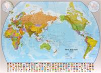
Wereldkaart World pacific-centred wall map, 136 x 100 cm | Maps International
View the world from a different perspective with Maps International's Pacific centred world wall map with flags.    Map details: This Pacific centred wall map shows the world centred along the 150° line of longitude. Instead of parting the map along the Pacific Ocean (as most world wall maps are), this one parts the map along the Atlantic Ocean meaning Europe and the Americas are in separate sides of the map!    Pacific centred world wall map has countries marked in different colours according to international country boundaries. Capital cities (including approximate population size) and hill shading are also shown. Mountain peaks and depths are given on this Pacific centred world wall map. Pacific centred map comes with a panel of country flags displayed on the base of the map.    Map uses: Great for re-learning about world and its geography. Ideal for use in secondary school classrooms and who those wishing to challenge their thinking.   Afwerking: geplastificeerd De wandkaart wor…
37,95
Nieuw
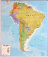
Wandkaart Zuid Amerika, politiek, 100 x 120 cm, geplastificeerd | Maps International
Fraaie politieke kaart van het continent, waarbij vooral de politieke aspecten heel duidelijk te lezen zijn. Alle landen hebben verschillende kleuren, steden en belangrijke verbindingen zijn goed te vinden. Geplastificeerde versie.   Afwerking: geplastificeerd   De wandkaart wordt afgewerkt met een inkapselingsproces. Inkapseling betekent dat de kaarten met warmte worden geperst tussen twee vellen film van industriële kwaliteit. Houd er rekening mee dat de randen van deze kaart niet zijn geplastificeerd.   Inkapseling geeft de kaart een schrijf- / veegafwerking, wat betekent dat met een droog afveegbare marker elk schrift op de kaart kan worden weggeveegd.   Maps International's South America political wall map shows all countries in South America from Venezuela and the Grenadine Islands down to Argentina and the most Southerly points of Chile and the Falkland Islands.    This political wall map of South America features countries marked in different colours, with international b…
38,95
Wereldbol - Globe Duo XL | Ø 40 Cm | met verlichting | Columbus Verlag
Na 28 drukgangen krijgt het kaartbeeld DUO zijn uiteindelijke vorm en ontstaat de Koning onder de globes. In onverlichte toestand zijn de verschillende landen zichtbaar en is het beeld staatkundig. Met het licht aan toont de globe zijn natuurkundige gezicht waarbij het reliëf op werkelijk schitterende wijze naar voren komt. Bol is van acrylglas en heeft een diameter van 40 cm. Voet en meridiaan zijn van edelstaal. Elektradraad extern. Van de uitgever Desktop globe made of acrylic glass Ø 40 cm, handcrafted, stainless steel mounting.   Since its introduction over 70 years ago, the DUO symbolizes the two-in-one principle: Non-illuminated, the map shows different countries, illuminated, the complex print additionally reveals the physical image - with detailed topography and seemingly three-dimensional elevations.   A complex 120 halftone printing process ensures that even the smallest writings are crystal clear and sharply depicted, down to details like railway and shipping routes and ev…
497,-
Wandkaart - Magneetbord Afrika Politiek - Africa Political, 120 x 100 cm | Maps International
Fraaie politieke kaart van het continent, waarbij vooral de politieke aspecten heel duidelijk te lezen zijn. Alle landen hebben verschillende kleuren, steden en belangrijke verbindingen zijn goed te vinden.   De kaart wordt in deze versie gelijmd op een plaat, voorzien van een mooie aluminium lijst en een ophangsysteem wordt meegeleverd. Daarnaast krijgt u een bakje bijgeleverd dat u er aan kunt bevestigen voor pennen, stiften of magneetjes.   Maps International's Africa political wall map shows the whole African continent from Morocco in the north, to South Africa and Madagascar in the south.    This political wall map of Africa features countries marked in different colours, with international borders clearly shown. The map's key shows a panel of flags from each of the countries displayed in this African continent map. This political wall map of Africa also contains population detail, capital cities and all the major towns and cities in this continent.    As with most of Maps Intern…
269,-
Wandkaart - Prikbord Afrika Politiek - Africa Political, 120 x 100 cm | Maps International
Fraaie politieke kaart van het continent, waarbij vooral de politieke aspecten heel duidelijk te lezen zijn. Alle landen hebben verschillende kleuren, steden en belangrijke verbindingen zijn goed te vinden.   De wandkaarten op prikbord worden geleverd met een aluminium lijst en een eenvoudig te monteren ophangsysteem. Zij zijn geschikt voor allerhande markeringsystemen als vlaggetjes en prikkers.   Maps International's Africa political wall map shows the whole African continent from Morocco in the north, to South Africa and Madagascar in the south.    This political wall map of Africa features countries marked in different colours, with international borders clearly shown. The map's key shows a panel of flags from each of the countries displayed in this African continent map. This political wall map of Africa also contains population detail, capital cities and all the major towns and cities in this continent.    As with most of Maps International's maps, the Africa political wall map,…
185,-
Natuurgids The Pocket Guide to Mammals of Southern Africa | Struik Nature
The Pocket Guide to Mammals of Southern Africa is a handy and compact guide to over a 100 mammal species from big cats to mice and bats Each entry contains a detailed description with: Clear, full-color photographs Information on identification, subspecies, mass, shoulder height, vocalization, age, habitat, habits, food, breeding, and male and female differences Details of other species with which the mammal could be confused, and their differences An illustration of typical tracks and their size A Southern Africa distribution map Listed where appropriate are the most recent standards set for trophy hunters by Safari Club International and Rowland Ward Additionally, the pocket guide has: A vegetation map and habitat keys for essential, summarised information at a glance on distribution and preferred habitats A photographic section on dung.An illustrated section on spoor and tracking Easy-to-use and compact, this is the perfect pocket ID guide to mammals of the region. It cover…
16,95
Nieuw
Wandkaart Azië Politiek, 120 x 100 cm | Maps International
Fraaie politieke kaart van het continent, waarbij vooral de politieke aspecten heel duidelijk te lezen zijn. Alle landen hebben verschillende kleuren, steden en belangrijke verbindingen zijn goed te vinden. Papieren versie, geen ophangsysteem. Maps International's political wall map of Asia shows all countries from Turkey in the West to Japan in the East, down to Indonesia in the South of Asia. The largest and most populated continent, Asia has a lot to fit onto a map! Rest assured though, with Maps International's high quality of mapping nothing is missed out! This political wall map of Asia features countries marked in different colours, with international borders clearly shown. The map's key shows the flags from the countries displayed in this map. This Asia physical wall map also contains city population detail, capital cities and all the major towns and cities in this continent of Asia.
27,95

Klanten-reviews van Opblaasbare wereldbol - globe Maps in a Box - Africa & World | MapStudio

Er zijn nog geen beoordelingen voor dit productBen jij de eerste die een review plaatst?

Meer over Opblaasbare wereldbol - globe Maps in a Box - Africa & World | MapStudio

Productomschrijving

Een leuke set van 2 wandkaarten, de wereld en Afrika, en een opblaasbare globe. Daar de heldere kleuren zijn de landen goed te onderscheiden. Van elk land is ook de hoofdstad weergegeven.
De kaarten en globe zijn engelstalig

Formaat:
- Wandkaart wereld 69 x 100 cm
- Wandkaart Afrika 100 x 69 cm
- Opblaasbare globe 30 cm

World Map
  • updated maps from our reliable map database
  • clear easy-to-read mapping on a large format sheet
  • bright colours with clear legible text
  • all countries of the world & their capitals listed
  • disputed international boundaries
  • bright colours highlighting each country• map legend, north point & scale bar
    Africa Map
  • New updated maps from our reliable map database
  • clear easy-to-read mapping on a large format sheet
  • all countries of africa and their capitals
  • bright colours highlighting each country
  • clear legible text
  • locator map showing position of african continent
  • flags of all african countries shown
  • map legend, north point & scale bar
  • major connecting roads
    Inflatable Globe
  • Learner-friendly type
  • great educational tool
  • colour coded countries
  • capital cities
  • latitude & longitude
  • international boundaries
  • elevation
  • international time zones
  • international date line
  • physical features
  • oceans & seas
  • drainage


Verken gerelateerde categorieën

Webshop.nl maakt gebruik van cookies. Ga je verder op onze website, ga dan akkoord met het plaatsen van cookies en de verwerking van deze data door ons en vermelde partners.