Meer Boom Uitgevers Den Haag

Navigating the Right to Housing (Paperback)

0
This book is a compilation of papers written by research assistants, PhD students, and senior researchers working on the EVICT project, a European Research Council (ERC) Starting Grant project. The papers in this book enrich our conceptual understanding of the right to adequate housing by expanding on the typology of access rights, occupancy rights...

Verkopers met dit product

Verkoper
Bezorging
Prijs

Anderen bekeken ook

Learning how to teach in higher education (Paperback)
'Learning How to Teach in Higher Education' focuses on the daily practice of teachers in higher education. Even though their role is changing, teachers are crucial for students. After all, it is up to the instructor to shape teaching in such a way that students achieve maximum learning outcomes. 'Learning How to Teach in Higher Education' is intended for beginning teachers in higher education, but it is also an excellent reference work for more experienced teachers who are looking for practical tips or a theoretical foundation. The book covers four themes: 1. How do students learn? 2. What should students learn and how do they demonstrate it? 3. How do students reach the desired final level? 4. The evaluation and development of education. The focus is on campus-based education; the interaction between teachers and students in a physical environment. There is also ample attention to online and/or blended forms of education. Using examples, diagrams, models and skills sheets, the authors
61,50
Nieuw
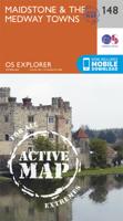
Wandelkaart - Topografische kaart 148 OS Explorer Map | Active Maidstone / the Medway Towns | Ordnance Survey
Walk a beautiful stretch of the North Downs Way offering spectacular views of the Kent Downs, Medway Valley and towards the Channel. Discover Kentish villages with their distinctive oast-house chimneys, vineyards on sunny slopes and romantic ruins as you head towards Rochester and its imposing castle guarding the road to London.    Visit the Historic Dockyard Chatham, a beautifully-preserved relic of the Age of Sail home to three historic warships and much more  Travel back in time at Leeds Castle near Maidstone, described as ‘the loveliest castle in the world’, or even further back at the megalithic dolmen known as Kit’s Coty  Walk, hike or cycle along the North Downs Way and other recreational maps including the Medway Valley Walk and Wealdway Met zijn 4cm voor 1 km (2 ½ cm voor 1 mijl) schaal, is de OS Explorer kaartenserie de ideale en meest gedetailleerde kaartenreeks voor mensen die graag outdoor-activiteiten zoals fietsen, wandelen, paardrijden, klimmen en watersporten.   Deze …
25,95
Nieuw
Wandelkaart - Topografische kaart 179 OS Explorer Map | Active Gloucester / Cheltenham / Stroud | Ordnance Survey
The essential map for outdoor activities in Gloucester, Cheltenham and Stroud. The OS Explorer Map is the Ordnance Survey's most detailed folding map and is recommended for anyone enjoying outdoor activities including walking, horse riding and off-road cycling. This map now comes with a digital version which you can download to your smartphone or tablet.Providing complete GB coverage, the OS Explorer map series details information essential in the great outdoors, including youth hostels, pubs and visitor information. Rights of way, fences, permissive paths and bridleways are clearly shown, ensuring you have the best information to get the most out of your time in the countryside. FeaturesCotswold Way Severn Way Gloucestershire Way Macmillan Way Wysis WayCotswold Way (National Trail) GloucesterCheltenhamGloucester Stroud1:25 000 scale (4 cm to 1 km - 2.5 inches to 1 mile)   Met zijn 4cm voor 1 km (2 ½ cm voor 1 mijl) schaal, is de OS Explorer kaartenserie de ideale en meest gedetaillee…
25,95
Nieuw
Wandelkaart - Topografische kaart 181 OS Explorer Map | Active Chiltern Hills North | Ordnance Survey
The essential map for outdoor activities in Chiltern Hills North. The OS Explorer Map is the Ordnance Survey's most detailed folding map and is recommended for anyone enjoying outdoor activities including walking, horse riding and off-road cycling. This map now comes with a digital version which you can download to your smartphone or tablet.Providing complete GB coverage, the OS Explorer map series details information essential in the great outdoors, including youth hostels, pubs and visitor information. Rights of way, fences, permissive paths and bridleways are clearly shown, ensuring you have the best information to get the most out of your time in the countryside. FeaturesIcknield Way RidgewayNorth Buckinghamshire Way Icknield Way PathSwan's Way Two Ridges Link Aylesbury RingSouth Bucks Way Chess Valley Walk Chiltern Link Thame Valley WalkGrand Union Canal Walk Midshires Way Bledlow Circular Ride Hertfordshire Way Chiltern WayRidgeway (National Trail) Bedfordshire Buckinghamshire H…
25,95
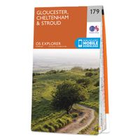
Wandelkaart - Topografische kaart 179 OS Explorer Map Gloucester, Cheltenham, Stroud | Ordnance Survey
The essential map for outdoor activities in Gloucester, Cheltenham and Stroud. The OS Explorer Map is the Ordnance Survey's most detailed folding map and is recommended for anyone enjoying outdoor activities including walking, horse riding and off-road cycling. This map now comes with a digital version which you can download to your smartphone or tablet.Providing complete GB coverage, the OS Explorer map series details information essential in the great outdoors, including youth hostels, pubs and visitor information. Rights of way, fences, permissive paths and bridleways are clearly shown, ensuring you have the best information to get the most out of your time in the countryside. FeaturesCotswold Way Severn Way Gloucestershire Way Macmillan Way Wysis WayCotswold Way (National Trail) GloucesterCheltenhamGloucester Stroud1:25 000 scale (4 cm to 1 km - 2.5 inches to 1 mile) Met zijn 4cm voor 1 km (2 ½ cm voor 1 mijl) schaal, is de OS Explorer kaartenserie de ideale en meest gedetailleerd…
19,50
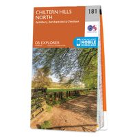
Wandelkaart - Topografische kaart 181 OS Explorer Map Chiltern Hills North | Ordnance Survey
The essential map for outdoor activities in Chiltern Hills North. The OS Explorer Map is the Ordnance Survey's most detailed folding map and is recommended for anyone enjoying outdoor activities including walking, horse riding and off-road cycling. This map now comes with a digital version which you can download to your smartphone or tablet.Providing complete GB coverage, the OS Explorer map series details information essential in the great outdoors, including youth hostels, pubs and visitor information. Rights of way, fences, permissive paths and bridleways are clearly shown, ensuring you have the best information to get the most out of your time in the countryside. FeaturesIcknield Way RidgewayNorth Buckinghamshire Way Icknield Way PathSwan's Way Two Ridges Link Aylesbury RingSouth Bucks Way Chess Valley Walk Chiltern Link Thame Valley WalkGrand Union Canal Walk Midshires Way Bledlow Circular Ride Hertfordshire Way Chiltern WayRidgeway (National Trail) Bedfordshire Buckinghamshire H…
19,50
Affordable Condominium Housing (Paperback)
The aim of this study is to gain more insight into how homeowner's associations work in low-income owner-occupied apartments. When parts of the residential buildings such as the ground on which they are built and the infrastructure are joint property, then a homeowners' association is necessary to keep maintenance of the common property parts. The lack of maintenance of these communal areas is a problem of increasing proportions, which has prompted this research. Which factors play a decisive role in how homeowner's associations function and how building maintenance is organized, how important is the horizontal property law and how does this affect low-income housing policy in Colombia and Ecuador?
29,95
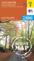
Wandelkaart - Topografische kaart OL08 OS Explorer Map Chichester, South Harting & Selsey | Ordnance Survey
Explore the South Downs National Park, follow the South Downs Way up to the picturesque village of South Harting sheltered beneath Harting Down. Discover Chichester Harbour with its delightful fishing villages or range further afield to Selsey at the tip of the Manhood Peninsula.    Seek unspoiled coastlines and countryside on Hayling Island, where windsurfing was invented  Marvel at Chichester’s intact Roman walls and cathedral tower now home to a family of peregrine falcons  Walk or cycle the South Downs Way through gorgeous countryside past South Harting, or explore Chichester Harbour on the Sussex Border Path and Shipwrights Way    Met zijn 4cm voor 1 km (2 ½ cm voor 1 mijl) schaal, is de OS Explorer kaartenserie de ideale en meest gedetailleerde kaartenreeks voor mensen die graag outdoor-activiteiten zoals fietsen, wandelen, paardrijden, klimmen en watersporten. Deze kaart is nog gedetailleerder dan de 'gewone' Landranger maps. Voor- en achterzijde bedrukt! Zeker op de moors e…
19,50
Nieuw
Wandelkaart - Topografische kaart 8 OS Explorer Map | Active Chichester South Harting area | Ordnance Survey
Explore the South Downs National Park, follow the South Downs Way up to the picturesque village of South Harting sheltered beneath Harting Down. Discover Chichester Harbour with its delightful fishing villages or range further afield to Selsey at the tip of the Manhood Peninsula.    Seek unspoiled coastlines and countryside on Hayling Island, where windsurfing was invented  Marvel at Chichester’s intact Roman walls and cathedral tower now home to a family of peregrine falcons  Walk or cycle the South Downs Way through gorgeous countryside past South Harting, or explore Chichester Harbour on the Sussex Border Path and Shipwrights Way    Met zijn 4cm voor 1 km (2 ½ cm voor 1 mijl) schaal, is de OS Explorer kaartenserie de ideale en meest gedetailleerde kaartenreeks voor mensen die graag outdoor-activiteiten zoals fietsen, wandelen, paardrijden, klimmen en watersporten.   Deze kaart is nog gedetailleerder dan de 'gewone' Landranger maps. Voor- en achterzijde bedrukt! Zeker op de moors en…
25,95
Reisgids Slow Travel Cambridgeshire and the Fens | Bradt Travel Guides
Een bijzondere serie van Bradt guides, waarin een gedeelte van Engeland uitgebreid beschreven wordt. Met veel aandacht voor kleine details die je niet al gauw elders zult vinden. Naast de beschrijvende informatie vind je ook een schat aan praktische informatie als accommodatie-adressen of leuke pubs. Een aanrader! This new book adds Cambridgeshire and the Fens to Bradt's award-winning Slow Travel series - the biggest series of UK regional travel guides, now over 20 titles strong. No other title offers the range and depth of information on this varied, beautiful and surprisingly undiscovered region. Cambridge itself attracts visitors, students, professionals and academics from around the world, but beyond the University City lie towns and villages, wide open spaces, gentle waterways and wonderful cycling and walking country that comparatively few take time to discover. Engaging and unexpected, this is an informative guide that captures both the stand-out highlights and lesser-known att…
22,50

Klanten-reviews van Navigating the Right to Housing (Paperback)

Er zijn nog geen beoordelingen voor dit productBen jij de eerste die een review plaatst?

Meer over Navigating the Right to Housing (Paperback)

Productomschrijving

This book is a compilation of papers written by research assistants, PhD students, and senior researchers working on the EVICT project, a European Research Council (ERC) Starting Grant project. The papers in this book enrich our conceptual understanding of the right to adequate housing by expanding on the typology of access rights, occupancy rights, and exit rights to housing. The authors traverse a diverse array of topics, shedding light on pressing issues such as housing shortages, challenges faced by students and minority groups in search of a home, the intricate link between domestic violence and homelessness, the dynamics of the black housing market, the criminalisation of homelessness, evictions, and the relationship between the right to housing and other human rights, such as the right to privacy and the right to property. The papers focus on a broad range of jurisdictions, such as France, Romania, Sweden, Turkey, the Netherlands, Bulgaria, Spain, the United States, and

Productspecificaties

Artikelnummer(s)
Brand
Boom Uitgevers Den Haag
Webshop.nl maakt gebruik van cookies. Ga je verder op onze website, ga dan akkoord met het plaatsen van cookies en de verwerking van deze data door ons en vermelde partners.