Mountainbikegids Lake District Mountain Biking - Essential Trails | Vertebrate Publishing

0
Lake District Mountain Biking - Essential Trails is the full third edition of the bestselling guide to some of the finest mountain bike riding in the UK. Featured are over 20 of the best mountain bike rides in the Lake District, between 12 and 60 kilometres in length, suitable for all levels of mountain bikers. Explore classic rides around Walna S...

Verkopers met dit product

Verkoper
Bezorging
Prijs
DeZwerver.nl logo
DeZwerver.nl
2,95
23,95

Anderen bekeken ook

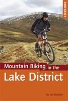
Mountainbikegids Mountain Biking in the Lake District | Cicerone
Mountain biking in the Lake District describes 24 routes in the Lakes, offering some of the best MTB riding in the UK. The routes are suitable for all abilities of riders, arranged by difficulty, from Kendal to Cleator Moor in the far north-west and Keswick to Winster in the Lyth Valley.SeasonsAlthough it is recommended that a few of the routes should only be done during periods of good weather, most can be ridden all year round.CentresThrelkeld, Pooley Bridge, Cleator Moor, Muncaster, Torver, Grizedale, Hawkshead, Ambleside, Elterwater, Kendal, Staveley, High Newton, Spark Bridge, WinsterDifficultyRoutes are graded blue (medium), red (hard) and black (very hard). Novice MTBers with reasonable bike-handling skills should be able to complete the blue routes, while experts should be challenged by the red and, more so, the black routes.Must SeeThe dramatic Garburn and Gatesgarth passes; views of Coniston Water, Esthwaite Water, Grasmere, Rydal Water, Elterwater, Ulswater, Derwent Water an…
19,95
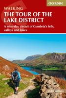
Wandelgids Tour of the Lake District | Cicerone
Engelstalige beschrijving van de mooiste wandeltocht in het Lake district. De gids voldoet aan alle verwachtingen die je kunt hebben, het enige dat je mist is een overzichtskaart. Inclusief gidsje met routekaarten van 1:25000 The Lake District National Park is England's most popular mountain region and is designated as a UNESCO World Heritage site. Suitable for most reasonably fit hillwalkers, the 145km (90 mile) Tour of the Lake District takes in the best of this beautiful region in a circular tour. The route is presented in nine stages, plus an optional 'prologue' stage from Windermere station to the start-point in Ambleside, and can be compressed into one week or extended over two weeks, giving time to visit many attractions on the way.   In addition to the main (non-waymarked) route, which links the main towns and valleys of the national park, five interchangeable high-level stages are also offered, enabling you to visit some of the region's most celebrated high peaks - including …
20,95
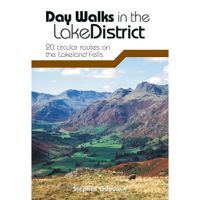
Wandelgids Day Walks in the Lake District | Vertebrate Publishing
Day Walks in the Lake District features 20 circular routes between 5 and 13 miles (8 and 21 kilometres) in length, suitable for hillwalkers of all abilities. The routes are split into four geographical areas - north, east, south and west - and include walks from the main tourist bases, such as Keswick and Ambleside, as well as sought after peaks, such as Scafell Pike, Great Gable, Blencathra and Helvellyn. Also included for the adventurous are the Lake District's best known scrambles - Striding Edge on Helvellyn and Sharp Edge on Blencathra - together with more accessible alternatives.   The author of this guidebook, Stephen Goodwin, is a former freelance journalist (former staff writer for The Independent), and a Lake District local. In his introductions to each route he recalls the tales of Wordsworth, Walpole and the fascinating history of Lakeland and its peaks and fells. Each route in this guide is described with easy-to-follow directions and details of distance, navigation infor…
20,95
Wandelkaart 01 Jasper National Park & Maligne Lake | Gem Trek Maps
Scheur- en Watervast papier Gem Trek’s JASPER AND MALIGNE LAKE MAP map is designed for outdoor enthusiasts looking to explore the section of Jasper National Park near the town and out to Maligne Lake. Whether you are touring along the roads or heading into the backcountry, you’ll find the waterproof and tear-resistant Jasper & Maligne Lake Map to be an invaluable tool.   This map features detailed cartography, accurate hiking trails with distances, and details such as campgrounds, equestrian routes, picnic areas, and fire lookouts. On the back of the map are trail descriptions and photos of 18 recommended day hikes, four overnight or multi-day trips, and six classic mountain bike rides. Each of these described trails is referenced and colour-coded to the map on the front. Also on the back is contact information for Jasper National Park, as well for as the three backcountry lodges located in the Tonquin Valley and on the Skyline Trail.   Jasper & Maligne Lake Map Coverage The Jas…
16,95
Wandelkaart - Topografische kaart 201 Trails Illustrated Yellowstone National Park | National Geographic
Prachtige geplastificeerde kaart van het bekende nationaal park. Met alle recreatieve voorzieningen als campsites, maar ook met topografische details en wandelroutes ed. Door uitgekiend kleurgebruik zeer prettig in gebruik. Scheur en watervast! National Geographic's Trails Illustrated map of Yellowstone National Park is designed to meet the needs of outdoor enthusiasts by combining valuable information with unmatched detail of America's first national park. Expertly researched and created in partnership with local land management agencies, this map features key points of interest including Mammoth Hot Springs, Canyon Village, Yellowstone Lake, Yellowstone Falls, Grant Village, and Old Faithful geyser area.   With over 1,000 miles of mapped trails, the Yellowstone National Park map can guide you off the beaten path and back again. The clearly marked trails include mileages between intersections. Trail summaries provide elevation, duration, and difficulty for a variety of suggested hike…
16,95
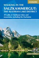
Wandelgids Walking in the Salzkammergut - the Austrian Lake District | Cicerone
Guidebook describing 30 day walks among the lakes and mountains of Austria's Salzkammergut. Easily accessible from Salzburg, the area is sometimes described as the Austrian Lake District. Routes range from easy lakeside strolls and walks to local points of interest to more strenuous through-routes and ascents of the neighbouring peaks. Guidebook of 30 stunning day walks in the beautiful Salzkammergut lake district of Austria. Easy to get to from Linz and Salzburg, the area is studded with lakes and bristling with mountain peaks, and has a great range of waymarked trails, from lakeside strolls to challenging mountain walks. The routes in this book are within the capabilities of any reasonably fit walker, many are suitable for family hiking, and cablecars and lifts can often be used to make walks shorter or easier. Walks range from 6 to 16km and a simple grading system makes it easy to choose the right one.   Walks are centred around a number of bases, such as Bad Ischl, Fuschl am See, …
24,95
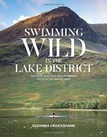
Reisgids Swimming Wild in the Lake District | Vertebrate Publishing
Deze zwemgids van het lake district bevat praktische informatie over de beste plekken om te zwemmen in de vele prachtige meren van het Lake District. Daarnaast geeft de auteur haar eigen ervaringen en tips over wildzwemmen in dit gebied.   Shortlisted: TGO Magazine Outdoor Book of the Year   Swimming Wild in the Lake District by Suzanna Cruickshank is an informative and inspiring book for both new and experienced wild swimmers, exploring the larger lakes in the beautiful Lake District National Park. The book explores secluded wild swimming locations in the tourist hotspots of Windermere and Derwent Water and takes you to the tranquil hidden gems of Bassenthwaite, Crummock Water and Devoke Water, with the emphasis on taking time to enjoy the stunning surroundings. Imagine yourself gliding through clear, still water, surrounded by rugged fells, with only the sound of birdsong to accompany you.   The book is full of useful tips for both new and experienced wild swimmers; it contains sect…
24,95
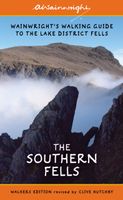
Wandelgids The Southern Fells | Lake District | Frances Lincoln
One name above all others has become associated with walking in the Lake District: Alfred Wainwright, whose seven-volume Pictorial Guide to the Lakeland Fells, first published in 1955–66, has become the definitive guidebook. Wainwright’s meticulously hand-drawn maps, diagrams and drawings take walkers up the 214 principal hills and mountains of the Lake District, describing the main routes of ascent from different starting points, as well as lesser-known variants, showing the summit viewpoint panoramas and the ridge routes that can be made to create longer walks. Every page combines words and illustrations to present the routes in a way that is original, visually appealing and easy to follow. This new edition of Wainwright’s Walking Guide to the Lake District Fells has been comprehensively revised. Paths, maps, diagrams and route descriptions have been checked and corrected throughout. These revisions have been undertaken by writer and designer Clive Hutchby, author of The Wainwright …
23,50
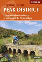
Fietsgids Cycling in the Peak District | Cicerone
Guide to cycling in and around the Peak District National Park, on road or trail bike. 20 day routes and one multi-day cycle tour of the Peak District. All easily accessible from Sheffield and Manchester with routes starting from charming Derbyshire towns such as Ashbourne, Matlock, Bakewell and Buxton. Includes route profiles and 1:100000 mapping. The scenic Peak District boasts an abundance of country lanes, tracks, towpaths and railway trails that are perfect for two-wheeled exploration. This guidebook presents 20 graded day rides in the national park, along with a challenging 250km route, the five-day 'Tour de Peak District'. With a focus on quiet lanes, gratifying downhills and not overly technical bridleways, tracks and trails, the routes are ideal for gravel/adventure bikes (or hybrid/cross), though most can be easily adapted for road bikes.   Each ride features step-by-step route description accompanied by 1:100,000 mapping. Overview stats are provided to aid route selection, …
18,50
Wandelkaart - Topografische kaart 748 Green Mountain National Forest South - Robert T. Stafford White Rocks NRA - Manchester | National Geographic
Prachtige geplastificeerde kaart van het bekende nationaal park. Met alle recreatieve voorzieningen als campsites, maar ook met topografische details en wandelroutes ed. Door uitgekiend kleurgebruik zeer prettig in gebruik. Scheur en watervast! National Geographic's Green Mountain National Forest South Trails Illustrated topographic map is the most comprehensive available for outdoor enthusiasts of all types. Designed to be easy-to-read, yet highly detailed – this map includes a comprehensive road and trail network distinguishing between major, secondary and 4x4 roads, hiking, horse, biking, multi-use and non-motorized winter trails. All forest roads are labeled with their official road number and trails are clearly identified with their given name. Land management boundaries are color-coded showing National Forest, Ranger District, Wilderness Areas, Conservation Areas and more, plus the locations of private land within the Green Mountain National Forest. The renowned Appalachian Trai…
17,95

Klanten-reviews van Mountainbikegids Lake District Mountain Biking - Essential Trails | Vertebrate Publishing

Er zijn nog geen beoordelingen voor dit productBen jij de eerste die een review plaatst?

Meer over Mountainbikegids Lake District Mountain Biking - Essential Trails | Vertebrate Publishing

Productomschrijving

Lake District Mountain Biking - Essential Trails is the full third edition of the bestselling guide to some of the finest mountain bike riding in the UK. Featured are over 20 of the best mountain bike rides in the Lake District, between 12 and 60 kilometres in length, suitable for all levels of mountain bikers. Explore classic rides around Walna Scar, High Street and Borrowdale, and discover several lesser-known gems.   Ride moorland singletrack, tackle massive climbs and rattle along some of the rockiest trails you'll ever encounter on two wheels. Enjoy lakeside cruises, picturesque valleys and 360-degree panoramas. Researched, ridden and written by local riders Richard Staton and Chris Gore, each route features clear and easy to use Ordnance Survey 1:50,000 maps; easy-to-follow directions; details of distance, timings and difficulty gradings; and refreshment stops and local knowledge.   A Bonus Section includes information about the man-made trails at Whinlatter and Grizedale, Top Tens and a detailed Appendix. Also includes downloadable GPX files.

Productinformatie

    Verken gerelateerde categorieën

    Webshop.nl maakt gebruik van cookies. Ga je verder op onze website, ga dan akkoord met het plaatsen van cookies en de verwerking van deze data door ons en vermelde partners.