webshop.nl
Categorieën
  Sluiten

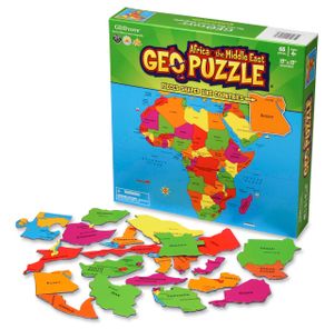
Kinderpuzzel GeoPuzzle Africa and the Middle East - Afrika en het Midden Oosten | GEOtoys

Unieke, educatieve puzzel van Afrika en het Midden Oosten met 65 puzzelstukjes in landvormen.  Gemaakt van gerecycled materiaal en ontwikkeld voor kinderen vanaf 4 jaar.   GeoPuzzles are maps of the major continents, with pieces shaped like individual countries. By putting together a GeoPuzzle, children learn what countries look like, what their na...
18,95

Webshops met dit product

Webshop
Bezorging
Prijs

Anderen bekeken ook

Kinderpuzzel GeoPuzzle Latin America - Latijns Amerika | GEOtoys
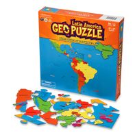
Unieke, educatieve puzzel van Latijns Amerika met 50 puzzelstukjes in landvormen.  Gemaakt van gerecycled materiaal en ontwikkeld voor kinderen vanaf 4 jaar.   GeoPuzzles are maps of the major continents, with pieces shaped like individual countries. By putting together a GeoPuzzle, children learn what countries look like, what their names are, and where they are in relation to one another. At 50-70 pieces, the puzzles are perfect for ages 4-12. Designed by an art professor, GeoPuzzles are generously sized, brightly colored, and each piece is large enough to be easily handled.    
18,95
Kinderpuzzel GeoPuzzel Wereld | GEOtoys
Unieke, educatieve puzzel van de wereld met 68 puzzelstukjes in de landvormen of de vorm van landengroepen De buitenste stukjes vormen een frame om de landvormige stukjes op de plaats te houden. Gemaakt van gerecycled materiaal en ontwikkeld voor kinderen vanaf 4 jaar. From Afghanistan and Belgium to Venezuela and Zimbabwe, multiple award-winning GeoPuzzles make learning geography fun! Each Geopuzzle has pieces shaped like countries, and helps to build fine motor, cognitive, language, and problem-solving skills. GeoPuzzle World has 68 pieces, with pieces shaped like individual countries and groups of countries. The outside of the puzzle forms a frame to keep the rest of the pieces, which are country-shaped, in place.    GeoPuzzle World is a jumbo-sized 26 x 12.5 inches. Ages 4 and up. Made in Germany and USA from recycled materials.
17,95
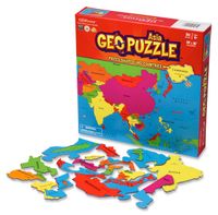
Kinderpuzzel GeoPuzzle Asia - Azië | GEOtoys
Unieke, educatieve puzzel van Azië met 50 puzzelstukjes in landvormen.  Gemaakt van gerecycled materiaal en ontwikkeld voor kinderen vanaf 4 jaar.   GeoPuzzles are maps of the major continents, with pieces shaped like individual countries. By putting together a GeoPuzzle, children learn what countries look like, what their names are, and where they are in relation to one another. At 50-70 pieces, the puzzles are perfect for ages 4-12. Designed by an art professor, GeoPuzzles are generously sized, brightly colored, and each piece is large enough to be easily handled.   The Asia GeoPuzzle does not include the Middle East. Though the Middle East is geographically part of the Asian landmass, it is culturally associated with North Africa. The Middle East has been included with the Africa GeoPuzzle.   GeoPuzzle Asia has 50 pieces, and is a jumbo-sized 19 x 16 inches.
18,95
Wegenkaart - landkaart Africa east & central - Afrika oost en centraal | ITMB
This is the latest map from our growing digital data base on Africa. One side of this map concentrates on the five countries of what is generally known as East Africa - Kenya, Uganda, Tanzania, Rwanda, Burundi, with bits of neighboring countries thrown in. The second side covers what has always been called Central Africa, probably because it was once British Central Africa. This is Zambia,Zimbabwe, and Malawi, with the northern half of Mozambique and the Okavango delta included, as well as a bit of DEM Congo. The map covers a vast portion of the African continent and includes a diverse ethnic and geographic reality. We have tried to categorize roads by condition, but the reality of Africa is that some main roads are in pretty poor condition. Some secondary roads are not shown as being as good as they probably are, but verifying data for Africa is difficult. This is our first map of this part of the world based on GIS Data. As such, it is much more precisely accurate than anything done …
13,95
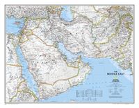
Magneetbord Middle East - Midden Oosten | National Geographic
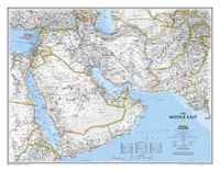
Magneetbord - Wandkaart van het Midden Oosten, met o.a. Afghanistan - Pakistan - National Geographic wandkaart geplastificeerd - Afmeting ca 76 x 58cm    National Geographic Maps' recently updated wall map of the Middle East region, formerly titled Afghanistan/Pakistan and the Middle East.   Includes updated place names and the addition of significant locations currently in the news, such as Marjah, Afghanistan. This wall map covers a broad geographic area ranging from northern Africa through the Middle East to the western edge of China and India.   Includes complete coverage of Afghanistan, Pakistan, Tajikistan, Iran, Iraq, Kuwait, Syria, Israel, Jordan, Lebanon, Saudi Arabia, Qatar, Bahrain, United Arab Emirates, Yemen, Oman, Cyprus, and Eritrea.   Also includes parts of India, China, Kyrgyzstan, Uzbekistan, Turkmenistan, Azerbaijan, Armenia, Turkey, Egypt, Sudan, Ethiopia, and Djibouti. Features thousands of place names, accurate political boundaries, archeological sites, and major …
189,-
Wegenkaart - landkaart Africa Equatorial - Afrika midden | ITMB
This is the third of our regional maps covering the African continent and covers the portion just south of Nigeria/Cameroun that, essentially, straddles the equator. The jungle-like western half has always been referred to as Equatorial Africa, which is a bit of a mis-nomer because Uganda and Kenya also straddle the equator. The area of coverage of this map is two-fold: to bring the western portion into our growing digital data base and to provide our first-ever ITM map of beautiful East Africa (the KUT countries, Rwanda, and Burundi). Unlike Michelin, that places what it calls Central and Southern Africa on to one large single-sided sheet, we have decided to divide the southern half of the African continent into three double-sided sheets at a better scale. This is the first one, covering Africa as far south as Zambia, with a bit of Zimbabwe. As with all of our regional African maps, this one focuses on road conditions, distances, urban areas, facilities, parks, and attractions.  Legen…
13,95
Reisgids Middle East - Midden Oosten | Lonely Planet
De perfecte reisgids voor zowel de georganiseerde als de zelfstandige reiziger. Naast een algemene inleiding van het land / streek vol met praktische informatie over hoe je er het beste kunt reizen: slapen, eten, vervoer, excursies ... alles kun je er in vinden. Engelstalig. Lonely Planet Lonely Planet’s Middle East is your passport to the most relevant, up-to-date advice on what to see and skip, and what hidden discoveries await you. Wonder at the mighty Pyramids of Giza, the last surviving ancient wonder; watch the sun set over the honeycombed magic of Petra; and explore tree-lined boulevards and exquisite blue-tiled mosques in Esfahan, Iran. All with your trusted travel companion. Get to the heart of Middle East and begin your journey now!   Inside Lonely Planet’s Middle East:   Colour maps and images throughout Highlights and itineraries help you tailor your trip to your personal needs and interests Insider tips to save time and money and get around like a local, avoiding c…
27,95
Wegenatlas Traveller's Atlas Southern Africa - Zuidelijk Afrika | A3-Formaat | Ringband | Tracks4Africa
Deze atlas omvat tien landen in zuidelijk Afrika en is speciaal gericht op reizigers die zelf rijden. De betrokken landen zijn: Angola, Botswana, Lesotho, Malawi, Mozambique, Namibië, Zuid-Afrika, Swaziland, Zambia en Zimbabwe.   De Atlas bevat 223 kaartpagina's met hetzelfde vertrouwde kaartdetail waarvoor Tracks4Africa bekend is.   De wegenatlas is afgedrukt in A3 formaat, weegt 2750g, heeft een stevige omslag, spiraal gebonden en de pagina's zijn afgedrukt op dik papier.   Bigger coverage than ever before: 1:4m maps for Southern and Eastern Africa – ideal for macro planning. 1:1m maps for Southern Africa, covering the following countries: Angola, Botswana, eSwatini, Lesotho, Malawi, Mozambique, Namibia, South Africa, Zambia and Zimbabwe. 1:500k maps for South Africa, Malawi, most part of Zambia and the area around Moremi/Chobe in Botswana. Road coverage: This Atlas is designed for overland travel and compiled from the same data used on our famous GPS maps. Use it for trip pl…
79,95
Wandkaart Middle East - Midden Oosten 76 x 58 cm | National Geographic
Wandkaart van het Midden Oosten, met o.a. Afghanistan - Pakistan - National Geographic wandkaart geplastificeerd - Afmeting ca 76 x 58 cm  National Geographic Maps' recently updated wall map of the Middle East region, formerly titled Afghanistan/Pakistan and the Middle East. Includes updated place names and the addition of significant locations currently in the news, such as Marjah, Afghanistan. This wall map covers a broad geographic area ranging from northern Africa through the Middle East to the western edge of China and India.   Includes complete coverage of Afghanistan, Pakistan, Tajikistan, Iran, Iraq, Kuwait, Syria, Israel, Jordan, Lebanon, Saudi Arabia, Qatar, Bahrain, United Arab Emirates, Yemen, Oman, Cyprus, and Eritrea.   Also includes parts of India, China, Kyrgyzstan, Uzbekistan, Turkmenistan, Azerbaijan, Armenia, Turkey, Egypt, Sudan, Ethiopia, and Djibouti. Features thousands of place names, accurate political boundaries, archeological sites, and major infrastructure ne…
31,95
Wegenkaart - landkaart Africa central and south - Afrika zuid en centraal | ITMB
This title is in our series of regional titles for Africa at 1:3,400,000 scale. All of Africa is available as a continental sheet at 1:5M scale and as regional titles at 1:3.8M and 1:3.4M, based on GIS data. This is a milestone for ITMB and the realization of a dream that began in 1993. However, the work is still only in its early stages. This map covers that portion of the continent that old Africa hands always referred to as 'central', meaning the Rhodesias and Nyasaland � now known as Zambia, Malawi, and Zimbabwe.   By its shape, generous portions of the southern portions of DEM Congo, the eastern third of Angola, the northern half of Mozambique, and Botswana's Okavunga Delta are included on the one side. The second side covers South Africa, Lesotho, Swaziland, the rest of Botswana, and southern Namibia in great detail. This is an excellent map for anyone visiting the larger region of the southern third of Africa. As with our other regional titles, this is a work in progress. The ne…
13,95

Klanten-reviews van Kinderpuzzel GeoPuzzle Africa and the Middle East - Afrika en het Midden Oosten | GEOtoys

Er zijn nog geen beoordelingen voor dit productBen jij de eerste die een review plaatst?

Meer over Kinderpuzzel GeoPuzzle Africa and the Middle East - Afrika en het Midden Oosten | GEOtoys

Productomschrijving

Unieke, educatieve puzzel van Afrika en het Midden Oosten met 65 puzzelstukjes in landvormen.  Gemaakt van gerecycled materiaal en ontwikkeld voor kinderen vanaf 4 jaar.   GeoPuzzles are maps of the major continents, with pieces shaped like individual countries. By putting together a GeoPuzzle, children learn what countries look like, what their names are, and where they are in relation to one another. At 50-70 pieces, the puzzles are perfect for ages 4-12. Designed by an art professor, GeoPuzzles are generously sized, brightly colored, and each piece is large enough to be easily handled.   GeoPuzzle Africa has 65 pieces, and is a jumbo-sized 17 x 17 inches.
Webshop.nl maakt gebruik van cookies. Ga je verder op onze website, ga dan akkoord met het plaatsen van cookies en de verwerking van deze data door ons en vermelde partners.