Meer Tu Delft Open
Meer Tu Delft Open in EBooks

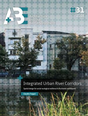
Integrated Urban River Corridors (Paperback)

0
This PhD thesis focuses on Urban River Corridors (URCs) as spaces of social-ecological integration par excellence-that is, spaces where the interaction between the urban systems (carrying the 'social-') and the river system (carrying the '-ecological') is (potentially) the most intense. The general hypothesis is that with an integrated spatial unde...

Verkopers met dit product

Verkoper
Bezorging
Prijs

Anderen bekeken ook

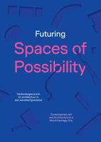
Futuring Spaces of Possibility (Paperback)
Futuring Spaces of Possibility explores how contemporary art and architecture address urban, social and ecological challenges and create new possibilities for the future city. It invites urban theorists, curators, artists and architects to use Bruges, a UNESCO World Heritage Site, as a testbed for new spatial imaginaries. How to deal with transformation and degrowth in a city whose boundaries have been shaped by its medieval history? How to question dominant histories, use underutilised public space and set in motion new cohabitations in the city? This book is published on the occasion of Bruges Triennial 2024: Spaces of Possibility, curated by Shendy Gardin and Sevie Tsampalla. Featuring contributions by the twelve artists and architects in the exhibition, it offers insights into the research processes behind the commissions, through texts, archival images, preparatory sketches and interviews. Newly commissioned essays address issues of urban transformation and the role that
29,90
Robocar and Urban Space Evolution (Paperback)
How can we create more human-centered, resilient, and sustainable cities in the tech age? Can we make use of technology and the opportunities presented rather than resisting its fast-paced evolution? What are the biggest and most likely spatial changes that autonomous vehicles will bring in cities? How can this change in mobility contribute to a better urban environment? To what extent do the spatial opportunities created by automated mobility respond to current urban issues and what is the role of urban design and spatial planning in this debate? Autonomous cars -Robocars- will dramatically change urban environments and the practice of urbanism, potentially making cities less dependent on and less dominated by cars. Driverless and mainly guided by digital infrastructure, Robocars can open up new opportunities for urban development. If guided by sustainable development goals, mobility automation can lead to urban we understand as a shared paradigm shift in mobility and urban design. To
19,95
Changing Values on Water in Delta Cities (Paperback)
The thesis develops an empirically tested analytical framework which links value theory with planning and design practices to investigate context-specific spatial transformations as a result of individual and collective value judgements. Four key aspects of water values including flood safety, as well as economic, social and environmental values, are studied, and their interrelationships are discussed. Morphological analyses and value assessments are conducted to explore in what sense spatial changes can be considered an expression of the changing values and what we can learn from it to deal with complex spatial situations. The empirical studies are based on the long-term spatial development of Guangzhou as representative of a historical and rapidly growing delta city in China. Three development stages are illustrated to show different patterns of water-city interactions, the waterways city (before the 1920s) that was mainly structured by natural forces including natural waterways, the
29,95
Fietskaart Cycling guides Exmoor - North Devon | Goldeneye
Scheur- en watervast foetskaart van Exmoor en Noord Devon met ingetekende fietsroutes.   Our maps are double-sided, printed on an A2 sheet with a concertina fold. This allows for easy folding and folding, and an ease of access to the mapping. The material is rain and tear-resistant. Our early maps were designed at the scale of 2 miles to 1 inch/1:126,720. The later designs along with digitalisation are 1: 100,000. We were encouraged by the Cycle Touring Club to convert our cartography toward the cycle market (to replace the out-of-print Bartholomew series). As time and the series progressed we have added more data: The National Cycle Network routes, Regional Routes, and Traffic-Free Family Routes, as and when they are developed. These routes are in addition to the Circular Routes Goldeneye Commissioned at the outset of our publishing schedule. We are also adding to new editions; bike shops, cycle hire, and tea rooms, along with the tourist attractions already featured. Our plan is to …
12,95
Fietsgids The Rhine Cycle route | Cicerone
This comprehensive guidebook offers a detailed stage-by-stage description of an epic 1370km route along the Rhine, one of Europe's great rivers, which passes through six countries on its way from Switzerland to the North Sea. The cycling is easy, downhill and along dedicated cycle routes, the countries visited are very cycle-friendly and the waymarking is excellent. The whole trip can be completed in two weeks by a fit cyclist.   The guide includes plenty of information to help you plan your trip, with advice on travel, accommodation and facilities. The full route is then presented in 27 stages of 32-69km, with step-by-step route description, 1:100,000 mapping and notes on local points of interest. A facilities table, glossary and list of useful contacts can be found in the appendices.   On its way, the Rhine Cycle Route passes the remains of Roman cities, medieval towns, castles, cathedrals, palaces, great cities of the industrial revolution and relics of 20th-century warfare – and i…
23,95
Wegenkaart - landkaart Cambodia & Mekong Delta | ITMB
Een degelijke kaart met aanduidingen van o.a. nationale parken, vliegveld, benzinepomp, dirt-roads en kleine plattegronden van de hoofdsteden.   Tourism to Cambodia is growing so quickly that we felt it necessary to bring back the country as its own map, instead of being combined with Laos. However, the entire country fits very nicely on one side of a map sheet, so we have combined it with neighboring Vietnam's Mekong Delta map. There are two treasures in Cambodia: the Angkor Wat complex of temples near Siem Riep, and the Capital of Phnom Penh. Cambodia became extremely destabilized by the Vietnam War in the 1960s, leading to a rebellion that placed the murderous Khmer Rouge in charge. This led to massive atrocities and de-populated all towns, killing millions. Siem Riep is a thriving touristic city, and UNESCO manages the Angkor complex very well. The capital has mostly recovered, but still retains the sleepy colonial atmosphere of the French era. River boats ply the Mekong River and…
13,95
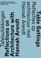
OASE 106 (Paperback)
For Dutch see below. -ENGLISH- The German-American philosopher Hannah Arendt (1906-1975) once stated that spatial thinking is 'political' thinking, as it is concerned about the world and its inhabitants. We certainly can understand spatial thinking here as architectural thinking: the 'world' for Arendt meant the ways in which we make the globe habitable for people: how we build houses and cities, infrastructures and other networks, and furnish spaces with tables, chairs, paintings and photographs. According to Arendt, this world-of-things was crucial for political life: it is this world that simultaneously connects people and separates them, just like a table organises the people (and the conversation) around it. This OASE examines architecture - design, building, built environment - from this perspective. The issue opens with an introduction to Arendt's political thinking, and how it is connected to the (production of) the world. Next, a variety of architects, including George Baird,
24,95
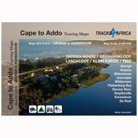
Wegenkaart - landkaart SC5-SC6 George to Kareedouw | Tracks4Africa
The Cape to Addo map series covers the southern parts of the Western Cape of South Africa in a series of eight highly detailed maps, printed on four sheets of A1 durable paper.   We start in Cape Town in the west and move along the southern coast through the Overberg, Winelands, Garden Route, Klein Karoo R62, Baviaanskloof to eventually arrive in the Addo National Park up to Gqeberha (Port Elizabeth) in the east.   The maps are highly detailed and well researched. Our map scale is 1:200 000 which allows us to show a lot of detail including minor gravel roads, hiking trails, farm boundaries and points of interest which are relevant to self-drive tourists.   The size of the paper is kept small enough to allow this to be the perfect road tripping map. We use Duraflex paper and print two maps per sheet of A1 paper, making this a four-sheet series. Each map sheet is individually packed in a plastic protective sleeve.   The maps are perfect for day drives, overlanding or just doing road tri…
29,95
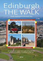
Wandelgids Edinburgh the Walk | Mica Publishing
This guidebook describes a ‘green chain walk’ of 69km (43 miles) around Edinburgh, Scotland's capital city, linking the city’s green spaces, and highlighting the people who shaped its future and the natural forces that created the landscape. Divided into eight sections of between 8km (5 miles) and 11km (6.75miles), the route can be followed as a continuous multi-day walk or as individual day walks. • A 69km (43 miles) walk around Edinburgh divided into eight sections of between 8km (5 miles) and 11km (6.75miles) • The route can be followed as a multi-day walk, or as individual day walks. • Each section is accompanied by details of public transport between the city centre and the section's start and finish points. 45 fully annotated Ordnance Survey Street View maps detail the route. • Geological, historical, architectural and cultural highlights are included in a variety of panels adjacent to the main text. • Edinburgh The Walk guides the walker through glorious cityscape, coastline, r…
23,95
Ruimtelijke transformaties van de steden in het Randstadgebied (12de-20ste eeuw) (Paperback)
In this issue of A+BE (written in Dutch), the transformation of the form of nine cities in the Randstad between 1250 and 1940 in relation to changes in infrastructure is central, namely Utrecht, Dordrecht, Leiden, Haarlem, Delft, Gouda, Amsterdam, Rotterdam and The Hague. Within this time span, three periods of great spatial dynamics are identified, namely the period 1240-1450, 1580-1680 and 1870-1940. Comparing the city maps with each other, they made a development from uniformity to diversification to levelling between 1250 and 1940. Typical for the spatial development was that in the first period urban centres were created in which the various urban functions were concentrated. In the second period, specialization took place, in addition to strengthening the regional market function in the late medieval centres, functions were moved to the city edges. In the third period, the international goods transports continued to be moved out of the late medieval centres. In addition, the
29,95

Klanten-reviews van Integrated Urban River Corridors (Paperback)

Er zijn nog geen beoordelingen voor dit productBen jij de eerste die een review plaatst?

Meer over Integrated Urban River Corridors (Paperback)

Productomschrijving

This PhD thesis focuses on Urban River Corridors (URCs) as spaces of social-ecological integration par excellence-that is, spaces where the interaction between the urban systems (carrying the 'social-') and the river system (carrying the '-ecological') is (potentially) the most intense. The general hypothesis is that with an integrated spatial understanding, planning and design of rivers and the urban fabric surrounding them, cities could become more resilient, not just to flood-related disturbances, but to general chronic stresses as well. Hence, the thesis addresses a number of spatial problems arising from the loss of synergy between the natural dynamics of rivers and the spatial configuration and composition of urban areas that they cross, namely: the relationship between fluvial geomorphology and urban morphology weakened by river-taming operations; the physical barrier caused by riverside vehicular traffic; the latent flood risk built up through resistance-based flood-protection

Productspecificaties

Artikelnummer(s)
Brand
Tu Delft Open

Verken gerelateerde categorieën

Webshop.nl maakt gebruik van cookies. Ga je verder op onze website, ga dan akkoord met het plaatsen van cookies en de verwerking van deze data door ons en vermelde partners.