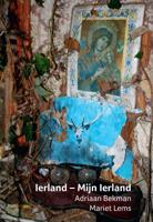
Ierland (Paperback)

0
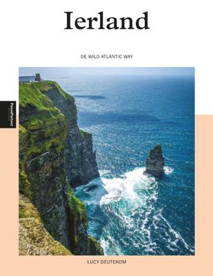
Steile kliffen, woeste baren en kleurrijke dorpjes, dat is de Ierse westkust in een notendop. Langs de gehele westkust - van (London-)Derry in het noorden tot Kinsale in het zuiden, loopt de 2750 kilometer lange Wild Atlantic Way. Dichtbij in Europa is het ruig en wild, en bovenal adembenemend mooi. Dit boek geeft je een overzicht van de meest bijz...

Verkopers met dit product

Verkoper
Bezorging
Prijs

Anderen bekeken ook

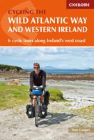
Fietsgids The Wild Atlantic Way and Western Ireland - Ierland | Cicerone
Uitstekende fietsgids van Cicerone over de westkust van Ierland. De routes zijn goed beschreven, met veel praktische informatie. Kaartmateriaal is redelijk, om echt op te fietsen wat summier.  Boasting deserted beaches, towering sea-cliffs and tiny harbours - not to mention rich cultural and historical interest - the west of Ireland has much to entice the visitor, and with many miles of quiet roads, it's a cyclist's paradise. The Wild Atlantic Way is a driving route along Ireland's Atlantic seaboard, covering over 2,350km of coastline and showcasing the region's breathtaking landscapes. This guide adapts the route for cyclists - and throws in a couple of other highlights (such as the Aran Islands and Killarney) for good measure. Since relatively few people are likely to have seven weeks to spare for a full Wild Atlantic Way tour, the book presents six self-contained cycle tours, each offering 7-10 days of riding. For the full Wild Atlantic Way experience, these distinct routes can be…
20,95
Reisgids PassePartout Ierland | Edicola
Het inspiratieboek “Ierland – de Wild Atlantic Way” laat de schoonheid van de Ierse westkust zien, die van oudsher een zeer populaire vakantiebestemming is. De term ‘Wild Atlantic Way’ is relatief nieuw (2014) en verbindt de negen graafschappen in Noordwest, West en Zuidwest Ierland, allen gelegen aan de Atlantische Oceaan. Met de schilderachtige dorpjes, eeuwenoude tradities en schitterende natuur blijft dit deel van Ierland tot de verbeelding spreken. Met meer dan 300 kleurenfoto’s en een grote hoeveelheid tips, laat de auteur op gepassioneerde wijze de meest bezienswaardige plekken aan de autoroute zien, en geeft achtergronden over de Kelten, Vikingen en Britse overheersers.     Reisleidster Lucy Deutekom houdt sinds enkele jaren een online blog bij www.mijnstaddublin.com over haar leven in Dublin en is actief of Facebook en Instagram. Ze heeft een groot netwerk in de reiswereld en toezeggingen van reisorganisaties om aandacht aan het boek te geven. 
24,50
Nieuw
Reisgids Ireland - Ierland | Rough Guides
Een zeer uitvoerige reisgids voor zowel de zelfstandige als de georganiseerde reiziger. Veel informatie, zowel praktisch als over allerhande achtergronden van het land; met o.a. aandacht voor geschiedenis, taal, flora & fauna en met veel plattegronden! Voor Europese landen nog iets completer dan de Lonely Planet. Discover Ireland with this comprehensive and entertaining travel guide, packed with practical information and honest recommendations by our independent experts. Whether you plan to drive the scenic Wild Atlantic Way, explorie the delights of Dublin’s architecture and dance along to traditional Irish music in one of the plethora of pubs in the country, Rough Guide Ireland will help you discover the best places to explore, eat, drink, shop and sleep along the way.   Features of this travel guide to Ireland: – Detailed regional coverage: provides practical information for every kind of trip, from off-the-beaten-track adventures to chilled-out breaks in popular tourist areas – Ho…
25,95
Ierland (Paperback)
Ierland (Paperback)
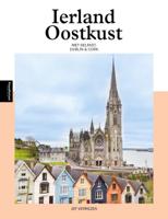
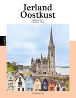
Als tegenhanger van de toeristische ontplooiing van de Ierse zuid- en westkust ging men het oostelijk deel van Ierland promoten onder de slogan 'The Ancient East'. Hiermee wordt de regio van Dundalk tot Cork in de kijker geplaatst. In dit boek hangen we er meteen de oostkust van Noord-Ierland aan vast. Niet alleen komen de hoofdsteden Belfast en Dublin uitvoerig aan bod in deze reisgids maar ontdekken we ook hoe de oostkust de poort tot Ierland werd voor de Vikingen en de Anglo-Normandiërs, op hun beurt gevolgd door de Engelse heersers. Het was eveneens het gebied van de eerste Ierse kerstening, de grote kloosters en de plaats waar de hoogkoningen regeerden. Graftomben, ouder dan de Egyptische piramiden, zullen je verrassen. Daarnaast worden we overdonderd door de fotogenieke vissershaventjes, naast de natuur van de prachtige glens met de slingerende smalle wegen omzoomd. Je zult ervaren dat er in Europa geen gelijke is als het gaat om uitnodigende pubs. Niet alleen door de inrichting
24,50
Wegenatlas Road Atlas Ireland - Ierland | AA Publishing
Handige wegenatlas van Ierland en Noord-Ierland, schaal 1:200.000. Met 10 stadsplattegronden: Belfast, Cork, Londonderry, Dublin, Galway, Killarney, Kilkenny, Limerick, Sligo and Waterford. Created from brand new mapping data, this atlas includes AA inspected camping sites and AA listed golf courses, picnic sites, port plans and ferry routes. Plus, motorway strip maps detailing all of Ireland's motorway junctions. Toll motorways are clearly highlighted.There are 10 detailed city and town plans with street indexes: Belfast, Cork, Londonderry, Dublin, Galway, Killarney, Kilkenny, Limerick, Sligo and Waterford and an easy-to-read place name index, with top tourist sites highlighted.New district maps of Dublin and Belfast show the surrounding area in more detail.
11,95
Reisgids Ireland - Ierland | Lonely Planet
De perfecte reisgids voor zowel de georganiseerde als de zelfstandige reiziger. Naast een algemene inleiding van het land / streek vol met praktische informatie over hoe je er het beste kunt reizen: slapen, eten, vervoer, excursies ... alles kun je er in vinden. Engelstalig. Lonely Planet Discover popular and off the beaten track experiences from tapping your toes to trad music in Dublin's world-famous Temple Bar to hiking the trails that traverse the spine of the Wicklow Mountains, and taking a surf lesson on Tramore Beach.   Build a trip to remember with Lonely Planet's Ireland Travel Guide:   Our classic guidebook format provides you with the most comprehensive level of information for planning multi-week trips Updated with an all new structure and design so you can navigate Ireland and connect experiences together with ease Create your perfect trip with exciting itineraries for extended journeys combined with suggested day trips, walking tours, and activities to match yo…
24,95
Wegenkaart - landkaart - Fietskaart Mayo en Sligo (Ierland) | Xploreit Maps
Mooie geplastificeerde en scheurvaste kaart van Mayo en Sligo met index. Mayo’s wealth of unspoiled, natural beauty is a fitting compliment to Sligo’s magnificent scenery providing a wonderfully varied landscape to be enjoyed by visitors. This map shows where all the famous landmarks and hidden gems are to be found when touring the area. A comprehensive compilation of waymarked trails with local walking loops , cycle routes, scenic drives, beaches, medieval buildings, megalithic sites, historic houses and numerous other points of interest are illustrated. Discover the haunts of W.B. Yeats like Lissadell, Drumcliff and Lough Gill along with dramatic vistas such as Croagh Patrick and the Doolough Valley using this easy to read sheet. Parts of Counties Galway, Roscommon, Leitrim and Donegal are also included.   The scale of the Mayo & Sligo map is 1:100,000.   Walking Routes The following long distance waymarked ways in Mayo and Sligo are included: The Western Way The Great Western Gre…
23,95
Reisgids PassePartout Ierland Oostkust | Edicola
Als tegenhanger van de toeristische ontplooiing van de Ierse zuid- en westkust ging men het oostelijk deel van Ierland promoten onder de slogan ’The Ancient East’. Hiermee wordt de regio van Dundalk tot Cork in de kijker geplaatst. In dit boek hangen we er meteen de oostkust van Noord-Ierland aan vast. Niet alleen komen de hoofdsteden Belfast en Dublin uitvoerig aan bod in deze reisgids maar ontdekken we ook hoe de oostkust de poort tot Ierland werd voor de Vikingen en de Anglo-Normandiërs, op hun beurt gevolgd door de Engelse heersers. Het was eveneens het gebied van de eerste Ierse kerstening, de grote kloosters en de plaats waar de hoogkoningen regeerden. Graftomben, ouder dan de Egyptische piramiden, zullen je verrassen. Daarnaast worden we overdonderd door de fotogenieke vissershaventjes, naast de natuur van de prachtige glens met de slingerende smalle wegen omzoomd. Je zult ervaren dat er in Europa geen gelijke is als het gaat om uitnodigende pubs. Niet alleen door de inrichting…
24,50
Nieuw
Reisgids Wild Guide West Ireland | Wild Things Publishing
The ultimate adventure guide to exploring Ireland's rugged west coast, this new guide reveals the region's 1,000 wildest and most enchanting places. From remote beaches and dramatic cliffs to secret waterfalls and magical woodlands, readers are taken off the beaten path to discover the untamed beauty of Western Ireland - Donegal, Galway, Mayo, Clare, Kerry, Sligo, Roscommon, Leitrim and Limerick. Perfect for adventurers, nature lovers and families, the guide uncovers hidden gems that most tourists never see and charts the best slow food and wild places to stay. From kayaking among hundreds of tiny islands in Mayo to sandwiching secluded coves and rolling mountains with superb food in Connemara, exploring the Burren's otherworldly rock formations and secret lakes in County Clare, and wandering the wild beaches, remote sea cliffs and waterfalls of Kerry, this new guide brims with Atlantic Ocean adventures, journeys around forgotten castles, forts and tombs, and expeditions into lush val…
27,50
Nieuw
Wegenkaart - landkaart - Fietskaart Cork (Ierland) | Xploreit Maps
Mooie geplastificeerde en scheurvaste kaart met index The Xploreit Map of County Cork includes all of Cork along with parts of counties Kerry, Limerick, Tipperary and Waterford. Cork's rich heritage of megalithic monuments, medieval churches and castles can instantly be identified. Noted sites such as Blarney Castle, St. Finbarr's Oratory at Gougane Barra and McCarthy's Bar in Castletownbere are featured in red text. Whether you want to explore Youghal's town walls in the east, savour the views from the footbridge at Mizen Head in the south-west or or imagine times past as you stroll around Mitchelstown's King's Square and Kingston College in the north it's easy to find your chosen destination. Showing a large array of golf courses, angling spots, sandy beaches for swimming and surfing, equestrian facilities, boating facilities, this map is an indispensable tool for visitors. Several scenic drives, cycle routes and waymarked walks are shown. The scale of the Cork map is 1:100,000. Wal…
23,95

Klanten-reviews van Ierland (Paperback)

Er zijn nog geen beoordelingen voor dit productBen jij de eerste die een review plaatst?

Meer over Ierland (Paperback)

Productomschrijving

Steile kliffen, woeste baren en kleurrijke dorpjes, dat is de Ierse westkust in een notendop. Langs de gehele westkust - van (London-)Derry in het noorden tot Kinsale in het zuiden, loopt de 2750 kilometer lange Wild Atlantic Way. Dichtbij in Europa is het ruig en wild, en bovenal adembenemend mooi. Dit boek geeft je een overzicht van de meest bijzondere plekken aan de route, en inspireert om zelf (een deel van) de route te rijden. Het belicht de negen counties aan de Ierse westkust - Donegal, Leitrim, Sligo, Mayo, Galway, Clare, Limerick, Kerry en Cork - en geeft tips voor tien wandelingen. Op veel plekken aan de westkust lijkt de tijd te hebben stilgestaan en leeft men in kleine, hechte gemeenschappen. De Ieren hebben de geschiedenis niet altijd aan hun zijde gehad, en de sporen daarvan zijn nog duidelijk zichtbaar. Met een klimaat dat ook nog eens weerbarstig is, is het opzienbarend hoe de Ieren wereldwijd bekendstaan als vriendelijk en humoristisch. Stap een pub binnen en ervaar de
Webshop.nl maakt gebruik van cookies. Ga je verder op onze website, ga dan akkoord met het plaatsen van cookies en de verwerking van deze data door ons en vermelde partners.