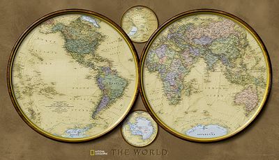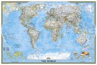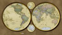
Historische wereldkaart World hemispheres, politiek, 107 x 62 cm | National Geographic

0
During the 1930s and 1940s, National Geographic designed several world maps using a projection that separated the eastern and western hemispheres. We have brought back this classic view of the world with modern cartography and elegant earth tones for a fashionably retro view of the world....

Verkopers met dit product

Verkoper
Bezorging
Prijs
DeZwerver.nl logo
DeZwerver.nl
5,95
32,95

Anderen bekeken ook

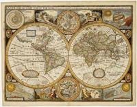
Historische wereldkaart Wereld antiek 1651 90,5 x 69 cm | Freytag & Berndt
Historische wereldkaart uit het jaar 1651. Deze papieren wereldkaart wordt geleverd in een stevige plastic koker.    The map is marked with the names of countries, major cities and ports of the time, along with the charted seas and islands. The exceptions are the extreme north of America, and Australia, which is alluded to as 'Psittacorum Regio or the Country of Parrots, soo called from ye extreaordinary and almost incredible bignes of those birds there'.   Surrounding the map are many interesting insets: the celestial hemispheres are shown, along with their  constellations; two diagrams explain pictorially how solar and lunar eclipses occur; 'A Figure of the Sphere' and 'The Heavens and Elements' occupy the top corners; and portraits of four notable explorers including Magellan and Drake are also shown.
22,95
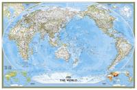
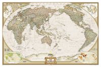
Wereldkaart Politiek, pacific centered, 117 x 78 cm | National Geographic
This unique view employs a new map projection to accentuate the Pacific Rim, and shows Oceania and Asia in close proportion to their actual size on the Earth. It brings Oceania and Asia into the center of the picture, while dramatically showing the entire breadth of the Pacific Ocean. The Pacific-centered world map features classic National Geographic cartography, with political boundaries, thousands of place names, time zones, and special insets showing world vegetation and land use, and population density.     
36,95
Wereldkaart Politiek, pacific centered, 185 x 122 cm | National Geographic
This unique view employs a new map projection to accentuate the Pacific Rim, and shows Oceania and Asia in close proportion to their actual size on the Earth. It brings Oceania and Asia into the center of the picture, while dramatically showing the entire breadth of the Pacific Ocean. The Pacific-centered world map features classic National Geographic cartography, with political boundaries, thousands of place names, time zones, and special insets showing world vegetation and land use, and population density. 
68,95
Wereldkaart 20331 Politiek, pacific centered, 185 x 122 cm | National Geographic
This unique view employs a new map projection to accentuate the Pacific Rim, and shows Oceania and Asia in close proportion to their actual size on the Earth. It brings Oceania and Asia into the center of the picture, while dramatically showing the entire breadth of the Pacific Ocean. The Pacific-centered world map features classic National Geographic cartography, with political boundaries, thousands of place names, time zones, and special insets showing world vegetation and land use, and population density. 
45,95
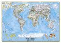
Wereldkaart 20379 politiek, 92 x 61 cm | National Geographic
Politieke wereldkaart van National Geographic. De klassieke blauwe vorm, met helder kaartbeeld. De landen hebben met kleuren duidelijke grenzen en er staan opvallend veel topografische details op. Ondanks de schaal een behoorlijk aantal plaatsnamen. Mooi vormgegeven met een klassieke rand er om heen.   This world map features the Winkel Tripel projection to reduce distortion of land masses as they near the poles. Features include subtle border coloring on land, and prevailing winds and ocean currents at sea. Separate insets show the North and South Polar Regions, world vegetation and land use, and world population density.
24,95
Wereldkaart Politiek, 92 x 61 cm | National Geographic
Politieke wereldkaart van National Geographic. De klassieke blauwe vorm, met helder kaartbeeld. De landen hebben met kleuren duidelijke grenzen en er staan opvallend veel topografische details op. Ondanks de schaal een behoorlijk aantal plaatsnamen. Mooi vormgegeven met een klassieke rand er om heen.   This world map features the Winkel Tripel projection to reduce distortion of land masses as they near the poles. Features include subtle border coloring on land, and prevailing winds and ocean currents at sea. Separate insets show the North and South Polar Regions, world vegetation and land use, and world population density.
32,95
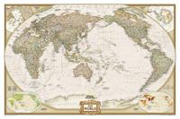
Wereldkaart Politiek & antiek, pacific centered, 117 x 78 cm | National Geographic
National Geographic's World map is the standard by which all other reference maps are measured. The World map is meticulously researched and adheres to National Geographic's convention of making independent, apolitical decisions based on extensive research using multiple authoritative source.   The Executive style World map uses an antique-style color palette and stunning shaded relief that provide a richness perfect for any decor. The Pacific Centered World map employs a unique view to accentuate the Pacific Rim, and focuses on Oceania and Asia and while showing the entire breadth of the Pacific Ocean. Drawn in a special Winkel Tripel projection, distortions are minimized and unlike many other World maps, Greenland is show the same size as Argentina and not as the size of all of South America.   Thousands of place names are carefully and artistically placed on the map to maintain legibility even in the heavily populated ares of Europe, Asia and the Middle East. Details include clearl…
36,95
Wereldkaart 20327 Politiek & antiek, pacific centered, 117 x 78 cm | National Geographic
National Geographic's World map is the standard by which all other reference maps are measured. The World map is meticulously researched and adheres to National Geographic's convention of making independent, apolitical decisions based on extensive research using multiple authoritative source.   The Executive style World map uses an antique-style color palette and stunning shaded relief that provide a richness perfect for any decor. The Pacific Centered World map employs a unique view to accentuate the Pacific Rim, and focuses on Oceania and Asia and while showing the entire breadth of the Pacific Ocean. Drawn in a special Winkel Tripel projection, distortions are minimized and unlike many other World maps, Greenland is show the same size as Argentina and not as the size of all of South America.   Thousands of place names are carefully and artistically placed on the map to maintain legibility even in the heavily populated ares of Europe, Asia and the Middle East. Details include clearl…
24,95

Klanten-reviews van Historische wereldkaart World hemispheres, politiek, 107 x 62 cm | National Geographic

Er zijn nog geen beoordelingen voor dit productBen jij de eerste die een review plaatst?

Meer over Historische wereldkaart World hemispheres, politiek, 107 x 62 cm | National Geographic

Productomschrijving

During the 1930s and 1940s, National Geographic designed several world maps using a projection that separated the eastern and western hemispheres. We have brought back this classic view of the world with modern cartography and elegant earth tones for a fashionably retro view of the world.

Productinformatie

    Verken gerelateerde categorieën

    Webshop.nl maakt gebruik van cookies. Ga je verder op onze website, ga dan akkoord met het plaatsen van cookies en de verwerking van deze data door ons en vermelde partners.